Tuesday, May 31, 2011

Pk. 3595, Oro Grande peaks


    ... and a desperate DEATH MARCH of SCHOOL ensued during the month of May... blogganeering was OBLITERATED.  I became a full-time editor of edgy 6th Grade Literature.  KIGSBLOG lay dormant.  (The weekends, however, held ACTION, fueled by Tyler's rage for the fine Spring skiing.)
     While the blog slept, Spring emerged.  But here, now, from this memory station at the beginning of big blue summertime, KIGSBLOG must fly back to where we left off:  the unfinished post from April, concerning Ryan and Ian's errant voyage into the mystery lands of the Oro Grande by snowmachine, and the near-death experiences along the way...
 (above)  Basecamp in the Oro Grande, April 2011, looking north.  Pk. 3595 at left edge of photo. 


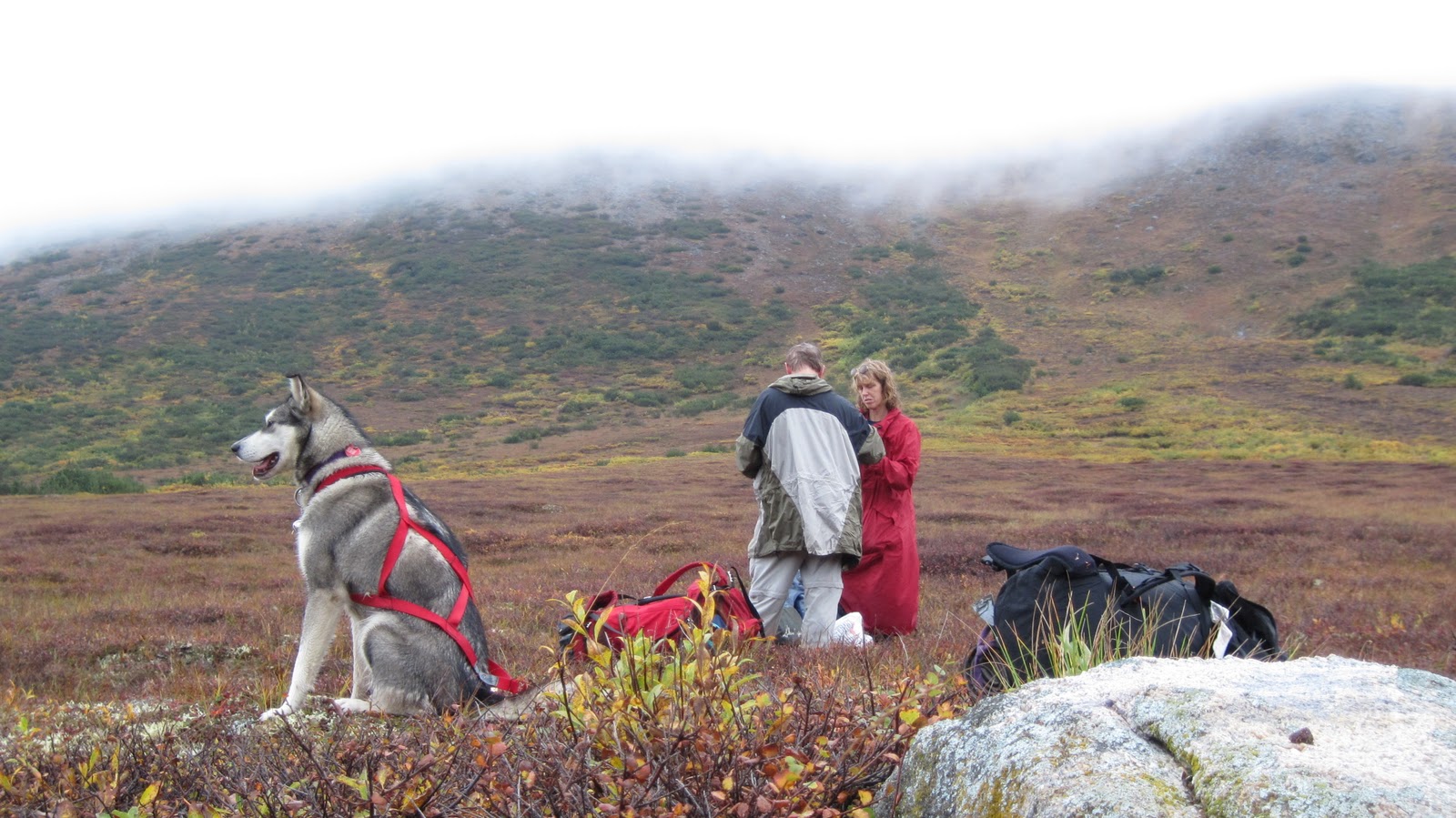
      The GLUE OF TOWN was fierce.  Like a cartoon character who has stepped in glue, Ryan labored against long sticky tendrils of causation that stretched, but never quite let him go.  Great matters of life and death portended in all the signs, but neither he nor Ian recognized their significance in the present, blinded as they were by the sunny weather, firm snow, and desire to get into the remote and mysterious Canyon Creek.  ...how was i to know that Ryan himself was in violation of the NO SKETCH PARTNER rule?  
         Pulling out of Crowley's gas, the first 30 seconds of the journey, Ian escaped the wheelchair only by the grace of God when the skid on his machine augured into a meter-deep furrow in the snow— a furrow dug by the very Snow Cat vehicle on board which that very morning he had ungraciously turned down an opportunity to ride.   ...knowing NOW what i did not know THEN, this horrible flip from the machine appears to have been a nodal confluence point for several threads of causation forming a synchronicity attractor of significant magnitude:  emotions, fractured friendships, reproduction, self-confrontation, all were to follow in the intervening weeks, with the nasty, near-miss accident, as so often happens, lurking in the matrix, exerting its own gravity... how do i get so lucky time and again?  Thank you to Arctic Cat for designing the cockpit of the BEARCAT so the rider does a perfect 360° flip over the handlebars...
 Admitting possible internal injuries, they continued;  their collective will to get into the backcountry and go camping on the most beautiful snow-machine mountaineering weekend of the year became the MACHETE which sliced through every problem, every obstacle the GLUE could throw in their path, and soon they were roaring down the Teller Road like Wyatt and Billy in Easy Rider.
(above)  Pk. 3595 viewed from adjacent peaklet to the west, looking northeast.  A way led through slough-avalanche slopes to the main summit, but the NO SKETCH PARTNER rule forced a retreat. The NO SKETCH PARTNER rule states: always prioritize the needs of your partner ahead of your own ambitions. The terrain in the picture would probably have taken me three hours round-trip, but I had told Ryan I'd be back in one, as the GLUE OF TOWN seemed to be pulling at his ankles like a strong rip-tide.  I pretended to be Rudi Matt in Banner in the Sky, forsaking the summit in consideration of others, but the truth was, I was nauseous from all the pain killers I had ingested the night before to treat my snow-machining injuries.  in other words, hungover.  How many John Barleycorn bails have my afternoons seen? 
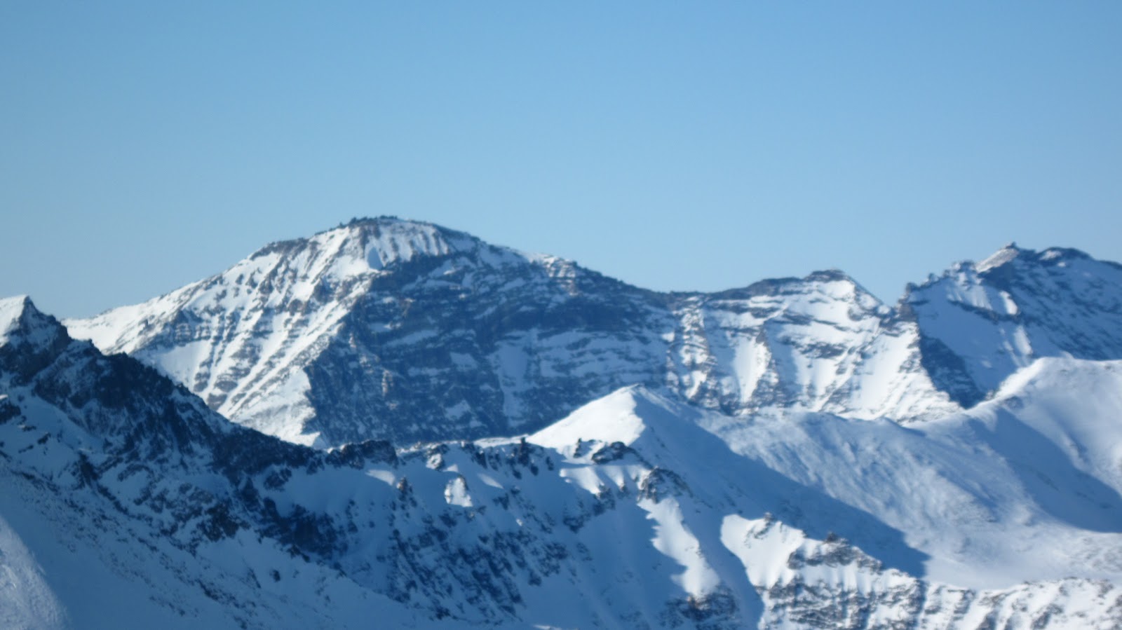
         I would have done better to ascend from the Oro Grande directly to the notch just in front the summit in the photo, but the snowpack had been sort of crackling with chain-reaction, avalanchey noises that morning, so it didn't seem wise at the time to venture onto plus forty-degree slopes.  By the end of the day, however, I had gained a bit of confidence in the snow, however, and was able to ignore the disconcerting crackle-echo noises.   
 

(right)  Bouldering on crumbly paragneiss halfway up Pk. 3595.  
   Ryan came halfway up the route in his shoe pacs.  We stopped at a nice ledge, and he took this picture.  The Oro Grande tors on the crest of the ridge are composed of the good old "pre-Cambrian Thompson Creek Orthogneiss," but the rock on the way up seems to be more in the manner of "highly resistant, coarse-grained pelitic paragneiss and schist" (according to the Amato map). 
     The snow slope in this area was criss-crossed with tracks from an AKLAQ freshly sprung from winter sleep.  As evidenced by the tracks we saw, the bear had, at one point, had been getting rad just for fun, jumping and sliding repeatedly off a dangerous cornice.
     The tracks also told a story that explains why Seward Peninsula AKLAT are so wary of humans.  No sooner had this poor AKLAQ emerged from its den, blinking in the morning sunlight, then it was beset upon by human predators.  Ramon's party (see below) had seen the bear and high-marked up to the den. Then Ryan and I camped a half mile away. As we were setting up the tent, a Super Cub on skis swooped in and landed up by the den.  The next morning, a young hunter from Nome came motoring breathlessly up to our camp inquiring about the very same bear.  Man!  The people are after you right from the get-go!  No wonder the mothers teach their cubs to run at the very sight of us. Up among the very highest tors, I saw how the AKLAQ had outfoxed everybody by climbing a circuitous route into an obscure valley to the northwest.    
(above)  Isabel Pass, chance meeting with other snow-machiners between Glacial Lake drainage and the Oro Grande.  Other people?!  In the Kigs?  Shows you how nice an April weekend it was.  Here we see the redoubtable Ramon and his posse of snow-machining fiends telling us that we are lost.  An astute reader will remember that Ryan and my destination was Canyon Creek.  Ramon is explaining that the pass to Canyon Creek is not the one we are in;  we needed to hang a left ten bumpy miles earlier. (see map, below)  It was at this point that Ryan and I decided the Canyon Creek camping trip had turned into an Oro Grande camping trip. 


(right) Region north of Glacial Lake  
1.  Glacial Lake  
2.  Isabel Pass. Dennis H. told me that was the name of this pass.  Is that right?  
3.  Pk. 3595.  I call it 'Oro Grande Peak' but that is my own appellation.  This is merely the high point of a long, prominent ridge, but Pk. 3595 as a distinct entity seems to be quite prominent from all over the range. 
 4.  Unnamed Pass.  This, I am told, is the snow-machine shortcut to Canyon Creek
(above)  Suluun, the Dorsal Fin, viewed from Oro Grande, looking southeast.  One of the biggest chunks of granite (gneiss) in the Kigs. Andy and I climbed several routes there, including the left skyline:  trip details here and here.
(above) Tor detail, Oro Grande peaks.  Amato, my patron geologist for the Kigs, told me he climbed "all" of these peaks in the nineties, but was vague on details-- at least, those details not relating to the geologic. 
(Above) Pk. 3595 (the one on the left) is merely the high point on a prominent, tor-studded ridge that forms the north side of the Oro Grande drainage, visible from village of Teller as a classic row of Sawtooths, hence, Kigluaik.  Is this the namesake ridge of the entire range?  This ridge, which I personally refer to as "the Oro Grande peaks," proved an exception to the rule that the north side of a ridge in the Kigluaiks will always be the precipitous side--  these tors poke out of the top of the ridge like true tors should, but there's not the usual fearsome drop-off on the north side. 


(Above) View to the south from peaklet to the west of Pk. 3595.  The little conceit of Kiganeering is to get to the top of something, so I put on crampons and labored, sweating Yukon Jack, to the ridgecrest. There might have been some Class 4.  This picture was taken from the same spot as the one earlier showing the main peak.  

Views from the DRIVE OUT of the mountains from Oro Grande via Mosquito Pass. (Above) we see the long wall of the West Face of Mt. Osborn (Pk. 4714), the mini-Emperor Face of the Kigluaik. I'm sure people have snow-machined up into the cirque, but what are the odds someone has climbed Osborn from this side? Not high.... 

(Below and bottom) Two views from the drive out of a hill I call "Turncorner Mountain" (Pk. 3250) because it is where you finally turn the corner to get to Mosquito Pass when slogging from the Kougarak Road.  My sweetie Kristine and I climbed the lefthand ridge in a 13 hour epic (Class 4/5), years ago in the pre-Raina days.  
somewhere we are still there

Tuesday, April 5, 2011

Distin Bluff Chicken Out

(left) Distin Bluff (Pt. 1129), Saturday, April 2.  The pixelization is due to  blowing spindrift.  I spent last Saturday huddled in relative warmth and sunlight against this hundred-foot cliff underneath great umbrellas of snow-streamers that blew out horizontally off its top.

       The object of any April weekend is penetration into the "real mountains."   Stopping partway in the foothills to play is a failure, a "chicken out," a mental turpitude stemming from an unwillingness to motor out into the deep water completely alone.  It is the nature of the Kigluaiks that a 20-mile slog from the foothills from a busted machine is a doable thing without frostbite;  on the other hand, a 35-mile slog from the inner mountains from a busted machine would be a HELL OF A SLOG, and the rescue party would probably intercept you before you ever reached Nome the next day.  Then the locals would  excoriate you mightily.  Hitting your rescue beacon is practically unthinkable;  one would most likely never be able to visit the mountains again, your machine would be stripped from your good name, and the headline would make page 1.
         So, wherever I use the term "chicken out," substitute the words GOOD JUDGMENT.  Last Saturday I saddled up for a solo penetration into Glacial Lake, my ego puffed with dreams of the blogganeering accomplishments I could engender there:  a mixed route up the south face of the picturesque peak that rises from the northeast side of the lake.  Years before I had tried this route and been defeated by post-education weariness halfway up when a violent nap overtook me in the warm winter sun.  On a second attempt  with Marshall Earp, we rang the CHICKEN OUT bell instantly upon arriving at Glacial Lake to find there a wind of such ungodly ALLAPA proportions that there was no question of shutting off our warm little machines.  Without a word we had turned around and went back to Distin for fun and dry-tooling in the regular old SUB-Arctic at the end of the sixteen-mile Glacier Creek Road.


(below) Reruns of Joni bouldering on Distin Bluff last year.


            And now for the CHICKEN OUT!   I got to the pass at the end of Glacier Creek Road that leads to the Stewart River and on to the heart of the Kigs.  How deep the snow was!  Although  Crusteo, my battle-scarred Polaris 340, was going good, he was pretty much submerged and streaming snow into my face, plus he was eating a lot of gas.  Two deserted valleys separated me from Glacial Lake, and the mountains were all FUZZED OUT with that tell-tale WIND GAUZE.  A Russian hard man would have continued on towards the goal.  Too long in the flesh pots, I repeated the pattern from last year, and formed the bight-of-shame leading back towards Distin.

       The game of 4-season bouldering seems to involve the capacity to hang out in little micro-climates out of the wind, behaving for all the world like tattooed, fat-pad Californians hanging out at the V11 all day, except without the chicks, plus you're alone and freezing to death.  The least windy place is always at the top of the mountain, in a little nook pressed right up against the cliff.  There you can hang out next to the radiant stone and listen to the mountains rage all around you.  I was sad because I could see the whole sad sweep of time and I never let you know I cared about you.  Then you climb up and down the cliff, sinking good sticks into turf, torquing and hooking the marble, stemming and mantling and swinging and daggering, occasionally finding yourself way off the deck in situations that pass instantly from the hedonism of bouldering into the cold, psychopathic indifference of alpinism.  It's all in the kinaesthetic movement.  You're looking for the Csikszentmihalyi moment, which you will never remember anyway, lost as it is in the eternal sunshine of the bouldering mind, but you will feel better for it all at work on Monday.

      The coolest part of the day was stopping in the evening for a telly ski in Hatcher Pass quality powder in some nameless bowl among the wastes of the Snake River Valley (below).  Life can be sweet, enjoy for all it's worth.

Monday, April 4, 2011

Nugget Pass Powder

(left)  Allapa at Nugget Pass area, Grand Central in background, Sunday, March 27.  As I came even with Tyler, his celebrated time machine already drawn and aimed, I unconsciously broke out of parallel and into telly snob.


March Powder Storm

The FLUFF is on
There'll be no climbing today.


No perching, pasting and grunting,
Your hooks will stay in the pack,
No stemming and slamming your wallet 
Into slabs that gain no purchase.
They'll be over there sucking down the lines
And I'll be there with them;
the FLUFF is on, and
There'll be no climbing today.


The silken sound of graupels
Swishing aside by the millions
Has got them in a kind of trance;
if my skin stays on
I'll be able to pet the monkey on my back,
He pops on at the bottom of the run,
Gets off at the top and hucks another one,
But they'll be no climbing today
For the FLUFF is on,
It's like skiing on a cloud.


The monkey came back at the bottom of the run, so
We climbed the mountain again;
Crazed with the powder,
The silk and sinuous sliding,
We never crossed each other's tracks,
The waves were all synchronized;
And none of us we
Battled the gravity,
No one offered fealty
For the FLUFF was on,
It was all just winging.


Someday we'll return to struggle,
Offer ourselves to the jaws of the mountain,
Instead of smooth over the sinuous curves;
We'll be clinching and closing with constrictions and praying
For the Lord to spare us one time;
But for now the FLUFF is on,
The stairs are all coated with vapor
Get boards for your feet and take to the machines,
Leave your Cobras for shovel and beacon,
There will be no climbing today.


(right) Skinning up.  Erica and me, our trusty little machines looking like turds left behind in the snow.  These are the hills east of the Kougarak Road.  Tyler was instrumental in helping us achieve TOWN ESCAPE VELOCITY on a hungover morning that broke windy and gray in Nome, on a day when many a local outdoorsman failed to break through the low psyche, but a day that proved to be calm and transcendently beautiful in the mountains, the light unreal bright, with downy feathers all over everything.

Wednesday, March 23, 2011

Ascent of "Kayuqtuq" (Pk. 4000+?)

   Recent post attested to thwarted attempts on Peak 4000+ located on the divide between Crater Creek / Fox Creek here .  Vowed to return to this insignificant hillock that my Christopher Robin imagination had transformed into a Chimborazo, a Cotopaxi, it had stolen my heart away, the Sentinel of the East End of the Kigs, a bookend paired with the Singtuq (Pk. 3870) way over on the West End, a bump become my albatross.  Three attempts I had made on Kayuqtuq, defeated each time by my servitude and laziness.  It was time to resort to the path of least resistance, which in the Kigs, is almost always the south side of the mountain.  
    Here is a pixellated figment of the mountain from the North, viewed from South Fork Crater Creek, March 2009. (below):
    The moment Earp touched ground after ascent Osborn Sunday (see here for account), the GLUE OF TOWN began to exert a strong undertow on her machine.  Perhaps "GLUE" is a misnomer;  what I saw tearing away at Joni was a FORCE, manifesting from thirty-five miles away, a concatenation of cares and responsibilities exerting attraction from a distance.  Soon, she was gone...  
     The GLUE was pulling at my machine in the direction of TOWN as well, but there was also a repulsive force emanating from town that caused me to turn, cold and soaked from the arduous climb, in the direction of wilderness.  Soon, thanks once again to Earp, I was ensconced in the cabin at Salmon Lake with gear drying, like Clyde huddling alone at Glacier House, but with MAD Magazine instead of the Iliad for company.
     The weather was banging fine, the conditions nearly perfect in the Kigluaik for mixed climbing.  My thoughts turned to Kayuqtuq;  not to be a crass peak-bagger or anything, but the peak had to be bagged.  The next morning, basking on porch with Jack Aubrey coffee in hand, I was visited by an honest-to-God KAYUQTUQ:
(above)  KAYUQTUQ (Vulpes v. alascensis)  I named him Ray Guy.  A good omen.  The peak was in the bag.

      However, before the old man could bag the peak, the old man needed a rest day from the GREAT THRASHING PUNISHMENT of bagging Osborn the day before. Rest day was used to reconnoiter a snow-machining route up Fox Creek.  It took quite a bit of searching about on foot with the Iron Dog parked to find a way past a cornice at Fox Creek's bottleneck, about three miles in from road.  
        Once this bottleneck was negotiated, however, the overwhelming OBSCENITY OF THE SNOW-MACHINE became glaringly apparent.  I was able to motor easily to the very base of Kayuqtuq's south slope.  If I had crampons with me, I would have just climbed it on my rest day.  I had snow-machined nearly to the top of my Chimborazo, my Cotopaxi.

(below)  Summit pyramid KAYUQTUQ (Pk. 4000+) from north shoulder of mountain.  My second attempt, solo, was thwarted when I chickened out of soloing this rather appealing-looking mixed ground. The drop-off to the right (northwest)  is really quite fearsome.


(above) Summit, Kayuqtuq (Pk. 4000+)  I have no reason to be sure of that elevation.  I like to fancy it is one of two "four thousanders" in the Kigs, along with Osborn.  I'll hazard a guess it has been climbed before, but I'll hazard a second that it was never climbed in a winter month either.  The wind came in huge spurts that day, like waves of customers at a market;  at the summit, it was perfectly calm.

 (above)  View towards southwest from summit of Kayuqtuq (Pk. 4000+)  1.  "Turncorner Mountain" (Pk. 3200+) between Northstar Ck. and Windy Ck.  Kristine and I climbed that big old righthand skyline one summer.  2.  Tigaraha, with its three granitic summits.  3.  Pk. 3213.  4. "Pen Tri Cwm" (Pk. 3650+), so called by Anchorage party. 5.  Mosquito Pass area-  routes to be had.
       This type of panorama fondling and pee marking is shameless, utterly embarrassing, really quite fun, never gets old.
 (above) Looking down East Ridge.  Attempt number 1 with Earp last February ended up with us retreating from somewhere in this photo.  We decided this peak wasn't anywhere near worth frostbite.  Did I mention it was cold?  Yes, very, ALLAPA!!, it was cold that day.  Lots of nice mixed climbing on gneiss around here.  If it were Scotland, there would be routes!

Monday, March 21, 2011

Mt. Osborn FWA

(above)  Osborn from the northeast.  Traversing icy slopes to the right underneath the row of summit tors to get to Osborn's high point, you are traversing over the great sinister wall holler of the Northeast Face.   The moves are not difficult, but you would not want to snag your bell-bottoms with your crampon points.  The regular route on Osborn comes up from the left (southeast) and traverses the summit ridge;  a rope can be of comfort on this summit ridge in alpine conditions.

 
(above) Northeast wall Osborn, March 2011. Earp demonstrated the climber inside her is still very much alive by gunning the throttle through a series of spiritual and situational green lights for all-out attempt on the Sluicebox Couloir.  We roared into that dreadful cul de sac on March 13, Joni's birthday, with guns loaded, ready for fearsome struggle.


(above) Earp on 4th pitch of Sluicebox  Couloir.  Both of us had felt the sting of Osborn's northeast wall before.  On another of Joni's birthdays in 2006, we had gotten halfway up the Sluicebox before a breeze sprang up on top, nearly drowning us down in the cleft with waves of spindrift.  Joni had been nauseous the entire climb and able to speak only in low groans.


(above) Upper half of Sluicebox, March 13, 2011.  But when we got to the wall last Sunday (supported on snow machine by Quinn, fresh from the ritual of pure madness known as the Nome-Golovin snow machine race) we instantly perceived that our route was anemic.  Where there should have been an ice hose dribbling down the upper wall, there was only cold marble.  Some elementary force of nature, probably the great South Wind event of February, had denuded the wall of its promised ice.  Gone are the freezing-rain layers of Thanksgiving and New Year's, if they ever existed at all at this altitude, in this frozen cauldron.  Compare this picture from a week ago with pictures of this wall from years earlier (below):


(above) Osborn from Grand Central.  The Northeast Face, and the Grand Central Glacier at its foot, is around the corner to the right.

       Upon finding the Sluicebox NOT WORTH CLIMBING IN THESE CONDITIONS, the effect was like waking out of a deep trance.  "What are we doing here, Earp?  How did we get here?"  We stood blinking in the bright sunlight.  So focused had we been on the NORDWAND, now that we were released from years of servitude in the gulag, we didn't know what to do with ourselves.
       If the gold medal for valor was not to be our reward this time.  I peeked in to my little black book for other nearby opportunities to conflate my sore and collapsed ego.  How could I contrive some new frontier out of the mountain wilderness at my disposal?
       "I know, Earp-  let's make the FWA (first winter ascent) of Mt. Osborn by the regular route."  As far as I knew, the mountain had not had a proper ascent to the true summit during the calendar winter.  Nor has it yet, by my reckoning, as you shall see, unless you count the leveling of an ice ax to the proper altitude an ascent.  Joni was plenty psyched to climb Osborn, having never ascended the crown jewel of the Kigs in any season.  Such contrivances as FWAs are generally poo-pooed as proper motivation to climb by the spiritual masters of true alpine wisdom, but a confused old dad like me finds they provide a structure of sorts upon which to pin decision-making, and energy resource allocation in a fatigued market.  So we motored around the corner of Osborn, parked our iron dogs in the sun, and commenced slogging up the southeast rib.   Earp, breaking training from WEIO,   was soon far ahead out of sight up the mountain.

    
(left)  "Snakey  Mt."(Pk. 2950+) and "Pen Tri Cwm" (Pk. 3600+) from the south fork Grand Central area.  These are peaks in the very cool South Fork of Grand Central, you see them to the south as you're hiking up Oz.  The pass to the right just out of the picture leads to the Windy drainage and is easy, though I've always been too chicken to MACHINE IT.  The saddle to the left of Snakey leads to the Sinuk, but is probably Class 3 or 4, so it is best for those seeking passage to choose the Windy/Sinuk side of Snakey Mountain.
      Years ago, Mikey and I slogged up the very ski-able backwards-S couloir on the lefthand mountain in the photo, which she later labelled as "Snakey" on a photo, which is how I have referred to it ever since.  Tyler calls it the "Z-couloir.  We are both in agreement that it represents the next great problem in Kigs descents— perhaps it's been hucked already.  The two pitches on the summit arete were steep and icy and made me glad that Mikey and I had brought a cord.  "Pen Tri Cwm" was a name bestowed upon the righthand peak by Todd et al in a Scree article, if I read it correctly, the name referring to its position at the head of three different valleys, Sinuk, Windy, and Grand Central.  A cool name for this mountain, which maintains a rather managerial prominence over the entire corridor of the Sinuk when viewed from the mouth of the Sinuk river--  I wonder if there's an older name from the early fish camp days? 
(above)  Looking south from the summit of Osborn.  Background peaks:  Snakey, Tre Pene Cwm Idi, Tigaraha, Turncorner Mt., Mosquito Pass Mt. and a chunk of Osborn's seldom-visited West Wall in the foreground.  The Hands-Full Factor was a bit high this time on Osborn's summit ridge--  the peak seems always to be embedded in a cold, upper stream, hands seem to stay inside gloves, cameras seem too imminently droppable to risk extracting from the pocket.

(above)  Summit tors on Osborn (not the actual summit) taken on descent.  These tors run like a fence along the top of Oz;  you HAVE TO traverse all the way to the north to reach the highest one, which is only higher than the penultimate one by probably ten or fifteen feet.  The Penultimate Tor, located at the southern end of the fence is the more spectacular formation;  on one of my earlier attempts I mistook it for the high point and rope-soloed it, finding moves at about 5.6, but then had no more time to traverse for 25 minutes to the north to get to the one that looked highest.  Roman may have soloed the Penultimate in the nineties while he was scientificaneering in Nome, but all is fog and uncertainty, it's hard to say.  The North Tor is easier, Class 4, or maybe Class 5;  I would say DON'T bring the rope in summer, but the thing can be useful snagging two people tied together by one when they are whizzing down the icy face in winter. 
       Earp had no love for the summit slopes and their bottomless chutes into wall holler;  she suffered my intimacy with the summit tors, my fabricated little rules for proper conduct when claiming ascents of Osborn, the merciless icy wind, and the way I foodled around in the scree and bullet-hard ice, picking my way ever so slowly across easy ground.  Many say they have climbed the Oz, some will tell of driving snow machines to the top--   but most, upon interrogation, reveal they merely reached the summit ridge, and do not deem the tors poking out the top of the mountain worthy of including in their definition of ascent.  
     The theme is contrivance as a motivator.  Without the conventions of traditional ascent, one would be content to stop short of the summit and there would be no game to play, no reason to escape the GLUE OF TOWN in the first place, no harmony of line or palette, no winner of the Iditarod.  And the rules need to be tailored to the particularities of a particular range.  I therefore propose that an ascent in the Kigs only be counted if the very topmost tiny rock has been attained.  
       I stopped short literally one meter shy of the top of the tor.  I raised my axe in the air, and it attained an altitude above sea level commensurate with the top of Osborn, 4714 feet.  It was not difficulty that stopped me from the last move, though, God!, you hadda be careful there, a thing just skids right on down and doesn't stop from there.  No, it was....  complexity, human complexity, I was paralyzed, transfixed, we had to get back home.  
             Therefore and hencefoth, Osborn awaits its FWA..
     

Thursday, March 10, 2011

Kayuqtuq, third attempt

          Ecstatic Spring weekend clusterJoy in the eastern Kigs, basing out of Earp's Rock of Ages home for not yet retired educators at Salmon Lake, the weather almost flawless, 10 degrees, negligible wind, traveling conditions a plane of perfect vanilla cream-- but due to partner's rucksack succumbing to Fell-off-the-machine syndrome, partnerless again in the high cirques for attempt number 3 on the mountain that I was this time calling (for my own personal silly referential reasons) KAYUQ, (Pk. 4000+) short for KAYUQTUQ, inupiaq for "Fox", which seems fitting for this peak which is located and visible from road at the head of Fox Creek drainage,  There are so many Fox Mountains already, who wants another?  If anyone has any information as to old Qaweraq names for this hill, let it percolate through, but I suspect no bubbles of name have made it to the surface of the present as the peak is rather secluded and unassuming, though it may possibly be the second highest summit in the Kigs, and unclimbed to boot.  (The U.S.G.S. maps I have seen smell a bit ambiguous as to its height.  They smudge the lines the way R.E.M. smudges lyrics.)
        If I have made this mountain sound like a brooding, inaccessible K2, it is not.  First of all, this is the Kigs we are talking about, a range for which the paradox is insoluble whether they are mountains or mere hills.  Second, KAYUQTUQ appears to be a walk up from the South from the Fox Creek drainage.  Each of my three attempts from the more precipitous north side have been beaten back by the same factors:  late starts, general disorganization, laziness, and chickenheartedness, which are not factors that would speak heavily for no one's technical difficulty other than my own.  But I will be back, and each attempt on old KAYUQTUQ, the tenth C-Tog technically, builds fond memories and deepens my love for the mountain.

Three views of Pk. 4000+ from last weekend's trip, March 05, 2011:

 (above)  From up in the east cirque of KAYUQTUQ (Pk. 4000+), the very headwaters of Crater Creek.  There's got to be a still-living nub of glacier in this cirque.  The route I followed was intended to be the path of least resistance:  up the broad couloir towards the left, then right along the easy back side of the south ridge.  The bowl at the top of the couloir was loaded, however.  There was evidence everywhere of recent and cataclysmic avalanching from the mighty storm two weeks previous, the tremendous south wind that had drifted everything around Nome in a weird and anomalous way and shut down town for three days.
      My paranoia spiked up like a dust devil off the desert.  The snowpack underfoot seemed to faintly echo with the sound of cellos.  Up above on the ridge, the cornices could be seen blowing gauzy banners of transluscent, rainbowed spindrift;  this gully was actively loading!  A massive chicken-out ensued, and I turned around.
 (above)  From the southeast near Salmon Lake.
 (above)  From the south, looking up Fox Creek.  Some dirtbag must have hiked up this mountain sometime.  You, reader, give a call, sharpen up your crampons, let's go this weekend....

 (above) Janet Balice and friends in Crater Creek.  A dog team in Crater Creek! Completely and absolutely something I have not seen in ten or more trips through here.   The irredoubtable DIBELS is in lead-cat position.  This is DIBELS second appearance in this blog in Crater Creek.  This team can cover some ground, let me tell you.  They started out from Nome late on Friday night, slept cold in Earp's bombed-out, blown-out cabin at Salmon Lake, penetrated into Crater Creek on Saturday, and mushed back to Nome via Eldorado Creek on Sunday.  

And now, another departure from the pure mineral indifference of mountain pictures... More dogs and humans superimposed on the snow, ice, and tundra:  friends!
(above)  Salmon Lake, looking south, Inuruq in background. Adhesion of TOWN GLUE is proportional for each individual in a party, meaning that, for a group to get out of town is no more or no less difficult than for one individual to get out of town.  The GLUE was fierce as usual, tragedy and psychological complexity lurking behind every move.  Ryan, Nikki, Carl, and me, already exhausted from the very trenches of public school education, headed out on the highway sometime near midnight.  Somewhere in the night we passed Janet and Dibels, detained as well by the GLUE, evidently. We'll get to the comfy cabin and pass out, was the thought that kept each person driving all night, bumping over sastrugi for numb hours in pitch darkness. 
        But there was to be NO COMFY CABIN.  Alai!  The monstrous South Wind had blown out a window. The familiar contours of the cabin's interior were coated over with snow.  The newly-installed drip stove had ripped apart in an avalanche.  Condition:  ICE STATION ZEBRA.  Instead of gratefully flopping onto snoring cots, we were bailing ship for hours and hours, ferrying little loads of snow out the door with our brightly-colored shovels until the middle of the morning.  Janet arrived expecting steaming mugs and warmth, and instead found people scurrying about grimly locked in struggle.  Through dint of Ryan's huge exertions the following day, the cabin was resurrected.  I could point to the epic of the cabin as the reason I didn't get up the mountain, But I know, to quote Jimmy Buffet, to avoid delusion,  it's my own damn fault.  
 (above)  Looking south from summit of Inuruq last Sunday.  Icy.  Loaded also, but windward-slope conditions still icy and good.

You better bring your buckets
We got some dreams to drain
I'll be at the bottom
I've been right here waiting so long
Just waiting so long

Saturday, February 26, 2011

Writers Night


(left) An earlier Iteration of the Ayasayuk ice, early '00s.  The Grade III+ pillar where Mikey and I epic-ed is at center of photo.

Nome Arts Council held a WRITERS NIGHT last month in January, local authors getting together to read their original works inside the awesome vault of Old St. Joe's Church.  Mine came out steaming like a fresh pile of ANAQ, it being the product of a weird eight hour blitz of most-likely abominable writing that occurred just prior to the reading. It was fun writing about Mikey, she is a type of badass of the positive attitude.  

CAPE NOME
Mikey's going to come off.  Any moment she's going to explode off the ice and be dangling in space in the wind and darkness.  My job will be to hold her on a top rope and try not to go skating off the edge of the frozen waterfall when she goes.  The rope will pendulum and saw through banks of overhanging icicles and shattered granitic gneiss.  
It was hard, the move.  I had done it on lead twenty minutes ago and peed my pants a little.  But the really exhausting thing had been dealing with the pitons just below the crux.  To bang the pitons in I had to cram my body into this cramped little alcove of stalactites and thrutch around trying to get a good hammer swing;  the footing was bad, everything was horrible, the sun was going down, I was there for an hour making grunting noises and dropping things while Mikey sat below patiently holding the rope, her warmth sublimating away despite wearing both our big puffy coats.   But the pins had been pump well spent;  they had given me the security to commit to the Grade IV ice pillar above.
Then it was Mikey's turn to follow.  As had I, she waged a titanic battle trying to get the pins out...  Tap... Tap... Tap... Even though I couldn't see her from up top the pillar, I could picture her down there thirty feet below, all puffy coats, helmets, headlamp and bobbles, kicking, kicking, trying to get footing, all the while trying to pound out vise-gripped strips of metal using new modern ice-climbing tools that are so light they are named after sub-atomic minutae.  Tap...  Tap... Tap... went the Quarks for twenty-five minutes.  Like any faithful dirtbag climber, Mikey was not going to leave without recovering the gear, she had been schooled to the point of paranoia, recover the gear, and now she couldn't hear me yelling to forget the gear, I'm freezing, just try to get up, even though it's too hard.
     Finally, the tapping stopped.  The rope moved a little. I knew Mikey was abandoning the pins and going for the crux.  And it was then I knew she was going for a whipper. 

(left and below)  Mikey on top-rope, Left Flow-First Iteration, sometime in the early '00s.  The left flow was always quite a bit easier than the center one.  I soloed it on several occasions, which tells you just how easy it must have been, but no one else will ever know for sure because it was blasted into chunks and trucked away to exist as part of the new jetty at the Port of Nome, as well as other seawall structures within road's reach on the Seward Peninsula.


She isn't going to back off, you see.  The climbing spirits flow through Mikey and have taken control.  Her big mushing mittens are set in the wrist loops of her Quarks.  With characteristic determination, she is gripping down on cold icy shafts and setting the tools in the vertical ice above.  I know she is totally pumped from fussing with the pins in the alcove, but somehow I also know that nothing is going to stop Mikey from pitching herself at that crux like Don Quixote at the windmills.  The quarks are rebounding off the ice. Prepare for impact.
I pat my anchor—  a network of three willow branches knitted together with slings to equalize the forces.  It should hold.  But suddenly my anchor seems absurd.  It's the "Help me Mr. Wizard moment."  That vertiginuous feeling when your awareness scopes out to a point in space where you can view yourself against the wall, the veils of denial disintegrate, you realize you have done a silly childish thing and imperiled lives unnecessarily.  What's Charlie going to think?  What of my own spouse, Kristine?   The light is gone.  Mikey is emitting audible epithets over the breeze, terrible thrashings, ominous cussings, if her students could hear her now they would not recognize her.  The rope moves up an inch or two.  I'm sitting in a pool of slush trying to stamp out footholds.
The current of fear and sympathetic amygdala response running up and down the rope intensifies.   An inhuman sound begins to rise over the wind, a moaning wail, the sound of an animal suffering horribly...  catecholamines and fear receptors are triggering and firing, alarm is running up the rope like a current, MIkey has the screaming-barfies sensation in her hands, the wrist loops have cut off her circulation, her legs are starting to sewing-machine.  Here it comes.  With one hand off the rope, I fumble frantically with an ice screw.  Maybe I can push it into something and lash more of myself to the cliff, but I drop the screw, my mitten is out on the runway preparing for take-off but I can't reach it.  The sun is reduced to burning embers over the Bering Sea.
A scream.  A perfect, Hollywood, girl scream, several seconds duration, with receding Doppler effect.  Mikey is off.  Sudden pressure.  Rope stretch and rope twang.   
And now I have been jerked right off my stance and pulled forward like a diving shortstop.   I'm gliding smoothly across the frozen pool at the top of the waterfall.  Somewhere I hear the crashing sound of ice, and a muffled squawk.  I'm heading for the lip.  Maybe I can grab those two gravestone-shaped chunks of gneiss there to stop from going over the edge.  I don't feel too bad about my own injury or death, but I feel really really terrible about Mikey's...  
Tough plants, those willows.  No first person narrative from crumpled bodies.  There's no way to dramatize what amounts in the end to a routine top-rope fall, but then again, this story was not about the fall.   I came to a stop with my head looking down over the edge, the rope locked off twangy tight in the belay device.  Now that I could see her, turns out Mikey really was dangling in space, like Kurz,  Arachne, Jonathan Hemlock, her headlamp revealing tiny flakes of snow drifting down.   We could actually hear each other now...

"I think I'm starting to get the hang of it!" yells Mikey.
__________________________________________________________________

(above)  Mikey emerging from Osborn's Northeast Cirque (home to the largest little living glacier in the Kigluaik) and starting up the East Ridge. First we slogged up the broad couloir at the left end of Osborn's huge marble north face.  Near the top, we took a side trip up a three-pitch, M4 variation, the top of which you can see behind Mikey.


MT. OSBORN
Have I sucked Mikey in over her hat again?  Nobody else breaks into a grin when you ask them if they want to go suffer in the Kigluaik Range just to climb a mountain.  What does Charlie think?  I think Charlie is worried about his snow machine.  
Mikey hates the snow machine.  I hate the snow machine.  But the snow machine is necessary to get to the high Kigs.  We will have to suffer the snow machine, but we are both slightly in fear of the things, like dudes at a horse ranch.  The proposal is to motor in to the north fork of Grand Central valley to the fabled north wall of Mt. Osborne and make an alpine ascent of the northeast ridge, then start the dreaded machines and motor back to Nome, all in one day.
In the morning I can't find my hat, which turns out to be on my head.  The glue of town binding me to my life is so thick that I have to hack at it with the machete, damaging women and children on the way out the door, my awful Hog already roaring and fuming in the driveway.  Mikey has been ready to go for hours.  We arrive at Osborn by two in the afternoon.  A yawning, brooding gloom comes over the sun as our machines enter the shadow of the north face of Osborn, a dark, enormous, marble amphitheatre located at the very swirl point of the cusp between weather basins, the mighty Imruk Basin to the north, the wise and omnipotent Pacific Ocean to the south.   Osborn's wall is 2,500 ft. and draped with ice.  Mikey and I  take up the long axes and head up a low angle snow gully at the wall's left extremity.  The snow is deep, and we have to plod using the insectile "upward posthole" trick.
(above)  Has this couloir been skied?  North Cirque Osborn, '06 or so. Once again, the naming problem: North Couloir? 

(below)  Mikey in the marble halls.


Hours pass.  Mikey and I are having an utter blast.  We are in the mountains, the sacred meta-sedimentary chunk of Osborn itself, and walls are all around.  We are feeling so good we decide to bust out the rope and make a three-pitch variation up a rock band, mixed climbing up to M3.  I place cams and Mikey takes them out.  Our crampons bite ice and our tools hook limestone.  We top out on the crest of the northeast ridge.  It's not steep, but it's bullet hard, so we leave the rope on.  All Alaska is at our feet now, you can make out Distin and White Alice thirty-five miles south.   The summit of Osborn, a certain little rimed-up hump on the summit ridge above us, begins to look tantalizingly close.  The snow has gone peach, but neither of us notices.
(left)  Mikey at the belay on our mixed variation to the North Couloir.  There was some real climbing, though the real climbing was still just practice for the real thing. 

Again, the sudden moment of awareness, the snapping out of the aerobic trance.  What the hell are we doing? I suddenly think.  The sun is going down.  The middle-of-nowhere quotient is fantastically high.  And here's Mikey and me like the dazed children we already were questing upward for the top of the mountain.  Epic.  Why was it hidden to our perception until the last minute, why didn't I see the epic coming?  We were having fun, I guess.
  As often happens at sunset, the breeze has changed direction.  We stop for a conference.
"Down?"
"That's what I was thinking."
"You got any water?"
"Almost nothing.  Whaddya you got?"
"Nothing."


(above)  Mikey near our high point on the East Ridge of Osborn, right about the time we snapped out of our climbing trance and realized we had continued too long.  I returned the following year and soloed the ridge;  it's the kind of thing where nothing is the least bit hard, but you wouldn't want to slip or you'd go for a high-speed pinball.

We have to make five rappels. Mikey is bonking.  She is stumbling like a zomby, but it's OK because we're off the part of the mountain where a fall was going to result in a rapid sliding fall of up to 800 feet.   In the gully, I start bonking too.  It's a dehydration bonk, a severe one.  We're both zombies, just the worst kind, speechless, listless, joyless, hollow shells.  We have to rest for twenty minutes simply to gather enough energy to walk for five.  Hallucinations set in, flashes and movements in the corner of the vision.  It's the middle of the night now, and I have Mikey's headlamp, which doesn't seem fair, so I turn to give it back to her, but she is far, far up the mountain still—  I have left her behind.  Not necessarily for dead, but it makes me wonder.  And now I am wracked with guilt, because I'm not going to wait for her.  Because there is only thing in the world.  There is only the thermos full of liquid H2O waiting for me at the machines. 

We will arrive back in town at six-thirty in the morning, just as the concern calls are beginning.  In the time it takes to get off the mountain and drive the machines forty-five miles back home in the icy cold, we will live several lifetimes, lifetimes full of suffering, nauseau, and pain.  But now Mikey has arrived at the machines at last.  And now we are all packed up, and the dreaded moment has arrived:  it's time to pull the cord on the machine. 

Monday, January 31, 2011

Mt. Distin, January 2011


(above) Mt. Distin.  The quintessential foothill of the Kigs taken from Grub Gulch."Distin Bluff" (Pt. 1129) is the little knob visible in the distance at the left edge of photo.  Silver Creek is the little drainage coming in under the Bluff from the left.  The boat in the foreground is like Hemingway's leopard;  no one has explained what it was seeking at this altitude.

ICE REPORT;  By New Year's, the Thanksgiving ice had dissipated into a thin film.  Gone was the nouveau-art skirts of cellophane, only a single layer of seran wrap remained, not so much fun for climbing.  But then, in early January, a refresh:  there came a night of freezing rain.  The snow draped on the hillsides had become saturated, then flash frozen.  The white-covered world was once again become an ice climb.

      The glue of town was viscous, VISCOUS!  But we made it out...  

(above) The Bluff, (Pt. 1129) Ryan, at the base of the bluff, between Silver Creek and Steep Creek, on the shores of Goldbottom.  I wonder what the miners called this formation?  We're about an hour's ride from town.  Minutes earlier, coming down the icy slope above his left shoulder in the photograph, Ryan's machine briefly qualified as an uncontrolled projectile.   On went my crampons upon leaving the machines, and my footing was happy for them.  Ryan motored back to town to work one of his many jobs.

(above)  Looking down Silver Creek.  Believe it or not, that right-hand wall in the photo sports a tiny scampering little 60 ft. nothing dribble-climb of water ice.  I was so jonesing for ice, I pounced on the scrap, like a Brit licking candy wrappers from the trash bags. 
(above)  Bluff, from high in Silver Creek.  In the distance, Bear Mountain, over by Banner Creek, along with the ubiquitous lentiforms overhead in flying-saucer mode.  I completed the trifecta of Silver Creek/Distin summit/Bluff by squeezing in a route on the Bluff at the end of the day, in darkness, to complete a damn-near perfect day in the mountains. 
(above)  Metamorphic clifflets at the very head of Silver Creek.  Some fine mixed bouldering times up here, a new little place...  It was right about here I realized I had stumbled upon a sacred day, a day to end all days, a day where you could have climbed anything in the Kigs had you had the good sense to get there in time...  RAW power of Earth thickly eddying at the ground interface, the tricky moon literally emerging from out of the summit of Mt. Distin like an emerging egg--  the climbing is everywhere, everywhere is climbing, mostly daggers, piolet panne and poignard, and now the sublime crampon to the summit, with the supreme panorama of the Kigluaitch all bathed in sunset and mauve, for which my camera stopped functioning.
(above) approaching Distin summit, January 16, 2011.  That's not really snow in the picture, it's pretty much a sheet of ice.  Fifth time to the summit, I think, in addition to many more trips and peeing expeditions to this area.
(above)  This silly map shows S:  Snow machine, B: Bluff, and C: Cliffs at Silver Creek.  As you can see, Distin is just a hill, but by making things very difficult for yourself by taking the hard way at every turn, and bouldering hard on every rock, and contorting and flexing and hooking as high off the ground as you dare at every opportunity, you can actually pretend like you are doing the real thing.