Showing posts with label Crater Creek. Show all posts

Monday, September 23, 2013

Peak 3650+ and Peak 3320, Eastern Kigluait

          SUMMARY:  a short account, mostly peemark, of two "three-thousanders" in the Eastern Kigs this year:  Peak 3320, a lumpen mass of quartzite located at the easternmost corner of the gigantic frown shaped by the entire Kigluaik Range as a whole—  so call the peak "Iqiq," meaning "Corner of the Mouth"— done earlier this year during Iditarod week 2013.  Then, two weekends ago this Fall, Peak 3650+ in the same general area, the high point of an interesting series of ridges above Big Creek Creek forming the northern rim of Crater Creek—  call it "Aqalgiqpaq Peak" (Big Grouse) as the high point lies between these two drainages (and because I hold to a curious little rule that names should be inupiaq in Qaweraq country)
(because inupiaq is the language the land speaks)
(these are just my own personal little pet names, but I think each one fits the character of the eponymous mountain).
            Mere peak baggery reported here, only a trifle of "fell walking," definitely not the North Face of North Twin .  I am becometh a peak bagger, a hobbyist, a silly birdwatcher.  FYI, both peaks make great day hikes from the Kougarak Road.  There is a niggly little rule of Kig that says you have to keep going until you've reached the very most apical point of a mountain, whether it be a fine tor or a bump on the ridge, so be sure to keep going until you are the highest thing around.
(above) Looking west from summit of Pk. 3650+.  Crater Creek runs southwest toward Mt. Osborn on horizon   The best rock route in the Kigs is visible on the Third Tog  near the cener of the photo.  Kayuqtuq, or Peak 3850+, otherwise known as Tog 7, looms just to the left of Osborn.  I once had a theory that Kayuqtuq was the second highest peak in the Kigs, but this myth was debunked.  In this picture, you can barely make out the tip of Peak 3922, a Grand Central hill, poking out over the top of Kayuqtuq.   Kayuqtuq has been down-sized accordingly, though the contour lines be vague.
(above)  Peemark map of peaks in the Eastern Kigluaiks. All the places I have lightly scented with my spray, in order to make a small statement to gratify my ego.

(above) Peak 3320 ("Iqiq," "Corner of the mouth"), left peaklet in the back, taken from Peak 3650+,  looking east toward the Bendeleebens.  Peak 3320 is the easternmost three-thousander of the range.  During Iditarod, of course, it was swathed in hard-shell marshmallow sauce, but I carried no camera that day, so this Fall picture several months later will have to suffice.  This pictured is showing a big chunk of quartzite, (according to the Amato/Miller Geological Map.)

      PEAK 3320 ("Iqiq"):   The WEIGHT!  Felt it immediately upon arrival at Earp's cabin at Salmon Lake.  The WEIGHT is different than the GLUE.  Whereas the GLUE is a steady pull back towards town, the WEIGHT is a kind of dread bearing down on the shoulders— dread over being alone in the naked north in Winter on a single snow-machine, out where the population is zero for many square miles in all directions.    
      The whooping and barking of the Iditarod over the tiny radio at Earp's cabin only accentuated the WEIGHT.  Deep silence drilled into my sub-awareness.  My "technical chicken out of Iditarod 2013" occurred right then and there in the no-heat cabin.  Disguising cowardice and lack of will as something approaching good, common sense, I decided I'd better not attempt anything too ambitious that trip. 
       After a late start the next morning,  fired up Super Smooth Andy G. and motored north up the road up to where it turns on the corner on the easternmost Kigs.  Scanning the hillside constantly for a way up that wouldn't result in Super Smooth! wrapped to the axles in willows.  Finally breached the horizontal willow band at full throttle up Homestake Creek, and proceeded up the slopes of Peak 3320 as high as the .570 Bearcat dared without tipping. 
       Donned crampons right at the machine, and began slog.  Fine day, not too alaapa.  First the snow was soft, then it was tundra, then it was hard.  As you could see from the picture above, nothing was too very steep.  The Bendeleeben Range hung on the horizon sixty miles to the north, calling to me across the deep waters like a frozen, blue Bali Ha'i.  I was hoping for a jagged summit tor encased in ice;  alas the summit was rounded. However, the ubiquitous north-side drop-off was in evidence.  Almost surely this mountain had been climbed before;  the scent of geologist was all over the rocks.  
       Admired view a long time, flat-footed it down the mountain.  Orange and yellow light played out over the deep blue bowl of the Imruk Basin.  When I reached Andy G., he started and we followed our own tracks back down to the road, back to Earp's cabin at Salmon Lake for another cold and lonely night listening to the Iditarod on the radio, and another day of climbing tomorrow.
(above) Peak 2600+, the sweet little peak visited the second day of my Iditarod. This picture is taken looking south from Grand Central;  I hiked up it from the other side.  The other side abuts Fox Creek and makes a nice shortish hike from Salmon Lake.  No crampons necessary.  This was one of several "climbs" that got me in trouble in KigsCourt:  because I didn't use my Iditarod vacation to climb something more challenging, the Judge says I was establishing a pattern of "Technical Chicken-Outs" and threatened to revoke my climbing license.
     
(above)  Big Creek Bluffs, with the limestone/marble/deathchoss band transversing the hillside.  A decent workout can be had bouldering along the bottom of this band, marveling at the varying metamorphic geology as you traverse along.  A paucity of anchors, a shortage of vertical, and an overabundance of deathchoss make top-roping here a dubious proposition.
(above) Earp top-roping the deathchoss at Big Creek.

      PEAK 3650+ ("Aqalgiqpaq"):  No WEIGHT!  No GLUE!  Arrived at Salmon Lake late Saturday night, with the stars and aurora reflecting on the dark water.  Any high expectations I might have had for myself had already been beaten down by a summer of Lethian forgetfulness and demotivation.  Calm, peace, resignation, the susuration of Cranes.  Got up early Sunday morning and motored down to Grouse Creek, not far north of the Crater Creek bridge.  Lucy bounded out of truck bed, and up we went.      
      Now, Peak 3650+ is a peak I had attempted multiple times before.  There was the ominous incident one late Fall near the "Lactation Boulder" (an awesome erratic of quartzite lying on the tundra folds between Grouse Creek and Crater Creek) when we got separated after having a picnic right next to the front porch of an aklaq lair, probably one in which the aklaq was inside sleeping!  There were several defeats by big powerful NAPS that swept out of nowhere and overtook my mind in the hot Fall sunshine.  More than once, maybe,  got lost in FOG.
       But there were only green lights this time, and crimson hillsides with fruit abounding.  Lucy and I scampered up thousands of feet of Class I and II talus slopes anchored in place by tundra patches, until we leveled out on the mystical and convoluted ridgetops above Big Creek, where we lay in the sun for huge swaths of time scoping through cupped hands out west across the ENTIRE range, from the Singtuq at the western end, to this peak at the eastern end where we perched.
       Prototypical summit of the Kigs, pathetically rounded on its southeast flank, frighteningly vertiginous on its northeast, with the prettiest little rail of rock running along the topmost ridge, about as high as a picket fence, so that the hiker hikes along the ridge neatly and anti-septically separated from the dangers of the abyss, yet dares out of boredom to make little dare-devil climbing moves on top of the rail, thus getting small, occasional whiffs of exposure to stay awake.  This summit, too, must have been visited before, though I wonder if others have been as meticulous in tracking down the true high point of the massif, vis-a-vis the Kigluaik "apical point" law, as I was required to be.  Going by human inner-ear transit, which can be pretty darn accurate, I determined the high point was an unsurveyed mound of quartzite halfway between Point 3325 and Point 3509.  This peak enjoys a certain prominence, which might account for the surplus of triangulation points on the old USGS topos, but a prominence which is only evident as you stand on the mountain itself;  the thing comes off as a heap of ridges when viewed from afar.          
(above)  "Grouse Creek Pass," a low divide between Grouse Creek and Crater Creek, not far from the Kougarak Road.  This may be the best way to access upper Crater Creek.  This picture is looking west from Grouse Creek.  The background peak notched in the pass is  Peak 3300+, a peak I call "Warren Peak," hiked up several springs ago in deep fog via the low-angle left skyline.
          If MENTAL PROCESS pervades matter and energy for all regions of space/time, then mountains also are pervaded by MENTAL PROCESS.  Mountains think.  The reason this seems preposterous, is that mountains, being made of relatively stable abiotic minerals, (at least, you hope they're stable!)  are not particularly entropic.  Mental process only manifests at detectable levels where a certain level of entropy is present, such as a neural network with nerve impulses whizzing down nerve pathways, or a planet with all kinds of things going on inside its atmosphere.  So MENTAL PROCESS is a zero-intensity wave that passes right through the mountain without making much difference.
        What I mean by "mountains think" is that the potential for MENTAL PROCESS exists at any spatial point within the mountain, except that, let's face it, there's not much probability it will manifest anywhere in the dead zone of stone.  But perhaps there is an "as yet unexplained" phenomenon that generates MIND within the stone due to the mountain being a component of a larger entity, the Earth, which can be said to be thinking, especially if it's busy little consumer-resource systems are included.  I know, I just know, these mountains have some type of awareness, it's just different than animal awareness, so we can't access it.  And because it is a weak force as it manifests within the systems, it resists empirical proof and eludes scientific observation. You will think I am out there talking to myself...

(above) Video of Lucy sending Copper Creek Falls, 2 Saturdays ago.  Class 4/5.
(above)  Lucy peacocking on top of the Anvil at Anvil Mountain on a Fall weeknight.  The Anvil is not to be underestimated as a rock climb, though many a kid has soloed it.  A case could be made for the Anvil being fifth class by any route.  So when I climbed to the top and called Lucy,  I figured I was only tormenting her, a primate mocking a quadraped.  I was surprised to find the quadraped soon standing next to me on the summit, but I was dismayed too, for it meant I would have to carry her somehow while I soloed down.  But no, she down-climbed just fine. She found a little dog ramp of her own.
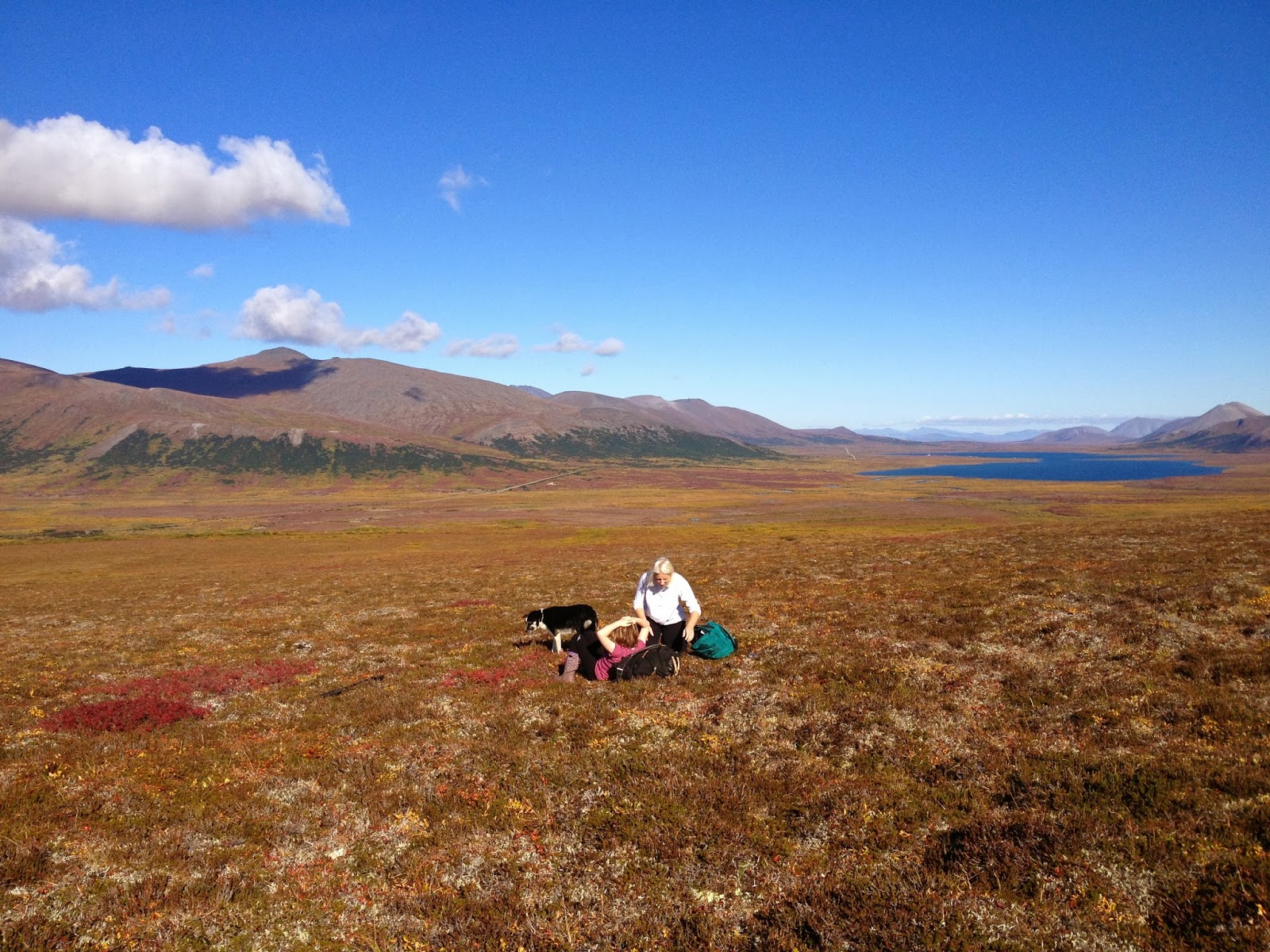
(above) Hold your life out at arm's length, beauty suspended in clear drop of time.  Kristine, Raina, and Lucy, picking September blueberries above Copper Creek.  And there's the peak Lucy and I were blessed to climb the following day, "Aqalgiqpq," hanging on the horizon left of Salmon Lake.

Saturday, August 20, 2011

Third Tog, North Ridge, Slimedog Millionaire

I'm fixing a hole where the rain gets in...

(above)  "Third Tog" (Pk. 3150+), Crater Creek valley.  North Ridge is the righthand skyline.

     1SA (1 Sunday ago)
     Andy Sterns and I slogged to Crater Creek for another attempt on the North Ridge of the "Third Tog".   Boy, did we get Murphied:  the days we were in the mountains, it rained, and the days we were out of the mountains, the sun shone, and shines still, as the GLUE OF TOWN holds me fast like a clam-digger with one boot stuck in the mud of Turnagain with the tide coming in.  M.L.D.'s-- Murphy's Law derivatives--  always difficult pills to swallow. One endures the irony-burn of all the oh what a nice day!s with as much good cheer as one can muster.  
      Though no SEND was obtained, we did some great pitches of sliming, despite the climb.  Andy was a driving force in comparison with my natural laziness and exuded immense climbing drive every morning.   Where my other Fairbanks friends poke fun at the choss topples in the Kigluaiks, Andy hallucinates routes are there.  We pretended to establish a partial route on the biggest of the Togs, "Slimedog Millionaire," two pitches of ICKY super-slime over fairly nice rock at S-8 ("slime-eight") with a few "Scottish-free" moves.   

(above)  North side of Tog 3, Crater Creek.  To see the approximate climbing line, you could click here. For an account of my rained-out solo attempt on the Tog last year (which I have foolishly reiterated this year), plus a discussion of Crater Creek hiking, you could click here.  The rock is granitic gneiss.

       On last week's attempt, Andy and I got about a third of the way up the ridge before severe SLIME necessitated a quick rappel back to the safety of the green slabs at the base, where Lucy the mountain dog was waiting for us, scampering on fourth class terrain.  
       The whole route, we learned, is probably only four pitches.  On many earlier trips to the mountain, my brain had perceived the Third Tog as a soaring Temple Crag fluted with multiple Moon Goddess Aretes, and had thusly persuaded Andy to "drain his tank" of mileage and come climbing in the Kigs. What we found there was more like a highly-degraded Aeolian Butte-- but what a gorgeous middle-of-nowhere in which to be climbing! 


(above)  The "human mules":  Rick, Daniel, and Andy, with Lucy, pausing at glacial erratic, Crater Creek.  Did I mention we were cold?  Yes, assuredly so, everyone is soaking wet.  A breeze is blowing.  Alaaparut.

       For the first time ever, we experimented with usage of human mules.  The idea was to exploit unwitting locals by offering them a few pittances in exchange for carrying our prodigious kit to the base of the moraines.   Rick and Daniel Anderson were easily gulled into leaving for Crater Creek immediately with 50 lb. packs on their backs, despite the rain;  both father and son, I assured Andy beforehand, were "monster hikers," and they certainly proved true my claim.  The idea was that mules would be cheaper than a helicopter with Bering Air, though the final result was mixed;  we grew emotionally attached to our mules, and felt horrible to see them suffer in the wet brush on the way in, and strange about trying to make it a hired gig... yet, did the mules seem to enjoy their burdensome task?  Next year, we'll all ride the helicopter, mule-brothers, how about it?  Yee-Haw!

(above)  Pitch 1, "Slimedog Millionaire."

      The first night was icky and cold;  we awoke soggy-clothed in the morning with the tent in full-puddle.  My ancient, utterly BEAT BIBLER was giving up the ghost, silly plastic pole-guide rings popping right and left, laminations delaminating, pinholes emerging like dripping stars, a ripping noise with every zip.  After so many years of proud service-- stove fires in the Todd-Tex, the massively-rumbling horrors outside the yellow wall, boredom on the inside, novels, pee bottles, drifting snow, pressing my face into the wall all night, spiders, the porcupine I slept with one night--  the tent finally earned its true name on this last trip:  ICKY WOODS.  
       The next day we retrieved the gear that Rick and Daniel had helped us to cache, under pulses of rain-shower and a sky that shifted directions like a candle at a birthday party where all the kids are blowing at once from different directions.  The following day we arose from our icky beds of gelatinous slime and ascended into mist, "just to have a look at the route."  Many crack systems presented themselves;  we chose an attractive one and started up.  Good jams, plugging cams, slimy hands, what does it matter if you got good jams?  But after a few fun moves, a squeeze chimney lubricated with Preparation-H raised a chafing conundrum: "Uh, Andy, I could aid this, but it would be so much more fun if only it were dry.  I just know I would enjoy shoving my body through this painful, corrugated, cheese-shredder, if only it were dry."  Rain was falling.  The black squeeze glistened with Preparation-H.
       So we switched off our northwall brows, and whipped up a top rope, and had an absolute ball climbing in the 100% precipitation for the rest of the day.  We left our gear and returned to Icky Woods.  A patch of sun came out and set us to steaming.  We dried our bags in the sun. Andy proclaimed our fortune had turned, the weather was now good.
(above)  Andy descending Class 4 slabs.  The buttress directly over his head is the proper route;  we chose greener, path-of-least-resistance lines a little further to the right.

       The next day, we went back up into chance of showers, "just to assess the slime-factor," but both of us knew it would probably be our one, big attempt--  we were sodden, and our calories were running out.  Lucy, the Border Collie, on her first technical climbing expedition, proved perfectly cognizant of a dogs role in wall climbing;  at the exact point where the 5th class commenced, she was happy to renounce her until-then constant obssession with following our every body movement, and retreat to the base like a good dog, with no blatant whimperings, nor attempts at mental manipulation at which this one-year old herding-dog excels.   
(above and below)  Pitch 1, "Slimedog Millionaire."

       We decided to damn the aesthetics and just clutch up whatever route would get us through the slime-fields the easiest.  A Class 4 approach pitch on wet grass led to some rock.  I placed an El Cap's worth of gear in about 40 ft., then did a cool little move across a dihedral and belayed.  The pictures show Andy following the cool little move across the dihedral. 
      The dark clouds were engorging, the rain ceiling was coming down fast.  Something happened to me for a moment;  the old tiger came out.  An arrogant Benowitzian impatience took hold;  I sunk all ten fingernails into vertical dirt and spider-clawed up the next 5.7 hanging tundra pitch, without putting in ten-thousand pieces or wailing like an expectant father.  Just as quickly, the tiger subsided back into loserdom and I felt fearful again.  Why the almost angry burst?  It was obvious to me that we would never complete this climb that day, we were soaked, we had no puffy coats, the wind was conjuring hypothermia, and the climbing was slime, only slime.  I felt like returning to Icky Woods immediately and reading about hypothermic Bolsheviks in my book, "The People's Act of Love," by James Meeks.  YET, I knew that Andy, bless his heart, was down there at the belay, perfectly excited to forge upwards into the increasing rain of our decreasing interval, to do one more pitch, just for the "fun" of it. 
          
(above)  The upper pitches of Third Tog, North Ridge.

      I came to a large, ledgy area with a slime-fall coming down from above.  The rain was like a foam, everywhere, over everything.  The upper part of the route looked very doable.  Murphy!  It actually looked like fun, exposed climbing.  This was the point where my woeful misjudgment of the climb became apparent. Hitherto I had held this climb of the Tog as a Jorasses-like north wall where hapless alpinists could potentially end up as frozen barnacles plastered to the headwall by cake-frosting, grimly visible from the green floor of the valley, forever out of reach.  Now I view it is a fun climb on decent choss that one could do in a few hours.  Must get back in there to solo it;  or you!
(above)  Rappelling off Slimedog Millionaire in the rain.  Pitch 1 went where the rope is.

(below)  Andy Sterns in the wet.  Slime factor 7.  Retreat.  As always, Andy is radiating positive vibrations, even though he appears in this shot to be glowering.


        Down at Icky Woods, Andy tuned a weather report on KNOM.  "There is a 100% chance of rain today, 100% tonight, 100% tomorrow."  Powerbar wrappers mucilaginously clung to the tent walls, which shook and spattered with wind and rain.  Lucy curled stoically outside in a nest of mud, too young to ever have known the precedent of coming inside Icky Woods. We discussed our options.  We had brought our gear down from the wall.  The GLUE OF TOWN was oozing in through the cracks in our steely focus.  We discussed relationships and what assholes we were. 
       In the end, it was decided that a full return to town was way too hideous a prospect:  responsibilities and commitments would be waiting there to spring like hidden predators.  We settled on the idea of hiking out to Earp's cabin the following morning with half the gear;  we would hike a "Togathon" the following day, in and out of Crater Creek, sixteen miles, to retrieve the rest of the gear.

(above)  Andy wading Crater Creek on our exodus, Thursday, August 11, 2011.  Still a casual crossing, but I had never seen the water that high.

       Here is what my friend Diana Haecker wrote in the Nome Nugget, week of August 18, about the day that Andy and I chose to flee Icky Woods and the mountains:

                         The unusually heavy downpour of rain last week made Thursday, August 11,
                         the wettest day in almost seven years with a precipitation of 1.21 inches, reports
                         the National Weather Service.  This is in line with the trend of this wet summer
                         of 2011, which already saw July being the seventh all-time wettest month in
                         Nome's 105 years of weather data record keeping.

It sucked.

       Crater Creek had physically increased in length.  We suffered.  Allapa.  We reached the 4-wheeler.  The plan was for Lucy to run alongside the 4-wheeler for several miles;  "I'll just perch up there on top of those bags," her eyes seemed to say, so we let her on.   The Clampetts motored down the Kougarak Road towards the dry cabin. 


(above)  Salmon Lake

             Earp's cabin had never felt so good.  I'll never forget the smile of the dog, who had been sleeping out in the drink for days.  But like an invisible gas, the GLUE OF TOWN seeped into the room.  A phenomenon known as "Relationship Force" was exerting a strong current on Andy, as he had not seen his partner all summer.  That meant we were hosed;  I myself am tragically predisposed to succumb to the GLUE.  It became a foregone conclusion:  the next day, our party of three piled onto Prolly, the 4-wheeler, and motored back to the fleshpots of Nome.

(above)  Tog 3 in Winter.

        The "Togs" is my pet name for the metamorphic-granite structures that one encounters in the south fork of Crater Creek.  These cliffs are not visible from the Kougarak Road, but unfold spectacularly when one turns the corner on the obviously-glaciated valley about six miles up.  The name derives from a color-coded designation in the explanation of my geological map of the Kigs, "Bedrock Geologic Map of the Kigluaik Mountains...," by Amato and Miller.  The good climbing rock in the Kigs shows up as pink on this map, and the explanation reads:  "pre-Cambrian Thompson Creek OrthGneiss," from which "C-TOG" was derived, which Andy and shortened this trip to simply TOG.
         I identify 7 separate Togs in the valley.  This is a cusp area where the pluton is in contact with the schist;  Crater Glacier must have come through during the last glaciation and sliced off the very edge of this plutonic uplift, leaving little fingernail clippings of granitic gneiss lying upright on the southeast wall of the valley.  There's plenty of rock up there.  The 7th Tog (Pk. 3950+?) is one of the highest peaks in the region;  got to get out of this naming business, really, the true EarthSea names of things are locked inside the land.    The Third is the largest of the Togs;  the summit is pleasantly attainable on the Class 2 south side;  try bouldering your way to the top on the northwest side via discontinuous I-can-imagine-it's-granite slabs interspersed with great fat-pad balconies made of hanging tundra.


(below)  Crater Creek area.  This is an old, rather sloppy map.  Regarding the approach to the Togs, the verdict is in:  it's easier to hike on the riverbed on the way in (but more bearonoid).

Wednesday, March 23, 2011

Ascent of "Kayuqtuq" (Pk. 4000+?)

   Recent post attested to thwarted attempts on Peak 4000+ located on the divide between Crater Creek / Fox Creek here .  Vowed to return to this insignificant hillock that my Christopher Robin imagination had transformed into a Chimborazo, a Cotopaxi, it had stolen my heart away, the Sentinel of the East End of the Kigs, a bookend paired with the Singtuq (Pk. 3870) way over on the West End, a bump become my albatross.  Three attempts I had made on Kayuqtuq, defeated each time by my servitude and laziness.  It was time to resort to the path of least resistance, which in the Kigs, is almost always the south side of the mountain.  
    Here is a pixellated figment of the mountain from the North, viewed from South Fork Crater Creek, March 2009. (below):
    The moment Earp touched ground after ascent Osborn Sunday (see here for account), the GLUE OF TOWN began to exert a strong undertow on her machine.  Perhaps "GLUE" is a misnomer;  what I saw tearing away at Joni was a FORCE, manifesting from thirty-five miles away, a concatenation of cares and responsibilities exerting attraction from a distance.  Soon, she was gone...  
     The GLUE was pulling at my machine in the direction of TOWN as well, but there was also a repulsive force emanating from town that caused me to turn, cold and soaked from the arduous climb, in the direction of wilderness.  Soon, thanks once again to Earp, I was ensconced in the cabin at Salmon Lake with gear drying, like Clyde huddling alone at Glacier House, but with MAD Magazine instead of the Iliad for company.
     The weather was banging fine, the conditions nearly perfect in the Kigluaik for mixed climbing.  My thoughts turned to Kayuqtuq;  not to be a crass peak-bagger or anything, but the peak had to be bagged.  The next morning, basking on porch with Jack Aubrey coffee in hand, I was visited by an honest-to-God KAYUQTUQ:
(above)  KAYUQTUQ (Vulpes v. alascensis)  I named him Ray Guy.  A good omen.  The peak was in the bag.

      However, before the old man could bag the peak, the old man needed a rest day from the GREAT THRASHING PUNISHMENT of bagging Osborn the day before. Rest day was used to reconnoiter a snow-machining route up Fox Creek.  It took quite a bit of searching about on foot with the Iron Dog parked to find a way past a cornice at Fox Creek's bottleneck, about three miles in from road.  
        Once this bottleneck was negotiated, however, the overwhelming OBSCENITY OF THE SNOW-MACHINE became glaringly apparent.  I was able to motor easily to the very base of Kayuqtuq's south slope.  If I had crampons with me, I would have just climbed it on my rest day.  I had snow-machined nearly to the top of my Chimborazo, my Cotopaxi.

(below)  Summit pyramid KAYUQTUQ (Pk. 4000+) from north shoulder of mountain.  My second attempt, solo, was thwarted when I chickened out of soloing this rather appealing-looking mixed ground. The drop-off to the right (northwest)  is really quite fearsome.


(above) Summit, Kayuqtuq (Pk. 4000+)  I have no reason to be sure of that elevation.  I like to fancy it is one of two "four thousanders" in the Kigs, along with Osborn.  I'll hazard a guess it has been climbed before, but I'll hazard a second that it was never climbed in a winter month either.  The wind came in huge spurts that day, like waves of customers at a market;  at the summit, it was perfectly calm.

 (above)  View towards southwest from summit of Kayuqtuq (Pk. 4000+)  1.  "Turncorner Mountain" (Pk. 3200+) between Northstar Ck. and Windy Ck.  Kristine and I climbed that big old righthand skyline one summer.  2.  Tigaraha, with its three granitic summits.  3.  Pk. 3213.  4. "Pen Tri Cwm" (Pk. 3650+), so called by Anchorage party. 5.  Mosquito Pass area-  routes to be had.
       This type of panorama fondling and pee marking is shameless, utterly embarrassing, really quite fun, never gets old.
 (above) Looking down East Ridge.  Attempt number 1 with Earp last February ended up with us retreating from somewhere in this photo.  We decided this peak wasn't anywhere near worth frostbite.  Did I mention it was cold?  Yes, very, ALLAPA!!, it was cold that day.  Lots of nice mixed climbing on gneiss around here.  If it were Scotland, there would be routes!

Friday, November 5, 2010

Bringing Out the Bucket


     This "Prindle Bucket" (above) stashed in the moraines at Crater Creek is an indication I am still in the game.  I am a climber who has gear stashed in the mountains.  My next attempt is imminent.  I'm a player.  To the question, "Been doin' any climbing lately?" I am able to answer in the strong affirmative, yes, how are you, as a matter of fact I AM climbing at this moment, simply by virtue of having a bunch of hardware and ropes in a 5-gallon bucket cached deep in the mountains (because my back is trashed and I have to double-carry everything these days.)
       But now, September had come.  The bucket was coming out.  Summer rock climbing in the Kigs was coming to an end.  The beginning of Loserdom once more....      
        
       Saturday, September 17...  Town had ravaged me...  Too many proboscises had been reamed into my chakras...I had completely lost the plot... a chance opening of circumstances allowed escape from the glue, the terrible GLUE of TOWN, the glue that requires such shameful and embarrassing self-absorption to overcome, to simply get out and do some climbing.  
      Yukon Jack acted counterintuitively as a stimulant, and got me out of Nome on Friday night.  But then, hours later, mounted on a four-wheeler with no high beam in pitch darkness out by Salmon Lake, one mile from my destination after a long ride on a long Friday evening, I drove straight into a large herd of Muskox on the road. 
        OOMINGMAK!!   Drat!    I had only been wanting to get to the cabin and collapse in my bag.  Now I would have to bull my way through this crowd of head-butters like a Polaris Centaur.  Again I would wear the hat of wildlife harasser. 
        One calf did not grasp the concept of get outta the road.  His mom, like Jim Otto, squarely in my headlights.  I rode in tight, quick circles, advancing forwards in incremental loops, my little bobble head swivelling, waiting for the awful contact with the great skull-plate coming out of the darkness.  It took 25 minutes to sweep the herd slowly off, and certainly constituted the most perilous moment of the whole trip.  I was grateful to finally fall asleep in the utter serenity and peace of the most grateful cabin at Salmon Lake... (below)
    Ostensibly, this bucket trip would also be a rematch with the lumpen heap of Pk. 3535, scene of my fog and ennui the week before.  And indeed, the day dawned beautiful, one of those not-quite-freezing Autumn days suspended in time,  but the familiar Kigsborne ennui of hiking up a hill and calling it a climb persisted, like vestigial fog on a sunny day. 
        I followed my trail along the bluffs on the south side of Crater Creek.  AKLAQ was all around, including the polite brown one that Janet, Carl and I had met a week earlier.  But the Aklaitch were fat with fish and berries;  situation non-stressful.  I dozed and power-lounged on tussoks, captivated by the thrumming humming marvel of the Kigs...  That weird thing happened, where the mountains cease to be inert stone, and reveal themselves to be sentient presences, ever communicating....  no way to translate it. 
     
      The climbing day slipped away.  I had been defeated (for the umpteenth time) by the debilitating power drains of town, coupled with my own foolish inability to patch them. 
          As consolation, I went for a hike (above) up the upper east fork of Crater Creek, a valley I'd never seen before.  Up some high moraines until I could see around the corner, lusting for a view of the hidden north face of Pk. 3325—  it proved to be another of those brown facades on the clash zone between the schist and pluton, reminiscent of False Tigaraha:  not worth climbing, unless some ice drip were to drip it on down, which looked entirely possible, north-facing cauldron like it is... A stupendous view down the length of the entire upper Crater Creek canyon—  but I had forgotten the camera down at the bucket.  You'll just have to slog up there yourself.

Saturday, October 9, 2010

Pk. 3535, Crater Creek


Pk. 3535 at the head of Crater Creek.  I walked up most of the South ridge which slants upwards to the right in the picture.

        Some lameness has crept in here.  It brings to mind the unresolved question of:  what is the lower limit of blogworthiness?   The latest is now I have failed to climb a Class 2 hill.  I have launched two Alaskan expeditions intending to achieve success on this walk-up, and been denied.  Shall I then take up valuable room in cyberspace to report this embarassment?  These are questions for the new age;  there is not yet an accumulated body of wisdom to help me decide.  
      But why not blog?  Let me detail every firing of a neuron, I shall recreate my brain on a worldwide web in conjunction with all of yours'.  The fog which follows is only an indication of my interior mental environment.
Pk. 3535 as it appeared the day I went up it, September 5, 2010.  

Fog over mountain
Fog over mind
Soon we will be mantling
Up into the sunshine

The top of the fog is an ocean
And the sky will be blue
We'll climb to the top of this island
If we can only make it through... 
  
(left) View, or lack thereof, western slopes of Pk. 3535 from halfway up South Ridge.
(right)  Claustrogo...                                      A form of madness begins to set in after a day mountain climbing in the fog.   The dissonance created when Equilibrioception is robbed of its visual component creates a mild anxiety, a hybrid of claustrophobia and vertigo:  I call it Claustrogo!  Something to dwell on as one stumbles upward through fog...  (More on Claustrogo)          At a shoulder, the ridge changed direction; I could sense it in the organelles of my vestibular system. The wind intensified.  The fog was really howling now!   The promised sunshine might still lie above, but this mountain was having trouble getting it up.  Come to think of it, the clouds had gone gray;   the September sun was getting low.  A vision of Peronto's weather map from Friday flashed into my head, all green zones and whorling Ls, along with the thought that here was come the next storm.
      Another section of weary plodding up ahead vanished into the mist.  I knew it wasn't far to the top now...  But a type of boredom had hold of me.  My mind had sprung power leaks. CHI hissed out of me and vaporized in the air like breath.  What worth this boring lump of a mountain? my mind reasoned, perhaps justifiably.  I was happy to turn around and head down.  There were interesting granite cliffs on the way.  I could huddle close to the rock in the fog and pretend to be in Tuolumne.  Pk. 3535 differs on Amato's geology map from the other peaks in the Crater Creek cirque (the C-Togs and Kayuktuqs and whatnot) by virtue of being true, unmorphed granite, as opposed to the highly metamorphic gneiss.
(above) DIBELS, Mr. White, Janet.

The miraculous, super-nice thing about the trip was getting to be in the company of friends and loved ones--  I hiked in with Carl, Janet, and DIBLS, we made it all the way to the First C-Tog and had a great night in the wind and rain.  Curious how Carl seems to have his own relationship with Crater Creek, how he repeatedly gets sucked into this vortex.  On the way in, we had Encounter #1 with a big, brown, very polite AKLAQ (Janet's first on the Seward, which seems a miracle, given how often she is found in the brush) who ran up a side hill to let us pass.  We would see more of him later.

(above) Google Earth, Pk. 3535, and hike up Crater Creek
       Here is one of my own personal hidden secret sequestered meaningless little rule for naming peaks:  whichever drainage is primarily responsible for opening up the view so that the peak comes into view, that drainage becomes the eponymous name of the peak.  For instance, "Fox Peak" is highly visible from one certain spot on the Kougarak Road where it crosses Fox Creek (when you are looking straight up Fox Creek), hence, the name Fox, even though the mountain in character seems more a denizen of Crater Creek on its northern side.  According to this rule, Pk. 3535 would become Crater Mountain, because it lies at the exact head of Crater Creek, and is what you see looking up the valley from the road. It's still rather a lump.  And these are just little reductionist fancies I entertain as I slog painfully and interminably over tussocks and through willows.

Tuesday, August 10, 2010

Third C-Tog North Buttress attempt

(left) The objective: North Buttress of the "Third C-Tog," the righthand skyline, last week on the July/August cusp.  I went in to Crater Creek thinking the route was 5 pitches;  I came out realizing it was probably twice that.  Base to summit we're looking at about 2,000 ft. in the picture;  the route itself might be 1,600 ft.  I got one pitch up and BAILED.  I could justifiably blame my retreat on the rainy weather, but deep inside, I know the bail was due to my chronic, deep-rooted failure of will.  (I count COMMON SENSE as a factor in this chronic failing!)  In fact, the weather was so-so during the six days of my trip, constantly threatening, but never precipitating all that much, fine, of course, for the approach days, deteriorating markedly on potential launch days.  In 2009 I bouldered my way to the summit via intermittent cliffs and 4th Class turf on the northwest side of the mountain, but the mountain still needs a truly technical ascent.  From the back (south) side, the  third Tog is a Class 2 walk-up.


                      The critters:  First, the 'Skox (OOMINGMAK) on the hike in, imperiously dominating the right of way (left), then the AKLAQ hanging around our camp the first night (above). He was a young male, and appeared to be nothing more than intensely curious about humans, as if he hadn't quite been paying attention to his mother's lessons and now needed to make up for his inattention in school by studying us closely in real life. He just couldn't get enough of us;  he showed off for a while with prodigious swimming feats in a nearby lake, then climbed up class 3 slopes and scree just so he kick back on a high ledge and study us for an hour or two, all the while giving off an air of youthful carefree abandon.  I had persuaded Rick Anderson to hike in with me for the first night.  After years hiking alone in the Kigs, both Rick and I are a bit jaded on being prey animals all the time.  I was so deeply grateful to Rick for being there as we stood by our tents with guns drawn, rendering the whole thing a lighthearted situation.  
      It was awful lonely bidding goodbye to Rick the next morning.  I moved my basecamp up, and was destined to spend the next few days in hyper-aware solitude twitching with constant Bearanoia, both in sleep and wakefulness. Never did see another AKLAQ, but they saw me.  They dominated my thoughts completely;  but this is the last I shall mention of them for now....

(above)  The route:  A very pathetic act, here...  I went for the Photoshop and drew the little red line EVEN THOUGH I have not yet completed the route.  Has the Internet freed us from the penalties for such a transgression?   This is the age of transparency.  I spent days scoping the route through my shiny new binoculars, and it was SO MUCH FUN drawing the little red line.  The crooked arrow points up the anus to a tremendous, sinuous, CHASM that penetrates the heart of the mountain like an intestine.    
(above)  The foot:  these are the initial cliffs of the north buttress.  The green parts are generally pretty easy climbing, but in a good drizzle, the green can be utterly treacherous, promising good footholds, but with suddenly variable coefficients of friction.  I'm still learning the art of Kigluaik route finding;  it's difficult not to let a route default into a GREEN LINE of least resistance.  The actual route here needs to go over the overhangs visible on the left.
(above)  Proof of climbing.  My new Beal rope hanging down 4th and 5th class slopes.  This is kind of embarrassing.  It might look like one could just SOLO ropeless, and one certainly could, and yet, when one is there, it all feels vaguely treacherous, especially with a scottish mist in the air.  In fact, there was a little 5.5 on this pitch; it provided a fine shakedown, no Gri-Gri, just using knots for rope-solo technique.   Kigluaik GNEISS is so preposterously fractured that climbing is like that old Mousetrap game:  one false move, one twitch, one spasm, and one risks unleashing catastrophic rockfall.  Rope soloing makes for such ridiculously slow climbing on this kind of ground that one longs for winter, when it is all frozen in place.
(above) KAYUQTUQ (Fox), Pk. 3950(?), on the divide between Crater Creek and Fox Creek, in essence, the Sixth Tog, and possibly the second highest summit in the Kigs besides the mighty Osborne, which stands nearby to the southwest...  I personally don't have access to a map which gives me a reliable altitude for this hill.  It pops into view from the Kougarak Road around Fox Creek at Salmon Lake.  KAYUQTUQ is only a little sobriquet I have applied in order to track the thing in my cluttered head.  If it has a name, could somebody please emerge forth with it?
         Kayuqtuq is included in this post by way of a RETRACTION.   For, I have already sprayblogged about this mountain in other posts, including the following post last April...     Fox and Foxy     ...which came after the second of two fun attempts on the mountain's north face the previous winter.  In the April post, I revealed myself to be completely befuddled as to which was the true summit. The photograph above, taken from Tog 3, shows which is the true summit, and myself to have been an idiot last April.  I shall not feel embarrassed, these types of befuddlements are de rigueur in the convoluted Kigs.  I still have not actually summited this mountain.  Somebody must have... yes? 

(above)  The Breach:  the preCambrian Thompson Creek OrthoGneiss has these features I call

    CHASMS...
.... one might simply refer to them as "gullies," but this term lacks the onomatopoeic grandeur of the former word to adequately describe these grand hidden canyons, formed along fault lines within the pluton that act as enormous debris chutes that shed the run-off as the mountain thrusts higher through the lithosphere over time.
        The best climbing of this trip occured after I coiled the ropes for the day, and peeked my head around the corner into this mother of all chasms, the very Breach itself.  Chasms often have very good rock, because they contain actual granite that was on the inside of the pluton and didn't get cooked into gneiss.  The Breach was no exception.  I bouldered upwards on the sidewalls of the chasm for hundreds of feet, losing myself in the continuous movement of granite climbing, sometimes looking down to find myself over that palpable limit where you suddenly say, who are you kidding, this isn't bouldering, it's free soloing...  A chasm is, however, a very very very terrible place to be for long, a hanging house of giant beartraps, an enormous playground slide littered with multi-ton boulders, NOT a place you take the boy scouts on the geology tour, a place where the foulest words you could utter are "SEISMIC ACTIVITY..."
(above)  The bouldering spot:  disgorged from the very maw of the Breach above, it's the Breach Boulders.  Some SWEET lines!  Friction, layback, offwidth, highballs...  Very nice stone...  the creek babbles among cobblestones...  can't say much for the landings.  Worth carrying the shoes for if you venture up Crater Creek....  


(above)  The Corner:  Togs 1, 2, and 3, looking west.  The C-togs are not seen from the Kougarak Road, they are AROUND THE CORNER of this T-shaped, obviously glaciated canyon.  The first miles of the hike are rather botanical, until you get up on the old moraines in the corner area.  I have not yet located any nub of a still-living glacier in Crater Creek, but one may be hiding at the top of the valley. 
(above)  Togs 1 and 2: looking northeast.  Fourth-classed a fun route on Tog 2 in '08 up the right hand side of the main buttress in this picture.  


(above) Togs 1 and 2 again, this time looking south.  After due consideration, I decided these were two independent structures.  Geologically, the C-Togs seem to be the very striking edge of the pluton where it is poking up through the mantle of schist, like a Humpback whale snout breaking up through sea ice.  You can pretty much see where the tattered edge of the schist (the sea ice) is riding up on the summit of the granite mountain (the whale's snout).
     Why "C-Tog"?  What the hell is a C-Tog?  Please remember that for all matters geological pertaining to the Kigluait, I regard my ultimate authority to be Amato & Miller's "Bedrock Geologic Map of the Kigluaik Mountains, Seward Peninsula, Alaska, 2004."  It's rather like my bible.  On the map, the C-Togs appear as little fingernails of pink pressed up against a big zone of brownish-green schist, with a little code that says the pink is pCtog.  The map key tells us this is "preCambrian Thompson Creek Orthogneiss."  That's the shit!  In the absence of any other names, that's what I call the peaks of Crater Creek South Fork...

(above) C-Tog 3 and 4, looking southeast.  The little red line shows a very silly but very fun bouldering/scramble excursion I soloed in 2009.  (link to silly related post:  Crater Creek Scrambles, featuring Carl White )  The yellow line is the north buttress that was the main topic of this post.  The outcome of this climb is still very much pending, though it looks like the rains of August may be dampening further prospects for now.

      If Norman Clyde had had Photoshop, would he have been able to resist drawing in the little red and yellow lines?

    Crater Creek is a fantastic place once you get up there.  It's as good as any National Park.  It's the epicenter of Nome climbing, which ain't saying much, brother, let me tell you, but it's a better hike any day than Grand Central Valley to the south, where the masses go...

      HIKING ADVICE:  I would recommend the south side of Crater Creek Valley (left as you're looking up Crater Creek from the Kougarak Road.)  There's a bluff paralleling and slightly elevated above the river to the south;  if you keep strictly to that bluff, that should keep you out of bushwhacking trouble.  When you reach the beginnings of the moraines (a deep unnamed drainage joins in from the left, or south) it is time to cross Crater Creek and swing wide to the right (north) as you travel left around the Corner.  Don't be too tempted to cut the corner on the inside (southwest), it gorges out into some less pleasant, rocky hiking.  
      As for the parking on the road...  man, I just don't know, lots of camps and private property, good luck, don't piss anyone off, camp on the shoulder of the road, get permission from someone, figure out something unobtrusive...  I like to park a quarter mile or so south of Crater Creek bridge, and then angle northeast towards the hiking bluff