Showing posts with label Kougarak Road hiking. Show all posts

Monday, September 23, 2013

Peak 3650+ and Peak 3320, Eastern Kigluait

          SUMMARY:  a short account, mostly peemark, of two "three-thousanders" in the Eastern Kigs this year:  Peak 3320, a lumpen mass of quartzite located at the easternmost corner of the gigantic frown shaped by the entire Kigluaik Range as a whole—  so call the peak "Iqiq," meaning "Corner of the Mouth"— done earlier this year during Iditarod week 2013.  Then, two weekends ago this Fall, Peak 3650+ in the same general area, the high point of an interesting series of ridges above Big Creek Creek forming the northern rim of Crater Creek—  call it "Aqalgiqpaq Peak" (Big Grouse) as the high point lies between these two drainages (and because I hold to a curious little rule that names should be inupiaq in Qaweraq country)
(because inupiaq is the language the land speaks)
(these are just my own personal little pet names, but I think each one fits the character of the eponymous mountain).
            Mere peak baggery reported here, only a trifle of "fell walking," definitely not the North Face of North Twin .  I am becometh a peak bagger, a hobbyist, a silly birdwatcher.  FYI, both peaks make great day hikes from the Kougarak Road.  There is a niggly little rule of Kig that says you have to keep going until you've reached the very most apical point of a mountain, whether it be a fine tor or a bump on the ridge, so be sure to keep going until you are the highest thing around.
(above) Looking west from summit of Pk. 3650+.  Crater Creek runs southwest toward Mt. Osborn on horizon   The best rock route in the Kigs is visible on the Third Tog  near the cener of the photo.  Kayuqtuq, or Peak 3850+, otherwise known as Tog 7, looms just to the left of Osborn.  I once had a theory that Kayuqtuq was the second highest peak in the Kigs, but this myth was debunked.  In this picture, you can barely make out the tip of Peak 3922, a Grand Central hill, poking out over the top of Kayuqtuq.   Kayuqtuq has been down-sized accordingly, though the contour lines be vague.
(above)  Peemark map of peaks in the Eastern Kigluaiks. All the places I have lightly scented with my spray, in order to make a small statement to gratify my ego.

(above) Peak 3320 ("Iqiq," "Corner of the mouth"), left peaklet in the back, taken from Peak 3650+,  looking east toward the Bendeleebens.  Peak 3320 is the easternmost three-thousander of the range.  During Iditarod, of course, it was swathed in hard-shell marshmallow sauce, but I carried no camera that day, so this Fall picture several months later will have to suffice.  This pictured is showing a big chunk of quartzite, (according to the Amato/Miller Geological Map.)

      PEAK 3320 ("Iqiq"):   The WEIGHT!  Felt it immediately upon arrival at Earp's cabin at Salmon Lake.  The WEIGHT is different than the GLUE.  Whereas the GLUE is a steady pull back towards town, the WEIGHT is a kind of dread bearing down on the shoulders— dread over being alone in the naked north in Winter on a single snow-machine, out where the population is zero for many square miles in all directions.    
      The whooping and barking of the Iditarod over the tiny radio at Earp's cabin only accentuated the WEIGHT.  Deep silence drilled into my sub-awareness.  My "technical chicken out of Iditarod 2013" occurred right then and there in the no-heat cabin.  Disguising cowardice and lack of will as something approaching good, common sense, I decided I'd better not attempt anything too ambitious that trip. 
       After a late start the next morning,  fired up Super Smooth Andy G. and motored north up the road up to where it turns on the corner on the easternmost Kigs.  Scanning the hillside constantly for a way up that wouldn't result in Super Smooth! wrapped to the axles in willows.  Finally breached the horizontal willow band at full throttle up Homestake Creek, and proceeded up the slopes of Peak 3320 as high as the .570 Bearcat dared without tipping. 
       Donned crampons right at the machine, and began slog.  Fine day, not too alaapa.  First the snow was soft, then it was tundra, then it was hard.  As you could see from the picture above, nothing was too very steep.  The Bendeleeben Range hung on the horizon sixty miles to the north, calling to me across the deep waters like a frozen, blue Bali Ha'i.  I was hoping for a jagged summit tor encased in ice;  alas the summit was rounded. However, the ubiquitous north-side drop-off was in evidence.  Almost surely this mountain had been climbed before;  the scent of geologist was all over the rocks.  
       Admired view a long time, flat-footed it down the mountain.  Orange and yellow light played out over the deep blue bowl of the Imruk Basin.  When I reached Andy G., he started and we followed our own tracks back down to the road, back to Earp's cabin at Salmon Lake for another cold and lonely night listening to the Iditarod on the radio, and another day of climbing tomorrow.
(above) Peak 2600+, the sweet little peak visited the second day of my Iditarod. This picture is taken looking south from Grand Central;  I hiked up it from the other side.  The other side abuts Fox Creek and makes a nice shortish hike from Salmon Lake.  No crampons necessary.  This was one of several "climbs" that got me in trouble in KigsCourt:  because I didn't use my Iditarod vacation to climb something more challenging, the Judge says I was establishing a pattern of "Technical Chicken-Outs" and threatened to revoke my climbing license.
     
(above)  Big Creek Bluffs, with the limestone/marble/deathchoss band transversing the hillside.  A decent workout can be had bouldering along the bottom of this band, marveling at the varying metamorphic geology as you traverse along.  A paucity of anchors, a shortage of vertical, and an overabundance of deathchoss make top-roping here a dubious proposition.
(above) Earp top-roping the deathchoss at Big Creek.

      PEAK 3650+ ("Aqalgiqpaq"):  No WEIGHT!  No GLUE!  Arrived at Salmon Lake late Saturday night, with the stars and aurora reflecting on the dark water.  Any high expectations I might have had for myself had already been beaten down by a summer of Lethian forgetfulness and demotivation.  Calm, peace, resignation, the susuration of Cranes.  Got up early Sunday morning and motored down to Grouse Creek, not far north of the Crater Creek bridge.  Lucy bounded out of truck bed, and up we went.      
      Now, Peak 3650+ is a peak I had attempted multiple times before.  There was the ominous incident one late Fall near the "Lactation Boulder" (an awesome erratic of quartzite lying on the tundra folds between Grouse Creek and Crater Creek) when we got separated after having a picnic right next to the front porch of an aklaq lair, probably one in which the aklaq was inside sleeping!  There were several defeats by big powerful NAPS that swept out of nowhere and overtook my mind in the hot Fall sunshine.  More than once, maybe,  got lost in FOG.
       But there were only green lights this time, and crimson hillsides with fruit abounding.  Lucy and I scampered up thousands of feet of Class I and II talus slopes anchored in place by tundra patches, until we leveled out on the mystical and convoluted ridgetops above Big Creek, where we lay in the sun for huge swaths of time scoping through cupped hands out west across the ENTIRE range, from the Singtuq at the western end, to this peak at the eastern end where we perched.
       Prototypical summit of the Kigs, pathetically rounded on its southeast flank, frighteningly vertiginous on its northeast, with the prettiest little rail of rock running along the topmost ridge, about as high as a picket fence, so that the hiker hikes along the ridge neatly and anti-septically separated from the dangers of the abyss, yet dares out of boredom to make little dare-devil climbing moves on top of the rail, thus getting small, occasional whiffs of exposure to stay awake.  This summit, too, must have been visited before, though I wonder if others have been as meticulous in tracking down the true high point of the massif, vis-a-vis the Kigluaik "apical point" law, as I was required to be.  Going by human inner-ear transit, which can be pretty darn accurate, I determined the high point was an unsurveyed mound of quartzite halfway between Point 3325 and Point 3509.  This peak enjoys a certain prominence, which might account for the surplus of triangulation points on the old USGS topos, but a prominence which is only evident as you stand on the mountain itself;  the thing comes off as a heap of ridges when viewed from afar.          
(above)  "Grouse Creek Pass," a low divide between Grouse Creek and Crater Creek, not far from the Kougarak Road.  This may be the best way to access upper Crater Creek.  This picture is looking west from Grouse Creek.  The background peak notched in the pass is  Peak 3300+, a peak I call "Warren Peak," hiked up several springs ago in deep fog via the low-angle left skyline.
          If MENTAL PROCESS pervades matter and energy for all regions of space/time, then mountains also are pervaded by MENTAL PROCESS.  Mountains think.  The reason this seems preposterous, is that mountains, being made of relatively stable abiotic minerals, (at least, you hope they're stable!)  are not particularly entropic.  Mental process only manifests at detectable levels where a certain level of entropy is present, such as a neural network with nerve impulses whizzing down nerve pathways, or a planet with all kinds of things going on inside its atmosphere.  So MENTAL PROCESS is a zero-intensity wave that passes right through the mountain without making much difference.
        What I mean by "mountains think" is that the potential for MENTAL PROCESS exists at any spatial point within the mountain, except that, let's face it, there's not much probability it will manifest anywhere in the dead zone of stone.  But perhaps there is an "as yet unexplained" phenomenon that generates MIND within the stone due to the mountain being a component of a larger entity, the Earth, which can be said to be thinking, especially if it's busy little consumer-resource systems are included.  I know, I just know, these mountains have some type of awareness, it's just different than animal awareness, so we can't access it.  And because it is a weak force as it manifests within the systems, it resists empirical proof and eludes scientific observation. You will think I am out there talking to myself...

(above) Video of Lucy sending Copper Creek Falls, 2 Saturdays ago.  Class 4/5.
(above)  Lucy peacocking on top of the Anvil at Anvil Mountain on a Fall weeknight.  The Anvil is not to be underestimated as a rock climb, though many a kid has soloed it.  A case could be made for the Anvil being fifth class by any route.  So when I climbed to the top and called Lucy,  I figured I was only tormenting her, a primate mocking a quadraped.  I was surprised to find the quadraped soon standing next to me on the summit, but I was dismayed too, for it meant I would have to carry her somehow while I soloed down.  But no, she down-climbed just fine. She found a little dog ramp of her own.
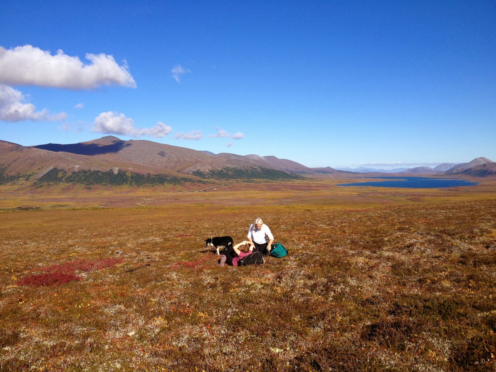
(above) Hold your life out at arm's length, beauty suspended in clear drop of time.  Kristine, Raina, and Lucy, picking September blueberries above Copper Creek.  And there's the peak Lucy and I were blessed to climb the following day, "Aqalgiqpq," hanging on the horizon left of Salmon Lake.

Sunday, December 23, 2012

Dorothy Falls

       Analogy for Interior Alaskan ice climbers:
  
Fairbanks, Alaska is to Dragonfly Falls
as 
Nome, Alaska is to Dorothy Falls. 

       The analogy holds, though Dorothy be not half Dragonfly.  Dorothy is where climbers are generally referred when the question is asked: "Is there any ice climbing round Nome?," though what the climber finds after hiking up the wonderful Dorothy Creek is only a paltry, rounded, 20 ft. blob of blue ice, WI 2 at best.
         I had climbed there many a time in the past, but not since the inception of Kigsblog in 2009, when Nate Skains and I spontaneously decided to motor out to mile 24 Kougarak Road on Saturday a week ago.  Since Kigsblog has never posted on the topic of Dorothy Creek, here arises the opportunity to "poo poo" this "popular" ice climbing area, just as a Fairbanks hardman might poo-poo Dragonfly for being the popular destination of weekend noobs, with a parking lot full of cars and young people in shiny new Gore-Tex, when the real climbing lies hidden deeper inside the canyons labyrinths, or up in the highest mountains.


       Nate and I developed exoskeleton as we ran laps up and down.  Dorothy Falls drip-streamed blue and wet, with the temperature well below zero;  water drip-dropped copiously from the surface of the ice as we climbed, then flash-froze onto our creaking Gore-Tex suits.  Our soft, warm bodies became encased inside a hardened, jointed, translucent shell, the memory of our warm-blooded, mammalian selves sealed over by cold, insectile sensibility— with the need for stealth and constant movement to keep from freezing immobile.  I was destined to ride home in Nate's Jeep still wearing my crampons frozen onto my  feet by the exoskeleton. 

       Cleaning out cobwebs in the brain pathways that light up with ice climbing... cobwebs accumulate rapidly while you were away on the rock... Had to rediscover that weight-shift, "monkey hang" thing in the hips where you stick your tushy out into space behind you even though your brain does not wish to stick your tushy out, only then does the absurd little system of opposed spikes on your toes and hands dig in to the ice correctly...   Death-knuckling of the shafts (due to the primordial fear of being surrounded by a steep walls with no purchase or friction whatsoever) gradually began to subside, and it was relearned that you barely have to hold on to the shafts at all.  Soon, I was bored at Dorothy Falls, a good sign...  We soloed many laps, trying to get the feeling back of movement over ice, enjoying the bonus adrenalin rush that comes each time you make the Zone 2 pullover at the top.

       The real fun comes on the mixed highballing problems to the right or left of the icefall that climb over the 20 ft., circular, marble wall that forms the Falls amphitheater:  steep little ramps and corners tufted with frozen dabs of turf necessitating stemming and pull-overs that are not without mental stimulation owing to the consequences of a mistake.  One M-5 move from last Saturday stands in my memory:  frontpoints precisely stemmed out on crystals in a nicely formed corner, you lean out and sink a big fatty in an overhanging, overflowing, overgrowing blob of turf, and without hesitation at 16 ft. you lean  your full weight back on the rig and yard up. 

       Johnson was hungry that Fall.  A man just gets tired of ptarmigan, that's all.  He was stuck out at Dorothy with everything iced up, no early season snow, the days short and dark, Nome looking very far away, and no company at the cabins except for Mr. Wiggins, and wasn't he a barrel of fun?
         One good thing:  the Company had set him up with some fine gear to use that season.  He particularly enjoyed the custom creeper / snowshoe rig he had engineered from all the truck:  right now, in this cold drought of a December, he was only using the creepers.
         After breakfast one morning around Christmas, Johnson went for his walk up the Creek, walking right out on the creek ice which was blue and bulging with suppressed flow.  As usual, he continued all the way up the drainage (which, Johnson had to admit, was not seeing the kind of color they had come to expect from it in years past) until he reached the waterfall, a charmed little spot that just made a hell of a swimming hole on a hot summer day.
       Now, Johnson, as you know a student of Eckenstein, Fehrmann, and Perry-Smith from his time at the Technicum in Saxony, as you might predict had on prior occasions executed a few moves of technical rock-climbing on the limestone walls at the swimming hole.   This Fall he had fashioned sharp and wicked hooks for his hands with a clever harness system, and with the excellent creepers on his feet intended to climb the ice of Dorothy Falls itself.
      But his efforts were over in a few seconds.  Johnson found his hooks and creepers bit the soft, pliable ice almost effortlessly.  A few kicks, and he had surmounted the steep bit in the creek.  Dorothy Falls had not been worth, as they used to say, "leaving the whiskey bar."  Johnson felt a bit embarrassed about his little divertimento--  it had taken him the better part of a day to fashion the gear.  No need to tell anybody about this one....  

       Beta:  find Dorothy Creek on the map, somewhere around Mile 20 something Kougarak Road.   Cross Nome River which is braided in this area, crossing can be problematic but usually not.  Head west up Dorothy Creek drainage at a red cabin visible from road.  Falls is a mile or two up the drainage.  If summertime and bearanoid, walk up on hillside above the drainage to the left (south) and easily drop back down into drainage at Dorothy Falls amphitheatre.  If not bearanoid, enjoy walk up the creek, about anybody can do it.  If creek is frozen, definitely wear crampons, the hike is almost always interesting and really fun and never deep enough to truly drown.  When Nate and I hiked it last Saturday there sure was a ton of overflow building the creek up.  A great place for beginning ice climbers, never hurts to bring a rope and some screws.

Wednesday, August 1, 2012

Tigaraha East

     Prior to the ascent of Slimedog (see previous post) three Saturdays ago, Phil and I slogged in to the Sinuk for a repeat of the "East Arete of the East Tig(II, 5.4, big Class 4 approach), the right-hand knuckle in the giant birdy-finger of Tigaraha as viewed from the south in the dead of winter when it's the only mountain not holding snow.  I don't think Phil and I could have achieved success in Crater Creek on the Slimedog (or "Greendog" as we are now calling it, being as the Slimedog is incomplete, having avoided the arete on pitch 1, see previous post) had we not gotten to know each other as climbers beforehand on Tigaraha, 7 Sundays previous.  East Tig seems the way more doable option in a weekend than the taller Grand Tig next door.  More Nomen-climbers should pay the price of one brutal hike to do this climb;  accordingly, I have reached into my brain for this post and clicked on Allow yourself to sound like a guidebook author.  


        (above) Phil Westcott on descent of "East Tig", June 2, 2012 ( 5 Saturdays Ago). Much of the route is visible beyond Phil.  The route follows a ramp system perched rather flutteringly over the impressive swoop of the north face of Tigaraha.  A 35 ft. chimney on the summit pitch is visible in the photo as a vertical black line rising out of a notch at the righthand edge of the photo.  In front of that is a rather exposed 5.4 slab.

  5SA The GLUE OF TOWN lay thick and sticky with the post-schoolyear pile-up of personal responsibilities.  The GLUE threw everything it could think of in my way, including, at the last minute, a failed, moose-blood dripping, refrigerator/freezer in my home.  In my blind frenzy to cut through the GLUE with the MACHETE OF SELFISHNESS to make my escape to the mountains, I committed many uncoolnesses;  wasted meat of moose incurred loss of karma points.  Thanks go out again to life-partner Kristine whose own nonentropy field counterbalances my own considerable disorder, and without whom no Kigsblog would be able to combine action with rave and spew.  
      Part of the urgency of the climbing window at the time 4SA was the dual presence of those two most rare commodities: good weather in the Kigs, and a motivated partner.  Phil Westcott was here for the Spring in the employ of the National Park Service and seemed to have the right set of rather off-beat qualifications to make a proper Kigsboy—  i.e., an individual who might see some sense in doing worthless climbs on small, toppling choss heaps with huge, torturous approaches.  We set the compass to STEELY FOCUS, hacked our way out through dense foliage composed of doubt, schedules, computers, parties, the GLUE, in short, to the mountains, where all was soon forgotten.


(above and left) Tigaraha from north.  The pitches are marked on the E. Tig to give a sense of scale. The best descent is to downclimb the route.   For greater kicks, from the summit of East Tig continue west along the spine of Tigaraha following the 2005 Peacock-McRae route (IV, 5.9)  MARK!, leg up, spin, leg up, can't find it, tail in the way, MARK!, spray some down there, ah, the easement upon the swollen bladder of Narcissus brings relief  the continuation of the East Arete to the Grand Tig, by downclimbing two pitches (these would be the West Ridge of East Tig, 2 pitches, 5. 3), then getting back up on the spine of the arete via an enlivening 5.9 pitch with a rotten overhang-- the rest is a sidewalk in the sky with great climbing up to 5.8 until you reach the summit of the Grand Tigaraha, whereupon downclimbing the 5.3 sky-friction slabs of the West Arete bring you to the West Notch between the Grand and West Tig.  This Notch, accessible by Class 3 slopes, would mark the starting point for the regular route on Grand Tigaraha, the West Arete, (II, 5.4).
    One may return to a basecamp in the Sinuk from the West Notch by heading back east across 4th class slabs that traverse under the 800 ft. south-facing wall Tigaraha, but it's a grovelfest, and treacherous when wet;  somewhat easier to contour around to the northwest of the West Tig, staying high, traversing across Class 3/4 terrain, to the conspicuous "Fab Four Tors," John, Paul, George, and Ringo, which, by the way, are all excellent one-pitch climbing tors little piss here, little piss there, whirl, lift, cancel, whirl, cancel, whirl, lift, little piss here, MARK!.  From the Fab Four Tors one may descend weary lengths of Class 3 talus slopes back to the Sinuk.
        There is a hidden "North Gully" that drops from the West Notch to the north providing potential quick access from the Sinuk to the Grand Tig.  Conditions are usually icy in this chasm, and huge hanging pianos chock the narrow walls.   Once I felt compelled to put in a screw for a self-belay on some weird ice in there;  another time I painfully rappelled North Gully in rock shoes with snow-bollard anchors.  Crampons advised.


(above) 800 ft. north face of East Tig, the Grand Tig in background.  A patchwork spectrum of metamorphized granite.

     Had a discussion this morning with Samuel Johnson on dreaded Facebook (no place for introverts)(link to Sam's blog alpineessence) about a possible climbing metric for assessing approaches;  I don't know if anyone has applied a term to the concept yet, so I would offer: "slog ratio."       
    The equation is stated:

number of miles to get to the base of the actual climbing ÷ 
number of pitches of actual climbing                       =  slog ratio

        For instance, on the East Tig, it takes 8 miles of slogging for 4 pitches of actual climbing, giving a ratio of 8:4, or 2.0—  a slog ratio which, Sammy and I agreed, is horrendously high, bordering on SILLY.  Anything over a slog ratio of 1.0, meaning a mile of slogging for each pitch, would feel silly for most climbers.   Even more damning for the slog ratio of the Tig (and the Kigs in general), an adjustment factor needs to be added to the numerator to account for the last half mile of Class 4 approach slabs, which are steep, loose, and treacherous, more like 4 or 5 miles of effort (with a packsack full of Camalots) than the half mile shown on the map. 
             
(above) Phil Westcott at the rope-up area for the East Tig climb, looking southeast.  Obviously Phil is impeded by his large camera which followers of Kigsblog wish I would carry instead of the paper cameras favored by men of action.  In our later climbings, Phil later had to stow his large camera after it came within one exhalation of rolling off a thousand-foot belay ledge.  
     This spot in the picture is reached from the Sinuk via Class 4 slabs that show a good, healthy "green quotient," meaning the talus is glued down by vegetation for good footing.  One can start slogging west up the hill at a prominent glacial erratic boulder that sits at the Sinuk headwaters;  many bouldering possibilities are available on the way up.  From this spot, one can descend directly west towards the West Notch for an assault on the Grand Tig, but one starts by downclimbing steep Class 4 slabs adjacent to a hideous chasm (Kigsterm for a gully filled with talus) and a rope might be warranted for those sheep unsteady on their hooves.

(below) Ian downclimbing from the East Tig roping-up area, heading west towards the Grand Tig. This image is taken by Mikey Lean from an earlier trip in 2002.
  Norman by that time had turned into a grumpy old mountaineer, regarded by many as sketchy.  Grey-stubble bearded, grumbling to himself, gear in tatters, the dogs of the village barked in protest from their chains.  The younger climbers were friendly, but few would go on a rope with him anymore, except for Jules, who had gone back to the city and his piano... 
     Many come to Nome saying they are climbers, but few keep climbing.   Few lie within the 0.02 percent of climbers who fit within the range of freakish qualifications that would allow them to actually enjoy the climbing on the Seward Peninsula, so they drift away from climbing after a time, with a degree of frostbite usually, and I am left with that familiar feeling of uncertainty as to whether the climbing in the Kigs is really climbing at all, nor daring to look in the mirror at the old mountaineer to gauge the actual degree of his sketchiness.  
      But really, it's the SLOG  RATIO that's causing the climber attrition.  You have to work so hard in the Kigs to get to the actual climbing.  Only a person living in their own fantasy world can continually fool themselves that dragging gear over tussocked ground in the cold and wet with little chance of ever using the gear on a real wall is a worthwhile and noble venture.  Has the global practice of climbing so far degraded as of 2012 that desperate climbers are finding it necessary to hike all the way back in to the back corners of the wilderness for a few stone smudges on a hillside?  What sort of masochist buys into this fantasy?

(below) Phil Westcott and Lucy at the roping-up area, facing south.
     Answer:  Phil.  Phil Westcott of the Westcott Brothers Band showed up in Nome on an SCA internship at Bering Land Bridge and actually sought out the sketch old mountaineer (thanks to flickr and Rick Anderson for the contact, see Phil's excellent photos on flickr), it seemed like a miracle:  here was a young man dropping out of the sky who said he wanted to go climbing the Kigs, had experience on multi-pitch choss from his time at Seneca Rocks in West Virginia, didn't mind a little backpacking, and didn't care a bit that he had no gear.  Furthermore, time would prove him a member of the freakish .02 percent of climbers who actually respond positively to HIGH SLOG RATIO-style mountaineering, even after his toenails fell off and he couldn't really walk for a week or two following.  He has that type of alchemical mind that can take a chunk of anaq (such as the prospect of a horrible slog through Spring posthole-snow with a heavy pack) and transform it into something gold, a mind that crops out unpleasantries, leaving only fun and beauty, so that the mind is tricked into returning again and again to the source of its pain and beauty. 

(above)  View from roping-up area of East Tig, facing southwest.  On the left is a beautiful peak, "Turncorner Mountain" (Pk. 3250+)--   Kristine McRae and I did a horrendous fifth-class schist route on one of the righthand ridges in the summer of 2001.  Lift leg, relax, relax  On the right is a mountain I am fond of calling "Falcon Killer Pk" (Pk. 2840+) due to an attempt on my life by a Peregrine as I was soloing the highest of the granitic tors, visible as a dark bump in the picture, a 5.6 thrillfest with a prodigious drop off the starboard bow.  Lift leg, nothing coming out...ah, there it is, MARK!  I was nowhere near the nest;  she leapt out from behind a granite turret from three feet away in a most murderous and calculated fashion as I was hanging from a hand traverse with no real footholds.  Had I not heard the click of her talons beforehand, I might have let go.
     A necessary skill is managing the GLUE of TOWN, a significant force built into causation that can hoist a trip with its own petard before it's ever left town, a type of causal gravity sucking one back into Nome even as one is trying to leave it. Phil proved he had the necessary focus, achieving escape velocity despite a few swirling, muddy eddies of communal torpor hanging like fog in the NPS Bunkhouse where he'd been staying. We slogged it to Hudson Creek Pass late on a Friday night; it was Solstice, mind you, time of day had become meaningless. Next morning developed sunny and fine, birds chirping, flowers resplendent, brooks babbling, breeze with no bugs. Phil, Lucy and I slogged it some more to the glacial erratic boulder at the Upper Sinuk where we made basecamp and prepared for a steep scramble with gear up the hillside above the erratic. (Better, really, to continue another half mile up the Sinuk valley and curve around into the stunning glacial cirque underneath Tigaraha, then traverse back left across the hillside above the erratic several hundred feet higher.)
(below)  Mylon Schield playing on Sinuk erratic in 2003.


      The thousand feet of fourth class approach can be punctuated by fifth class bouldering.  After hours of sweaty toil, the three of us reached the ridgecrest.  A convenient roping-up area presented itself, also, the STAY!-command spot for Lucy.  The route follows a ramp-system with a few steep spots that leads out over the north face of Tigaraha.  I have free-soloed it several times;  the East Arete of the East Tig lends itself well to this type of Norman Clyde-style approach for anyone with decent climbing skills.  Phil was simultaneously cowed and bewitched—  "I don't think we're at Seneca Rocks anymore"— before getting his sea-legs.  
      I banged in an angle piton at a belay for the simple joy of hearing the ascending RING! drifting out over the vertical walls.  The summit pitch, a 5.6 squeeze behind 3 Volkswagons, radiated the usual Kigs feeling of fun climbing mixed with loose death.    Soon we were astride the excellent pinnacle of the East Tig looking for hundreds of miles from the Singtook in the West to Kayuqtuq in the East down the spine of a sweet little mini-Brooks Range.  I glanced at Phil's eyes;  he was bitten.  Infected.  Smitten.  He was a Kigsboy now.
(above) Phil on top of the East Tig, Mt. Osborn in the background.


(above) Grand Tig from southeast, taken from roping-up area of East Tig.  The 2005 Peacock-McRae route (IV, 5.9) on the East Arete is marked.  The best way to approach the start of the little red line there is top climb up and over the East Tig route described in this post.  The 5.9 crux would be that first vertical part of the red line that regains the crest of the arete.  From here, two easy and utterly-spectacular pitches follow the "sidewalk in the sky," followed by two pitches on the headwall with a 5.7 jamcrack to the summit.  Descend the 5.3 slabs of the West Arete and rappel a 5.6 overhang to the West Notch between Grand Tig and West Tig.

(above) Ian nearing the 5.9 overhang that gains the East Arete of the Grand Tig;  photo by Mikey Lean from an early attempt in 2002.
(above) "Chimneys of Tiresias," (III, 5.8, A1), on Northeast Wall of Grand Tigaraha.  Soloed in June, 2007. Four pitches up the north face to where it joins the peak's "regular route," the West Arete (II, 5.6), then three more classic, easy, and spectacular pitches up low-angle friction slabs to the summit. This is the only shot I seem to have of the West Arete of Tigaraha.  There is a deathly chockstone on Pitch 4 of the Tiresias Chimneys that necessitated a point of aid so as not to brush it with the slightest touch.
(above) Map of Tigaraha area 1) Park at incut gravel pit on west side of Kougarak Road around Mile 29.  The first quarter mile of bushwacking is the worst part of the hike.  2) Sinuk basecamp  3) Tigaraha  4)  Hundred year-old rockfall across Windy Creek-  best camp in the Kigs.  5) Mosquito Pass  6)  Pt. 3207, high point of "False Tigaraha"  7)  Grand Central Valley  8) "False Tigaraha", mismarked on maps as the real Tigaraha  "other 8")  "Hudson Pass"