Showing posts with label Nome ice climbing. Show all posts

Sunday, September 9, 2018

Ring of Ayasayuk

Fourth Tier ice, November 2016

BLOG-LAG tremendous. The Kigsblog-year is in danger of lapping itself. It's almost time to return to Ayasayuk for the new ice climbing year. This is an update for the last two.
Quarry face, November 2016
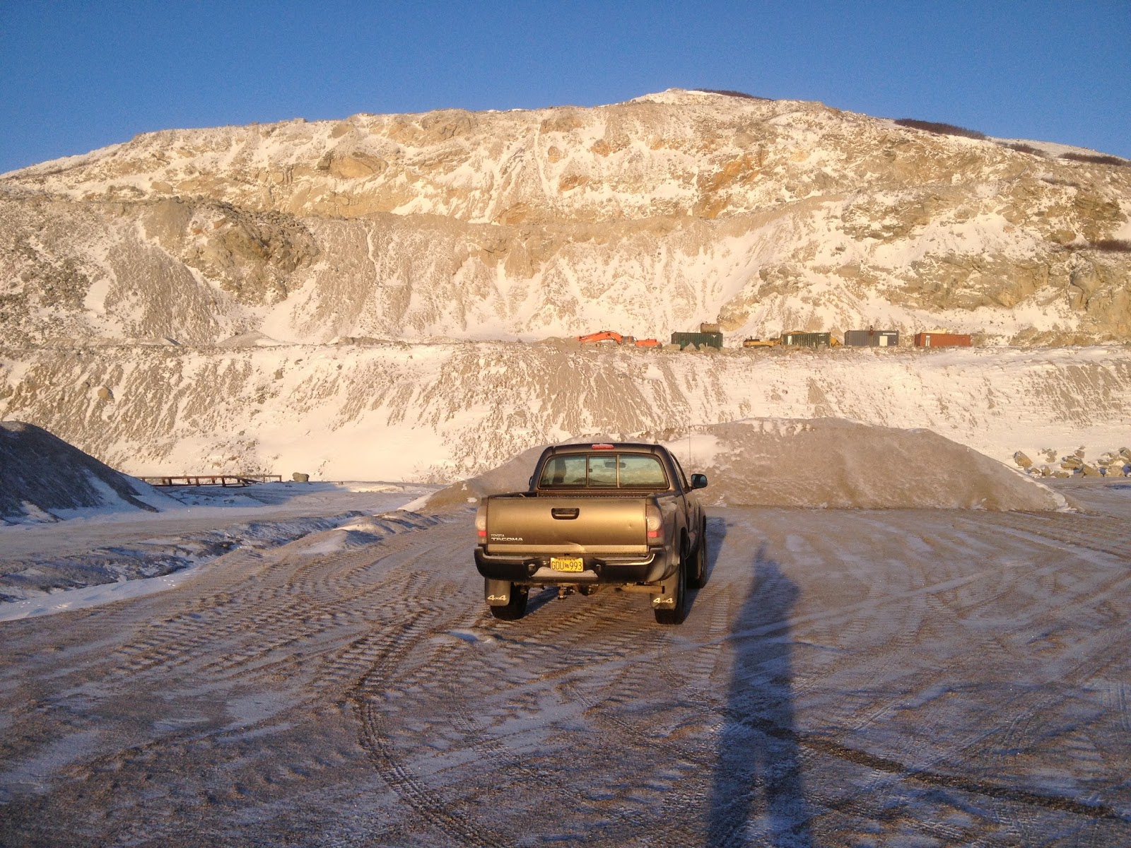
       The idea was to blog the iterations of the quarry as it develops over the years, adding to the layers of information like successive tree rings each December when the rivulets freeze into ice, when all the ice climbers in town drive 15 miles out to the point of land with their ice tools brandished, intent on grappling the ice and frozen stone dust that glues the hanging rubble to the quarry face. Each new year brings a subtle deviation in the layout of the cliff. Or sometimes a not so subtle deviation— during the years of the Shishmareff seawall project, the entire cliff was blasted away into infinity several times, hence the iterations, but there is always a path of least resistance for water to find its way down, and so there is always some kind of thin, wandering ribbon of ice to climb, even a pillar or two, if the gods of the quarry have been kind to ice climbers that year. For the hardcore Valdez climber it would all be weak sauce, but this is roadside ice climbing in Nome, let us be thankful for any helping of that.
Quarry face, 2017

      With only minor variations in the last three or four years, the iteration has remained the same. This tree ring represents climbing adventures from the last two years, as I did not manage an Ayasayuk post last year. Each year, the game is to follow a Direct route up the entire cliff, bottom to top, incorporating as much ice as possible. Lamefully, I haven't successfully completed a Direct since three years ago with James.
Third Tier ice, 2016

    The First Tier presents only steep hiking, a chance to test the bite of your crampons in the frozen stone dust of a new day. The crux is crossing the road, the boundary of trespassing, trying not to be glimpsed by cars as you leave the road and launch directly up the quarry face— this is uncool, to climb here, and I will be cited for this blogpost. You soon come to the wide access road at the top of the First Tier. Solariums have been installed at the top from which to view the surrounding amphitheater. If you think about it, the cliff at Ayasayuk represents a 430 feet tall void left by the earthly removal of the bluff once known as Ayasayuq. But what does not remain remains a place of power to this day.
Third Tier, 2016

     More fields of hanging stone dust lead up the Second Tier. The motions involved with climbing the dust mimic those of true alpine climbing. Sometimes blobs of real water ice seep from the Second Tier, but not for the last two years, so you just kick your way up great buttresses of steep, hard dirt. The consequences of a wee slip from the dust slabs are not just a mimic of alpine climbing, however, but the real thing: possible enmanglement.
David on his first ice climb, 2017


       The Third Tier is the main business, the highest of the tiers, a pitch and a half of climbing up to the next access road. The weeps and seeps have followed variable patterns the last few years, but the usual Direct route has gone up a not-very-steep mud runnel with a ribbon of water ice at the back. The runnel pools out at the top and vanishes right into the stone dust. To complete the Third Tier the climber is forced out onto the hanging dirt fields, easy terrain, but palpably creepy, and studded with rip-raps of gneiss that look like they were arrested in motion mid-roll. Typically, I solo up to the frozen pool halfway up, where I file  for a petition of chicken-out, and downclimb. Three years ago, James and I made it up the Third Tier: we draped the rope across fins of frozen stone dust, pretending it was pro.
Random Access Flow, 2017

     They shaved away the Third Tier until the face of the quarry was about level with the the top of the bluff. However, a few more little rises remained in the bluff profile, unshaved, so a few more access roads went in, creating the Fourth Tier, a 50-foot cliff situated in a little network of roads at the  top of the quarry. This road network pools up with Fall rain in unpredictable ways to create a head-dispatching system for all the frozen flow below. With a minimum of treachery, tope ropes can be set up for practice on Grade 2-ish and 3-ish water ice, and there's often"childrens ice climbing area" with perfect soft landings in billows of drifted snow.
From the archives: 2003

     It's all coming down on you
    There's nothing you can do
   And it was me that triggered
    The death cascade.
 Cracking, shouts, thundering,
   Let your destiny ring!
 Ship is going down 
 Just jump the whole thing,
While I stand to the side
Watching you drown. 
  I'm sorry we never danced around
   Or stopped at the Safety Saloon
 The lights of town
  Were always dragging us in.
   Now the climb is gravity's child,
Groaning half ton blocks
Right down on your timeline.
  Now the climb is coming down
    Right into our face
   If ever we get back to town,
    Never go back with you to this place.
Quarry face, 2003. This iteration of the cliff was blasted
away in subsequent years.


      Peemarking, in a 2-year tree ring such as this post, presents a technical challenge due to my complete lack of recall. I do remember soloing around. I whacked tool into every chunk of ice that was present. I do remember air under the crampon points, and punch-card holes spent on objective danger. I remember chickening-out of every climb I started up. I remember David chunking his way up some wet flow on his first day ice climbing. But I do not remember enough details to lift a leg and make a confident peemark (a claim of real climbing using locations, grades, nomenclature). Any peemarking claims I might try to make would only spray, dispersing message. Too bad there so few ice climbers come to Nome. David went south. Lack of climbing partner creates such a weight of nothing. No partner creates psychological rope drag holding you back from a partner that's not there. Chicken-out is reduced 75% when there is another climber present. If only there were another climber besides the great lone ME hanging in the sky, blocking the sun.
Map showing Norton Sound Coast inupiaq place names, found in a random drawer at Nome Elementary School


       Earth energy streams eastward off the Pacific, into the bottleneck of the Norton Sound, and gets channeled up against the Norton Sound coast between Cape Rodney and here, bathing the bluff in PHI waves. The other key ingredient for sentience is present: a rich archaeological history of the area. There may no longer be a kasGi every seven miles, no more L.A. coastline glittering with lights, nor even a big encampment of families a fathom down where the water is now off the beach at Nook, but stone memory is slow to dissipate. Ishigait, little people, still roam the place, manifestations of morphogenetic eddies, like dust devils of PHI, potential nodes of mental process. Does an ishigak climb ice?
      Quyana, BSNC...  

Wednesday, July 13, 2016

Cape Nome Ice, Iteration 2015

Cape Nome ice climbing
In December light, James is climbing quarried chunks of granite held together by frozen mud
Red arrow points to Ayasayuk, Cape Nome. 
Nome ice
Third Tier ice, 2015. We climbed a dirt/ice line out of the picture to the left. James was fated to leave town, the Winter Solstice world grew mega-cold, and the GLUE OF TOWN sealed me over. I never made it back out to climb this pitch.

       Cape Nome lies about 20 miles east of Nome. Viewed from Nome on a clear day, the bluff resembles a 5-mile long sausage, with the seaward end of the sausage visibly gnawed-on. Drive out there on the Nome-Council Road and the gnaw-marks prove to be the 450 ft. high Cape Nome Quarry, a long-time source of “industrial grade armor stone and rip-rap commonly used on seawalls, causeways, and breakwaters,” and also, my secret, no-doubt-trespassing, little ice climbing area in the late Fall. 
        So loose, such a hanging mine field of rock and mud is the Cape Nome Quarry, that one would never set foot on it unless it were well frozen. The Quarry is a little microcosm unto itself, a self-contained space shaped not unlike a Greek theatre. The ice that "cryo-sucks" down the face each year is a study in randomness, for no two years are ever the same. Somehow, a central flow always develops, but the path followed by the water varies according to a complex equation involving temperature, saturation, and dynamite.
         We are used to the ephemerality of ice, but this is ephemerality of Earth. Some years the quarry face has been blasted away completely leaving no trace of the climb from the year before. There is something satisfying about doing a climb which has never existed before, and will probably not exist into the next year. This year's iteration of Cape Nome did not offer particularly high-volume ice flows, but it did offer the usual helping of climbing adventure as I managed to once again to ascend the quarry face from bottom to top, up the middle of all four tiers. 
Cape Nome ice climbing
James hiking the First Tier, Council Road below
Cape Nome ice climbing
Ayasayuk, November 2015

       I drove out there twice in late November to check it out. Some interesting pillars of ice had blossomed, but my first order of business was to complete the yearly game of ascending the quarry face from bottom to top. I started up solo, but in the middle of the third tier, the ice receded into the mud wall, leaving me looking at a hundred feet of exposed, frozen mud soloing. All I could think of was how much better this mud section would be if I could go back into town and talk James into coming back out with me to hold a psychological rope.
       So we returned in early December. Technically, it was James' first alpine climb. Too bad his first ice climb had to take such a ghastly form. Stupidly, we double-rode on the snow-machine to get out there, bumping across the tundra, getting lost in the fog, and overheating the machine as people passed us by in their nice comfortable trucks up on the road, which was still open, it turns out. 
       We accessed the magical quarry kingdom from one of the access roads that transverse the face, and then dropped down to the main Council Road to make the full, bottom-to-top ascent. The first two tiers of the face are a casual mud romp, no rope necessary. Frozen mud seems to behave exactly like ice, and crampons and axes work quite well if the saturation is right. In between the tiers, the access roads provide big, spacious ledges.
        The Third Tier is the highest of the four tiers, more than a pitch. The main ice flow could be cascading down on the right in a spot that was different than the year before. A new pillar had formed, and above that, ten-inch thick slab of ice was trying to adhere to an utter hanging shit-pile of creeping granite blocks. I fully intended to return for this ice a later date, with a rack of stubby screws and a James now schooled in the ways of ice climbing, but for now, the line was to take the path of least resistance, up a mud groove to the left with an easy piping of Grade 1 blue ice at the back of it.
       At the spring, the high point of my solo a week earlier where the ice recedes into the mud wall, I made a good belay and brought James up. It's not like the next pitch was hard. There's not a hard move on it. There is just something hideous about steep frozen mud climbing. The medium is like real ice, so you whack your tools extra hard, but you feel like some sort of slump or solifluction is going to suddenly pitch you off and down the 45° slope in a great clattering, clawlike mass of spikes and rope. I drove a few Snargs and Spectres straight into the mud. They wouldn't have held a thing.  I really don't know what James thought of the whole charade as he is always rather an inscrutable lad, but I do know I was overjoyed to have him there holding the useless belay. Hard to say whether that pitch was a Class 4 scramble up some dirt, or a real pitch deserving of an "M" rating. Probably the former....
       The Fourth Tier, only about 60 ft. high, offered more flows and steep ice, but the afternoon light was throbbing with darkness. We did an easy pitch up the middle and reached the top. Waves from the dim sea lapped against the beach hundreds of feet below. An emaciated Red Fox watched us curiously. The December sunset was only a red smudge against the gray pall in the west. The lights of Nome could already be seen, and the GLUE of TOWN began to suck us slowly and inexorably toward it.
Cape Nome
Third Tier from the Proscenium
ice climbing in Nome
Looking down Third Tier
         As we zig-zagged down the access roads in the big, deep, Arctic dusk of December, still wearing crampons because the roads were a sheet of ice, I noticed the hydraulics of the ice flow underfoot. In places, birms made by machinery had caused the ice to pool up and grow thicker. Could it be that water flowing down the access roads is the source of the ice flow at Cape Nome Quarry? I had always assumed that some type of aquifer was leaking out the scar of the blown-out bluff, but this makes little sense given the elevation of Cape Nome and the fact that water does not flow uphill. 
        Geologists do not seem to have come to a consensus regarding the Late Proterozoic meta-granite of Cape Nome. Is Cape Nome related to the meta-igneous gneiss of the Kigluaiks thirty miles to the North? Just what is this anomalous little intrusion of ancient rock doing here?Marine life seems to get bunched up in the waters off the cape. Before the dynamite and the flu epidemic of 1918, plenty of people lived on the bluff. Strange little men called isragak roam the grassy headland. It was named "Ayasayuk" by the natives, "Tolstoi" by Captain Tebenkov, "Sredul" on an 1852 Russian hydrographic chart, and finally, "Nom" by Sir William Kellet, though what the British explorer meant by writing that word on his map is anyone's guess. 
Cape Nome Quarry 2003
The glory days somewhere around 2003 when that Grade 3 ice on the right used to come in. This is almost an entirely different cliff than the one in 2016 (though odd vestiges remain). Begging forgiveness from BSNC... 

Sunday, February 23, 2014

Ayasayuk '13: Sixth Iteration

At the risk of citation, here is the full disclosure of Ayasayuk 2013, with sincere apologies for the trespass, and this Kigsblogpost.

(above and below) View from the middle of Qubliaq, an unfinished and transitory drool of ice squirting from the middle of a 50° frozen mudwall festooned with gneiss chunks. Due to weak mind, I chickened and downclimbed at the cusp between mere enmanglement and probable fatality.
         Ice climbing is a changing medium, we know this. Unlike rock, the ice you climb today is not the same ice you climb tomorrow. But what if a piece of rock were as ephemeral?
       Every summer, another slice of the Bluff at Ayasayuk is blasted away by dynamite, trucked 15 miles to the Port of Nome, and distributed to village seawalls around the Seward Peninsula. What's left behind each Fall is a fresh, new, and ever-lengthening cliff overlooking the Norton Sound. Some weird aquifer must be zig-zagging around inside the rock, seeping out the face in random places, creating thin ice flows never two years the same.
       This year's Ayasayuk iteration logs as the second most interesting in fourteen years-- no Grade III pillars like in 2004, but the huge 180 ft. Third Tier from last year is still intact, with frozen trickles squirting out in new and varied places. Despite driving the ice road out to the quarry a total of seven times in November and December, the annual game of climbing from the bottom to the top went unfulfilled; I chickened out in the middle of the Third Tier, at the cusp between mere enmanglement and visualized certain death. The ice started growing in late November, peaked around mid-December, and then got destroyed in the rains of January.
(above) Ayayasuk quarry, December 2013. Can you spot the water ice? It's not easy.

       Who works at this place? What are your special names for each feature, terms known only to yourselves? Is it the job of certain individuals to scramble around on the steep stuff? Are you out there?  I can see the exasperated expression on the contractor's face. I am your biggest fan. I salute your work. The quarry hath becometh an ecosystem, a microcosm unto itself, a little kingdom of frozen mud, ice, and stone. What amounts to a scar is beautiful. I would not dare blog of it, and hath not in the past; however, it seemeth unlikely that great hordes of nano-puff recreationalists will soon be flocking to this particular sketchscape. The very mud itself oozes instability, death attractors, enmanglement clouds. Whoever driveth the Excavator on such a precipice must surely be a badass.


(above)  Bouldering around at Winter Solstice

       The measure of a village was, did it have a kasgi? John R. Bockstoce's The Archaeology of Cape Nome, Alaska says that the village of Ayasayuk lay tucked west of the Bluff, and Setuk and Mupterukshuk tucked to the east. Norton Sound can be thought of as a bathtub ringed with six or seven old beach lines. Present-day Nome sits on the third beach. The second beach is about a hundred feet offshore, where every nice day in summer we see a row of floating gold dredges; the beach miners are fifteen feet below on the sea floor hoovering up the gold, just as they did on the famous third beach in the Bonanza of 1899. Villages followed the beachlines as the millenia went by. You build your next village further inland (or out, as the case may be) in the row of driftwood from the beach line that went before, as the water in the bathtub rises and falls.


(above) Found among a pack-rat elementary school teacher's possessions.


 (above) Pirated from the interesting Bockstoce book.

    One gets an image of an entire northern Norton Sound shoreline populated by whole chains of kasgi as of the early 1800's.  So where did these populations go?  Today, the ghost villages are indiscernible from the driftwood, at least to an unobservant, non-archaeologist climber hurrying along to perform narcissistic deeds on the scar where the headland used to be. One need not look further back than 1918 to see where all the people went. Rubbed out. No wonder this shoreline is, at times, haunted with ishigait.  One of these little beings went flying by the cabin at Topkok on a tiny snow-machine, but when I went outside to inspect the tracks, I found no trace in the freshly fallen snow. 

(above) Third Tier from the mezzanine, looking east.


       Kigsblog has descended into gray depths of middle-aged anxiety, inflexibility, and loss of will. Most climbing trips these days end in chicken-out, each post must rationalize a failure. This year's iteration of Ayasayuk  is no different—  the complete bottom-to-top ascent, which is a little game this climber plays and usually quite achievable, got away from me this year, despite six or seven trips down the Zambonied road to the quarry, 15 miles east of Nome.

          I succumbed to Technical Chicken-Out.  On the Third Tier, I was unwilling to commit to soloing the second 45° mud pitch, a section of remaining wall that did go the previous year. The grade had grown subtly steeper following another summer of excavation above, and the saturation / penetrability factor conspired to make the mud-climbing feel more sketchy. I employed whole complexes of further excuses to get out of actually climbing the thing, including the whole notion that climbing such sloping choss was really just a farce, but had entirely too much fun clambering around anyway with my poor beat-up Cobras and dull Charlet-Mosers by the sea, the shining sea.
 (above) Third Tier ice flow at its peak, mid-December, 2014        

      So I hatched a plan for a type of long hanging top-rope wherein I would take the road to the top of the Third Tier and rappel down. Chickened that one, too... the Ayasayuk quarry face is just too damn sketchoid a place. I visualized the rope pulling volkswagons of gneiss and crushing both me and Sim, a mysterious character who began coming along on these December adventures. Winter Solstice was upon us, and none of these trips were an exception to the rule that the ice climber must run out of light when climbing out on the Council Road. Had a lot of fun highballing around on the Third Tier this year, but never did link it up with the Fourth.   
(above) Fourth Tier ice looking west

A MAJOR ICE CLIMBING DISCOVERY came when Sim and I boot-skated our way up the icy access roads to the Fourth Tier on top. What we found there was the Beginner's Ice-climbing wall, which was appropriate for Sim because it was. This was where we spent our cold days through the late Fall, teetering on short points, trying to allow the experience of climbing ice to become relaxing so that we would not tax our poor, feeble arm muscles by holding on much too hard. The nice thing about the Fourth Tier, it was just a darn nice balcony at which to hang, views of Setuk and Mupterukshuk to the east, and the possibility of Pinnipeds and Cetacians in the gathering sea ice below.
(above) Sim at the 30-foot Beginner Wall.

      Hollow sound, familiar sound, booming sound, propagating doppler dominoes remembrance-of-epics-past sound—  THE BEGINNER WALL IS COMING  DOWN!  Oh, and here's the horrible thing:  I, I, I, am belaying, well off to the side, safely sequestered from the multi-ton fall of Pompeii which is about to thunder down— it is not I who will be crushed but Sim, who has been flailing around on top-rope and whose bodyweight is probably causing the collapse, who will be located directly under the impact. Another partner done gone! As if the fate of the escapade were predestined to converge upon my worst fear! At least Andy Sterns had already signed his contract with the devil at the time of our accident;  Sim, he is innocent, a Zen dude from the Rec. Center wall who thought he might try ice climbing.
        It is over. Sim is fine. The small frozen pond at the base of our wall settled as Sim rained down chunks of ice upon it. Sim's name is Simon.   
(above) From Ayasayuk looking east, Lucy, and Sim. Did I mention it was cold? Uh, yes, yes it was cold.

         The spell of the quarry had begun to come over Sim, I could tell. On our January trip, the one where we discovered the ice gone, dessicated by rain, the quarry face in ruins, the walls dripping rocks so badly you couldn't stand anywhere near the base, we encountered a lone, rather diminutive Oomingmak hanging out at the rim of the Fourth Tier. We walked right past the little guy, and he kept popping up at odd angles amongst the Minecraft maze of the quarry. Was he injured, or was he hanging out in shame after some lost butt? Later that day, at the base of the Second Tier, looking in vain for a climbing line through the dripping rocks, Sim suddenly said, "Woah, heads up!" Perceptually speaking, the micro-second with which I accelerated to a run caused the incident to be registered in my memory of it as having begun to run before Sim said anything. The "Polar Vortex" held the midwestern U.S. in its grip in January, 2014, but up in Nome, Alaska, the frozen mud was melting and the quarry was a daft place to be. 
(above) Looking down the Third Tier, December 2012.  A godawful dripping choss ramp of stone and mud, a frightful place to hang, but an interesting world unto itself that grows on you after a while.

       The machines, frozen Excavators and Loaders, lonely sentinels gazing out to sea from their regal platforms on Ayasayuk.   Non-entropic pattern in an exploded waste of choss. Each one with a personality. Each haunted by an operator who is probably in Hawaii, or maybe reading this blogpost. "My name is Caterpillar, King of Kings:  Look on my works, ye mighty, and despair!"

       The lone and level Norton Sound stretches far away...

Sunday, December 23, 2012

Dorothy Falls

       Analogy for Interior Alaskan ice climbers:
  
Fairbanks, Alaska is to Dragonfly Falls
as 
Nome, Alaska is to Dorothy Falls. 

       The analogy holds, though Dorothy be not half Dragonfly.  Dorothy is where climbers are generally referred when the question is asked: "Is there any ice climbing round Nome?," though what the climber finds after hiking up the wonderful Dorothy Creek is only a paltry, rounded, 20 ft. blob of blue ice, WI 2 at best.
         I had climbed there many a time in the past, but not since the inception of Kigsblog in 2009, when Nate Skains and I spontaneously decided to motor out to mile 24 Kougarak Road on Saturday a week ago.  Since Kigsblog has never posted on the topic of Dorothy Creek, here arises the opportunity to "poo poo" this "popular" ice climbing area, just as a Fairbanks hardman might poo-poo Dragonfly for being the popular destination of weekend noobs, with a parking lot full of cars and young people in shiny new Gore-Tex, when the real climbing lies hidden deeper inside the canyons labyrinths, or up in the highest mountains.


       Nate and I developed exoskeleton as we ran laps up and down.  Dorothy Falls drip-streamed blue and wet, with the temperature well below zero;  water drip-dropped copiously from the surface of the ice as we climbed, then flash-froze onto our creaking Gore-Tex suits.  Our soft, warm bodies became encased inside a hardened, jointed, translucent shell, the memory of our warm-blooded, mammalian selves sealed over by cold, insectile sensibility— with the need for stealth and constant movement to keep from freezing immobile.  I was destined to ride home in Nate's Jeep still wearing my crampons frozen onto my  feet by the exoskeleton. 

       Cleaning out cobwebs in the brain pathways that light up with ice climbing... cobwebs accumulate rapidly while you were away on the rock... Had to rediscover that weight-shift, "monkey hang" thing in the hips where you stick your tushy out into space behind you even though your brain does not wish to stick your tushy out, only then does the absurd little system of opposed spikes on your toes and hands dig in to the ice correctly...   Death-knuckling of the shafts (due to the primordial fear of being surrounded by a steep walls with no purchase or friction whatsoever) gradually began to subside, and it was relearned that you barely have to hold on to the shafts at all.  Soon, I was bored at Dorothy Falls, a good sign...  We soloed many laps, trying to get the feeling back of movement over ice, enjoying the bonus adrenalin rush that comes each time you make the Zone 2 pullover at the top.

       The real fun comes on the mixed highballing problems to the right or left of the icefall that climb over the 20 ft., circular, marble wall that forms the Falls amphitheater:  steep little ramps and corners tufted with frozen dabs of turf necessitating stemming and pull-overs that are not without mental stimulation owing to the consequences of a mistake.  One M-5 move from last Saturday stands in my memory:  frontpoints precisely stemmed out on crystals in a nicely formed corner, you lean out and sink a big fatty in an overhanging, overflowing, overgrowing blob of turf, and without hesitation at 16 ft. you lean  your full weight back on the rig and yard up. 

       Johnson was hungry that Fall.  A man just gets tired of ptarmigan, that's all.  He was stuck out at Dorothy with everything iced up, no early season snow, the days short and dark, Nome looking very far away, and no company at the cabins except for Mr. Wiggins, and wasn't he a barrel of fun?
         One good thing:  the Company had set him up with some fine gear to use that season.  He particularly enjoyed the custom creeper / snowshoe rig he had engineered from all the truck:  right now, in this cold drought of a December, he was only using the creepers.
         After breakfast one morning around Christmas, Johnson went for his walk up the Creek, walking right out on the creek ice which was blue and bulging with suppressed flow.  As usual, he continued all the way up the drainage (which, Johnson had to admit, was not seeing the kind of color they had come to expect from it in years past) until he reached the waterfall, a charmed little spot that just made a hell of a swimming hole on a hot summer day.
       Now, Johnson, as you know a student of Eckenstein, Fehrmann, and Perry-Smith from his time at the Technicum in Saxony, as you might predict had on prior occasions executed a few moves of technical rock-climbing on the limestone walls at the swimming hole.   This Fall he had fashioned sharp and wicked hooks for his hands with a clever harness system, and with the excellent creepers on his feet intended to climb the ice of Dorothy Falls itself.
      But his efforts were over in a few seconds.  Johnson found his hooks and creepers bit the soft, pliable ice almost effortlessly.  A few kicks, and he had surmounted the steep bit in the creek.  Dorothy Falls had not been worth, as they used to say, "leaving the whiskey bar."  Johnson felt a bit embarrassed about his little divertimento--  it had taken him the better part of a day to fashion the gear.  No need to tell anybody about this one....  

       Beta:  find Dorothy Creek on the map, somewhere around Mile 20 something Kougarak Road.   Cross Nome River which is braided in this area, crossing can be problematic but usually not.  Head west up Dorothy Creek drainage at a red cabin visible from road.  Falls is a mile or two up the drainage.  If summertime and bearanoid, walk up on hillside above the drainage to the left (south) and easily drop back down into drainage at Dorothy Falls amphitheatre.  If not bearanoid, enjoy walk up the creek, about anybody can do it.  If creek is frozen, definitely wear crampons, the hike is almost always interesting and really fun and never deep enough to truly drown.  When Nate and I hiked it last Saturday there sure was a ton of overflow building the creek up.  A great place for beginning ice climbers, never hurts to bring a rope and some screws.

Wednesday, December 12, 2012

Ayasayulgit


(above) Ayasayuk quarry face, 2012.  Scarp rendered transitory as ice, never the same year after year, never before climbed, never to be repeated in exactly this same condition.  I feel very embarrassed to have gone to such lengths blogging about what essentially amounts to a piled slag heap, but perhaps its charm lies in this very ephemerality.  No egos have been chiseled into anything that will stand the test of time, it all gets dynamited to bits tomorrow.   


           Imagination is needed to climb in Nome. Once climbing becomes the metaphor that defines existence, logic follows that any medium whatsoever becomes climbing:  the two-inch jam between the bed and cab, the main-mast ladder on the six-story Dredge #5, a steep mound of frozen tailings, or the chair upon which you sit.
         Or, a ghastly 45 degree debris-flume of frozen sand and glued-in granite chunks--  I am speaking of the Ayasayuk quarry, 15 miles east of Nome.  Yes, the cat is out of the bag, there is no adequate way for Kigsblog to obfuscate around the location any longer.  It was I trespassing upon the Cape, along with Mr. Collins, last Saturday, in the kundali-intensive freezing cold of thirty-below chill factor. 
      Can this quarry even be called a cliff?  Does this 450 ft. tall scar count as a climbing area, a place where you don't go near the steep areas of rock for fear they will fulfill their destiny prematurely by rolling down the cliff over you on their way to the seawalls of Nome, Kotzebue, and other villages?       
           Imagination is needed to climb here.  But once you have made the decision to apply your imagination to this festering junk show, a run up the Cape provides a great climbing workout in a majestic setting, so closely approximating the motions, decisions, and risks of real climbing that it can only be counted as such.

 (above) Lower tier. Forty-five degree, chalk-hard frozen mud. Is this intended as another Monty Python simulated climbing shot?  Not at all, it turns out:  you cannot tell from this photo, but if Mr. Collins were to open his hands, his feet would begin to skid downward with surprising velocity. 

           I went back with Mr. Collins to get good pictures, something lacking in the Thanksgiving Ayasayuk Post due to dead batteries that day in the now-legendary Canon ProShot, the camera that spent the entire summer lying in the tundra in Tyler's driveway but still functions;  picture-taking in these photos was hampered by extreme allapa.  Did I mention it was cold?  Great streaks of gangrene it was cold!  
       The other reason for going back for another climb of the Ayasayuk was to straighten out the original Thanksgiving line, which zig-zags a great deal due to confrontations with death beetles of  trigger-happy batholithic bullshit, combined with horizontal access roads wide enough to drive  large excavators across the face of the cliff.  Mr. Collins and I should have bypassed Cape Nome altogether that day and driven 60 miles down the Norton Sound to the cliffs and ice-flows of Topkok, a journey possible in the comfort of our heated town trucks because of unusual freeze-up conditions.  But the TOWN GLUE was thick, we were losers, and we didn't go.  We settled for a repeat of the fun route on the Cape.


(above) Lower Ice Dribble, Middle Tier.

     Tried to put in screws, but the ice was cold, and they were the dirt screws— not the sharpest screws in the shed.  The first move onto the ice solicited an inelegant mantle onto a tool that, according to the Law of the Hardest Move, might give the pitch an overall rating of WI3 though it really be WI1. In truth, the whole climb felt rather like a Class 4 scramble, except that the entire medium is so weird and shattered and improbable that the only rating one could ascribe to this climb would be to invent a Cape Nome Dirt Scale specific to 2012 and use the climb itself as the one benchmark to measure itself relative to its own group of one. 


(above and above) Upper Ice Dribble. 

      Though not strictly necessary, we wore the rope between us the whole way, feeling vaguely as if we were enrolled in some groovy, therapeutical, human bonding class.  We set up anchors and went over sequences and pretended it was real climbing, even though it was.


(above) Upper dirt pitches.

    The upper dirt pitches is where I had dreamed Jeff and I could make a big splash and push the very frontiers of low-angle dirt climbing.  But the day was simply too cold for any dicking around.  I straightened out the line a bit by stair-casing it up a little rock ramp above where the ice comes oozing out, but it warn't nothing we didn't simul-climb.  There is something pleasurable about the continuous movement of crab-walking over steep mud in ice climbing gear.  Soon we were at the rim feeling like we had climbed something, though we weren't sure what.

       What has not been mentioned is the constant, pulsating force of the natural beauty exuding from our surroundings, the white desert ocean stretching to the horizon at the ice edge, the abrupt angles created by the quarry face, the buzz of SINH TALA exuding from the exploded pores of the Earth...  I apologize for not doing more research on the industry of this fascinating site.  I have so many questions.  How do they plan the excavation?  Just what causes these frozen waterfalls?  Has the quality of gneiss changed over the years.  Who works here?  What are their terms for each little thing?  Who draws the hieroglyphics on the boulders?  And will we be arrested for climbing there, and Kigsblog used against us as evidence?  Leave comments....

Monday, November 26, 2012

Ayasayuk, Fifth Iteration

(above) Raina on pointy summit of 4-story Pea Gravel mound, Ayasayuk, November 3, 2012.  


(above) Same spot 4 days later.  The ice grew surprisingly while I was in Fairbanks for those four days to say goodbye to a friend and mentor.  Though I climbed the ice visible in the picture to a discerning eye, a complete ascent of the entire cliff would require two more trips. On the sunny, gorgeous day I finished the climb, my cameral malfunctioned, so these rather gray images are from earlier trips.  The ice has continued to grow, and by Thanksgiving was blue and bulging. 

      I've down-graded the fall situation from "mangled for six to nine months" to "only minor enmanglement, maybe just a deep bruise," should I lose my purchase on this steeply canted mass of huge boulders frozen in place by semi-vertical frozen dirt.  This down-grade makes me feel better and able to enjoy the spectacular situation:  the slushy, still blue ocean stretching over the curve, and the dull yellow of the frozen dirt cliff against the sky.
        I am leaving the low-angle water ice and kicking a tentative foot into the upper dirt pitches for the first time.  Last week the dirt did not feel good, but the dirt feels good today, not the usual sensation of a cohesive mass ready to solifluct at the slightest weight.  It's Thanksgiving day.  Five above, no wind-- the Norton Sound is congealing with the first skins of sea ice.
     Now, up on the cliff, barely a centimeter of dirt glued onto a solid granite slab. Swings produce sparks.  But the steepness is not sufficient to create real tension;  magically, front points glue onto blops of dirt, good sticks are everywhere in pillows of dirt, the dirt will not landslide today.  Curved plane of blue ocean drops away as rapid progress is made scuttling through surreal steep slabs of falling sand, saturated and sculpted to the perfect consistency for dry tool climbing.
      The rim.  Four hundred feet above the silenced breakers. Chips have been spent in karmic lotteries in order to complete the ascent of this shattered facade, all for nothing:  this wall will never last.  This itereation, too, will be dynamited into the same type of dust which made the frozen climbing of it possible today.
    (above) Upper pitch of ice, Fifth Iteration, Ayasayuk 2012.

  The aquifer is not dead after all.  The seep will have its way. It twists and turns as they blow it this and  that.  Each iteration sees its own seep, but never in the same way twice, so dry in previous years I had the temerity to think it over and done. But pieces of earlier iterations reappear, toes of buttresses remembered from years back, ramps with a particular ice flow, certain distinctive cracks in the granite, all of it overladen with this gooey frozen mashed-potatoes dirt that just makes it the most fun continuous simulated alpine climbing on this fine Thanksgiving morning, until I am going mad trying to piece the whole puzzle together of how this cliff has progressed through such accelerated geological cycles, where it ends and begins. 
    Is there anyone else out there who has followed these iterations?  A foreman, an operator, perhaps? Is there a mastermind behind this cliff, a Daedulus of these iterations?  If so, allapa must not come forward, for he is surely trespassing, but let him salute you, he is one of your biggest fans, besides the same three ravens that always occupy the choice eyries, year after year.  These iterations I have shored against my ruins...
 (above) Lower drip, Fifth Iteration. 

       Clem was gone.  That is how this year's iteration started. 


Take a look at poor Peter
He's lying in pain
Now let's all go 
Run and see
Run and see
Run and see

    So I got off the plane in Nome at mid-day, all death-mongered out on the passing of Clem in Fairbanks, on the subject of which there can in truth be no words to sufficiently convey.  He was Kristine's father, and Raina's grandfather, and my father in law, and a father figure to many, and kigsblog has not the parameters to express the respect I feel.  So when I got back home I headed down the coast posing as a surfer thinking it was good to be alive.  
     Very surprised to find drips of live blue ice that had grown nicely since Raina and I had visited the spot a week previous.  Like a starving mouse seizing crumbs, I was soon soloing.  To be climbing water ice so close to a road:  it was as if the Seward Highway had come to the Seward Peninsula!  A pitch of WI1 was followed by a steepening dirt apron:  I wanted to boulder out onto the steeper dirt for kicks, but my mind saw dump-truck-sized loads of sand and gravel and boulders oozing out under my knees if I stepped up on the steep.  
    So I settled on path of least resistance, and soon gained a full-on road that transects the upper face.  This led to an enormous wall of dirt (sand and gravel would be a more apt term) with one, distinct dribble of water ice coming down.  This I soloed, but the pitch ended abruptly in a ridiculous dirt wall where the spring bubbles out of the face, ridiculous because who would ever want to climb such a slag heap?  With the orange in the West fading fast, I retreated.
(above) View from cliff.  
 Back in town, back stuck in the gluey GLUE CENTRAL of Nome, it nagged me that I had not rimmed out on my initial attempt at this year's Sixth Iteration of Ayasayuk.  I have a little Kigs-rule that states that the yearly ascent of the Ayasayuk quarry face must go from bottom to top with a maximum of vertical, and climb over whatever mediums may present themselves for that given year:  ice, mud, rock, or lameness. 
   I went back with Nate days later, but our workaday, late-afternoon formula for TOWN GLUE ESCAPAGE did not permit an ascent of the entire face;  once again, I had only time for the ice.  The dirt headwall to the rim remained unclimbed. 
    It nagged at me still.  Kigsblog lay constipated until a complete ascent could be made on the all-time Thanksgiving Day.  A person can write, and say they had an epiphany, and were laid bare upon the Earth, and were humbled by the great maker, and were weeping with thankfulness at the beauty and intensity of it all, but that wouldn't be anything at all the same as the actual moment it all happened.  Humility is to be found in the boulder-slathered fields of the quarry because it's all going to come down on you and crush you and bury you and be taken away in huge trucks and be forgotten.


(above) Chart from a previous post.  Simply add another slice to the bluff for the latest iteration.  As has been necessarily pointed out in earlier installations, the ordinal numbering of these Iterations is only relative from the author's point of view in space and time;  an older-timer than allapa might employ a different numbering system for the face of this ever-changing cliff. And I am glad to report the "friendly ice-making aquifer" is not dead after all.

Links to earlier posts:  Ayasayuk Iterations,   WI 3 or 4 pillar of Second Iteration,
Ayasuk 2010