Showing posts with label Salmon Lake. Show all posts

Monday, September 23, 2013

Peak 3650+ and Peak 3320, Eastern Kigluait

          SUMMARY:  a short account, mostly peemark, of two "three-thousanders" in the Eastern Kigs this year:  Peak 3320, a lumpen mass of quartzite located at the easternmost corner of the gigantic frown shaped by the entire Kigluaik Range as a whole—  so call the peak "Iqiq," meaning "Corner of the Mouth"— done earlier this year during Iditarod week 2013.  Then, two weekends ago this Fall, Peak 3650+ in the same general area, the high point of an interesting series of ridges above Big Creek Creek forming the northern rim of Crater Creek—  call it "Aqalgiqpaq Peak" (Big Grouse) as the high point lies between these two drainages (and because I hold to a curious little rule that names should be inupiaq in Qaweraq country)
(because inupiaq is the language the land speaks)
(these are just my own personal little pet names, but I think each one fits the character of the eponymous mountain).
            Mere peak baggery reported here, only a trifle of "fell walking," definitely not the North Face of North Twin .  I am becometh a peak bagger, a hobbyist, a silly birdwatcher.  FYI, both peaks make great day hikes from the Kougarak Road.  There is a niggly little rule of Kig that says you have to keep going until you've reached the very most apical point of a mountain, whether it be a fine tor or a bump on the ridge, so be sure to keep going until you are the highest thing around.
(above) Looking west from summit of Pk. 3650+.  Crater Creek runs southwest toward Mt. Osborn on horizon   The best rock route in the Kigs is visible on the Third Tog  near the cener of the photo.  Kayuqtuq, or Peak 3850+, otherwise known as Tog 7, looms just to the left of Osborn.  I once had a theory that Kayuqtuq was the second highest peak in the Kigs, but this myth was debunked.  In this picture, you can barely make out the tip of Peak 3922, a Grand Central hill, poking out over the top of Kayuqtuq.   Kayuqtuq has been down-sized accordingly, though the contour lines be vague.
(above)  Peemark map of peaks in the Eastern Kigluaiks. All the places I have lightly scented with my spray, in order to make a small statement to gratify my ego.

(above) Peak 3320 ("Iqiq," "Corner of the mouth"), left peaklet in the back, taken from Peak 3650+,  looking east toward the Bendeleebens.  Peak 3320 is the easternmost three-thousander of the range.  During Iditarod, of course, it was swathed in hard-shell marshmallow sauce, but I carried no camera that day, so this Fall picture several months later will have to suffice.  This pictured is showing a big chunk of quartzite, (according to the Amato/Miller Geological Map.)

      PEAK 3320 ("Iqiq"):   The WEIGHT!  Felt it immediately upon arrival at Earp's cabin at Salmon Lake.  The WEIGHT is different than the GLUE.  Whereas the GLUE is a steady pull back towards town, the WEIGHT is a kind of dread bearing down on the shoulders— dread over being alone in the naked north in Winter on a single snow-machine, out where the population is zero for many square miles in all directions.    
      The whooping and barking of the Iditarod over the tiny radio at Earp's cabin only accentuated the WEIGHT.  Deep silence drilled into my sub-awareness.  My "technical chicken out of Iditarod 2013" occurred right then and there in the no-heat cabin.  Disguising cowardice and lack of will as something approaching good, common sense, I decided I'd better not attempt anything too ambitious that trip. 
       After a late start the next morning,  fired up Super Smooth Andy G. and motored north up the road up to where it turns on the corner on the easternmost Kigs.  Scanning the hillside constantly for a way up that wouldn't result in Super Smooth! wrapped to the axles in willows.  Finally breached the horizontal willow band at full throttle up Homestake Creek, and proceeded up the slopes of Peak 3320 as high as the .570 Bearcat dared without tipping. 
       Donned crampons right at the machine, and began slog.  Fine day, not too alaapa.  First the snow was soft, then it was tundra, then it was hard.  As you could see from the picture above, nothing was too very steep.  The Bendeleeben Range hung on the horizon sixty miles to the north, calling to me across the deep waters like a frozen, blue Bali Ha'i.  I was hoping for a jagged summit tor encased in ice;  alas the summit was rounded. However, the ubiquitous north-side drop-off was in evidence.  Almost surely this mountain had been climbed before;  the scent of geologist was all over the rocks.  
       Admired view a long time, flat-footed it down the mountain.  Orange and yellow light played out over the deep blue bowl of the Imruk Basin.  When I reached Andy G., he started and we followed our own tracks back down to the road, back to Earp's cabin at Salmon Lake for another cold and lonely night listening to the Iditarod on the radio, and another day of climbing tomorrow.
(above) Peak 2600+, the sweet little peak visited the second day of my Iditarod. This picture is taken looking south from Grand Central;  I hiked up it from the other side.  The other side abuts Fox Creek and makes a nice shortish hike from Salmon Lake.  No crampons necessary.  This was one of several "climbs" that got me in trouble in KigsCourt:  because I didn't use my Iditarod vacation to climb something more challenging, the Judge says I was establishing a pattern of "Technical Chicken-Outs" and threatened to revoke my climbing license.
     
(above)  Big Creek Bluffs, with the limestone/marble/deathchoss band transversing the hillside.  A decent workout can be had bouldering along the bottom of this band, marveling at the varying metamorphic geology as you traverse along.  A paucity of anchors, a shortage of vertical, and an overabundance of deathchoss make top-roping here a dubious proposition.
(above) Earp top-roping the deathchoss at Big Creek.

      PEAK 3650+ ("Aqalgiqpaq"):  No WEIGHT!  No GLUE!  Arrived at Salmon Lake late Saturday night, with the stars and aurora reflecting on the dark water.  Any high expectations I might have had for myself had already been beaten down by a summer of Lethian forgetfulness and demotivation.  Calm, peace, resignation, the susuration of Cranes.  Got up early Sunday morning and motored down to Grouse Creek, not far north of the Crater Creek bridge.  Lucy bounded out of truck bed, and up we went.      
      Now, Peak 3650+ is a peak I had attempted multiple times before.  There was the ominous incident one late Fall near the "Lactation Boulder" (an awesome erratic of quartzite lying on the tundra folds between Grouse Creek and Crater Creek) when we got separated after having a picnic right next to the front porch of an aklaq lair, probably one in which the aklaq was inside sleeping!  There were several defeats by big powerful NAPS that swept out of nowhere and overtook my mind in the hot Fall sunshine.  More than once, maybe,  got lost in FOG.
       But there were only green lights this time, and crimson hillsides with fruit abounding.  Lucy and I scampered up thousands of feet of Class I and II talus slopes anchored in place by tundra patches, until we leveled out on the mystical and convoluted ridgetops above Big Creek, where we lay in the sun for huge swaths of time scoping through cupped hands out west across the ENTIRE range, from the Singtuq at the western end, to this peak at the eastern end where we perched.
       Prototypical summit of the Kigs, pathetically rounded on its southeast flank, frighteningly vertiginous on its northeast, with the prettiest little rail of rock running along the topmost ridge, about as high as a picket fence, so that the hiker hikes along the ridge neatly and anti-septically separated from the dangers of the abyss, yet dares out of boredom to make little dare-devil climbing moves on top of the rail, thus getting small, occasional whiffs of exposure to stay awake.  This summit, too, must have been visited before, though I wonder if others have been as meticulous in tracking down the true high point of the massif, vis-a-vis the Kigluaik "apical point" law, as I was required to be.  Going by human inner-ear transit, which can be pretty darn accurate, I determined the high point was an unsurveyed mound of quartzite halfway between Point 3325 and Point 3509.  This peak enjoys a certain prominence, which might account for the surplus of triangulation points on the old USGS topos, but a prominence which is only evident as you stand on the mountain itself;  the thing comes off as a heap of ridges when viewed from afar.          
(above)  "Grouse Creek Pass," a low divide between Grouse Creek and Crater Creek, not far from the Kougarak Road.  This may be the best way to access upper Crater Creek.  This picture is looking west from Grouse Creek.  The background peak notched in the pass is  Peak 3300+, a peak I call "Warren Peak," hiked up several springs ago in deep fog via the low-angle left skyline.
          If MENTAL PROCESS pervades matter and energy for all regions of space/time, then mountains also are pervaded by MENTAL PROCESS.  Mountains think.  The reason this seems preposterous, is that mountains, being made of relatively stable abiotic minerals, (at least, you hope they're stable!)  are not particularly entropic.  Mental process only manifests at detectable levels where a certain level of entropy is present, such as a neural network with nerve impulses whizzing down nerve pathways, or a planet with all kinds of things going on inside its atmosphere.  So MENTAL PROCESS is a zero-intensity wave that passes right through the mountain without making much difference.
        What I mean by "mountains think" is that the potential for MENTAL PROCESS exists at any spatial point within the mountain, except that, let's face it, there's not much probability it will manifest anywhere in the dead zone of stone.  But perhaps there is an "as yet unexplained" phenomenon that generates MIND within the stone due to the mountain being a component of a larger entity, the Earth, which can be said to be thinking, especially if it's busy little consumer-resource systems are included.  I know, I just know, these mountains have some type of awareness, it's just different than animal awareness, so we can't access it.  And because it is a weak force as it manifests within the systems, it resists empirical proof and eludes scientific observation. You will think I am out there talking to myself...

(above) Video of Lucy sending Copper Creek Falls, 2 Saturdays ago.  Class 4/5.
(above)  Lucy peacocking on top of the Anvil at Anvil Mountain on a Fall weeknight.  The Anvil is not to be underestimated as a rock climb, though many a kid has soloed it.  A case could be made for the Anvil being fifth class by any route.  So when I climbed to the top and called Lucy,  I figured I was only tormenting her, a primate mocking a quadraped.  I was surprised to find the quadraped soon standing next to me on the summit, but I was dismayed too, for it meant I would have to carry her somehow while I soloed down.  But no, she down-climbed just fine. She found a little dog ramp of her own.
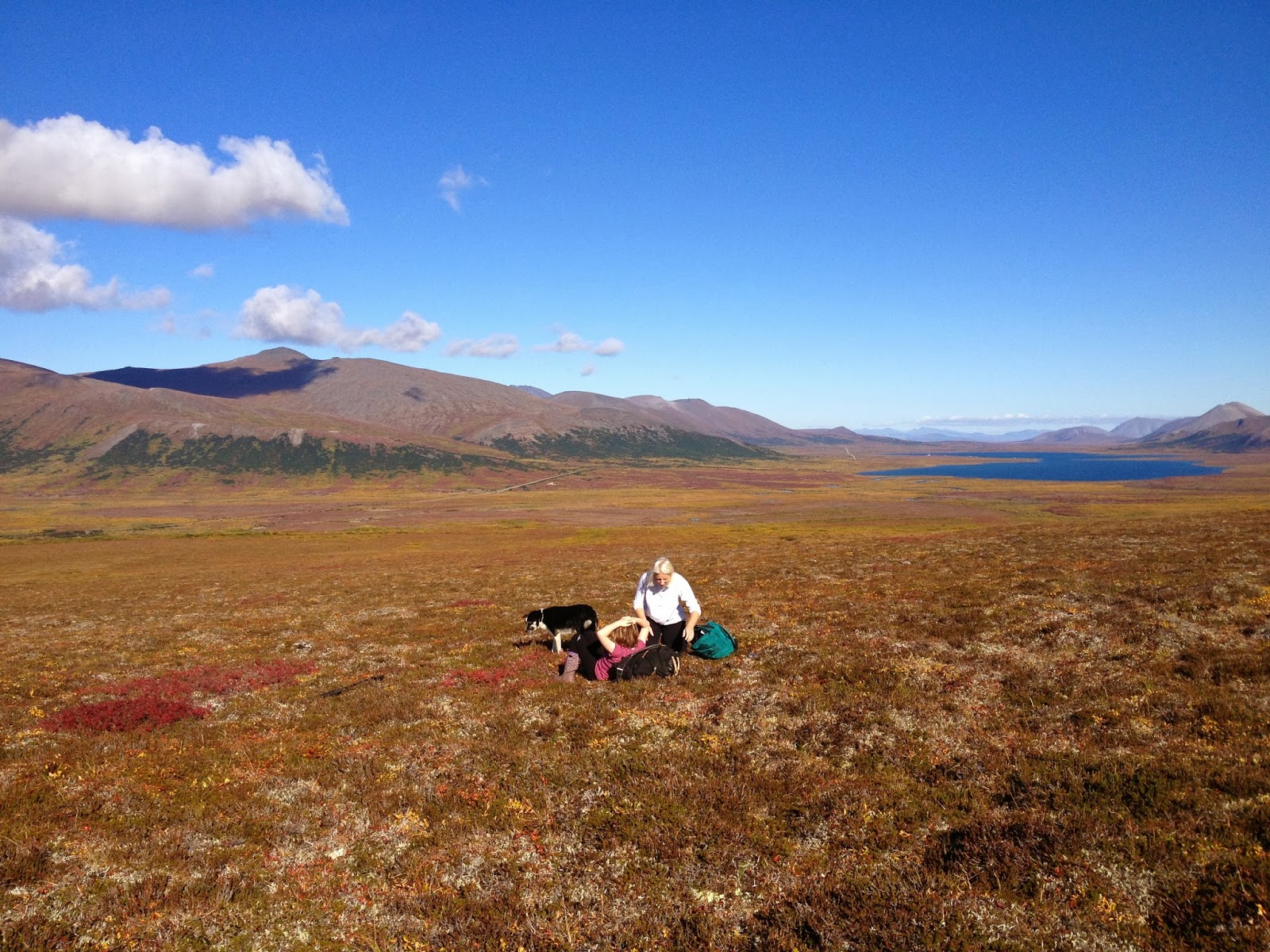
(above) Hold your life out at arm's length, beauty suspended in clear drop of time.  Kristine, Raina, and Lucy, picking September blueberries above Copper Creek.  And there's the peak Lucy and I were blessed to climb the following day, "Aqalgiqpq," hanging on the horizon left of Salmon Lake.

Friday, July 23, 2010

Mt. Warren (Pk. 3300+) via Fox/Warren Creek

Days of rain and self-pity at Salmon Lake (above, looking north), folded up between the mountains, the lake, the fog, and the DELUSION that I AM THE CENTER OF THE UNIVERSE.  On the third day I left the cabin, with a compass and a map of the Fox Creek area downloaded on a very feeble short-term memory, and headed east into the hills, having decided to provide my little summit-grubbing ego with a tiny nub of consolation:  a peak lying on the divide between Warren Creek (a tributary of Fox Creek which drains into Salmon Lake) and the Southeast Fork of Crater Creek:  Peak 3300+. 
Looking up Warren Creek (above)...   Madness quickly set in, claustrophobia.  Locked in a cell of fog all day, the brain is receiving inputs from four of the senses that the mountains are all around, but no fifth sense, no visual.  You can feel the mountains like a phantom limb.  It's disorienting, like Neo and Morpheus standing in the construct.  The obligatory Grizzly dissolved into and out of the view for a moment, precipitating much irrational fear and unnecessary detouring.

Several miles in from the Kougarak Road, the slopes began to rise, up and up.  Vapors, nothingness, sensory deprivation.  Onset of hallucinations.  Voices.  I had had too much caffineated GU.  The compass was constantly in play.  Fortunately, the terrain was matching the feeble brain download.  The summit of Pk. 3300+ (or Warren Mt., as I had started to call it) finally appeared through the fog (left).  As is usual with Kigluaik summits, the north side dropped off into chasms, while the south side provided a Class II walk up.   
This is supposed to be a picture of the fearsome drop off to the north (right), but as you can see, the image is nothing more than fuzzy shapes on a sheet.  Standing there, you could feel the space beneath your feet registering as a tingle in the solar plexus region (where lie the sensitive organelles in the electromagnetic energy body that register the sense of vertigo) but without the corresponding visuals, the feeling lacked adrenal punch. 


This, then, is the theme:  a mountain, and a sensibility, truncated by fog.  Follow the lines in this picture of Mt. Warren from the north (above), taken on a subsequent gear-ferrying trip up Crater Creek.  Extrapolate where the apex of Warren Mt. must be. Thus, our mind throws a veil over the peaks of our enlightenment.  Nothing has changed much for a week.  Reality shrouded.  Sanity diffused.  Motivation muted. Tarps dripping.  Poor American:  his belly is full, but he still finds something to complain about...

Thursday, May 13, 2010

Inuruq (Pk. 1926)

(below)  Journalist and ski ace Tyler Rhodes descending into Tolkienesque murk, two Sundays ago, north slopes of"Inuruq" Mountain.    He got lacerations in his P-Tex.  Crater Creek and Pilgrim River lurk in the mist.
          Here's an analogy that might make sense to any Supertopian:  Supertopo   Salmon Lake is to the Kigluaik Mountains, as Bishop is to the Sierras.  It's a horrifying analogy if you really think about it.  Salmon Lake is on the road, you see, the Kougarak Road, and so may have involuntarily invited just such a fate, looking one trans-Siberian highway forward in time... 
      
         This blog takes responsibility for crimes against the Earth.  This reportage of climbs is nothing more than another unit of encroachment upon the wilderness.  Just by posting Tyler in front of this grey curtain, I have destroyed the pristine wilderness veiled behind it.  These were unknown places;  now there exists a little more known..
       And why these crimes, what justification for a Kigsblog?   Let us be honest, brothers and sisters:  Ego, and the mammalian need for recognition.  A European craving for exploration, and the bringing home of another conquered wilderness to the homeboys at the Explorers Club in the father land.  The same reason there sits a bust of Amundsen on Front Street.  Coupled with an inability to stop the thing because it's actually SO MUCH FUN doing it, so WRITE ON!!..

        But another reason to blog, perhaps, is to preserve worthy languages.  When I asked Earp (...Earp's Salmon Lake cabin is to me, what Glacier House was to Norman Clyde...) what was the name of the funny, little, incongruous mountain at the north end of Salmon Lake?, she replied: "Inuruq."

(below) Inuruq. The map is not the territory.

     I asked Marie Saclamana, who teaches Inupiaq in the classroom next to Mr. McRae's 4th grade, how she would translate "inuruq."   This kind of question can be super tough;  it's a bit like transferring a file from an Apple to a PC. 
    I had figured the word—  inuruq—  was constructed out of the Inupiaq noun and suffix combo:

inuq (person)    +   tuq (he, she, or it is doing) =  inuruq

    What Marie forced up (translation works using approximations...)  "person who has had an accident." This actually makes a whole lot of sense, if you know this mountain—  it has a conspicuous landslide on the front (north) face, a real MASSIVE one, which, rumor has it, was witnessed by people from Salmon Lake sometime in the last century.  Inuruq looks like a little person who has vomited away the front part of their torso, and held the whole load in cupped hands around their waist level.  You can see it across Salmon Lake from Interstate 395... I mean, er, the Kougarak Road....

Someone undoubtedly knows much more about this mountain's name than I have come up with here.  The Todd party reported the mountain's name as Coho in an edition of Scree.  Please comment.  One problem with blogging that keeps jamming my foot a little further into my mouth, is that I keep writing about things which I have only partially researched.  But if one waits until the research is complete, one would never post!  Is is supposed to be Inuraq?
(above) Not an image of Inuruq-  rather, this is another hill off the Kougarak Road further south showing the avalanche conditions of 3 Sundays ago.  The crown face on the left, foreground hill is probably 800 ft. wide and 1 meter deep. If you search closer, there are other slides.

A question that has long plagued me:  is there real avalanche danger on the Seward Peninsula, or am I just over-paranoid?  The day Tyler and I tried to ski Inuruq was grey and rainy.  The summit was sheathed in spring blizzard which we were unwilling to penetrate.  Worst of all, the AVALANCHE PARANOIA light was lit on our mental dashboards as we kept encountering sketchy-feeling snowpack in the deposition zones, as well as recent slides, plus rain, and warmth.  It was reassuring for me to see that Tyler was not without paranoia.   We eventually took off skis and began booting up the bare tundra of the northeast ridgeline, before getting shut down.   Back to the machines, back to the truck and trailer at Nugget Pass, back to town, grind, sleep deficit,  paperwork, kitty litter, and kids, the flow of kids, pushing like ocean at the bulwarks....

Sunday, November 1, 2009

Crater Creek Scrambles

Above, the "Second C-Tog," the second peak on the left after you turn the corner going up the South Fork of Crater Creek. "C-Tog" is a reference to Amato and Miller's "Bedrock Geologic Map of the Kigluaik Mountains" (NMSU, 2004) and refers to the "preCambrian Thompson Creek Orthogneiss," the pluton which forms the spine of the Kigluait. Somewhere in the whitish slabby area to the right of the indistinct buttress in the center of the photo, I pretended to be Norman Clyde on a warm June evening in 2009, wandering up 5th class slabs and cracks, arriving at the summit just before impending rain. As usual, I've no way of knowing if the peak had been climbed previously.

To the right is the same C-Tog as above, C-Tog 2, but taken from further down the valley. The prow on the rightlooks to be, what?, 4 full pitches, maybe 800 ft. As with so many teeth in the 'Tooths," the south side (the back side in this photo) is much less precipitous than the wall here on the north side. So why not have climbed the prow? Lack of partners, cursed lack of partners, coupled with unwillingness to rope solo(all that rappeling and jugging over the fields of death flake, all that solitude weighing down like the sky.) Besides, Norman Clydeing it is just so much fun.

Above, we have the "First C-Tog," the first peak on the left after you turn the corner going up the South Fork of Crater Creek. It is home to another Norman Clyde route I soloed in June of 2008. Looking at this photo now, my sabotaged memory has no recollection of where the route went. I see myself vegging out on beautiful bryophyte ledges for many minutes at a time. Body remembers a 5.6 friction slab on a patch of plain, old-fashioned granite as good as Tuolumne. I remember looking down between my legs at the slabs tumbling away and the adjacent angles of air, thinking, maybe this climb actually is transcending mere bouldering. I remember doing a few moves where I imagined Norman himself might have balked. Yet, the nature of the terrain would have permitted him to scramble around with a fair amount of ease, his dignity intact.

Weighty dome of solitude sky
He breaks alone into solitary crying
He cannot remember that line from Thucydides
Curtains of rain hang from the summits
Salmon Lake is on most maps. The C-Tog Towers on the may be on Bering Straits Native Corporation land, but more likely on BLM, and it is rather rude that I'm not sure and too lazy to find out. Perhaps the heinous responsibility of internet posting, the sheer weight of the many thousands of you that are reading this AT THIS MOMENT, will drive me to find out the stewardship of the Crater Creek granite, and edit accordingly.
Crater Creek is a more straight-forward walk-in than its parallel cousin 5 miles south, Grand Central Valley. At one point a few miles in from the road, the left arm of Crater (unnamed valley?) and the right arm of Grand Central (Gold Run Creek) reach out and almost touch, separated by one slender Class 2 pass. If one were to actually visit this place, one would need to be extremely respectful of the people who have cabins on the Kougarak Road. Like, basically, I'm saying, even though I'm posting this detailed information on the worldwide web, well, like, um, don't really go here, dude, we're all going to ruin it and piss off the landowners, we will be as infections to the beautiful organism of the mountains . So, like, I really need to quit going to the Kigs and so should you.

Me, Mr. McRae, below left, and ex-principal Mr. White on the right, looking west up the southwest fork of Crater Creek, the First and Second C-Togs to the left. Can you see the wind, blessedly blowing the bugs away? Look how happy Carl looks! The burden of Nome Elementary freshly lifted from his shoulders, and replaced by my dead guy daddy's old Kelty Tioga, big blue summertime stretching ahead, the day standing still in photographs.