Showing posts with label Kigluaik. Show all posts

Sunday, September 7, 2014

Peak 3250+ (SaGuiq), west ridge attempt

       Theme: people snowboarding down things I call climbs. The latest humiliating installation comes via this awesome video (below) of Miner Joe and another guy boarding the west side of Peak 3250+ near Mosquito Pass, shot from a Bering Air helicopter in 2012. From my personal viewpoint of everyday flow, I experienced this video as a synchronicity factor 1.2, a slight rise in the standard deviation of normal coincidence, as the following tale will tell.


       Eighteen Saturdays ago, ( the current rate of blog-lag), during the climate-change brief window of optimal snow conditions we experienced last April, I loaded the Bearcat, nicknamed Super Smooth Andy G., onto the trailer and slush-bogged it to the place at Mile 30 Kougarak Road where all the trucks and snow-machine trailers were parked, just before Nugget Pass where the plow hadn't gotten yet.
(above) Kougarak Road heading north to the Kigluaiit.

        The terror of driving the truck and flagellating trailer up the mud road, the horror of gunning the throttle to load  big, scary Andy G. on and off,  the loathing of this mechanically-inept, environmentalist hippy at the smoke-belching engine, followed by the hypocritical utter joy of whizzing off on Smooth Andy G. into the Kigs at incredibly high speeds, west over good Spring crust.

(above) Snow-machine mountaineering journey to Peak 3250+, April 19, 2014. Kougarak Road was open to that point.

           Snow-machine crept a thin strip between the Windy Lakes and the foot of the mountain, didn't want to go out in the middle of the lake on that big piece of metal, too much thought of the temperature weirdness that winter— Nome had been a Zambonied ice rink, its snow-plows sleeping, a winter with two or three different times of rain. I imagined parabolic thaw fields lurking in the ice cover of Windy Lakes, and hugged the shore, up against the many rocks showing through.

(above) "Never get out of the boat!" Looking northeast up the Sinuk headwaters, April 22, 2014. This was a trip to the same peak several days later, again unsuccessful when Super Smooth Andy G. could no longer cross the Sinuk, which was breaking up for miles in both directions.

    Parked Super Smooth at the foot of west ridge of Peak 3250+. This mountain is an old friend, a lump of quartzose schists jammed up against the neighboring gneiss of Tigaraha to the north, not quite sentient, but with enough presence to be referred to as an entity. The best camping spot in the Kigs, the "hundred-year old rock slide" sits at the base of Peak 3250+ to the west. On a long summer day in 2002, Kristine and I climbed the southwest ridge, a horrible, festering Class 4 choss mound. I went back on snow-machine to bag the next ridge to the left  (west ridge) on a school Sunday years ago, but was defeated by a large NAP that swept over me in the warm afternoon sun. But I had come back for another try, and the temperatures were too cool this time for napping.

(above) Saguiq from the south. Southwest ridge is left skyline.

       After many trips, a mountain begins to require a name. Other things require names as well: clumps of willow, glacial erratics, indistinct bluffs, tundra dips, morainal confluences, pee spots, hills— all those features hitherto without a name that now do require a name, just so you can use them as milestones to get through long torturous hikes into the Kigs under a 60 lb. climbing pack. But a mountain, especially, requires a name.
       Hiking in to Mosquito Pass from the Kougarak Road, the hiker crosses Buffalo Creek, then Hudson Pass, then Sinuk, and Northstar Creeks. Reaching Peak 3250+ in the Windy Creek drainage means the hiker has "turned the corner" on the hike and finally arrived. Thus, I have always thought of Peak 3250+ as "Turncorner Mountain," which, under the "First Languages Fairness Compensation Act" must necessarily be translated into Inupiaq, a translation which in this case has been taken care of by my new contacts in the Qaweraq dialect department at the school in which I work. The result is the word "SaGuiq" (sah-ghoo-ik) to refer to Peak 3250+, which means (kind of, sort of, maybe) "turn the corner" in Qaweraq, the dialect of the southern Seward Peninsula. The capital G designates an Inupiaq "dotted g,"  the consonant pronounced with a glottal growl. Henceforth, I will refer to Peak 3250+ as SaGuiq, even though the governing body which has made this appointment is nothing more than large and random agencies of neurons in my scattered head.
(above) SaGuiq from west, west ridge on left and southwest ridge on right. In between, the face boarded in the video.

         This post chronicles a climb far from rad. In summer, the west ridge of SaGuiq is probably Class 3, and as we saw in the video, is perfectly skiable in the spring. 
      Nevertheless, I bailed.  The issue this time was not a NAP descending from nowhere, but moderate avalanche conditions up near the top. It was the wind-loading problem: snow piles up in the deposition zone on the lee side of a ridgecrest. The slope had already whumpfed twice under me on the way up;  now the snowpack dynamics were changing once more within the little narrow band of weather tucked under the very top of the mountain. 
       My route traversed over to some rocks, but I began to visualize how the pad of snow supporting me would disintegrate under my weight;  my crampons would snag, my tib-fibs snap, my body tumble in a slither of snow.  MOJO power-leaked from my energy body.  Suddenly, the alternative of going down seemed perfectly acceptable
(above) Looking south across the southwest ridge from the west ridge of SaGuiq, April 19, 2014.

        Retreating due to avalanche danger creates a Schrodinger's cat of a paradox: if you had continued up the slope it would have avalanched, but since you didn't, it was never going to.  And you never get to find out the answer until the cat climbs up the slope, which if it doesn't, you never do. All in all, a situation designed to torment a self-negationist such as me. As I rode back towards the road on Super Smooth Andy G., my mind was busy performing obstreperous rationalizations. 
        I made the decision to invoke the LIVE TO SEE ANOTHER DAY CLAUSE (a rule of the mental game which basically states that the climber cannot be punished or battered by self-judgment in the case of ambiguous bails) and tried to convince myself that the slab conditions on the climb I was bailing from had fallen in the "fifty-fifty" category— it might've gone, it might've not— but my claim seemed false. My attorneys tried to throw together a defense based on me being solo—  "...if I had a partner I would have scampered right up it, you can't take any chances when you're solo in the Kigs..."— until it was pointed out the nullity of this argument in the precedent of allapa vs. Swan Slab Jamcrack (1981), given that the climb itself is exactly the same whether you are solo or with a partner. Most damningly for my case, Intuition was prepared to testify that the slope on Saguiq was fine. Eventually, a straight CHICKEN-OUT was handed to me. I took it home and logged it on the shelf with all the other CHICKEN-OUTS. 
(above) On the right, Kirgavik Inuatqi (Killer Falcon Peak), Pk 3000+, between SaGuiq and Tigaraha. Had a fine day on good rock in the summer of 2002 soloing those little, (60-80 ft.) dark, gneiss tors in the picture. A falcon tried to murder me near the summit, hence, my little pet name for the thing. Osborn in the distance...

         Retribution for a chicken out.  Back in school the following week, I was visiting a colleague in the second grade pod.
       "Dude," he called from his teacher desk. "You know where this is?" He flipped his laptop around and showed me the same youtube that started this post.
       I was flabbergasted... the Kigs!  On youtube!  We recognized miner Joe and the Bering Air helicopter pilot. But I couldn't identify the mountain. So we played the video several more times. My face grew closer to the computer screen. Planes of snow spun around in circles, cliff patterns riffled through like shadows, familiar landmarks swooped by, and I grew nauseous with motion sickness. Finally, the fragments in the Kigs-o-scope coalesced into a specific place. I recognized the place. 
       The scarlet "L" began to burn like fire across my forehead. These yahoos were boarding down the same mountain I had bailed off the previous weekend! 
(above) Peak 3250+ at far left edge of photo, looking southwest. This gives us an idea of the peak in relation to its friends. Moving right one sees the dark mass of Tigaraha, with its 800 ft. north wall.


"It doesn’t matter how much effort it takes. The consequences of an accident are so huge, I think, in retrospect, and it's easy to see things in retrospect, what should we have done?  We should have had visibility. and should have waited, but it would have been a hard one to sell to us at the time...

"Avalanche danger is always high, and sometimes it’s really, really high, but that’s the attitude of walking on thin ice and really being highly aware all the time of the hazard so that you’re doing this right. All of a sudden you stop and say, hey wait a minute, is this going to be OK? Can I pick a better route, or can I get on belay and get out on the slope and dig a hole in it and see if I can reveal some layers and assess some stability, but really taking that avalanche hazard very seriously…

"I don’t hold anything against the mountains. I’d say that i’m hugely more… PARTICULAR about the things that I climb, and I’m just very PICKY.  I just won’t get on anything anymore…. in college, I was, we all were, just a little bit more ready to jump on everything..."

Thanks to Colby for the quotations, and the esteemed Dr. Krupa for listening. 


(above) Tom Walter, my great mentor from the eighties, sucked down by wind-loading. He would stubai his way up anything.

       After I trundled out Tom in Kigscourt, I was acquitted, lock, stock, and barrel. There was not a pin to be dropped after Colby's testimony. I was handed the LIVE TO SEE ANOTHER DAY CLAUSE that I had originally requested. I was even given a pass on self-humiliation over the snow-boarding video; it was remembered that around the time those boys were skiing SaGuiq in 2012, Tyler and I were over by PiNarut (Pk. 3367) (ping-a-root) throwing glory turns in tight couloirs. Sometimes the snow is O.K. And besides, these are all absurd turns of mind and deserve to be ignored. The truth remains that when traveling solo on snow-machine and climbing mountains in the Kigluaik, you want to avoid any kind of screw-up. /k/ /k/ /k/


(above) One of our Kigsblog photography staff, none too enthused with the skiing conditions at Nugget Pass around the time of this adventure, April 2014.


Wednesday, August 1, 2012

Tigaraha East

     Prior to the ascent of Slimedog (see previous post) three Saturdays ago, Phil and I slogged in to the Sinuk for a repeat of the "East Arete of the East Tig" (II, 5.4, big Class 4 approach), the right-hand knuckle in the giant birdy-finger of Tigaraha as viewed from the south in the dead of winter when it's the only mountain not holding snow.  I don't think Phil and I could have achieved success in Crater Creek on the Slimedog (or "Greendog" as we are now calling it, being as the Slimedog is incomplete, having avoided the arete on pitch 1, see previous post) had we not gotten to know each other as climbers beforehand on Tigaraha, 7 Sundays previous.  East Tig seems the way more doable option in a weekend than the taller Grand Tig next door.  More Nomen-climbers should pay the price of one brutal hike to do this climb;  accordingly, I have reached into my brain for this post and clicked on Allow yourself to sound like a guidebook author.  


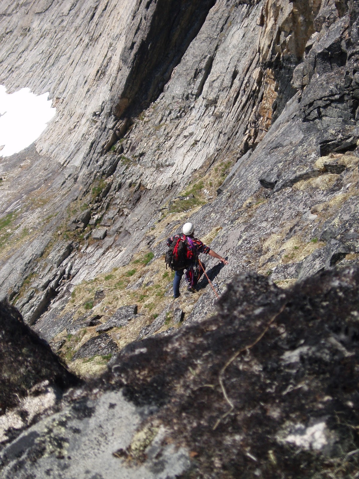
        (above) Phil Westcott on descent of "East Tig", June 2, 2012 ( 5 Saturdays Ago). Much of the route is visible beyond Phil.  The route follows a ramp system perched rather flutteringly over the impressive swoop of the north face of Tigaraha.  A 35 ft. chimney on the summit pitch is visible in the photo as a vertical black line rising out of a notch at the righthand edge of the photo.  In front of that is a rather exposed 5.4 slab.

  5SA The GLUE OF TOWN lay thick and sticky with the post-schoolyear pile-up of personal responsibilities.  The GLUE threw everything it could think of in my way, including, at the last minute, a failed, moose-blood dripping, refrigerator/freezer in my home.  In my blind frenzy to cut through the GLUE with the MACHETE OF SELFISHNESS to make my escape to the mountains, I committed many uncoolnesses;  wasted meat of moose incurred loss of karma points.  Thanks go out again to life-partner Kristine whose own nonentropy field counterbalances my own considerable disorder, and without whom no Kigsblog would be able to combine action with rave and spew.  
      Part of the urgency of the climbing window at the time 4SA was the dual presence of those two most rare commodities: good weather in the Kigs, and a motivated partner.  Phil Westcott was here for the Spring in the employ of the National Park Service and seemed to have the right set of rather off-beat qualifications to make a proper Kigsboy—  i.e., an individual who might see some sense in doing worthless climbs on small, toppling choss heaps with huge, torturous approaches.  We set the compass to STEELY FOCUS, hacked our way out through dense foliage composed of doubt, schedules, computers, parties, the GLUE, in short, to the mountains, where all was soon forgotten.


(above and left) Tigaraha from north.  The pitches are marked on the E. Tig to give a sense of scale. The best descent is to downclimb the route.   For greater kicks, from the summit of East Tig continue west along the spine of Tigaraha following the 2005 Peacock-McRae route (IV, 5.9)  MARK!, leg up, spin, leg up, can't find it, tail in the way, MARK!, spray some down there, ah, the easement upon the swollen bladder of Narcissus brings relief  the continuation of the East Arete to the Grand Tig, by downclimbing two pitches (these would be the West Ridge of East Tig, 2 pitches, 5. 3), then getting back up on the spine of the arete via an enlivening 5.9 pitch with a rotten overhang-- the rest is a sidewalk in the sky with great climbing up to 5.8 until you reach the summit of the Grand Tigaraha, whereupon downclimbing the 5.3 sky-friction slabs of the West Arete bring you to the West Notch between the Grand and West Tig.  This Notch, accessible by Class 3 slopes, would mark the starting point for the regular route on Grand Tigaraha, the West Arete, (II, 5.4).
    One may return to a basecamp in the Sinuk from the West Notch by heading back east across 4th class slabs that traverse under the 800 ft. south-facing wall Tigaraha, but it's a grovelfest, and treacherous when wet;  somewhat easier to contour around to the northwest of the West Tig, staying high, traversing across Class 3/4 terrain, to the conspicuous "Fab Four Tors," John, Paul, George, and Ringo, which, by the way, are all excellent one-pitch climbing tors little piss here, little piss there, whirl, lift, cancel, whirl, cancel, whirl, lift, little piss here, MARK!.  From the Fab Four Tors one may descend weary lengths of Class 3 talus slopes back to the Sinuk.
        There is a hidden "North Gully" that drops from the West Notch to the north providing potential quick access from the Sinuk to the Grand Tig.  Conditions are usually icy in this chasm, and huge hanging pianos chock the narrow walls.   Once I felt compelled to put in a screw for a self-belay on some weird ice in there;  another time I painfully rappelled North Gully in rock shoes with snow-bollard anchors.  Crampons advised.


(above) 800 ft. north face of East Tig, the Grand Tig in background.  A patchwork spectrum of metamorphized granite.

     Had a discussion this morning with Samuel Johnson on dreaded Facebook (no place for introverts)(link to Sam's blog alpineessence) about a possible climbing metric for assessing approaches;  I don't know if anyone has applied a term to the concept yet, so I would offer: "slog ratio."       
    The equation is stated:

number of miles to get to the base of the actual climbing ÷ 
number of pitches of actual climbing                       =  slog ratio

        For instance, on the East Tig, it takes 8 miles of slogging for 4 pitches of actual climbing, giving a ratio of 8:4, or 2.0—  a slog ratio which, Sammy and I agreed, is horrendously high, bordering on SILLY.  Anything over a slog ratio of 1.0, meaning a mile of slogging for each pitch, would feel silly for most climbers.   Even more damning for the slog ratio of the Tig (and the Kigs in general), an adjustment factor needs to be added to the numerator to account for the last half mile of Class 4 approach slabs, which are steep, loose, and treacherous, more like 4 or 5 miles of effort (with a packsack full of Camalots) than the half mile shown on the map. 
             
(above) Phil Westcott at the rope-up area for the East Tig climb, looking southeast.  Obviously Phil is impeded by his large camera which followers of Kigsblog wish I would carry instead of the paper cameras favored by men of action.  In our later climbings, Phil later had to stow his large camera after it came within one exhalation of rolling off a thousand-foot belay ledge.  
     This spot in the picture is reached from the Sinuk via Class 4 slabs that show a good, healthy "green quotient," meaning the talus is glued down by vegetation for good footing.  One can start slogging west up the hill at a prominent glacial erratic boulder that sits at the Sinuk headwaters;  many bouldering possibilities are available on the way up.  From this spot, one can descend directly west towards the West Notch for an assault on the Grand Tig, but one starts by downclimbing steep Class 4 slabs adjacent to a hideous chasm (Kigsterm for a gully filled with talus) and a rope might be warranted for those sheep unsteady on their hooves.

(below) Ian downclimbing from the East Tig roping-up area, heading west towards the Grand Tig. This image is taken by Mikey Lean from an earlier trip in 2002.
  Norman by that time had turned into a grumpy old mountaineer, regarded by many as sketchy.  Grey-stubble bearded, grumbling to himself, gear in tatters, the dogs of the village barked in protest from their chains.  The younger climbers were friendly, but few would go on a rope with him anymore, except for Jules, who had gone back to the city and his piano... 
     Many come to Nome saying they are climbers, but few keep climbing.   Few lie within the 0.02 percent of climbers who fit within the range of freakish qualifications that would allow them to actually enjoy the climbing on the Seward Peninsula, so they drift away from climbing after a time, with a degree of frostbite usually, and I am left with that familiar feeling of uncertainty as to whether the climbing in the Kigs is really climbing at all, nor daring to look in the mirror at the old mountaineer to gauge the actual degree of his sketchiness.  
      But really, it's the SLOG  RATIO that's causing the climber attrition.  You have to work so hard in the Kigs to get to the actual climbing.  Only a person living in their own fantasy world can continually fool themselves that dragging gear over tussocked ground in the cold and wet with little chance of ever using the gear on a real wall is a worthwhile and noble venture.  Has the global practice of climbing so far degraded as of 2012 that desperate climbers are finding it necessary to hike all the way back in to the back corners of the wilderness for a few stone smudges on a hillside?  What sort of masochist buys into this fantasy?

(below) Phil Westcott and Lucy at the roping-up area, facing south.
     Answer:  Phil.  Phil Westcott of the Westcott Brothers Band showed up in Nome on an SCA internship at Bering Land Bridge and actually sought out the sketch old mountaineer (thanks to flickr and Rick Anderson for the contact, see Phil's excellent photos on flickr), it seemed like a miracle:  here was a young man dropping out of the sky who said he wanted to go climbing the Kigs, had experience on multi-pitch choss from his time at Seneca Rocks in West Virginia, didn't mind a little backpacking, and didn't care a bit that he had no gear.  Furthermore, time would prove him a member of the freakish .02 percent of climbers who actually respond positively to HIGH SLOG RATIO-style mountaineering, even after his toenails fell off and he couldn't really walk for a week or two following.  He has that type of alchemical mind that can take a chunk of anaq (such as the prospect of a horrible slog through Spring posthole-snow with a heavy pack) and transform it into something gold, a mind that crops out unpleasantries, leaving only fun and beauty, so that the mind is tricked into returning again and again to the source of its pain and beauty. 

(above)  View from roping-up area of East Tig, facing southwest.  On the left is a beautiful peak, "Turncorner Mountain" (Pk. 3250+)--   Kristine McRae and I did a horrendous fifth-class schist route on one of the righthand ridges in the summer of 2001.  Lift leg, relax, relax  On the right is a mountain I am fond of calling "Falcon Killer Pk" (Pk. 2840+) due to an attempt on my life by a Peregrine as I was soloing the highest of the granitic tors, visible as a dark bump in the picture, a 5.6 thrillfest with a prodigious drop off the starboard bow.  Lift leg, nothing coming out...ah, there it is, MARK!  I was nowhere near the nest;  she leapt out from behind a granite turret from three feet away in a most murderous and calculated fashion as I was hanging from a hand traverse with no real footholds.  Had I not heard the click of her talons beforehand, I might have let go.
     A necessary skill is managing the GLUE of TOWN, a significant force built into causation that can hoist a trip with its own petard before it's ever left town, a type of causal gravity sucking one back into Nome even as one is trying to leave it. Phil proved he had the necessary focus, achieving escape velocity despite a few swirling, muddy eddies of communal torpor hanging like fog in the NPS Bunkhouse where he'd been staying. We slogged it to Hudson Creek Pass late on a Friday night; it was Solstice, mind you, time of day had become meaningless. Next morning developed sunny and fine, birds chirping, flowers resplendent, brooks babbling, breeze with no bugs. Phil, Lucy and I slogged it some more to the glacial erratic boulder at the Upper Sinuk where we made basecamp and prepared for a steep scramble with gear up the hillside above the erratic. (Better, really, to continue another half mile up the Sinuk valley and curve around into the stunning glacial cirque underneath Tigaraha, then traverse back left across the hillside above the erratic several hundred feet higher.)
(below)  Mylon Schield playing on Sinuk erratic in 2003.


      The thousand feet of fourth class approach can be punctuated by fifth class bouldering.  After hours of sweaty toil, the three of us reached the ridgecrest.  A convenient roping-up area presented itself, also, the STAY!-command spot for Lucy.  The route follows a ramp-system with a few steep spots that leads out over the north face of Tigaraha.  I have free-soloed it several times;  the East Arete of the East Tig lends itself well to this type of Norman Clyde-style approach for anyone with decent climbing skills.  Phil was simultaneously cowed and bewitched—  "I don't think we're at Seneca Rocks anymore"— before getting his sea-legs.  
      I banged in an angle piton at a belay for the simple joy of hearing the ascending RING! drifting out over the vertical walls.  The summit pitch, a 5.6 squeeze behind 3 Volkswagons, radiated the usual Kigs feeling of fun climbing mixed with loose death.    Soon we were astride the excellent pinnacle of the East Tig looking for hundreds of miles from the Singtook in the West to Kayuqtuq in the East down the spine of a sweet little mini-Brooks Range.  I glanced at Phil's eyes;  he was bitten.  Infected.  Smitten.  He was a Kigsboy now.
(above) Phil on top of the East Tig, Mt. Osborn in the background.


(above) Grand Tig from southeast, taken from roping-up area of East Tig.  The 2005 Peacock-McRae route (IV, 5.9) on the East Arete is marked.  The best way to approach the start of the little red line there is top climb up and over the East Tig route described in this post.  The 5.9 crux would be that first vertical part of the red line that regains the crest of the arete.  From here, two easy and utterly-spectacular pitches follow the "sidewalk in the sky," followed by two pitches on the headwall with a 5.7 jamcrack to the summit.  Descend the 5.3 slabs of the West Arete and rappel a 5.6 overhang to the West Notch between Grand Tig and West Tig.

(above) Ian nearing the 5.9 overhang that gains the East Arete of the Grand Tig;  photo by Mikey Lean from an early attempt in 2002.
(above) "Chimneys of Tiresias," (III, 5.8, A1), on Northeast Wall of Grand Tigaraha.  Soloed in June, 2007. Four pitches up the north face to where it joins the peak's "regular route," the West Arete (II, 5.6), then three more classic, easy, and spectacular pitches up low-angle friction slabs to the summit. This is the only shot I seem to have of the West Arete of Tigaraha.  There is a deathly chockstone on Pitch 4 of the Tiresias Chimneys that necessitated a point of aid so as not to brush it with the slightest touch.
(above) Map of Tigaraha area 1) Park at incut gravel pit on west side of Kougarak Road around Mile 29.  The first quarter mile of bushwacking is the worst part of the hike.  2) Sinuk basecamp  3) Tigaraha  4)  Hundred year-old rockfall across Windy Creek-  best camp in the Kigs.  5) Mosquito Pass  6)  Pt. 3207, high point of "False Tigaraha"  7)  Grand Central Valley  8) "False Tigaraha", mismarked on maps as the real Tigaraha  "other 8")  "Hudson Pass"

Tuesday, May 1, 2012

(Pk. 3300+) Canyon Creek

      The measure of a valley is the degree to which it and the surrounding peaks radiate a certain type of energy:  sinh tala, after the interior Athabaskans, or maybe just chi.  But measure requires a unit, and there is no established unit of measure for chi because the Uncertainty Principle renders chi too unpredictable a form of energy for quantitative measure, one only "feels" it qualitatively.
        Whatever, Canyon Creek in the western Kigluaik Range is a valley that exudes particular waveforms of this energy.  For so long I had tried to access Canyon's mysterious interiors, but like Alice at the door to the garden, had been denied, until 2SA weekends ago, when Rick Anderson and I finally managed to find the right pass into Canyon Creek on snow machines, in sunny Spring traveling conditions.   
(above) Pk. 3300+, Canyon Creek, Kigluaik Mountains, April 14, 2012.  I ascended via the easy slopes on the righthand side, treating the opportunity as a mere peakbagging exercise, wussing out of more challenging lines due to a good excuse:  a good friend waiting at basecamp who deserved better than to wait the extra hours a more technical line would have required.  To be fair, even the lowly Class 2 slopes sported some AI1;  you wouldn't want to trip on your pantlegs, or you'd go whizzing down the slope at a high rate of speed! 


(above) Map of Canyon Creek area
   A.  Snow-machine pass of choice to access Canyon Creek from the south. 
   B. Pk. 3300+.  Climbed to summit via easy southwest slopes.
   C.  Untouched gneiss. 
   D.  Pk. 3850+.  Highest peak in the area.
   E.  Canyon Creek
   F.  Pk. 3390.  Climbed last year.
   G.  Blume-Valpa Pass.  Easy hiking- maybe not so good for machine.
   H.  Pk. 3195.  Also climbed last year.
    I.  Johnston-Canyon Pass.  Easy hike. Possibly snow-machinable.
   J. Johnston-Right Fork Pass.  Class 2.  
   K. Inuksuk Pass (American-Right Fork) Interesting set of manmade rock piles.
   L.  Pk. 3000+.  Climbed year before last 

(above) Pk. 3850+.  This mini-massif may be the fifth highest independent summit in the Kigs, depending on how you define "independent summit"— (My unofficial list: 1. Mt. Osborn (4704)  2. Osborn's northwestern neighbor, Pk. 3998   3. Grand Singatook (Pk. 3870) and 4. Kayuqtuq (Pk. 4000+ ?)  Peakbagging the summit in the above picture was my primary objective this Canyon Creek trip, but Pk. 3300+ up canyon seemed like a nicer place to be, so we camped there.

(below) Gneiss towers on the southeast shoulder of Pk. 3850+.  The wall in this picture has, on very rare occasions from certain summits, flitted into my frame of perspective through lined-up corridors of mountain, but its exact location remained hidden in the geologic folds until this trip, when Rick and I turned a corner on Canyon Creek to discover its true location.  


The NO-SKETCH PARTNER LAW is stated thusly:  the scope of your climbing ambitions must conform to the mean climbing ambitions of the group.

     What this means is, you can't be an asshole.  We've all had that kind of Comstockian partner who is ready at a moment's notice to bail from the corniced ridge on which you both are standing.  Some alpinists have no natural ability to execute the crucial task of NON-CLIMBING when the conditions permit, and these are the ones who seem strange and extremely self-centered within a group in, or going to, the mountains.  Such a climber cannot hang except with those of their own kind.  It takes great effort.
      On Friday, 3SA, as Rick and I were packing for our weekend trip into Canyon Creek, I saw a post on Supertopo by a friend of mine:  Jabber's thread on Supertopo .   He was bailed on by a mancrushed partner!  Huge arrangements had been made and dates precisely calibrated for the two of them to escape the GLUE OF FAIRBANKS, but at the last minute, the guy goes "off with Bridwell" to some other mountain.  Clearly, a violation of the NO-SKETCH PARTNER LAW.
(above) Rick Anderson at the "Snow-machine Pass into upper Canyon Creek," looking south.  (The one labelled "A" on the map.  Gneiss unclimbed tor in background!

(below) Upper Canyon Creek from Pk. 3300+, looking southeast.  The Snow-machine Pass is at center of photo.


      I was psyched!  A friend to go to the mountains with!  And a fellow Kigluaik lover who's been all over these hills on foot and by dog team.  It's so much fun doing trips with Rick because we can sit around like long-lost brothers discussing extremely obscure minutia of hill and valley, and never grow bored with it.  
      But first we had to escape the GLUE OF TOWN.  Over many weeks of winter, the GLUE OF TOWN had gotten Rick pasted down like a victim from the movie Alien, but I was certain the lure of a trip to the Kigs in perfect April weather would loosen the bonds of the slimy substance that coated him.  I offered him my best old mount, Crusteo, the Polaris .340.   The GLUE began to loosen.  We hacked at it with our machetes, carving away excuses, harboring sleep throughout the weekdays, patiently unraveling obstacles.  My wife Kristine, who possesses the magic power to either dissolve or intensify the GLUE with the slightest look, was blowing in our favor;  someday soon Kristine and I will wage our own war on the GLUE and escape together, but for this weekend it was Rick and I, and I was mighty glad of it, someone experienced with whom to share the adventure.   

(below) Rick power lounging at Canyon Creek basecamp, base of Pk. 3300+.
(below) Pk. 3300+ from south.  This photo was taken in June 2011.  Rick, note the fresh, cataclysmic landslide in that gully we were hanging out in behind camp—  Is that why I felt creepy in there?

(below left and below right)  Inuksuk.  I found these homunculi on a previous reconnaissance to Canyon Creek, at the pass marked "K" in the map above.  I know nothing about how they got here, only that it looked like a likely place to herd reindeer into a ravine.


        Solitude is jagged and hard, a bare floor.   All it takes is another mind in a lonely valley to warm the place up, no matter how cold the temperatures, no matter how far from town you might lie.  So enormous is the contrast between a trip into the Kigs with friends, and a trip to the Kigs with no one, that my brain cannot even grasp the disparity;  they are two different mental modes, the one primitive and speechless, the other easy and confident. Both are necessary for wisdom, I cannot turn my back on either.  But it is very hard to fight the GLUE alone.  I am deeply grateful for the friends I have found, for the times we have had huddling in the wind and surreal beauty.

(below)  The Grand Singatook (Pk. 3870) from the north. Nils Hahn and I had a great trip here sometime in a June of the 2000s.  We came from the Teller Road seeking the ultimate Nordwand of the Kigluaik on the back side of the Singatook:  instead we found a two-thousand foot snow-slope capped by two or three pitches of easy Scottish-gully ice.  Why are my climbs always skiable?  


Wednesday, September 28, 2011

Pk. 3390 and Pk. 3195, Blume Ck.

15SA, Spring viewed from Fall...

       (above) Lucy near summit of 3390, at the head of Blume Ck.  She balked at the actual summit pinnacle, which required, in her mind at least, following me down the 5.5 down-climb in the picture;  there's probably a way around this obstacle, but she never found it.  
        O.K., so maybe the 25 ft. summit pinnacle is only 10 ft. higher than Lucy's high point shown here.  The rule is:  you have to get to the very highest, most tippy-toppy point, or it doesn't count.  Without this rule in place, climbing in the Kigs would legally be rendered "ridge-walking" rather than climbing.   


       June:  summer stretched ahead.  Serotonin flowed from springs that would never expire.  The GLUE OF TOWN was effortlessly overcome.   The requisite self-centeredness necessary for escape velocity was easily achieved, as Lucy rode strapped in the dog box on the back of Prolly, trusty 4-wheeler.  Towards the western range we penetrated, that surreal terra incognita which is the visible part of the Kigluaitch from the village of Teller to the northwest, where no Kougarok Road crosses the Kigs with its urban hordes.  
       If people know any of the true names of particular mountains over by Canyon and Cobblestone, float them over these techno-mind waves, please, quyana.
       (above) Summit pinnacle, Pk. 3390.  One, Class 4 move perched over a respectable void at the summit of an otherwise boring ridge...   Condition:  foghead


       Things feel strange to me in the Western Kigs.  When you're at Salmon Lake over on the eastern side, Pacific Ocean feels far away, but here in the West, Woolley Lagoon is licking its foggy, windy head into the valleys at all times.  The rock itself, a special blend of metamorphic stew, affects the psycho-electromagnetic nonentropy fields of this region in ways that cause time distortion and shamanic dimensional-interface.
       (above) Prolly the 4-wheeler encamped for a few days at Feather River, haunted by the ghosts of her ancestors buried near this spot, the World War II junk-pile where they put everything under the ground when the war was over, Or SoI'mTold..


       Set out with the Border Collie on her first trip to the real mountains.  Trying to discover the best direct hiking route from Teller Road to Canyon Creek, stalking a hidden giant out in the cortical folds of inner Canyon Creek, a region about which I know nothing.  
     Conditon:  foghead.  Silks and wreaths of fog swirling tantalizingly around the shoulders, glimpses of eyes through the 3,000 ft. cloud ceiling.  Beautiful, yet always that familiar, flat, oppressive feeling bearing down on thoughts and hopes, claustrogo, the weight of opacity, fog, mist, creating a dreamlike sensation,  as if all of this were a scene from a Lost In Space episode. 
       (above)  Pk. 3390, south ridge.  This image weighs in on the side of the argument that the Kigluait are only hills.  But what a fine fell run this ridge provided, up among the shifting heads of fog.
      Deceptive argument, however...  within this bland, low-resolution exterior lie hidden hollows of boulder-hole and northern drop-offs.  In winter, this peak might pose a more formidable challenge even than Scotland.


       This trip happened when summer was young and strong and stretching ahead like an endless road.  This 15SA trip, it seems almost naive to say, as viewed from the charred wreckage of present Fall, was a fun trip.  Lucy and I camped way up at the top of Blume Creek, right below the Class II pass that leads from Blume to Valpa Creek.  I hiked/bouldered up both peaks at the head of the pass, Pk. 3390 (Blume?) and Pk. 3195 (Valpa?). Both walk-ups, no real radness, except for a very brief traverse through the summit rocks to get to the Class 4, 25 ft. summit pinnacle, complete with hanging choss Volkswagon registering proximate death-attractor metrics on certain loose-rock scales.  
drift-bank foghead in the Alzheimer' eternal sunshine of the spotless mind,  
bottomless breathing upward valley-draft through the strip-dancing wave, 
saw the granitoid rumors vaporizing into reality for sure, 
glimpsed pinnacles and towers through channels lined-up in the memory loss, 
sing out if you see the granite! 
there is a hidden lake beyond this picture (above and below), Pk. 3300, 
the western lake where lie the hidden dragon vaults of the sacred sought-after igneous, 
oh wondrous healing rock, 
a western lake to fly to, fly to in the jingey-copters, 
to plunder the hidden spoils of all the western range. 


(above) Lucy in peril.  In this picture, Lucy is actually arm-barring hard off that right paw.  She has no footholds, her hind legs are paddling in space;  it's a bottomless crevasse, with a 10 ft. drop down to a gravel creek bed.  Notice the polite look on her face, one ear drooped:  uh, Daddy, how about you doing that ice climbing thing you're always doing and CLIMB DOWN HERE AND GET ME!  Indeed, I felt the need to fetch my long ax off my pack before making the rescue move, and also took the time to snap this picture while Lucy held the arm-bar.  
(above) Camp at head of Blume Ck., June 2011.  The snow made for great walking and glissading on the pass between Blume and Valpa--  ValpaBlume Pass.  Hard to say if snow-machinable:  could be a bit of a blow-over on the north side, who's ever gone over it?  Here's a map (below) to jog your own fog.

Friday, July 23, 2010

Mt. Warren (Pk. 3300+) via Fox/Warren Creek

Days of rain and self-pity at Salmon Lake (above, looking north), folded up between the mountains, the lake, the fog, and the DELUSION that I AM THE CENTER OF THE UNIVERSE.  On the third day I left the cabin, with a compass and a map of the Fox Creek area downloaded on a very feeble short-term memory, and headed east into the hills, having decided to provide my little summit-grubbing ego with a tiny nub of consolation:  a peak lying on the divide between Warren Creek (a tributary of Fox Creek which drains into Salmon Lake) and the Southeast Fork of Crater Creek:  Peak 3300+. 
Looking up Warren Creek (above)...   Madness quickly set in, claustrophobia.  Locked in a cell of fog all day, the brain is receiving inputs from four of the senses that the mountains are all around, but no fifth sense, no visual.  You can feel the mountains like a phantom limb.  It's disorienting, like Neo and Morpheus standing in the construct.  The obligatory Grizzly dissolved into and out of the view for a moment, precipitating much irrational fear and unnecessary detouring.

Several miles in from the Kougarak Road, the slopes began to rise, up and up.  Vapors, nothingness, sensory deprivation.  Onset of hallucinations.  Voices.  I had had too much caffineated GU.  The compass was constantly in play.  Fortunately, the terrain was matching the feeble brain download.  The summit of Pk. 3300+ (or Warren Mt., as I had started to call it) finally appeared through the fog (left).  As is usual with Kigluaik summits, the north side dropped off into chasms, while the south side provided a Class II walk up.   
This is supposed to be a picture of the fearsome drop off to the north (right), but as you can see, the image is nothing more than fuzzy shapes on a sheet.  Standing there, you could feel the space beneath your feet registering as a tingle in the solar plexus region (where lie the sensitive organelles in the electromagnetic energy body that register the sense of vertigo) but without the corresponding visuals, the feeling lacked adrenal punch. 


This, then, is the theme:  a mountain, and a sensibility, truncated by fog.  Follow the lines in this picture of Mt. Warren from the north (above), taken on a subsequent gear-ferrying trip up Crater Creek.  Extrapolate where the apex of Warren Mt. must be. Thus, our mind throws a veil over the peaks of our enlightenment.  Nothing has changed much for a week.  Reality shrouded.  Sanity diffused.  Motivation muted. Tarps dripping.  Poor American:  his belly is full, but he still finds something to complain about...