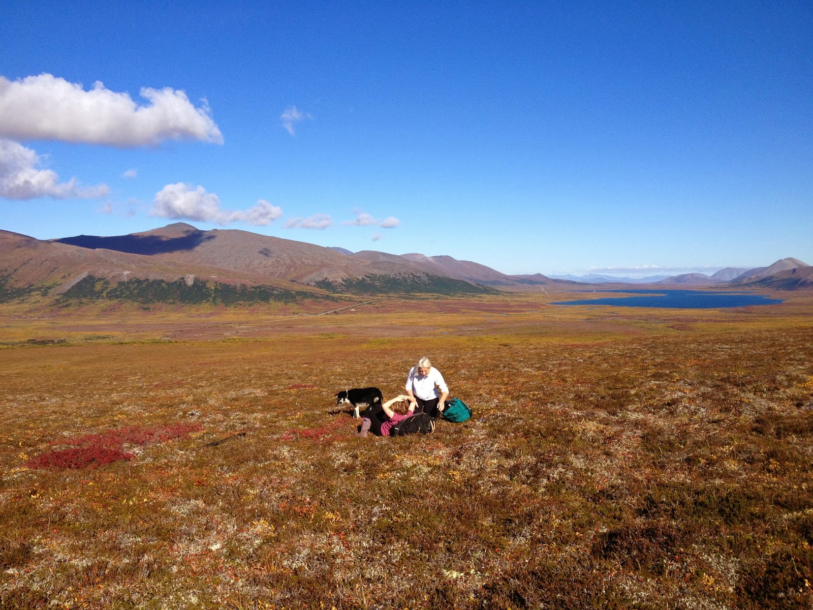
Showing posts with label Grand Central Valley. Show all posts

Wednesday, September 15, 2021

Central Water Company Ridge

Pk. 2800+ and Central Water Company Ridge
BLOG LAG: 14 months
       After a long first ascent drought, I finally got up something.  With Keane Richards, in June of 2019, we did a sweet little mixed climb  in Grand Central Valley.  "Central Water Company Ridge" follows the sun-shadow line in the picture above for 1300 ft. of moderate snow and rock, to the summit of Pk.2800+ located at the southern end of Crater Lake.
Keane Richards on Company Ridge

       There's something about the camping place at the north side of Crater Lake. Morphogenetic resonance from the tent city that existed there 115 years ago makes it the de facto campsite of Grand Central Valley.   People looking for a camp in Grand Central tend to seek out Crater Lake. The 115 year old carriage road which can still be found leading up Grand Central goes straight to Crater Lake, a base of operations in the old days for the Wild Goose Pipeline that boomed, and fizzled, over a century ago in this valley. Not only can ghostly voices of long-departed Teamsters and miners be heard on the wind, but nice planks of old-growth redwood lie strewn about in abundance, and Kitchen Rock provides a windbreak as well as worthy bouldering lines.

Keane is visible belaying from the gendarme. In the background is Ooquienuh (Mt. Osborn, Pk. 4714).

        Spring of 2019: early days of the pandemic. Not much tolerance for the risk yet in those days. I lay awake at  night preparing for slow death by oxygen starvation. The only safe place to be, it seemed, was outside in the ultraviolet. 
       A Spring crust had been on for weeks. By early June, a thin crust remained, enough for dogs and sleds. In their first Spring in the Kigs since moving to Nome from Tok the previous Fall, Keane and Sarah Richards, plus intrepid younglings Rosalie and Amelia, plus Sarah's electron cloud of dogs hitched up into a couple of teams, plus myself, trailored our whole kit and caboodle up the Kougarak Road on the weekend and mushed up Grand Central to an awesome family camp in fine weather, highs in the thirties by day, lows in the twenties at night.  
Company Ridge marked in yellow
        The first night, we figured 5 am was adequate wake-up call. By 8:30 am, after we reached the middle part of the climb, the rocks began to whizz down like a sniper warming up over morning coffee.
        "We shoulda left at midnight," I deprecated.
        "OK, let's come back at midnight," Keane said commonsensically.

Sarah and Amelia about to give the signal to mush. Keane, Rosalie, and I rode the iron dogs.
      We swarmed all over Grand Central for a Saturday. Even if you do leave a trace, such as a snow-machine track, such a trace ceases to exist in the snow after a short time. Keane and I left at midnight on schedule. Rock solid was the snow, with a breeze at ten.
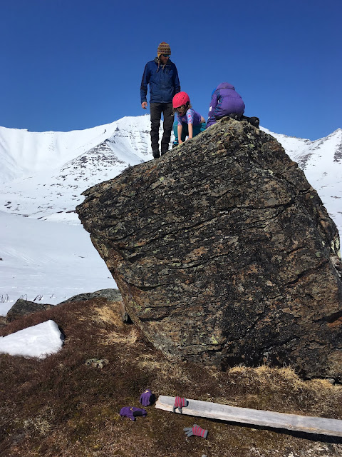
Keane, Rosalie, and Amelia bouldering in the nice warm thirty-degree temps at Crater Lake Camp.
       The climb was easy enough to simul-climb the whole way, but steep enough to justify the rope. Mostly we put in pickets, (long dastardly aluminum stakes,) which went into the snow easily, yet felt totally bomber. A few pitches of 45° snow led to the crest of the ridge, where an abyss dropped from our feet off the northwest side. Kicking steps in snow, we climbed past some steepish rocky kigs, banging in an occasional piton or picket. The wind picked up as we neared the top. A crafty tunnel led through a rock buttress, followed by a steep pitch with some good whacks of the ice tools into exposed tundra. The last move was an easy mantel onto a little pointed summit.  


"Not only can ghostly voices of long-departed Teamsters and miners be heard on the wind, but nice planks of old-growth redwood lie strewn about in abundance, and Kitchen Rock provides a windbreak as well as worthy bouldering lines."
       Somebody climbed the Company Ridge before us. There were bear tracks all over the climb. What I've seen all over the Kigs is that these critters definitely like to play games on snow structures in the early Spring, sliding, jumping, and climbing. Awakening from winter sleep, they step on to the front porch of their lairs, which are located high on the hillsides in skiing and climbing territory, and they mess around on the snow slopes in the nice warm sun before going back in their cave to hit the snooze button just one more time.
        Keane and I were forced to search a bit for a viable way down to Crater Lake. We finally started down a gully, but it was a trifle steep, so like some kind of gumby I called for the rope. We would down-simulclimb on pickets.
          I went down first, kicking front points in to the steep snow, and stabbing my picks in piolet canard position. The ground was steep enough. If you fell, you'd go whizzing down for quite a ways at a reasonable velocity I looked over to my left and saw tracks, 5 pinpoints in the ice. I could practically see the bear front pointing down next to me, claws forward, my mirror image, with my exact same simian climbing posture on the steep hard snow.
Looking southeast from the summit of Pk. 2800+ across Thompson Creek at Pk. 3207, the true high point of False Tigaraha, the peak mistakenly marked as Tigaraha on the map. To surmount that little summit kig there on 3207 requires one rather fearsomely exposed fifth class move. In the background, Pen Tri Cwm can be seen.
     Today, road penetration threatens the Kigluaik Mountains. What if, someday soon, Grand Central is repopulated back to the demographic it showed at the turn of the 20th Century during Wild Goose Pipeline days? A consummation devoutly to be unwished, in my estimation. But if it were so, I have no doubt that Crater Lake would be the locus of the alpine climbing scene. A nice little cirque of miniature peaks surrounds the lake. This mountain wall would lend itself well to endless scrutiny, and feats of derring do, by the legions of climbers, skiers, and boarders who would congregate there at the end of the day, and its features and chutes and walls would become animated with the legends that would accrue. We'll build a hut out of the redwood planks. The bears will probably be driven out by the arrogant humans.
       If this comes to pass, let the Central Water Company Ridge be entered as the first excrescence, a line drawn on a mountain. I predict it becomes an alpine classic, for its moderate nature, and ease of access from Tent City at Crater Lake.
Pk. 3050+, around the corner from Crater Lake in the West Fork of Grand Central, showing the number one most desirable first descent remaining to be skied in the Kigs:  the "Z-Couloir," which is visible snaking down between the two ears.

Wednesday, December 27, 2017

Guess That's Why They Call It Grand Central

North Face of Pt. 4250+ from North Ridge Osborn, looking into East Fork Grand Union Creek, Johnson's Tower at left.
       Grand Central Valley, 1910.
           Franklin Johnson, failed mining engineer, now roustabout in the Nome diggings, sat wearily down on his load of redwood planks. The trolley lay sunken in the muck of Grand Central Valley for the fifteenth time that day. Green layers of swamp buzzed and chirped all around the miner, a stout man of Scandinavian descent. Might as well take off this damn harness, thought Johnson, unbuckling a leather strap around his waist. Just like  a dog. They had tried a couple of horses to haul the lumber up the valley, then a team of dogs, but the quicksand of Grand Central had sucked the rigs down every time. In the end, the best solution was for one, stout man to wheedle the 16 ft. planks through the swampy sections, inch by inch, sometimes piece by piece, along the makeshift road the men had fashioned along a line of bluffs. Johnson had discovered if he used the planks themselves as shaft and handle of the cart, the hauling wasn't too bad.
Northeast Cirque of Osborn. Weird story about this camp... I hiked up here last July, 20 Saturdays ago. When I got up to this place at the very top of the valley, I had time to kill, so I spent a ridiculously long time choosing a tent platform. I walked around for an hour examining various patches of tundra like a choosy homebuyer. Even after I had selected a tent platform, I kept fussing around with the tent's orientation like an anal-retentive furniture arranger until I felt quite silly about myself for being so particular, when real climbers are supposed to flop down on any surface whatsoever and just sleep on it. When I finally got the tent where I wanted it, I was surprised to find one, buried, aluminum, SMC, tent peg at the exact corner of the tent. This is not a major campground we're talking about here, but seemingly empty wilderness.  The tent peg does support the general hypothesis that Grand Central has, at times in the past (as so many places in Beringia) seen a greater population than it does at present.
         Johnson wasn't so grumpy. He counted Grand Central as one of his favorite places to be in all the Sawtooths, and the sun had come out. At the head of the valley, Mt. Osborn skyed upwards in a series of stacked triangles, and snow glittered on the peaks of Thompson Creek and Gold Run. The clang of a hammer rose above the sound of the creek. Must be Osborn up on the Wild Goose rolling tube, thought Johnson.
       The sound of the hammer turned his thoughts back to their project: the Wild Goose Pipeline.  "Plunger," cursed Johnson out loud,  and spat. "Das ist bescheuert." The engineer in him did not subscribe to the notion that the pipeline would add "head" to the entirety of Nome's ditch system.  Misapplication of the Darcy-Weisbach, he thought scornfully. Not only that, but the other crew, the Campion Ditch boys, in a friendly spirit of competition, had confused the mathematics: by ingeniously contouring their open ditches up Buffalo Creek, they had achieved an apical elevation higher than that of the Wild Goose. Like all the miners in the Nome diggings, Johnson was passionate on the subject of ditches. A miner in these hills would as soon dig a ditch as open a can of beans.
       To say Johnson was a failed engineer was disingenuous. His true knowledge and expertise belied his lowly position as laborer. Johnson's only failure was his final exams at the Technische Hochschule back in Germany. Or, rather, the night before his final exams. 
       The American, Perry-Smith, had showed up in his Bugatti, with Petrus in tow. Off the three had sauntered for a night of drunken, moonlight rock climbing on the Elbsandstein. Exams had not gone well for Johnson the next day. With no pedigree to show for all his studies, Johnson boarded a steamer for North America soon thereafter.
Northeast Face Mt. Osborn (Pk. 4714) The dark slash at center of photo is the infamous Sluicebox Couloir.
        Where Gold Run comes in from the north to join Grand Central, Johnson crossed from the north side of the valley to the south side, cursing the beavers, all beavers. He and the boys had argued whether to send the road above or below the beaver ponds. What in the hounds of hell are beavers doing up here anyway? But as he grew close to Thompson Creek, pushing and pulling the 16-footers across the polished river rocks, Johnson grew solemn, and nervous. 
       There was a woman at Thompson Creek. An honest to god, living, breathing, female. Her presence filled the entire, ten-mile long, Grand Central Valley like a cloud. One of the Osborn brothers had "imported" a wife from Sweden. Against everyone's advice, Osborn had built her a tent cabin to live in for the summer in the moraines of Thompson Creek. Now she was all Johnson could think about as he grunted and sweated over his damn trolley of wood. Jimminy, I don't even know her first name, thought Johnson. He found himself rehearsing the witty things he would say to her. The last time he had passed through, she had invited him in for tea, where they had discussed Shakespeare and Goethe while her husband labored above them on the hill. She had mentioned she craved some running water at her cabin door--Maybe I'll just pick up a shovel and knock out a quick ditch line for her, thought Johnson, it wouldn't be any trouble at all.
         But when Johnson finally pulled up to the encampment, the poor woman was already besieged by admirers. Two men were seated on crates outside her cabin, a new kid, and that Irish pensioner whose name Johnson could never remember. From behind the tent flap she emerged, not the beauteous, flaxen-haired maid from Johnson's memory, but the same woman, transformed, apparently, by a week of backcountry living. Her bonnet was torn and muddy, her face swollen with mosquito bites, her dress blackened with soot. Her cheeks bulged with chaw, and she commenced to cussing up a blue streak with the two miners. 
       Something had changed. Johnson was disillusioned. The pensioner was carrying on at great length. This guy probably just hired on with Wild Goose for doctor benefits, thought Johnson, but said nothing. Instead, sat down and loaded his corn-cob.


Looking west up Thompson Creek from the terminal moraines of the extinct Thompson Creek Glacier. A plethora of planks and ancient cabin frames is my evidence that this spot was inhabited during Wild Goose Pipeline days.  
       Guess that's why they call it Grand Central, mused Franklin Johnson. Mighty crowded for the middle of nowhere. Diffidently, Johnson departed the scene at Thompson Creek, taking only his coat, and leaving his rifle. He also left the Irish pensioner to continue his palaver in that accent Johnson could never well understand, for though Johnson was a Swede, his first language was German. 
       One item of conversation, however, had filtered through Johnson's attention: the Irish claimed to have "prospected" up the North Fork of Grand Central the week before, and passed over Mt. Osborn to the Cobblestone River, just up the valley. 
       Johnson had launched vigorous inquiry;  "D' right fork, you're sure? To d' right o' Osborn? On der gletcher? Chu made it to d' Cobblestone?"    
       "Aye, the right fork it was,"the pensioner had assured him.
         Now, Johnson, on prior occasion had poked around the North Fork himself: he knew there was nothing around that bend but huge, unscalable, limestone walls. No way that little Irish dude had scaled Mt. Osborn from the north. Not even Fehrmann would venture up onto those verscheissene walls.  Nevertheless, Johnson had resolved right then and there to hike up to the glacier that very afternoon, to check out this pensioner's claim of a crossing. 
In the process of making this map, I learned so much. Here have I spent several weeks struggling to write this work of historical fiction, and also made many wrong turns in the deep brush, just to prove my theory of a turn-of-the-century carriage road up Grand Central, and the whole time the thing was already marked on the old USGS map. I  just never noticed it before. The red line (above) shows the dashed line on the old map, which must have represented the road, as near as I can tell. It seems to follow the braided creek bed for much of the way, which might explain why it's so damned intermittent these days. They must have often used the bluff that parallels the river on the northeast side because there is a road up there, too, shown by the purple line above, which represents my hiking route last July, 2017.  Point A (surveyed on the map as Pt. 747, the spot in the photo above) shows the flat place next to the river in the Thompson Creek moraines where Johnson shows his narcissistic tendencies. Point B shows a spot where I once found evidence of rectangular stone walls and stone structures; it is the origin of the smoke plume where Johnson turns his back on society. Here also have I argued for the existence of a Grand Central Glacier;  I believe it, too, is depicted on the USGS map above, if one zooms in close enough.  
        He continued north up Grand Central. Up valley the road became easier, after it crosses the braided channels of the creek and reaches the moraines of Thompson Creek that spill in to the main valley from the side. He made swift time for a mile or two before reaching the confluence of moraines at the fork in the valley, near the foot of Mt. Osborn.
       Johnson could see a plume of smoke coming from an encampment up in the West Fork, a mile out of his way. He knew that yet another Osborn had been appointed as foreman and seen fit to move in there up the West Fork, at the very head of the whole ditch line, with yet another imported wife from Sweden. They had made tidy little homes down on the riverbed, with stone walls and chimneys of rock, a nice little domestic scene.  
       But after the crowds at Thompson Creek, Johnson had soured on domesticity.  If he had been honest with himself, he would have admitted he was bitter that Mt. Osborn had been named after Osborn instead of after, well, himself. They didn't even climb to the highest tor, thought Johnson. Nobody but he had made the distinction of continuing along the summit ridge to find the actual high point of the mountain, and his daring ascent of the highest, crumbling tor had gone unnoticed and unheralded.
The road up Grand Central is easier to follow on Google Earth than in real life. Above is a Google Earth showing the confluence of Thompson Creek with Grand Central River. Johnson is waiting outside Osborn's wife's cabin at Pt. 747 (Point A from the map above) near the top center of the frame. If one looks closely enough, one begins to see old roads leading everywhere. Such is the case when one is down on the ground as well, and delirious from hours of strenuous hiking with a heavy pack: roads, everywhere, in front of me, that line of willows, just up ahead... Was I hallucinating all these roads in Grand Central?
       Johnson was reflecting with satisfaction on how the breeze had abated the bugs, when he was struck by a chance remembrance: was this the week that teacher fellow from Nome (What was his name?... ah, Frank, another Frank, like me... wait, that's not my real name... ) was bringing a group of school kids up to climb the mountain? Johnson had said he would meet them in Grand Central. Maybe the teacher and his gang were over there in the West Fork of Grand Central right now, less than a mile away, having a merry time and singing songs around a blazing bonfire full of Wild Goose lumber. Johnson imagined he heard the trill of young voices carried on the breeze. 
       The thought of social interaction waiting so close at hand filled Johnson with a mixture of longing and dread. In his mind, Grand Central had forked in two: one fork led to human company, the other to solitude. The choice confronted the miner like an elemental question. But what did Johnson know of introspection? How could he have known it was his own sense of diminished self-worth that drove him to choose the fork with no people in it? 
A photograph by Franklin Karrer taken somewhere near the summit of Mt. Osborn, looking southeast over Crater Lake and the Wild Goose Pipeline, sometime between 1910 and 1914. Who knows, maybe Karrer or one of his students ferreted out which of the summit pinnacles is the highest and snapped this photograph from its narrow top, but I doubt it. Thanks to Laura Samuelson at the old Carrie MacLean Museum for forking this one over to me.
    Johnson stopped at a pair of glacial erratics which stood alone on the tundra, a favorite spot of his in which to practice rock climbing. He called the boulders "Sow and Cub" because he invariably mistook them for bears from far away, causing his heartbeat to rapidly accelerate when traveling without a gun, as he was now. 
       Johnson took off his gumboots and climbed barefoot, because that's what Perry Smith would have done, though barefoot had been more suitable for the soft sandstone of the Elba than this sharp,  jagged stein of the Sawtooths. Soon, Johnson was lost in a reverie, moving up and down and sideways over the face of the free-standing boulder. The game was to eliminate holds by placing them out of bounds, thereby creating the most tenuous sequence of moves possible over the tiniest of holds. 
       It was an odd game, one that Johnson would never have come by in his lifetime had he not met the influential Fehrmann back at the Technicum.  Not one of Johnson's compatriots in Alaska understood. They considered Johnson's rock climbing to be just another antic of another eccentric miner. Petrus called it art, thought Johnson. Maybe someday, someone will come here that understands.
Erratics high in Grand Central North Fork, looking northeast. Find Lucy.
        Years before, Johnson had visited the Brenta in the Italian Dolomites. He thought maybe the limestone walls of Osborn's Northeast Cirque were just as big. Osborn's wall hid itself from the rest of Grand Central and only revealed itself after one travelled the full two miles around the curve of the North Fork. 
       Johnson soon arrived at the glacier. He looked up. Two-thousand feet of appalling cliffs frowned down. Loose stone coated the ledges. Horizontal bands of limestone (Johnson had always argued it should be called marble, a metamorphic rock) crossed the entire cliff, showing slabs that would require plentiful amounts of Level 0 climbing.  No way. No way the Irish pensioner had passed over the northern shoulder of Mt. Osborn. Dude must have been mixed up.
Looking southwest across Northeast Face Osborn. Franklin Johnson never did succeed in climbing Johnson's Tower.
           Johnson couldn't let it rest. These walls were his domain, his and the eagles. He had to know where that pensioner had gone, had to sniff his tracks and pee on them himself. Johnson knew that if he crossed the crest of Osborn's north ridge too far to the right he would end up in the Grand Union drainage, and the pensioner had clearly stated he passed over to the Cobblestone River drainage.  The night was perfectly fine, with nary a breeze, and if the midnight sun did not blaze, it certainly shone. So Johnson continued up, angling across easy slopes toward a prominent limestone tower. Maybe if I climb it they'll name it Johnson's Tower, thought Johnson, but he doubted it, then grew ashamed. Only someone who had participated in the obscure cult of tower climbing in Saxony could possible appreciate the value of climbing a tower, well below the main summit in altitude and off to the side, simply for the sake of climbing the tower. 
Looking down at glacial remnant in Grand Union Creek East Fork. It was still a living glacier in Johnson's time, a fact he later reported to his inquisitive friend, Henshaw, the surveyor.

       He soon reached the ridge crest. The view to the north sprang open like a Jack-in-theBox.  Johnson saw another little pocket glacier down below. Johnson's intention was to climb southward along the crest toward Johnson's Tower, and then along toward Osborn's summit, but Johnson quickly saw it was a no-go. The climbing was too steep, too continuous. A stone tossed off the cliff to the north did not hit bottom for many seconds. Fehrmann might have soloed along this ridge, but not Johnson. No feasible way presented itself that would allow passage to the north shoulder of Osborn. The Irish Pensioner had been spouting palaver. 

       Unless... unless the dude went up the low-angle gully beneath Johnson's Tower, thought Johnson. The gully didn't look too bad from down below. The sun had reached a point in the sky where it was just rolling along the western horizon from sawtooth to sawtooth, gunsight to gunsight, casting the entire mountain range in oranges and red. Johnson decided to drop back down to the glacier and investigate the gully.
Looking up the couloir investigated by Johnson
        It was conceivable, Johnson figured, some goober might climb up that gully, though the top exit appeared to be Level II in difficulty, maybe even Level I. Johnson himself couldn't imagine a time he would ever venture up into the rockfall trap of that gully... middle of Winter maybe, when the stones were frozen in place. Johnson shivered to think of this place in winter. Alaapa. 
           He was tired, Johnson realized. His plan had been to finish the night with a hike back to the depot, all the way out to the road where his gear was cached, but this was too far, it was never going to pay. He briefly considered going to the encampment in the West Fork, but he did not wish to inflict his unworthy presence upon the god-fearing crowd there. He'd have to siwash  at Thompson Creek. Hopefully he could find a stray smudge pot lying around the camp to keep the blamed bugs away.
Osborn's brooding northeast wall
        "Oh, aye, did I say to the right of the top?" spoke the Irish pensioner the next morning.  "Aye, no, I meant the left side."
        "Ja, ja, dat is wot I thought," replied Johnson. "I mean, dot is what makes sense." The southern shoulder of Osborn wouldn't be too hard to cross. Johnson felt a bit silly now for hiking all the way up the North Fork just to check out a claim he had already known was bogus.
        He had slept well. The moraine had been swept all night by a breeze that blew the mosquitoes away, along with Johnson's personal demons from the day before. The smell of beans and bacon filled the air.  He did not resent his coworker his erratum, and even when Johnson received an order from the Foreman to return with the trolley to the depot to pick up another load of planks for the day, he was cheerful, though the weather looked to be rain again soon.

Monday, September 23, 2013

Peak 3650+ and Peak 3320, Eastern Kigluait

          SUMMARY:  a short account, mostly peemark, of two "three-thousanders" in the Eastern Kigs this year:  Peak 3320, a lumpen mass of quartzite located at the easternmost corner of the gigantic frown shaped by the entire Kigluaik Range as a whole—  so call the peak "Iqiq," meaning "Corner of the Mouth"— done earlier this year during Iditarod week 2013.  Then, two weekends ago this Fall, Peak 3650+ in the same general area, the high point of an interesting series of ridges above Big Creek Creek forming the northern rim of Crater Creek—  call it "Aqalgiqpaq Peak" (Big Grouse) as the high point lies between these two drainages (and because I hold to a curious little rule that names should be inupiaq in Qaweraq country)
(because inupiaq is the language the land speaks)
(these are just my own personal little pet names, but I think each one fits the character of the eponymous mountain).
            Mere peak baggery reported here, only a trifle of "fell walking," definitely not the North Face of North Twin .  I am becometh a peak bagger, a hobbyist, a silly birdwatcher.  FYI, both peaks make great day hikes from the Kougarak Road.  There is a niggly little rule of Kig that says you have to keep going until you've reached the very most apical point of a mountain, whether it be a fine tor or a bump on the ridge, so be sure to keep going until you are the highest thing around.
(above) Looking west from summit of Pk. 3650+.  Crater Creek runs southwest toward Mt. Osborn on horizon   The best rock route in the Kigs is visible on the Third Tog  near the cener of the photo.  Kayuqtuq, or Peak 3850+, otherwise known as Tog 7, looms just to the left of Osborn.  I once had a theory that Kayuqtuq was the second highest peak in the Kigs, but this myth was debunked.  In this picture, you can barely make out the tip of Peak 3922, a Grand Central hill, poking out over the top of Kayuqtuq.   Kayuqtuq has been down-sized accordingly, though the contour lines be vague.
(above)  Peemark map of peaks in the Eastern Kigluaiks. All the places I have lightly scented with my spray, in order to make a small statement to gratify my ego.

(above) Peak 3320 ("Iqiq," "Corner of the mouth"), left peaklet in the back, taken from Peak 3650+,  looking east toward the Bendeleebens.  Peak 3320 is the easternmost three-thousander of the range.  During Iditarod, of course, it was swathed in hard-shell marshmallow sauce, but I carried no camera that day, so this Fall picture several months later will have to suffice.  This pictured is showing a big chunk of quartzite, (according to the Amato/Miller Geological Map.)

      PEAK 3320 ("Iqiq"):   The WEIGHT!  Felt it immediately upon arrival at Earp's cabin at Salmon Lake.  The WEIGHT is different than the GLUE.  Whereas the GLUE is a steady pull back towards town, the WEIGHT is a kind of dread bearing down on the shoulders— dread over being alone in the naked north in Winter on a single snow-machine, out where the population is zero for many square miles in all directions.    
      The whooping and barking of the Iditarod over the tiny radio at Earp's cabin only accentuated the WEIGHT.  Deep silence drilled into my sub-awareness.  My "technical chicken out of Iditarod 2013" occurred right then and there in the no-heat cabin.  Disguising cowardice and lack of will as something approaching good, common sense, I decided I'd better not attempt anything too ambitious that trip. 
       After a late start the next morning,  fired up Super Smooth Andy G. and motored north up the road up to where it turns on the corner on the easternmost Kigs.  Scanning the hillside constantly for a way up that wouldn't result in Super Smooth! wrapped to the axles in willows.  Finally breached the horizontal willow band at full throttle up Homestake Creek, and proceeded up the slopes of Peak 3320 as high as the .570 Bearcat dared without tipping. 
       Donned crampons right at the machine, and began slog.  Fine day, not too alaapa.  First the snow was soft, then it was tundra, then it was hard.  As you could see from the picture above, nothing was too very steep.  The Bendeleeben Range hung on the horizon sixty miles to the north, calling to me across the deep waters like a frozen, blue Bali Ha'i.  I was hoping for a jagged summit tor encased in ice;  alas the summit was rounded. However, the ubiquitous north-side drop-off was in evidence.  Almost surely this mountain had been climbed before;  the scent of geologist was all over the rocks.  
       Admired view a long time, flat-footed it down the mountain.  Orange and yellow light played out over the deep blue bowl of the Imruk Basin.  When I reached Andy G., he started and we followed our own tracks back down to the road, back to Earp's cabin at Salmon Lake for another cold and lonely night listening to the Iditarod on the radio, and another day of climbing tomorrow.
(above) Peak 2600+, the sweet little peak visited the second day of my Iditarod. This picture is taken looking south from Grand Central;  I hiked up it from the other side.  The other side abuts Fox Creek and makes a nice shortish hike from Salmon Lake.  No crampons necessary.  This was one of several "climbs" that got me in trouble in KigsCourt:  because I didn't use my Iditarod vacation to climb something more challenging, the Judge says I was establishing a pattern of "Technical Chicken-Outs" and threatened to revoke my climbing license.
     
(above)  Big Creek Bluffs, with the limestone/marble/deathchoss band transversing the hillside.  A decent workout can be had bouldering along the bottom of this band, marveling at the varying metamorphic geology as you traverse along.  A paucity of anchors, a shortage of vertical, and an overabundance of deathchoss make top-roping here a dubious proposition.
(above) Earp top-roping the deathchoss at Big Creek.

      PEAK 3650+ ("Aqalgiqpaq"):  No WEIGHT!  No GLUE!  Arrived at Salmon Lake late Saturday night, with the stars and aurora reflecting on the dark water.  Any high expectations I might have had for myself had already been beaten down by a summer of Lethian forgetfulness and demotivation.  Calm, peace, resignation, the susuration of Cranes.  Got up early Sunday morning and motored down to Grouse Creek, not far north of the Crater Creek bridge.  Lucy bounded out of truck bed, and up we went.      
      Now, Peak 3650+ is a peak I had attempted multiple times before.  There was the ominous incident one late Fall near the "Lactation Boulder" (an awesome erratic of quartzite lying on the tundra folds between Grouse Creek and Crater Creek) when we got separated after having a picnic right next to the front porch of an aklaq lair, probably one in which the aklaq was inside sleeping!  There were several defeats by big powerful NAPS that swept out of nowhere and overtook my mind in the hot Fall sunshine.  More than once, maybe,  got lost in FOG.
       But there were only green lights this time, and crimson hillsides with fruit abounding.  Lucy and I scampered up thousands of feet of Class I and II talus slopes anchored in place by tundra patches, until we leveled out on the mystical and convoluted ridgetops above Big Creek, where we lay in the sun for huge swaths of time scoping through cupped hands out west across the ENTIRE range, from the Singtuq at the western end, to this peak at the eastern end where we perched.
       Prototypical summit of the Kigs, pathetically rounded on its southeast flank, frighteningly vertiginous on its northeast, with the prettiest little rail of rock running along the topmost ridge, about as high as a picket fence, so that the hiker hikes along the ridge neatly and anti-septically separated from the dangers of the abyss, yet dares out of boredom to make little dare-devil climbing moves on top of the rail, thus getting small, occasional whiffs of exposure to stay awake.  This summit, too, must have been visited before, though I wonder if others have been as meticulous in tracking down the true high point of the massif, vis-a-vis the Kigluaik "apical point" law, as I was required to be.  Going by human inner-ear transit, which can be pretty darn accurate, I determined the high point was an unsurveyed mound of quartzite halfway between Point 3325 and Point 3509.  This peak enjoys a certain prominence, which might account for the surplus of triangulation points on the old USGS topos, but a prominence which is only evident as you stand on the mountain itself;  the thing comes off as a heap of ridges when viewed from afar.          
(above)  "Grouse Creek Pass," a low divide between Grouse Creek and Crater Creek, not far from the Kougarak Road.  This may be the best way to access upper Crater Creek.  This picture is looking west from Grouse Creek.  The background peak notched in the pass is  Peak 3300+, a peak I call "Warren Peak," hiked up several springs ago in deep fog via the low-angle left skyline.
          If MENTAL PROCESS pervades matter and energy for all regions of space/time, then mountains also are pervaded by MENTAL PROCESS.  Mountains think.  The reason this seems preposterous, is that mountains, being made of relatively stable abiotic minerals, (at least, you hope they're stable!)  are not particularly entropic.  Mental process only manifests at detectable levels where a certain level of entropy is present, such as a neural network with nerve impulses whizzing down nerve pathways, or a planet with all kinds of things going on inside its atmosphere.  So MENTAL PROCESS is a zero-intensity wave that passes right through the mountain without making much difference.
        What I mean by "mountains think" is that the potential for MENTAL PROCESS exists at any spatial point within the mountain, except that, let's face it, there's not much probability it will manifest anywhere in the dead zone of stone.  But perhaps there is an "as yet unexplained" phenomenon that generates MIND within the stone due to the mountain being a component of a larger entity, the Earth, which can be said to be thinking, especially if it's busy little consumer-resource systems are included.  I know, I just know, these mountains have some type of awareness, it's just different than animal awareness, so we can't access it.  And because it is a weak force as it manifests within the systems, it resists empirical proof and eludes scientific observation. You will think I am out there talking to myself...

(above) Video of Lucy sending Copper Creek Falls, 2 Saturdays ago.  Class 4/5.
(above)  Lucy peacocking on top of the Anvil at Anvil Mountain on a Fall weeknight.  The Anvil is not to be underestimated as a rock climb, though many a kid has soloed it.  A case could be made for the Anvil being fifth class by any route.  So when I climbed to the top and called Lucy,  I figured I was only tormenting her, a primate mocking a quadraped.  I was surprised to find the quadraped soon standing next to me on the summit, but I was dismayed too, for it meant I would have to carry her somehow while I soloed down.  But no, she down-climbed just fine. She found a little dog ramp of her own.

(above) Hold your life out at arm's length, beauty suspended in clear drop of time.  Kristine, Raina, and Lucy, picking September blueberries above Copper Creek.  And there's the peak Lucy and I were blessed to climb the following day, "Aqalgiqpq," hanging on the horizon left of Salmon Lake.

Wednesday, August 14, 2013

Peak 3147 Expedition On Trial


 (above)   The smoking gun. The date is April 6, 2013, 21 Saturdays Ago.  The photo clearly shows Max, Riley, Kevin, ad Nate hanging out and enjoying themselves in a sheltered spot under Mt.Osborn.  Allapa admits to taking the picture.  Nate and Allapa had already stated their  day's objective to be a climb of a technical nature further down the Grand Central Valley.  So why aren't they getting after it? 

  What follows is an analyis of a case that was rendered in Kigs-Court 20 Saturdays Ago in March of 2013, Kigsblog vs. Nate and Ian, in response to a claimed "Technical Chicken Out"on the North Face of Crater Lake Mountain by said defendants.  Because of the long stretch of Post Traumatic Fog Disorder brought on by seriously horrendous incidents since that time, Kigsblog has not been able to report on this monumental ruling until now.  The influence of the case upon the subsequent GNAR in the Sluicebox Couloir makes this analysis all the more ironic. 
        The purpose of filing suit against myself back in the Spring was to jack my climbing frame of mind into an "Alaska Range state of awareness" in preparation for summer climbs on McKinley and Deborah.  Even a cursory reading of Kigsblog through the last several years will reveal the extent to which my mental preparedness for the Alaska Range had deteriorated.  The complacency evidenced by one lame post after another documenting a moment's clinging to a lump of frozen tundra close to Nome, the endless references to the dreaded GLUE of TOWN (a relentless inertial force composed not only of comfort, lack of motivation, and disorganization, but all the good things of life in town as well, the world of family and community and fun), as well as the atrophy of climbing skills due to forever approaching climbs rather than climbing them—  all these tendencies had to be cut away with the machete.  So my intention was to use the authority of the blogosphere to call bullshit on myself with a trial.
        Here then, is an account of the events leading to the trial, and a partial transcript outlining key precedents.  I thought for a while afterwards the ruling had done its job and motivated Allapa to achieve a higher level of alpine climbing, but as so often happens, the legislation held unforeseen consequences, including horrendous ENMANGLEMENT of beloved partners, and excessive COMA-HAGGERY for the entire tribe.


(above)  Looking northwest up Grand Central Valley.  Nate and I were appointed to climb a new line on Pk. 3147, on the 45° gneiss-ribbed face that defines the right side of the peak.  But we started having, to invoke Buchanan, "entirely too much fun" with Max, Riley, and Kevin, our Sno-Go-ciates.  So Nate and I ended up NOT CLIMBING.  Failure?  Success?  It was up to KigsCourt to decide.  

       It was the first Saturday in April.  Nate had hooked up with three other clubbers riding on two machines and it felt great to be clutching it up with Max's boarding crew on a Saturday in Spring.  No one in the party had ever visited the hidden Northeast Cirque of Osborn, and I was intent on checking the ice conditions there in the Sluicebox for the upcoming epic with Andy, so I showed everybody the secret keyhole in the moraines which leads to a long, recently-ablated gully curving around the mountain to the Grand Central Glacier, if it indeed qualifies as a glacier.  Storms swirl out of here on sunny days, the marble walls rime up like Ben Nevis, perpetual shadow hangs over the wall.  On the day we visited, the Cirque was strangely foggy, like a gauze, warm and still.  We might have stayed there for a ski, but everybody felt the underlying menace of the place, so we left.
(left) Stiff winds blowing in the main Grand Central  Valley as we made our egress. The Northeast Cirque, behind us around the corner where we hung out for a time was quiet.  This was completely the reverse of normal.      

    Can a decision to hang out and have fun with friends justify a no-shame bail?  That is the question at stake here.  Nate and I sprayed forth about how we would do a mixed climb on Crater Lake Peak in Grand Central, and made great show of packing our bags with the latest fads in ironmongery and cordage, then instead of climbing, hung out all day with the totally cool people we were snow-machining with, pictured above on the Grand Central Glacier, and had a lot of fun in the warm foggy paradise of snow, and made new friends.  Is this a justified bail, or should the label of "poser" be imprinted on my brand for too many repetitions of this spray and bail pattern.  Kigsblog vs. Nate and Ian was supposed to be the landmark case that settled the question once and for all.


Adjutant:  We are gathered here on Monday to review the weekend of climbing, as per standard procedure;  according to the measure of climbing, have we been true to the spirit of climbing, which is to:  1. do rad stuff 2. Worship the Earth  3. Achieve a homeostatic Ego/Id balance.
   
Judge:  As regarding the climb of last weekend, April the sixth, your attempt on the northeast face of Peak Thirty-One, Forty-Seven, how do you plead?"

Allapa:  I would like to plead a Technical Chicken Out, your Honor.

Judge:  As opposed to a mere Chicken Out, you mean.

Allapa:  Yes, your honor.

Judge:  (chuckles)  I see...

D.A.:  Your Honor, I object.  There is no such code for a Technical Chicken Out.

Judge:  Sustained.  Mr. Allapa, I hate to quote Yoda in KigsCourt, but 'Do, or do not, there is no try.'  You follow my meaning?

Allapa:  Yes, your Honor, it's just that the B.B.Y.E.S. (acronym for 'Bail Before You Even Start') was forced upon us by the circumstances that day.

Judge:  The circumstance of being with friends?  Or the circumstance of being too late to get up the route before nightfall?
  
Allapa:  Both.  Uh, don't those two follow consequentially upon each other?

Judge:   Adjutant, please read us the Kigsblogic definition of a TECHNICAL CHICKEN-OUT.

Adjutant:  A Technical Chicken Out is a decision to retreat made for valid reasons, but where the objective could have been reached with a greater level of commitment.

Judge:  As you know, Mr. Allapa, in a court of law, any bail, big or small, justified or not, constitutes a Chicken Out.  The T.C.O. clause was merely an appendum designed to mitigate the deleterious effects of excessive SELF-NEGATION after backing off an otherwise aesthetic boulder problem due to the key holds being loose rat traps.

Allapa:  Your Honor, that is exactly what I am seeking for myself.  Relief from self-negation.

D.A.:   May I remind you of the Qaaqtut matter in 2006?  Kigsblog vs. Allapa?  When he backed off a big vicious 5.6!  Rather an attractive bouldering line, as I recall.  Need I remind your Honor of the ruling in that case:  too many bails in a row may result forfeiture of climber status.

Allapa:  But the exact number of Bails was never stipulated!

Judge:  Overruled.  Allapa is correct, and out of order.

D.A.:  He can't even remember the last time he didn't bail!

Judge:  Order!  Now,  look, when you backed off the boulder problem—  uh, what was it called again?

Allapa:  Qaaqtuq.  It means, "It bursts off."

Judge:  Kack Took, right.  When you backed off Kack Took, there was no question it was fully justified.  You were going to get squished, your body mashed into the multi-ton flake of rock like the heel of God stepping in fresh turd, your friends writing enconiums on various internet sites, your beautiful boulder problem lying on top of you.  This, however, is a different situation.  A pattern is developing in which you are justifying your own lack of climber will-power with these silly rationalizations.
(above)  Another view of Pk. 3147.  I took a picture of this beautiful peak and just had to SLAP a vulgar red line of ascent upon its flanks.  The line shows approximately where Laurent Dick, Kevin Bop and I did a semi-technical face route in 2005.  This whole cursed trial comes from Nate and me making a simple decision not to climb this face again.

Allapa:  Your Honor, on behalf of myself and Nate, we invoke the NO SKETCH PARTNER LAW to justify our bail, thereby postponing forfeiture of our climbing license for said period of time required to fulfill promise of total mental commitment on the Sluicebox Couloir in weeks to come.

Judge:  Adjutant, please read the Kigsblogical definition for the "No Sketch Partner Law."

Adjutant:  The NO SKETCH PARTNER LAW states that the scope of your climbing ambitions must conform to the mean climbing ambitions of the group you are with.

Allapa:  I would like to take this chance to point out that this is a LAW.  Thou shalt not be an asshole is how one would say it in the mountains.

Judge:  Order!  Are there any further questions for the defendant?

D.A.:  Yes, your Honor.  (turns to Allapa)  Please tell the court once again your reasons for the Bail Before You Started on Peak Thirty-One Forty-Seven on April 6, 2013.

Allapa:  As I stated previously, I didn't want to sketch on the nice people we were with.  I mean, it was no big deal at the time, we got a late start, we decided not to climb, we hung out and did this sort of snow-boarding water-skiing thing on the Kougarak Road.  So what, right?


D.A.:  So what, yes, unless you care about the status of your climbing license...  This bail on Peak Thirty-One Forty-Seven fits into a long-term pattern of bailing:  GLUE of TOWN leads to NO SKETCH PARTNER leads to NOT CLIMBING.  It's all very fine and beautiful, but the natural consequence according to Kigslaw should be forfeiture of climbing license.

 Allapa:  Objection, your Honor. This consequence is not written into the stipulation, nor is the precise amount of bails specified.

Judge:  Sustained.


 (left)  Allapa detained at the start of a skiing trip by the GLUE of TOWN.  The GLUE is an elemental force that sucks like a rip-tide at the ankles of the climber as he or she is trying to gain escape velocity from the place in which they have been situated.  Little, last-minute tasks are a common constituent of the GLUE.  Like a cartoon character who has stepped in glue, the attachments of town form elastic tendrils attached to the climber's feet which retract the climber's forward mountain,, causing the climber to come springing back into town after only a few miles, usually to retrieve the crampons he or she forgot, or to log out their computers.

Adjutant:  In the matter of KigsCourt vs. Nate and Ian, the bail from Peak Thirty-One Forty-Seven on April 6, the honorable judge will now decide.

Judge:  Mr. Allapa, let me ask you a question.

Allapa:  Yes, your Honor.

Judge:  Did you have fun?

Allapa:  Fun?

Judge:  It's a simple question.  Did you have fun?

Allapa:  Yes.  Yes, we did have fun, your Honor, me, Nate, and the other clubbers,  a whole lot of fun.  Mountains floated in three-dimensional white ether, and I was so grateful to be out there NOT ALONE, not alone in that unsettling, lonesome, Kigsian way when the GLUE of TOWN pushes on your heart like G-Forces swirling towards a drain, makes you miss all your friends and hold your entire life out at arm's length so that you feel

Judge: Yes, uh, so noted, had a bit of coffee, did we?  Yes.  Clerk, let it be noted that Mr. McRae had fun in the mountains on the day of his bail from Peak Thirty-One, Forty-Seven.

Now, Mr. McRae, you have overlooked the obvious.  The ALEX LOWE CLAUSE forces me to throw out this whole case.  Adjutant, please read the Alex Lowe Clause for the court.

Adjutant:  The best climber is the one having the most fun.

Judge:  Since you had fun, you are the best climber in the world, even though you did no climbing whatsoever.  No self-negation is merited, no revocation of climbing license warranted, and your bail is nullified.  Any coding would be irrelevant to your future climbing.  Case dismissed!

audience: (murmuring)

Judge:  Order!  Order in KigsCourt! One more thing!

Mr. Allapa, I would be remiss in not pointing out your obvious legal escape from sanctions via the Alex Lowe Clause.  But I would also be remiss in not dispensing you a piece of stern advice.  

After thirty years of alpinism, you know the score well enough by now:  if the climb is worth it, you spend the chips.  If you decide to spend the chips, you don't waste them on doubt, hesitation, and self-questioning.  Don't waste your chips on a load of drivel like this kigsblog post.  Simply climb.  Or do not climb.  Classifying your bails on a hierarchy is a giant ladder of shit.  You have some grave meditation to do, young man!  Empty your mind.  Focus on the mountain.  And organize your junk in town.  Now, I recommend you go home and read Extreme Alpinism and The Rock Warrior Way.  

(left)  Andy Sterns last week dry-tooling in eighty-degree temperatures on the artificial wall at the University of Alaska, Fairbanks.  FAQ:  "How's Andy?"  A:  "Check him out!"    

     The judge was actually waving his prodigious index finger at me as he spoke.  Make no mistake, I was greatly chastised.  I left the court room with my tail between my legs.  I vowed right then and there I would pack my sack for the Sluicebox, and if the time came I would send with no hesitation, no attachments.
       And that is essentially what happened.  During weeks to come, Andy and I talked on the phone twice daily, him in Fairbanks, me in Nome, and it was all business and obssession with the weather.  When things did finally line up, and we found ourselves starting up the route on Friday, April 19, green lights stretched ahead.  There was no thought of a bail, no hesitation.   Thoughts of the controversy surrounding the long pattern of Technical Chicken-Outs was far from my mind.  If the judge was wagging his finer, I wasn't thinking about it.
          The Sluicebox was only supposed to be a training climb for my return to the greater ranges.  I was getting back that "Alaska Range feeling."  You know, the one where the mountain is rumbling, and avalanching, and shooting stones, and giving out suddenly beneath your feet, and you're coming out of denial about the danger fast, and you know it will lead to great wisdom later on, but for now you're scared to ever-loving death.
         "You have to sort of write yourself off before one of these jobs," said Doug Scott.  Well, thanks in part to the trial of Peak 3147,  I had actually been able to achieve that sort of focus and detachment.  I was able to return to the glorious stupidity of youth and go for it.  But to what end?  My partner is MANGLED and I'm back where I started, taking forever to get on rappel because I don't in my heart believe the anchors will hold, turning back on a trip after a day because I can't handle the solitude, spending weeks embedded in the GLUE of TOWN with all its charms, and staring upward as if hunted from above.  Nothing to do, but start climbing again from scratch.  Let's hope there's not another trial.

(above) Sluicebox couloir.  X marks where the rogue rock hit.  • marks rappel points.   One interesting thing this summer was Andy and I got to hang out and compare memory traces on the Accident in the Sluicebox.  Still only meta-data is available to us, but my theory of a single rock coming from above that augured in to the 45° snow right next to Andy's stance, followed by an avalanche several seconds later, was corroborated by him.