Monday, August 9, 2010

Sampson Creek Boulders


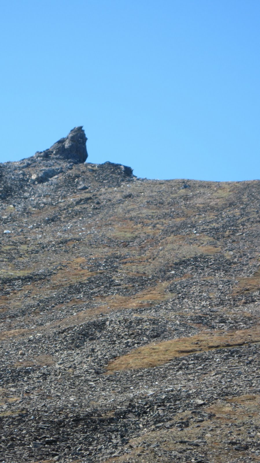
(left) Sampson Creek boulders visible from the Kougarak Road-  as i pulled up to park on the shoulder of the Kougarak Road during the rains of July, just to the north of what must be the most dangerous ramp on the entire road, i  was informed by a fellow named Ken who came motoring out to greet me that this— he gestured toward this hill- was Sitnasuak Corporation...

phase one, JOY OF DISCOVERY Nome rockclimbing, when you are getting to know all the roadside crags thinking you are the first, you are going to be the Fred Beckey of this obscure little rock clump  (not understanding that ishigaitch, the little people, have been cragging here since the Distant Time, not to mention probable instances of visiting climbers to Nome through its 100-year history, and undoubtedly the centuries before...)

typically, it goes like this:  from one of the four highways the climber espies a dark rock sticking up from the tundra fields, maybe only ten feet worth by the looks of it, but let's go check it out...   after a short hike through blueberries the climber gets to the rock and discovers that in addition to the 10 feet of vertical seen from the road, another 15 feet of vertical was hidden behind a fold of tundra, the result being a fairly sweet little 25-foot crag, with scattered dudes of 10-foot boulders, which will, from here on in, provide year-round bouldering— hooking, camming, and moss in the winter, marble and schist in the summer 

but now, after 10 years of frequent 4-season bouldering, "phase one JOY OF DISCOVERY rockclimbing in Nome" is drawing to a close for me;  i've climbed out all my favorite spots (up to the .10c level, of course-  plenty left for the V2 crowds of the future)...  which is why i was so happy, several weeks ago during the rains of July, to be exploring a brand new set of boulders, ones i had never noticed before despite how many passes, a new slant of sunlight driving by one day, a chance sighting of a rock hitherto camoflagued as bush:  potential JOY OF DISCOVERY and new fresh meat boulder takings... 

(above) A pair of Mew Gulls (Larus Canus)  i think, help me out here...  the first issue with a new crag is always:  RAPTORS:  where's the nest?  whadda we got this year?  a serene and welcoming eagle?  a stressed and strafing falcon?  a pair of ravens with marital troubles?  but as i approached the Samson Creek boulders, i was surprised to see a pair of gulls on sentry (no, they weren't jaegers or terns)-  they put up almost no resistance to my intrusion... i'm not sure they even had a nest up there.... they flew away, i never saw them again...


(above) Delilah's, a one-move 5.6 offwidth, which you will know is an oxymoron if you are student of climbing, offered here as a sarcastic comment upon the general paucity of this area for any worthwhile bouldering...   The score for Sampson Creek Boulders:  ZILCH...   one star,  not the next Cloggy, NO COLOR IN THE PAN, not worth a return visit, of which i was relieved to inform Ken when he came motoring out to my car once again as i was leaving...   
(above)  Pk. 3922 ("Aapa") in the distant Grand Central region framed through a "hole in the wall" at Sampson Creek boulders.   i'm assuming the boulders in these pictures are meta-sedimentary MARBLE, they had these awful white plates that broke at a touch, maybe this stuff:

PLATEY MARBLE (light to medium gray, medium to coarse grained, with grains 0.25 to 1 mm, heavily weathered, marble composed largely of 85% calcite and subordinate amounts of quartz anhedra (5%), tremolite (3%), locally diopside in disequilibrium (1%), and white mica (8%). Platy nature caused by thin interbeds of white mica-chlorite lenses and wisps usually less than 1 cm thick.  Frequently isoclinically folded and sheared along fold axes.  Less resistant than [other marbles] due to white mica content and folded nature, which produce broken, sheared outcrops and rubble.) (Bundtzen et al. 1994)

but i am SO NOT SURE what kind of stone it was...  i departed Sampson Creek early, and returned to the "plagioclase porphyroblasts" of the Windmill Boulders to work on the proj., mildly depressed because of the rains of July, though little did i suspect, my fortunes were soon to change in the greater mountains....

Friday, July 23, 2010

Mt. Warren (Pk. 3300+) via Fox/Warren Creek

Days of rain and self-pity at Salmon Lake (above, looking north), folded up between the mountains, the lake, the fog, and the DELUSION that I AM THE CENTER OF THE UNIVERSE.  On the third day I left the cabin, with a compass and a map of the Fox Creek area downloaded on a very feeble short-term memory, and headed east into the hills, having decided to provide my little summit-grubbing ego with a tiny nub of consolation:  a peak lying on the divide between Warren Creek (a tributary of Fox Creek which drains into Salmon Lake) and the Southeast Fork of Crater Creek:  Peak 3300+. 
Looking up Warren Creek (above)...   Madness quickly set in, claustrophobia.  Locked in a cell of fog all day, the brain is receiving inputs from four of the senses that the mountains are all around, but no fifth sense, no visual.  You can feel the mountains like a phantom limb.  It's disorienting, like Neo and Morpheus standing in the construct.  The obligatory Grizzly dissolved into and out of the view for a moment, precipitating much irrational fear and unnecessary detouring.

Several miles in from the Kougarak Road, the slopes began to rise, up and up.  Vapors, nothingness, sensory deprivation.  Onset of hallucinations.  Voices.  I had had too much caffineated GU.  The compass was constantly in play.  Fortunately, the terrain was matching the feeble brain download.  The summit of Pk. 3300+ (or Warren Mt., as I had started to call it) finally appeared through the fog (left).  As is usual with Kigluaik summits, the north side dropped off into chasms, while the south side provided a Class II walk up.   
This is supposed to be a picture of the fearsome drop off to the north (right), but as you can see, the image is nothing more than fuzzy shapes on a sheet.  Standing there, you could feel the space beneath your feet registering as a tingle in the solar plexus region (where lie the sensitive organelles in the electromagnetic energy body that register the sense of vertigo) but without the corresponding visuals, the feeling lacked adrenal punch. 


This, then, is the theme:  a mountain, and a sensibility, truncated by fog.  Follow the lines in this picture of Mt. Warren from the north (above), taken on a subsequent gear-ferrying trip up Crater Creek.  Extrapolate where the apex of Warren Mt. must be. Thus, our mind throws a veil over the peaks of our enlightenment.  Nothing has changed much for a week.  Reality shrouded.  Sanity diffused.  Motivation muted. Tarps dripping.  Poor American:  his belly is full, but he still finds something to complain about...

Thursday, July 8, 2010

Windmills, by Raina

   Overall psyched about this post because it marks the debut of MOUNTAIN PHOTOGRAPHY BY RAINA MCRAE.  Age six, relationship daughter.  She actually had to dangle from holds with one hand and wield the camera like a veritable Jim Thornburg to get these shots. Time of shoot was about 10 p.m. last month around solstice.  Night sweet as can be, with a breeze to blow the bugs, and the 'Skox herd lurking nearby.

 (below) The "jut" on Courtyard traverse, .10c
      Something completely tedious and boring (like bouldering) is rendered interesting by handicapping oneself in a variety of ways (both on and off the field) thus increasing the challenge.  For instance, the low-ball traverse rule:  you cannot use holds that are on the top edge of the boulder.  In the picture above I may seem to be violating this rule, but I am allowed those holds on a technicality, namely, the .10c rule:  once the problem is harder than .10c I will need to begin removing handicaps to make it .10c again because that is the hardest I can climb.    
Therefore, all my hardest boulder problems shall henceforth be rated 10c.
(above) Awning.  This sloping pull-over problem I have almost topped, but not quite. Wish I were allowed the desecration of a Fat Pad for the distasteful landing in the center of the Courtyard that a blow-out from the last move would bring.

(below) Scoop traverse, 5.8.  Killer M-5 ice tool pendjy-swing move in winter, from where the Scoop gets its name:  in deep snows, always a classic little wind-sculpted scoop formed at the top of an enormous drift, out of the wind, with dreamy convex landings (when not rock hard from wind), and fun moss sticks.

(left) BoreHole Overhang, 5.6. or what have you. This move is actually just a tiny bit off the deck. I was trying to get Raina to convey a sense of exposure, but all the photo conveys is a sense of age. The move is part of the overall Bore Hole Traverse, my current "proj", constituted by the low-ball circumnavigation of the entire lower wall at the Windmills.  Rating coming in at —  .10c, of course.  The windmills have a surprising number of crack moves here and there.  
(above) Hamlet.  This was Raina's favorite pic, and she wanted it included.  This little mouse is a survivor.  Like Diemberger on K2, Hamlet narrowly avoided the SNAKE.  He'll never know how closely he touched the void.  He was the best climber, cranking Separate Reality moves upside down on the roof of the cage, and this is what saved him.  
     At the start of summer, my student Kaitlin showed up at the door with 4 fat adult mice to feed to "Speedy", our class snake, who is currently residing in my bathroom at home with the hot shower on at my summer spa for arctic pythons.  Kids from all over Nome bring their rodents to us.  Mom and Dad say we have to get rid of them.  Raina has learned to successfully petition me to take one mouse out of ever fodder as a pet, just for one night.  Hamlet was the clear choice.  
    The first three victims were dispatched without great ceremony, BAM!, squeak!, gulp.  Hamlet, the fourth, went into Raina's room, and that night slept in golden chambers.  He entertained us with his cheer, good disposition, and hard climbing.  He was a hit with the neighborhood children, pawed and fondled by all with no complaint or bite on his part.
     Raina left the house the next day.  I whipped out Hamlet by the tail and carried him towards the big cage where the python was waiting for him, coiled, ready.  And then I was overtaken.  Suddenly, profoundly...  Every unit of KARMA I had accumulated from every living MOUSE I had ever thrown to this MONSTER suddenly burst forth from my chakras in one agglomerated spasm.  I fell to the floor, weeping.  "Oh, my offense is rank, I stinks to heaven!"  I wept for 20 minutes.  I cursed Hamlet hysterically and hurled him back in his feeding cage:  "I CAN'T DO IT!"  He was just a mouse, but he was so cool, he had a life, I had known him from an earlier incarnation.  
    We took Hamlet to Animal House, the awesome Nome pet store, where Chrystie was kind enough to take him in.  A sign was posted on his cage  proclaiming him the Kurt Diemberger of mice.  He eventually went to the home of another wonderful, kind, child of Nome, Alaska, where I'm sure he is bouldering on the walls of his cage.

Wednesday, June 16, 2010

Pk. 2345, Johnstone Creek


..saw this tor (left) on the hike out... was hoping to redeem myself for the "insufficient fifth class" foul I had received on the trip thus far... i bounded up the thousand-foot slope expecting a summit tor with mandatory 5.8, but it turned out the tor wasn't a tor at all, but more of a scarp, built into the hillside like a sod house... the back side required little more than class II moves to reach the top.   .

  
    The west side of the tor, however, sported some precipice action... bouldered this 25 ft. route (right) to the summit of 2345..  warm, sunny day... curious little falling away sensation when you finally hang back into the air...  thoughts in the head clean up desktop... tune in the head clarifies.... ear pressure changes white noise as assemblage point of energy body shifts... but it was only for a moment...

   (above)  A 2 m. chunk of white marble near the top of Pk. 2345.  One sees these white rocks scattered everywhere around the Seward Peninsula.  Have you ever mistaken one for a patch of snow?  People will knowingly pronounce it to be quartz, but I believe the correct answer is marble.

   The 2345 Tor I climbed, iamprettydarnsuresortof, was granitic gneiss... in other words, the pluton, a piece of the bedrock poking up through the shell of schist...  Pk. 2345 is one of many triple clashing zones where the three dominant geologies of the Kigluaiks coexist in one place:  the granite, the schist, and the marble.  

   The Amato/Miller map seems to refer to this spot as a "strike and dip of foliation" and gives a "trend of stretching lineation."  Studying these geological hieroglyphics, which I am not fully equipped to understand, led me to believe the map was saying 2345 Tor was formed by a slippage along a fault line, like laying two books together and then sliding one up an inch...  the tor is the part of the one book that's sticking out... 

   Too bad it wasn't the dream climb I came for... very recommendable as a hiker's summit... high meadows,  soft tundra beds with flowers, a bit of decent rock awaiting more routes, falcons soaring nearby...

  Here is the view looking south (above) from Pk. 2345, which is the arc of the panorama I left out in the tragedy constituted by the previous post to this one...  I just haven't come to know this part of the range well, yet... the apical mountain there in the very back, furthest south in the picture, is the great Singtook, Pk. 3870, the western sentinel, battering ram of southwest storms, the ship's prow, lead Tooth, third highest in the range, trickster, beacon, the Mt. Washington of the Seward Peninsula.

Monday, June 14, 2010

Peak 3000+, Southwest Ridge

  WHY AM I COMMITTING THE WRONG I'M ABOUT TO COMMIT?  I've become a stamp collector with a little album.  I have used Photoshop to type little numbers on the mountains, which I shall now categorize, classify, number, name, shuffle, and dote over.  Even more absurdly, they're only the Kigs, barely even big enough to qualify as mountains, mere dunes, really.

   Answer:  I'M HAVING SO MUCH FUN DOING IT.  There is something about the Internet, with all that consciousness pulsating through each keystroke, that is blowing away my lifelong writer's block.  Every unit of suppressed spray accumulated over years is coming bursting out, accompanied by features formerly poo-pooed, such as maps, pictures, and route descriptions of climbs which are not even climbs at all, but firmly belong in the category of hikes, such as today's feature.  Blame it on the utter transparency of the Matrix.  Couple this giddy loss of cyber-inhibition with the giddy fun of hiking and climbing in the Kigluaiks, and click!, you have these transgressions.  I invoke the Alex Lowe theorem: FUN is the measure of the climber. 

"...Go out and have entirely too much fun..."    Doug Buchanan
(above) Pk. 3000+,  one of the high points on the divide running west from Glacial Lake.  Class II.  It was a hike-up.  I got a funny feeling it has been ascended before.  My first foray of the summer into the high Kigluaiks, the well-springs of power, chi, prana, sinh tala in Athabaskan.
(above)  The ridge took about an hour.   "The best climber in the world is the one having the most fun."  It was so much fun last week to simply be hiking up a little mountain,  not surfing around my own event horizon on a death-pile.
(above)  Looking east around the bend of upper Johnstone Creek canyon.  Pk. 3000+ in background.

     MY EXCUSE for LAMENESS, for not seeking out a pocket of true, TECHnical climbing:  this was an exploratory trip

    Never had I properly explored the western side of the Kigs, it was time to do so.  The goal was to find a southern approach into the Kigs from the Teller Road into Canyon Creek, where lurks granite.  The GLUE of town was attached to my ass like a stretchy tendril, so I couldn't stay in there long enough—3 days, 2 nights— to do justice to my explorations.  The resistance of the GLUE was greatly increased by my extreme and irrational BEARONOIA, though once I got out there with my cannon slung over shoulder and madly singing, I saw literally no critters at all the entire three days.  

    So, what follows, simply because it's so much fun, is a little panoramic indulgence.  To a true Kigs enthusiast it would prove irresistable and might help mediate the disgust you should feel at this public disrobement of beauty.  It should also remind you somewhat of a dog trotting in circles peeing in various places systematically and with great enthusiasm.  Do dogs not have fun when they do this?  And is not FUN the justification for today?

Thanks to "Bedrock Geologic Map of the Kigluaik Mountains," by Jeff Amato and Elizabeth Miller.  I am butchering the geology.

(above)  View looking east from summit of Pk. 3000+.
1.  Tigaraha.  Means "finger" in Inupiaq. I've climbed it by at least 3 different routes, with Mikey and Lahka, but don't know who made the first ascent. Gneiss.
2.  Pk. 3367.   Visible from many places. A landmark.  Cobblestone headwaters. Deserves a name.  I've always called it "Three Gables" ("Tikilik" maybe?).  Climbed it solo one Iditarod on a mystical snow-machining day. No idea about the first ascent. Schist.
3.  One of the Grand Central or Crater Creek peaks.  It's probably Fox (Kayuqtuq), poking up from behind.  Currently stalking this one. Gneiss and schist clashing zone.
4.  [i think] One of the Grand Central peaks that form the right side of Grand Central, Pk. 3190. I always call it the "Mother." ("Aana").  Snow-climbed it one spring via machine. Schist, as are the next two.
5. A little Grand Central peak, 3290 [i think]. I always call it "the Child" ("Uiviilaq").  Skiied with Tyler and Keith one year.
6. Tallest Grand Central Peak besides Osborn, Pk. 3922. The "Father" ("Aapa"). Cramponed up with Phil on a very cold January day.   
7.  Mt. Osborn, Pk. 4714, King of the Kigs. First ascent unknown, at least to me. Do not leave comments reminding that it does not matter, we know this. Maybe it was Osborn first climbed Osborn?  Probably a hunter from Beringia.  It's only a rolling, flowing lump in the mantle.  My understanding is that Osborn is a giant chunk of "meta-sedimentary" marble riding up on the pluton.


(above) Looking northeast from Peak 3000+.
7.  Osborn, with [probably] unclimbed west face.
8. Pk. 2490. Just north from Glacial Lake on the right.   
9. Pk. 3320. I mean the peak down below the little red "9".  
10. The north peaks of Osborn. (one on right higher.) 
11. Suluun, the Dorsal Fin. Andy and I did 3 routes there. 8, 9, and 11 are a line of the orthogneiss, pink on Jeff's map.
12. East terminus of a line of jagged peaks visible from Teller. Are they the "Sawtooths"?


(above) Looking northwest from Pk. 3000+
12.  I've heard them called the "Dragontooths" and the "Oro Grande".  "Sawtooths" works.  Ascents by Amato. A ridge studded with granite tors.
13. Pk. 3700+ over by Falls Creek. I would like to know more about this area.
14. Pk. 3300+.  Granite.  I suspect it of having non-hideous rock climbing.
15. The mysterious 3850+.  One of the higher elevations in the range.
16. Canyon Creek.  MUCH more searching for real climbing to be done.

   O, my offense is rank, it smells to heaven...
    It hath the primal eldest curse upon't—
   
And yet, here's one more.  A sign of aging, plus extreme self-centeredness, plus lack of job.


(above) TR region, Johnstone Creek area
1. Pk. 3000+
2.  Inuksuk pass (see below)
3.  "Johnstone/Right Fork Pass" I had good walking on snow fields, probably a doable snow-machine ride in winter if there were not cornices..." 
4.  Pk. 2930 a slice o' the gneiss
5. Pk. 2710 couple of hour backpacker's climb, I didn't get to it.
6. Another way to get over to Canyon Creek. I'd wager it's machinable.
7.  Pk. 2345  I climbed a little 5.7 on the summit tor;  this is a classic hike.
8.  My bearanoid campsite, out of the way of the main corridor. 


(above) inuksugait  Strange to be surrounded by homunculi in the lonely mountains. Here is a link about rock piles that took seconds to find:

...and so there ain't nothing more to write about, and I am rotten glad of it, because if I'd a knowed what a trouble it was to make a book I wouldn't a tackled it, and I ain't a-going to no more


Wednesday, June 9, 2010

Spring Bouldering

     Have continued to languish in the River of Forgetfulness:   warm, golden, syruppy, midnight-sun BOULDERING sessions around Nome, the high Kigs but a distant memory.  Post school-year lapse is to blame;  every year it takes me at a week to recover from the end days of school.   I am too exhausted in the first days of vacation to do anything other than slump.  Any grade-school teacher will understand.      
    How could an expedition to the remote hills be mounted at such a time?  This is a time for merriment, music, parties, and the crucial, often underestimated, human-bonding.  That the weather has been fine through these days of peace and love has only exacerbated my guilt at failing to extricate from the glue of town.  But the BOULDERING, nightly BOULDERING... that is what gets a climber through. 

(below)  Old picture of Mylon Schield on a (granitic) gneiss boulder at the Sinuk headwaters.  This is BLM land, so you can actually sort of talk about it without fear of impending ethical thunder clap.  From Nome, getting to the gneiss (ohjustcallitgranite) generally requires a day of hiking.  
     Came to Nome 10 years ago expecting the end of climbing.  After all, western Alaska is flat, like Bethel.  Oh well, we'll make a lot of money and go to Denali in the summer and get out of Nome as soon as possible.  But then, from the plane, as we flew low coming into town, we immediately noticed lots of little dark smudges on the tundra down there.  
  Turns out that each of these smudges houses a little rock garden.  Life in Nome is like this:  you just espy the tip of an outcrop from a conveniently-placed road, hike over to the outcrop, and more often than not, the view from the road had been concealing a little extra 15 feet of rock.  Am I just hard up, and out of touch?  Or is there not nice bouldering in these little Nome klettergartens?  And they are endless, BTW, thousands of them poke up across the wastes of Beringia, you could grab a pair of axes and just boulder your way back across the land bridge...
(above) The featured Raptor this Spring at Sunset Rocks is a family of Gyrfalcons. Look closely at the photo above and you can see Mom directly above the nest, which is perched on a little nose sticking out.  Mom is concerned about a menacing little simian scurrying around the base of the rock.  


The calendar on my wall translates this month as "Time of Year When You Encounter Lots of Critters At the Boulders."  Rock Gardens are natural gathering points.  Every time you approach the rocks, the chance of an encounter hangs potent in the air.  What will IT be, in just a moment, when I crest this rock, waiting on the other side, its peaceful grazing suddenly disturbed?
     In the later years of my life, living here in Nome, I have morphed into a type of person that my California environmentalist Hippy upbringing demands I revile:  I have become a wildlife harrasser.  I don't mean to be...  Some of these guys just get so, well, territorial.  Take the old Musk-Ox bull up at the Windmills the other day.  He startled my colleague Andrew so badly that the tiny human dropped his backpack and ran;  then, the beast refused to relinquish the pack back to Andrew's care, but instead sat there snorting and stomping his hooves over it, for all the world an old Cassius Clay befuddled from the years of head-butting and quite out of it... an old man being an asshole just for the sake of being an asshole.
     I don't mean to harrass.  But I've encountered too many of these old fellows.  Obviously, Musk Ox are extremely intelligent, especially in the social domain.  Look in their eyes and it's like, mammal-to-mammal here!—  this isn't harrassment.  I am lobbying for my right to occupy part of this rock, that is all.  I understand that this guy is working with a different set of criteria, but really, we can work it out, there is no reason we cannot share this rock.
    Am I anthropomorphizing?  Am I attributing this ungulate human tendencies he does not possess?  Or am I legitimately negotiating a niche out here in the wilderness like any other animal?  They get so officious, sometimes it's hard not to mount 5.7 rock directly over their heads and laud it over them a bit like a chattering monkey safe in his tree.  But I sing them songs too, for balance. (Musk Ox do NOT appreciate the lycan high registers of the human voice, but seem to tolerate low growls on the order of Tom Waits.)  These very behaviors, though questionable, led to the return of Andrew's pack.
      The alacrity with which Musk Ox (relatives of sheep and goats) adapt to these negotiations leads me to believe that they do not feel particularly harassed.  After a while, they forget all about you, and then THERE YOU ARE bouldering amidst herds of Musk Ox thinking, too bad the bouldering mentality does not more readily encourage the bringing of a camera...
    But they would be horrified in California.  I would be villified and cited.  How hath the redneck taken root?  Who placed MAN at the center of things?    But, in the deeper programming, the Californian inside me retains some unassailable primacy.  My rule is, always give the critters their required space.  Respect nests.  And if you even remotely suspect you might truly be creating a negative impact, then you must perform the difficult but sometimes necessary act of NOT CLIMBING.
(above) Chris Miller crimping the Bore Hole traverse at the Windmills. The rock is some crazy half-baked schist.  Often looks like death-by-crushing and probably very well is.  Nome climbers should follow the "3 points of attachment" rule. 


(below) Looking up orange wall (every crag must have an orange wall) at Angstroms Rocks. This is an 80 feet chunk of meta-sedimentary marble next to the Kougarak Road, way fun to climb, but friable as chalk!  The featured Raptor is Golden Eagles;  their nest is visible directly to the right of Mikey Lean, who is battling the nice 5.10a Angstroms Orange on a crisp Fall day.  Photo by Phil.
    Out at Angstroms the other night... sated on the Lotus fruit of limestone climbing...  CHI oozing liberally up through the pores of the hillside, the air alive with buzzing and chirping and whirring of wings... plenty of scare and dare, breath or death, trust or dust, the ground was 30 feet down and I didn't even care, mantels and pockets and it was all there...  Flexibility and strength were soaking up into my limbs like water returning to the sponge. Winter was so long and cold.  It's all an abstraction now, a 30 second commercial in the mind. Now, back to our main feature, big blue summertime and warm rock under the hands...
      When all at once—  LARGE MAMMAL IN THE CORNER OF MY EYE!  Fight or flight!  Flee!  Hide! screams Brain.   So I did hide, up on the limestone.  I don't care what they say, bears can't do 5.8 or higher...  So I'm out of breath, heart pounding, freaking out in a totally unnecessary fashion, and the whole time my brain was processing the visual data from what I had seen...  very poor visual data, I have to add, my old eyes have gone very bad.  The animal had been a good quarter mile away.  So my brain is sort of Photoshopping the image, and lo and behold, the latent image emerged not of BEAR, but of WOLF.  The audio kicked in, and I realized I had been listening to the wolf howling for several minutes without realizing it.  So, back to the limestone (marble) for a long, sweet night of bouldering. 


(below, bottom) BSNC lands. 

    At every indent I am bumping my head against the problem, the problem of posting descriptions of sacred places on the internet, of all places.  I have manufactured various rationalizations and justifications for the act, but the act still has an unsettling feel to it, the fear permeates each keystroke.
    Worse yet, the problem of seeming to encourage climbing rocks on shareholders' lands.  It's sort of embarrassing to be a climber these days;  we are the final scourge of the west, the scavengers who pick the remains from whatever the cowboys, explorers, and businessmen failed to ravish.  Never spray.  It is petrifying to be doing so.  But I'm not out there shooting anything....    


Banner Creek Bouldering Getaway


the lovers were loving at the love-in
the music drifted down to the willows by the river
the rock it was solid and undercut—
     oh, leave it all and get off to the war

we lay sprawled on the grass, the sun glinted off riffles,
her voice was a tickle just this side of a dream...
one more try and we'll have unlocked this sequence—
      now, off to the war, enough of this peace

  the nap hung heavy on our eyelids, the breeze blew away the bugs,
 i had convinced myself we were where we ought to be...
  but when we awoke, the ground was too close—
       so, it's off to the war, before we get used to this

no more capering with our seats next to the ground
off to the glittering kingdoms, to be in peril in the air
away from this babbling brook of Forgetfulness—
     now, off to the mountains, to the war... 

Saturday, May 22, 2010

Singatook- Gregg Stoddard Memorial Springtime Yahoo Field Trip to 3870, year 2010

(below) View from top of Solar sidewalk at 3200 level, looking south down the upper part of Singtook.  Woolley Lagoon indiscernible in distance. Keith Conger about to drop off the edge in search of dropped gear.   

MAY 09, 2010:  GREG STODDARD MEMORIAL SPRINGTIME YAHOO FIELD TRIP TO 3870 was a great success!  Keith and Ian summited the Singtook once again to commemorate the man who brought us together as friends so many years ago, the arch telly fiend, Stoddard.  Though he left Nome for the big city, the spirit of our original trip propagates forward, compelling us each spring to make the pilgrimmage to the sacred mountain.    

 (below) Singatook from the Teller Road, 17 miles distant.  Singtuq?  Sinughaiq? Sinaillaq? Somebody help me!  How do you say it?  Leave comments...  Francis Alvanna says "Sing-took!" kind of like that, so that's what I'm going with.  It is almost universally referred to by the people of Nome as "3870".  

The Singtook... the Mt. Washington of the Seward Peninsula... possibly the most climbed peak in the Kigluaiks...  receives the full brunt of any weather coming in from southwest...  like any mountain invested with mental process by interaction with humans, the Singtook is a type of psychic private property..  people have lived at Woolley Lagoon for a long time, climbers must choose their spiritual windows with care, or otherwise are required to show their asshole license...  hence, our permit for the Greg Stoddard SpringtimeYahoo Field trip to 3870...

(below)  Keith Conger at the start of the Solar Sidewalk, the classic ski tour up and down the Singatook, usually of four or five hours duration.  A fine Greg Stoddard lies ahead.

(above)  Keith skinning up the via media part of the Solar Sidewalk...this is the fun part on the way down, a black diamond due to the potential for smashbody on the perfect Cretaceous granite.

(below) Via alta part of Sidewalk, summit hump of 3870 in background.  On other Greg Stoddards, Keith, who can be a mighty sick huckster,  has hucked the center of that face in the background.  On the 2010 Stoddard trip he launched from the saddle to the right of summit, while I crept to a blue square lower down. 

(above)  LOVE these hills!...   'v lost count of how many times i been (sic) on this summit...  probably equal to the number of times 'v failed to reach this summit!


(below) Apres ski...    we didn't get any good pictures of the descent because of it was ALL ACTION!  Like any good Greg Stoddard, we skied right up to the car.
    If you go to the Singtook, it's good to sort of ask permission of the mountain, and maybe the locals too, if you can park your car on the Teller Road.  I'm not really sure what I'm talking about, but it seems like wise advice for anywhere you go.

   Farewell, GREG STODDARD MEMORIAL YAHOO FIELD TRIP TO 3870, year 2010.  So this was our yearly pilgrimmage to a sacred mountain. It's always nice to bag the summit. Have you ever seen it wreathed in lenticulars?  Monsters!   Greg Stoddard is probably batting about 50% when it comes to reaching the summit.  I believe this year makes two or three in a row.

     Skiing is so louche, so hedonistic—  I mean, anyone can go WITH gravity.  That is why I state, Stoddard is a fiend, the arch demon of telemarks.

   It is time to return to the fight UPWARDS against earth's gravity.

Windmills, Sunset, Pennies, midnight sun bouldering

   River Lethe bouldering under the midnight sun on work days,
for days and days, for what seems like weeks and weeks
(the days are bright/and filled with pain
enclose me in your gentle rain)

  Metamorphic nightmare leaning choss piles with sky ladders of big jugs
(I've spent years gradually testing them)
 climb smoothly though,
it's never pleasant dangling supine under tons of meta-sedimentary,
this is playing with guns that are loaded,
this is some very brittle bones

I shall climb in the Kiguaik no more
there is no need of venturing up the Kougarak Road
we can wonder here, by the sea, amongst these outcrop gardens
befuddled with the lotus fruit of crack and crimp, air and dangle,

finch, longspur, sparrow, wren,
(the home team, the ravens and ptarmigan,
 trying to protest their rights for staying the winter)
entire landscape humming in and out, oscillation

the day of pain and yawning drops out of sight,
here is the hole, hole, thumbs down, jug, jug, dangle that requires all of your attention
here is a mantle onto a glued flake
here is the best damn boulder problem you ever expected
down in the thrustle of chirp, reep, whoo-oo--oo, keep, keep

chi is oozing out the pores of the earth into the pores of my skin

i have forgotten all about the silent peaks
summits still encrusted with snow
repulsing every attempt

wonder here, for now, by the sea, pulling down,
soon it will be morning and the streams of humans will begin...

Thursday, May 13, 2010

Inuruq (Pk. 1926)

(below)  Journalist and ski ace Tyler Rhodes descending into Tolkienesque murk, two Sundays ago, north slopes of"Inuruq" Mountain.    He got lacerations in his P-Tex.  Crater Creek and Pilgrim River lurk in the mist.
          Here's an analogy that might make sense to any Supertopian:  Supertopo   Salmon Lake is to the Kigluaik Mountains, as Bishop is to the Sierras.  It's a horrifying analogy if you really think about it.  Salmon Lake is on the road, you see, the Kougarak Road, and so may have involuntarily invited just such a fate, looking one trans-Siberian highway forward in time... 
      
         This blog takes responsibility for crimes against the Earth.  This reportage of climbs is nothing more than another unit of encroachment upon the wilderness.  Just by posting Tyler in front of this grey curtain, I have destroyed the pristine wilderness veiled behind it.  These were unknown places;  now there exists a little more known..
       And why these crimes, what justification for a Kigsblog?   Let us be honest, brothers and sisters:  Ego, and the mammalian need for recognition.  A European craving for exploration, and the bringing home of another conquered wilderness to the homeboys at the Explorers Club in the father land.  The same reason there sits a bust of Amundsen on Front Street.  Coupled with an inability to stop the thing because it's actually SO MUCH FUN doing it, so WRITE ON!!..

        But another reason to blog, perhaps, is to preserve worthy languages.  When I asked Earp (...Earp's Salmon Lake cabin is to me, what Glacier House was to Norman Clyde...) what was the name of the funny, little, incongruous mountain at the north end of Salmon Lake?, she replied: "Inuruq."

(below) Inuruq. The map is not the territory.

     I asked Marie Saclamana, who teaches Inupiaq in the classroom next to Mr. McRae's 4th grade, how she would translate "inuruq."   This kind of question can be super tough;  it's a bit like transferring a file from an Apple to a PC. 
    I had figured the word—  inuruq—  was constructed out of the Inupiaq noun and suffix combo:

inuq (person)    +   tuq (he, she, or it is doing) =  inuruq

    What Marie forced up (translation works using approximations...)  "person who has had an accident." This actually makes a whole lot of sense, if you know this mountain—  it has a conspicuous landslide on the front (north) face, a real MASSIVE one, which, rumor has it, was witnessed by people from Salmon Lake sometime in the last century.  Inuruq looks like a little person who has vomited away the front part of their torso, and held the whole load in cupped hands around their waist level.  You can see it across Salmon Lake from Interstate 395... I mean, er, the Kougarak Road....

Someone undoubtedly knows much more about this mountain's name than I have come up with here.  The Todd party reported the mountain's name as Coho in an edition of Scree.  Please comment.  One problem with blogging that keeps jamming my foot a little further into my mouth, is that I keep writing about things which I have only partially researched.  But if one waits until the research is complete, one would never post!  Is is supposed to be Inuraq?
(above) Not an image of Inuruq-  rather, this is another hill off the Kougarak Road further south showing the avalanche conditions of 3 Sundays ago.  The crown face on the left, foreground hill is probably 800 ft. wide and 1 meter deep. If you search closer, there are other slides.

A question that has long plagued me:  is there real avalanche danger on the Seward Peninsula, or am I just over-paranoid?  The day Tyler and I tried to ski Inuruq was grey and rainy.  The summit was sheathed in spring blizzard which we were unwilling to penetrate.  Worst of all, the AVALANCHE PARANOIA light was lit on our mental dashboards as we kept encountering sketchy-feeling snowpack in the deposition zones, as well as recent slides, plus rain, and warmth.  It was reassuring for me to see that Tyler was not without paranoia.   We eventually took off skis and began booting up the bare tundra of the northeast ridgeline, before getting shut down.   Back to the machines, back to the truck and trailer at Nugget Pass, back to town, grind, sleep deficit,  paperwork, kitty litter, and kids, the flow of kids, pushing like ocean at the bulwarks....

Tuesday, April 27, 2010

Topkok in early Spring

 if anyone is offended by the sharing of these secrets, please leave comments and i will discontinue this entire silliness immediately...

         the ishigak darted by, mounted on a little child's snow machine...  i was sitting in the sullen gloom of the Topkok shelter cabin two Sundays ago staring out the lighted frame of the window when i saw the ishigak go by, but only for a second...  as you can see from the picture of the shelter cabin (below, left), there was little snow that day, the temperature being far too warm for ice climbing, which was what i had come for (but at least the Iditarod Trail had hung in there— silky smooth sailing on snow machine, as a matter of fact, due to the miraculous meter of snowfall in mid-April)...   i ran outside the cabin to view the ishigak, but the little man had disappeared, no sound, no trace, no lingering exhaust...


        later, leaving the hut, i walked east for two or three miles down the beach, under the exfoliating cliffs...  the First Weep was non-existent, and the Second Weep, (top, looking east, with Tapkak Head in the setting sun) which Collins and I had epicked out on the year before, was a shaky-looking thing that did not inspire confidence
           it was warm in April, the tors in the distance poked out of emergent tundra like the cover of a Yes album,  but PARANOIA overtook me like a squall whenever I walked out into the open... Topkok had become like a mental illness to me...   i mean, just look at Phil and Ryan's spring Topkok story fro last year!

http://nomemisadventures.blogspot.com/2009/05/excellent-bear-tacular-madventure.html

why is Topkok so weird?  i think it's the quality of the wind, all circular and eddy-like and going-every-which way like the Z-waves on a cartoon TV screen... this must be due to some odd confluence of air masses...  if anybody understands the winds of Tapkak, please leave comments...  but really, the deal is, the place is a psychic node, a crackling network point for the Earth's psycho-electromagnetism....
(above)  February 2009 iteration of Topkok 2nd Weep, Ian climbing, 30 below... 
(below) the same climb two Sundays ago, April 18, 2010, with hanging bells, like a Hung Jury of Nome...  Ian was too damn chicken to solo the whole thing...
Here was a new one, not present in 2009:  it could only be the 1.5 Weep (above)...  I was scared even to touch it, with the birds singing in the air and the temps so warm...  this was a great personal failing, a complete let down of will and power, a sin, the sin of CLIMBING NOT...    nevertheless, these types of chicken-outs have a way of preserving oneself, so one can remain whole to climb the 1.5 Weep on another day, KOW, KOW...
 Normally, the First Weep  is a fun 60 foot solo on water ice (WI-1 or WI-2), but Spring had already melted it by two Sundays ago (above)...  the beta is, you climb the falls, then continue up steep willows and solo the south arete of the Ishigak, visible in the background as the lefthand skyline of the 100 ft. outcrop... there's good THWACKS on turf and hooks of frozen flake (M-1 or M-2) with at least the illusion of exposure, pretty good for all the trouble getting there, and the ocean gently tugs on your earlobes as you climb...

   this was the trip where i felt the rock of Tapkak for the first time, warm under the fingers...  always in the past the feel of the rock had only been transmitted to nervous system by the feel of the tools, the chrome molly and carbon fiber shaft,  always in the past you couldn't take your gloves off, so cold, so inhumanly unworldly ALLAPA!

   but now it was April,  the quartzite had hatched from its icy pupa...  i discovered ("discovered" only for myself, of course, all this data has been known by people for milleniums since before the whole bluff rose out of the sea for the second time, somewhere in the Pliocene) that the choss quality was highly variable...  in places, like in the picture (above), the degree of choss approached actual decent rock, almost so good that a drilled hole with a bolt in it might actually hold something, which is rare for the Seward Peninsula...  in the second zawn from the hut,  i bouldered in Scarpa Inviernos on beach boulders where the quartzite was gray and dimpled, and the cracks were true cracks and would have taken nuts marvelously...  elsewhere, the rockfall was so bad, it was like the Eiger Sanction, i huddled under that very bottom inside angle of the overhanging sea cliff where the rocks can't technically get you, scuttled along with  feet pressed right up against the cliff where the sea ice met the rock,  climbing the choice bits, lost in rock and turf and ice and thought, don't go there, they all say, don't go there, but of blogging, who can really say?

(Below) is a map of phoneme/land correspondences from the Norton Sound coast that have been propagated for some time...   I've had this map floating in my school files for a long time, but have no idea where it came from, or who made it.  Leave comments if you know.  And i do understand that climbing, and worse, spraying about a magical place, before you have actually done the research of the land stewardship is a rude and reckless act not to be condoned, but shouldn't these particular words be posted, do they not justify the desecration of the post?  

                                                
http://www.paulcolor.com/index.php#mi=2&pt=1&pi=10000&s=16&p=5&a=0&at=0