Wednesday, September 15, 2021

Central Water Company Ridge

Pk. 2800+ and Central Water Company Ridge
BLOG LAG: 14 months
       After a long first ascent drought, I finally got up something.  With Keane Richards, in June of 2019, we did a sweet little mixed climb  in Grand Central Valley.  "Central Water Company Ridge" follows the sun-shadow line in the picture above for 1300 ft. of moderate snow and rock, to the summit of Pk.2800+ located at the southern end of Crater Lake.
Keane Richards on Company Ridge

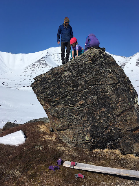
       There's something about the camping place at the north side of Crater Lake. Morphogenetic resonance from the tent city that existed there 115 years ago makes it the de facto campsite of Grand Central Valley.   People looking for a camp in Grand Central tend to seek out Crater Lake. The 115 year old carriage road which can still be found leading up Grand Central goes straight to Crater Lake, a base of operations in the old days for the Wild Goose Pipeline that boomed, and fizzled, over a century ago in this valley. Not only can ghostly voices of long-departed Teamsters and miners be heard on the wind, but nice planks of old-growth redwood lie strewn about in abundance, and Kitchen Rock provides a windbreak as well as worthy bouldering lines.

Keane is visible belaying from the gendarme. In the background is Ooquienuh (Mt. Osborn, Pk. 4714).

        Spring of 2019: early days of the pandemic. Not much tolerance for the risk yet in those days. I lay awake at  night preparing for slow death by oxygen starvation. The only safe place to be, it seemed, was outside in the ultraviolet. 
       A Spring crust had been on for weeks. By early June, a thin crust remained, enough for dogs and sleds. In their first Spring in the Kigs since moving to Nome from Tok the previous Fall, Keane and Sarah Richards, plus intrepid younglings Rosalie and Amelia, plus Sarah's electron cloud of dogs hitched up into a couple of teams, plus myself, trailored our whole kit and caboodle up the Kougarak Road on the weekend and mushed up Grand Central to an awesome family camp in fine weather, highs in the thirties by day, lows in the twenties at night.  
Company Ridge marked in yellow
        The first night, we figured 5 am was adequate wake-up call. By 8:30 am, after we reached the middle part of the climb, the rocks began to whizz down like a sniper warming up over morning coffee.
        "We shoulda left at midnight," I deprecated.
        "OK, let's come back at midnight," Keane said commonsensically.

Sarah and Amelia about to give the signal to mush. Keane, Rosalie, and I rode the iron dogs.
      We swarmed all over Grand Central for a Saturday. Even if you do leave a trace, such as a snow-machine track, such a trace ceases to exist in the snow after a short time. Keane and I left at midnight on schedule. Rock solid was the snow, with a breeze at ten.

Keane, Rosalie, and Amelia bouldering in the nice warm thirty-degree temps at Crater Lake Camp.
       The climb was easy enough to simul-climb the whole way, but steep enough to justify the rope. Mostly we put in pickets, (long dastardly aluminum stakes,) which went into the snow easily, yet felt totally bomber. A few pitches of 45° snow led to the crest of the ridge, where an abyss dropped from our feet off the northwest side. Kicking steps in snow, we climbed past some steepish rocky kigs, banging in an occasional piton or picket. The wind picked up as we neared the top. A crafty tunnel led through a rock buttress, followed by a steep pitch with some good whacks of the ice tools into exposed tundra. The last move was an easy mantel onto a little pointed summit.  


"Not only can ghostly voices of long-departed Teamsters and miners be heard on the wind, but nice planks of old-growth redwood lie strewn about in abundance, and Kitchen Rock provides a windbreak as well as worthy bouldering lines."
       Somebody climbed the Company Ridge before us. There were bear tracks all over the climb. What I've seen all over the Kigs is that these critters definitely like to play games on snow structures in the early Spring, sliding, jumping, and climbing. Awakening from winter sleep, they step on to the front porch of their lairs, which are located high on the hillsides in skiing and climbing territory, and they mess around on the snow slopes in the nice warm sun before going back in their cave to hit the snooze button just one more time.
        Keane and I were forced to search a bit for a viable way down to Crater Lake. We finally started down a gully, but it was a trifle steep, so like some kind of gumby I called for the rope. We would down-simulclimb on pickets.
          I went down first, kicking front points in to the steep snow, and stabbing my picks in piolet canard position. The ground was steep enough. If you fell, you'd go whizzing down for quite a ways at a reasonable velocity I looked over to my left and saw tracks, 5 pinpoints in the ice. I could practically see the bear front pointing down next to me, claws forward, my mirror image, with my exact same simian climbing posture on the steep hard snow.
Looking southeast from the summit of Pk. 2800+ across Thompson Creek at Pk. 3207, the true high point of False Tigaraha, the peak mistakenly marked as Tigaraha on the map. To surmount that little summit kig there on 3207 requires one rather fearsomely exposed fifth class move. In the background, Pen Tri Cwm can be seen.
     Today, road penetration threatens the Kigluaik Mountains. What if, someday soon, Grand Central is repopulated back to the demographic it showed at the turn of the 20th Century during Wild Goose Pipeline days? A consummation devoutly to be unwished, in my estimation. But if it were so, I have no doubt that Crater Lake would be the locus of the alpine climbing scene. A nice little cirque of miniature peaks surrounds the lake. This mountain wall would lend itself well to endless scrutiny, and feats of derring do, by the legions of climbers, skiers, and boarders who would congregate there at the end of the day, and its features and chutes and walls would become animated with the legends that would accrue. We'll build a hut out of the redwood planks. The bears will probably be driven out by the arrogant humans.
       If this comes to pass, let the Central Water Company Ridge be entered as the first excrescence, a line drawn on a mountain. I predict it becomes an alpine classic, for its moderate nature, and ease of access from Tent City at Crater Lake.
Pk. 3050+, around the corner from Crater Lake in the West Fork of Grand Central, showing the number one most desirable first descent remaining to be skied in the Kigs:  the "Z-Couloir," which is visible snaking down between the two ears.

Friday, July 23, 2021

Moon Mountain Geopsychic Survey


Nick Treinen on Pk. 1781, Moon Mountains, Seward Peninsula

      Zooming back from the Moon Mountains down the Norton Sound coast on my spanking new SkiDoo Expedition Ace on the weekend following our conquest of Peak Grand Union, I felt confident in my new sled, the first example of a modern-style 4-stroke push-button machine I have ever ridden. Until, that is, I slammed head-on into the shimmering, invisible, outer envelope of a "phase-variation vortex" that lay in wait out there by the Cripple River mouth, sort of like an electromagnetic, tidal rip, causing my new machine to malfunction immediately, stop dead in its tracks, and stop working altogether. 

I was perturbed; you don't expect this kind of behavior from a brand new machine. The thing started again, it stopped again, it was confused, then stopped for good. In the old days, I raised the hood and might well have been able to fix the problem, but with the new push-button machines, all I could really do was contemplate my button.  Not until many months later would I finally discover the truth about the malfunction. Read this post until the end, because you won't find about this potential product hazard anywhere else but kigsblog.

Telly the Moons

    The gimmick was to find a viable approach to the fabled Moon Mountains. You hear a lot about the Moons because their name conjures shades of Edgar Allen Poe and Lunar Modules, but in fact, they're called the Moon Mountains mostly because of weird-looking tundra, or the lack thereof, basically an eroded pile of magic minerals where not much grows. However, the actual magic of the area comes not from the lunar color of the landscape but the geo-electromagnetic bends and folds that ebb and flow around this region of coast, which makes the Moon Mountains worthy of Poe after all, a spooky place. My Numinosity Scale Ratings showed the PHI to be out of control at certain moments, which I am now positive had something to do with the mysterious demise of my snow-machine.

Looking South

      How to access the Moon Mountains was Nick's gimmick, one he eventually cracked the following summer by packrafting to the Moon Mountains down the Sinuk River from the Teller Road bridge, and then walking the coastline back to Nome!     

       "Zer are no mountains zer vort climbink," (Anderl in The Eiger Sanction), but it seemed like easy pickings in the big snow year of 2018 to just blast into the Moons on snow-machine, scratch the Moon Mountain itch that everybody seems to get, ski around for a day, attain the high point, and fill out some NRE's (Numinosity Rating Estimate) to get an overall assessment of the PHI levels in the region.

Norton Sound coast between Nome and Woolley Lagoon. The Moon Mountains is the
gray patch towards the left. Looking at about thirty miles of coastline here.


Criteria for Sentience of Landscape


For a defined region of the Earth's surface, sentience may be supported by the presence of one or more of the following phenomena.


1. Geological discontinuity: a rift, upheaval, clash, or upwelling within the Earth's crust    

2. A rich human or animal history: artifacts, ancient crossroads of culture

3. Electromagnetic flux: mineral-caused, position or variation in the Earth's magnetosphere

4. A distinct landform: prominence, uniformity, analogue, definition of structure, nonentropy


PHI resonance is a by-product of these phenomena so is not included on the list of causes. PHI is also a system of measurement. PHI bears a relation to sentience as something like voltage does to electricity:  unit of measurement to elemental force.

Elevated PHI-resonance levels will usually be scaled when the phenomena mentioned in these criteria.

"Over the Mountains of the Moon, / Down the Valley of the Shadow...

       My own gimmick was the usual one, fabricated, as usual when there are is no real climbing to be had: the High-pointing Conceit. The plan was to conquer, nay, subdue the Moon Mountains by climbing to the highest elevation point. Nick agreed to this reductionist goal but at least high-pointing provides a white man structure in a wilderness of choices. The Moon Mountains do not qualify as mountains, but as hills, and Pk. 1781 was not slated to be Piolet d'Or material.. We could easily have driven snow-machines to the top, but it is necessary to kill the engines in order to conduct geopsychic research, so we skied around on the excellent 2018 snow cover, and skied to the top of the Moons' high-point. Our PHIDs crackled with activity, but absent of the near-death experience associated with real, death-defying climbing, little of which exists in the central Moons, I was unable to achieve triangulation off the death attractor, and my Numinosity Scales went flat, despite Nick and I having a once-in-a-lifetime, beautiful day in a sacred, charged, and powerful place.

Ride, boldly ride," the Shade replied, / "If you seek for Eldorado!"

And what of the brand-new Expedition Ace? Well, I have a theory...


       The section of Norton Sound Coast where the Moon Mountains meet the sea, located between the mouth of the holy Sinuk River and Woolley Lagoon, is a confusing section of coast. At least for me—  when you live in Nome, you get used to thinking of the coast as a direct east-west line, but in fact, if you get about 15 miles down the beach west of Nome, the coast begins to imperceptibly curve to a northwest-southeast asymptote, but a Nomeite like me fails to notice, and still assumes they are heading due west. I mention this only because it relates to an understanding of what caused the CPU in my brand-new SkiDoo to suddenly malfunction. 

Picture a map of the Seward Peninsula coastline overlaid not with weather data, but energy data, specifically, electromagnetic energy, but calibrated down to the level of atomic event horizons, (we are hunting for the patterns that will prove synchronicity somewhere in the rubix cube of leptons, hadrons, and quarks) calibrated with a time exponent that I don't think has quite been discovered yet but will be any day. What do you see? The overlay resembles auroral activity, which is plasmic energy. Remember, it's out of phase with our normal definition of time since it's occurring at the event horizon level. Also, just as land and water structures exert a considerable influence over the weather patterns of the region, so the land and water exerts an influence over this out-of-phase energy map we are viewing. Back to the subtle curvature of this section of the Norton Sound coast:  it is this bending of the coast that makes it susceptible to tiny, almost infinitesimal rips in the fabric of the quantum foam that makes up our universe.

My snow-machine encountered one such geo-electromagnetic rip, as I was happily speeding along at excessive speeds heading home to Nome from the Moon Mountains that day. Muons, gluons, bosuns, gravitrons, God knows what other wave-particles, all started piling up somewhere in a very small dimension embedded within this dimension, a lot like a multiple-car pileup on the expressway at rush hour, causing a tiny variation in electromagnetic potential which was just barely enough to trip one of the micro-processors in the Central Processing Unit of the snow-machine existing in this physical universe, upsetting the programming in the CPU, some zeros getting changed to ones in the portion of its brain that handles automatic shutdowns, initiating weeks and weeks of frustrating malfunctions during which time my snow-machine was fated to leave me stranded multiple times, in several lonesome valleys, always promising full function at the beginning of the trip, and then growing confused and being unable to start once deep in the wilderness. 

Fortunately, after Nick and I returned double-riding to Cripple River on a subsequent day, and limped, dragged, and cajoled the thing back to Nome, never quite fathoming the nature of the malfunction in this modern, pushbutton-type machine, the good folks at SkiDoo bought my story. They replaced the Ace's brain that had been damaged by excessive PHI in the Moon Mountains with another brain, on warranty. 


Spoiledbysupercub's post about Moon Mountains in summer showing how they really look like the lunar surface 

Sunday, June 13, 2021

The Siege of Peak Grand Union

Nick Treinen chilling at summit of Peak Grand Union (Pk. 4500+), March 31, 2019.

Scroll down for a reproduction of an article that appeared in Scree, the monthly publication of the Mountaineering Club of Alaska.              


  Never in Kigsblog history have so many bails been registered, nor resources squandered,for so nebulous a quarry as Peak Grand Union. Here are links that provide evidence of the drawn-out siege:


Zero For Seven on Peak Grand Union Pt. 1 


Zero For Seven on Peak Grand Union Pt. 2 


Zero For Nine on Peak Grand Union


Attempt Twelve on Grand Union

Nick, with skis stashed at col, heads for the long-awaited triumph
         The Kigs remained formless, an undifferentiated mass of bumps and ridges, until one summer when bean-counting, list-keeping, peakbaggers from Washington  came to the Seward Peninsula and showed the locals the way of the Marilyn. Now armed with a rudimentary knowledge of the laws of prominence, the Kigs could be devolved into a series of definable summits. Down the Vin Hoeman rabbit-hole I fell, doomed to take the easy walk-ups from the south instead of north walls and real routes.

Central Kigluait from North with Grand Union River drainages
          Peak 4500+, formerly a mere northwest shoulder of Mt. Osborn, emerged under the spotlight of prominence as the second highest summit in the range, a veritable “K2 of the Kigs,” except that it’s an easy walk-up from the south. It suddenly seemed desirable, and worthy of a grand name, “Peak Grand Union” because it’s the high point of the six-forked Grand Union River drainage to the north. The formula for climbing Grand Union would be: make many failed attempts over several years until a high snow year comes, snow-machine north 35 miles over Mosquito Pass, hang an east off the Cobblestone flats, and take advantage of the big snowpack to access the five-mile long “West Cwm of Osborn” from where Grand Union looked to be an easy, blue-square run from the the south.
Westernmost glacier in North America? Remnant? This is the Grand Union Glacier below Peak Grand Union in July of 2018.

Years of ridiculous shenanigans were eventually required for what should have been a simple bag. Twelve attempts spanned four years before Nick Treinan and I finally motored up the West Cwm of Osborn on April 2, 2018, and made the ascent of Grand Union. The reason for so many bails? Not difficulty, nor remoteness, nor weather— “GLUE of TOWN” was the reason. GLUE may be defined as a force which attracts a climber back toward town, tent, addiction, car, or relationship. GLUE costs an expedition time, energy, gear, and personnel by creating friction in every phase of its execution. Eventually a bail is precipitated, a bail founded not upon exigencies of the climb itself (weather, difficulty, fortitude,) but rather, to actions made before the climb ever started, the bumbling and dithering that took place under influence of GLUE.


Drew Maurer up the wrong cwm
on a Grand Union attempt

In Nome, partners phase in and out. Drew was a true GLUE Master, entangled in webs of Front Street chaos, his entropy and dissolution exceeding even mine, but he had an old snow-machine, and had skied the steeps on St. Lawrence Island. Drew was to form the first phase of Peak Grand Union expeditions. We were rumpled and disorganized. Nome retracted us time and again like the big GLUE POT it is. Expeditions never departed before 2 pm.  On our first attempt, we went up the wrong cwm of Osborn. On the second attempt, Drew became obsessed with penetration of the West Cwm proper by snow-machine, a feat he finally achieved through hideous effort in the bushes that I witnessed from the opposite wall of the valley, having been wise enough to leave my snow-machine below on the Cobblestone. We climbed the wrong mountain (Pt. 3800+) that day. A ground blizzard came on. We tried to leave, but the West Cwm had already closed around Drew’s machine like a phagocyte around a foreign particle. We abandoned the sorry thing in its sub-nivean pit and rode double all the way back home through raging sketch-weather on my trusty Bearcat. Third trip was a rescue mission wherein any Grand Union attempt was eclipsed by the Fitzcarraldian epic of digging Drew’s machine out of the Cwm. Fourth trip, we never made it out of Nome, languishing instead in the fleshpots of Nome, the mountain far away, with GLUE Index Levels at maximum.

David Panepinto in the West Cwm of Osborn

David formed the next phase of Grand Union attempts. A less entropic partner than Drew, it still wasn’t enough to overcome the friction of impedimenta. Our strategy was to camp on the Cobblestone and ski (David skiing on a splitboard) the five miles up the Cwm, obviating the need for snow-machine penetration. But a subtle interface of HOUSE GLUE and JOB GLUE retarded initial velocity on Friday night of our first attempt. On the second attempt, we stayed too long in the tent discussing Princess Bride which chain-reactioned a bail from near the summit later in the day, like Wiessner and Gombu high on K2. There were other bails. Never could the GLUE be cut. Peak Grand Union took on white whale status even though it had started out as a mere shoulder of Osborn.

Nick stops to scavenge

Known center of Kigs universe may lie down this drainage,
the West Fork of Grand Union


Finally, the Nick phase brought success on Grand Union. Nick had found a line in William Oquilluk’s People of the Kauwerak that seemed to indicate the known center of the Kigs universe was located on the flanks of Peak Grand Union at some kind of giant eagle feather, and so agreed to go on a snow-machine mountaineering trip in April, 2019. Something about Nick’s free spirit, unfettered by peak bagging epistemology and nomenclature, caused the GLUE to lift like clouds over Kigs, plus the huge winter snowpack that permitted snow-machine access to the West Cwm sans Drewlike epics. The last few hundred feet were a little too icy for skiing off the top. Nick tellied from near the top, and I lower down. On the summit, Nick asked me if I felt elation at our eventual success after so many attempts, but I had to explain that the whole Peak Grand Union thing was really just kind of a grim joke to ameliorate the giant carbon footprint I made over an insignificant bump on a ridge, though the peak does look nice from the north, and we did have a ton of fun, justification enough. Nick and I motored back to Nome, where the GLUE of TOWN drew us back in with its subtle but persistent gravity. 

Success came in 2018 because it was a high snow year. Unlike previous attempts, we were easily able
to access the West Cwm of Osborn by snow-machine, which made reaching Grand Union a snap.
The red arrow in this picture shows the high shoulder on the right that allowed us to creep into
the valley on machines. 

Looking along towards Osborn.  A lot of last great kigs-problems given away here. North Ridge of Osborn, plus look at that hourglass shaped ski run.. but it's an avalanche trap.

Friday, March 19, 2021

Early Winter Superposition

The intent of Kigsblog is to follow the seasonal cycle: rock in Summer, mixed in Fall, ski in  Winter, and alpine in Spring. To have the reader scroll down through cycles of white and gray, chronologically revolving like a true weblog.  Currently, we are taking advantage of "compositing" to resolve the tremendous BLOGLAG (the time interval between the present and current post) afflicting Kigsblog by representing segments of linear time in superposition, aligned by season, in order to reign in BLOGLAG without compromising seasonal cycle. The following post, which depicts a wedge of time from October through December, carries a valence of three years, 2018, 2019 and 2020, making it a Covid overlap.

FOX MOUNTAIN

Author at Fox Mt. Bluff,

cliffs of Nome

Splitboard John on Fox

Spot the dog


Fox Mt., near Mile 27 Kougarak Road, January 1, 2021


ANVIL MOUNTAIN

At the base of Anvil Mountain lie great mounds of dirt which make a wonderful "alpine climbing gym" for busy urban climbers who don't have the time for real mountains. The tailings have been extensively reworked the last few summers by heavy machinery, making the Anvil Mounds a strangely transitory medium upon which to climb in the same way that ice climbs are transitory. Each year, in late Fall, the big Excavators are parked for the season, and the coast is clear for climbers to sneak in there and confront a whole new configuration of dirt climbing problems formed by the awesome amounts of dirt moved by the miners. "Mud Mounding" is a brutish form of climbing, highly dependent on weather patterns and the saturation and temperature of the mud. The climber must whack their precious and expensive ice tools into frozen mud. At its best the mud behaves like water ice, but at its worst, the mud has the consistency of concrete which no delicate flick of an ice axe can penetrate. It is fun to wander in the fading light of an early winter day and scamper about in the mounds, canyons, bowls, cliffs, slabs, the whole playground likely toxic. Adrenalin is available upon request. Kigsblog avows any knowledge of climbing on these grounds and everything written above is merely speculative, however, there has been documentation of this changing, reimagined landscape from the state right-of-way.  Here is a double-conjunction composite of Mud Mound shots from the previous two years.


Higher on Anvil Mt., Vince is hooking schist


Vince demonstrating there IS such a thing as "Dry Tool Bouldering" on King Mt.

KING MOUNTAIN


KOUGARAK ROAD CORRIDOR ICE 

Many years ago during his young turk phase, Mr. Collins reported to me that he and another young turk, Graham, had climbed a low angle "ice fall" above the road opposite where you park for Dorothy Falls. It came in again during this band of time. Mostly just a minor, unnamed, frozen creek, it's not even steep enough for a WI rating, but here, I will dress it up anyway with all the trappings of a big time second ascent for all my sponsors to view: Quayagit (He Almost Slipped), WI 0.5  So much fun to poke around the draws above the Kougarak Road in early winter hunting for ice that seldom or never forms, past the end-of-the-road signs that have been put up for the end of the season.

Quayagit (He Almost Slipped)
Ben at Dorothy Falls
Nest Left, Engstrom's, (M4.) Great climb, but
off limits due to nesting Eagles


AYASAYUQ 

Here, embedded within the interference patterns of this post, lies another Ring of Ayasayuk, viewed through a valence of two years. Water finds its pathway down the tiers of the Cape Nome quarry and forms ice climbs. But just like the Anvil Mud Mounds, the quarry gets worked by machinery during the summer season and Fall finds an entirely new scarp for which climbers to practice absurd derivations of Mixed Alpine Climbing. The temperature gradient dropped a little too succintly this last Fall into the sub-freezing zone and the ice was scant, but previous years did better.  The quarry is Bering Straits Native Corporation property and Kigsblog disavows any knowledge of climbing within the boundaries but will offer that the giant scar is a fascinating little ecosystem unto itself with its own awareness, moods, and ectoplasmic resonance from the past.

Nick 2018
Ayasayuq 2019
Iteration 2019