Sunday, December 27, 2015

Moon Mountains

The Past is entombed in the Present! The world is its own enduring monument; and that which is true of its physical, is likewise true of its mental career. The discoveries of Psychometry will enable us to explore the history of man, as those of geology enable us to explore the history of the earth. There are mental fossils for psychologists as well as mineral fossils for the geologists; and I believe that hereafter the psychologist and the geologist will go hand in hand — the one portraying the earth, its animals and its vegetation, while the other portrays the human beings who have roamed over its surface in the shadows, and the darkness of primeval barbarism! Aye, the mental telescope is now discovered which may pierce the depths of the past and bring us in full view of the grand and tragic passages of ancient history.    —Joseph Rodes Buchanan, 1893
Skin Folded Badly Rock

       Many years ago, at a big camp full of wildland fire-fighters on the Kuskokwim River, a woman from Delta Junction, the same one who had been harassing me the whole silly fire (it had gone out) since her own crew had booted her out for lascivious behavior, handed me her big knife to cut away some plastic.
       Not a flash in the brain. Not a film cut to a stabbing. Only a very strong suggestion, the moment I grasped her handle in my hand. I've been in a few knife fights, the knife seemed to say, even killed a man. It was the knife talking, I tell you, the knife itself!
       As I looked up, I saw the dirt-streaked, brown-haired, "eff-ho" firefighter watching me. Her over jetting teeth broke apart into a sharp, evil grin, her expression revealing more mischief and knowing than I had ever witnessed before in my youthful life, and she nodded her head very slowly and wickedly, as her eyes flicked deliberately and distinctly back to the knife. She knew that I had sensed the story in the knife. The psychometry was real.
       A similar psychometry happened to me at the big tor near the Moon Mountains this previous August, more of a geo-pyschometry, in this case. It was the rock itself told me this story.  I stood at the eastern base of the alpha tor of the the group under a vacated eagle's nest, on a mat of tundra that crackled underfoot with the bones of slaughtered beasts.    
       My brain, as usual, was crackling with scattered and random impulses. Some of these impulses belonged to larger agglomerations of various complicated neural processes, vis a vis, the construction and projection of my reality based on my senses and memory. One of these thought projections seemed to stand out, almost in the way of a sensation, a luminescence, a bright phosphene. The details I supply in the following account are totally imaginary.

 "Tell him we meet in three days."
       "Where shall we meet?"       
       “We shall meet at the group of rocks where we met before,  the time the sounds of the cranes"

       “At the rock that is folded like a skin that has been packed badly?”
       "Yes, at the rock that is folded like a skin that has been packed badly."
        "In three days?"
       "In three days."

       "But when Ayaluq arrived three days later, he found Paniq-Paniq sleeping in the sun, reclined against the Rock That Is Folded Like A Skin Packed Badly  Instead of waking Paniq-Paniq to discuss the current state of the known extent of the world in the gray area between the North-of-the-Kigs people and the South-of-the-Kigs people, as the two men had planned, Ayaluq chose instead to sneak up on Paniq-Paniq from the other side of the  Rock That Is Folded Like A Skin Packed Badly and "accidentally"crush him to death from above with a cave-in of loose boulders. 

        Paniq-Paniq had been having a dream. In the dream, he heard echoes of men's voices against the Rock That Is Folded Like A Skin Packed Badly. Squinting into bright light, he saw men with ropes that were colored brightly, and wondrous snap-links that worked so efficiently Paniq-Paniq knew he must be dreaming. What the hell were they doing, anyway? But then something moved, something moving in the landscape, sudden movement, and then nothing.


     "Ayaluq often felt his evil deed brought him bad luck as the years went by. Once he had been the alpha hunter, a man of authority and respect. But age had brought injuries, and a general malaise, and nobody had ever liked him much anyway since he was a bully and psychopath. They found him one day, out in the wind by the Rock That Is Folded Like A Skin Packed Badly."


        David Panepinto and I were the voices in the dying man's dream. Our goal, in late August of 2015, had been to reach the Mountains of the Moon, but our hike fell a few miles short— "Can't Climb Because Of Too Much Climbing Gear" syndrome slowed us down. To justify the heavy climbing junk that had already prevented us from reaching the actual Moon Mountains, we unfurled the ropes at a group of rocks I had tor-bagged  with Jeff Collins a few years before, the "Cranestocks," for lack of their true, Wolley Lagoon name. It was there, at the Cranestocks, the geo-psychometry took place.
This map is so messed up. I'm not sure where we hiked. A better map can be found here: Moon Mountains 2017
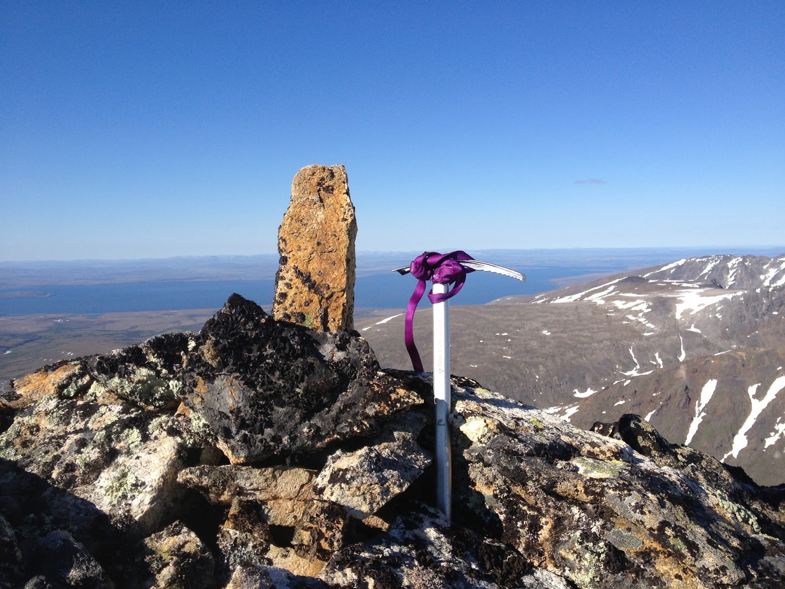
       The Cranestock choss felt so dire at every step, I cowered on easy moves. The summit of the highest tor, "Poorly Packed Skin Rock," was a balanced block so fragile I dared not go near the only quality cracks on the formation.  I led up the 5.3 north side and we top-roped 5.7 stuff on the south side.  Only a desperate fiend would ever consider hiking so far over tussocks and swamp to climb on such paltry, chossified, meta-sedimentary feces. David, on his first roped climb, coped with the madness calmly, as he also had the day before when we smacked bang into his first Grizzlies, a mother and two cubs, on the hike in. 


       After two days, we tried to leave the region. As if an alien were manipulating our minds with a psychic anesthetic, FOG pumped into our view, replacing the world pixel by pixel with WHITESPACE in a short order of time.  Once again, as in  the previous post from July, I found myself somehow "within" no-thing, except this time David and I chased the Heffalump four times as far, hours through the night, until our bodies tired, and our dreams of Nome turned to white also as we bivvied between wet folds of tent that had to be peeled apart like adhesive strips. I had tried to steer the ship on the compass heading we had set before the fog virus depixellated our display, except that the damn coast runs northwest by southeast in that region of the peninsula instead of east by west like I am used to, and I ran us miles too far to the east, confidently declaring Livingstone Creek to be Feather River, when really I had no idea until the chill of morning would cause the roof to drop, revealing the sad fact we were within a quarter mile of the road during the entire epic.

Thursday, December 10, 2015

Falcon Killer Buttress

Pk. 3250+ (Kirgavik Inuaqti) from the west, taken from the mouth of Tigaraha cirque. Vaughn Fetzer and I climbed on the turdlike buttress at center of photo. The attempted murder by the falcon occurred somewhere on the left skyline of the upper peak.
Pk. 3250+ from the southwest, at right. The summit tor had a few moves of 5.6.
Scroll down deeper in this post for the current blogstream. But first, a tale from the early, pre-Kigsblog era, written in 2nd person narrative, to relieve pressure on the narcissistic "I".

FLASHBACK: 
PROBABLE F.A. OF Kirgavik Inuaqti, August 2002. 

     This is what you came for: free soloing, "with one hand waving free," on good granite, deep in the Alaskan wild. You are palming a hand-sized arete, lay backing with your ass cantilevered into space. Beneath your ass is a sixty feet drop down to some ledges, but you also know that just on the other side of the arete just around the corner lies a sickening, thousand-foot drop into the canyon off the starboard bow. The day is hot and sunny. Your fear is gone, the rock solid, the lights green. You come to a hand traverse which leads horizontally from the arete. You are thinking about Peter Croft.
        Little do you know that you are being stalked, here in this remote, high location. A keen predator is busy laying a trap on the other side of the arete, and is about to make a premeditated and calculated attempt on your life.
       All day long, as you have labored up thousands of feet of scree and scrambling (with gear on your back), a nesting Peregrine couple has been hassling you from afar. You have long since determined that their nest is perched in the vicinity of some towers located a respectful half-mile away from the summit you are attempting, Peak 3025, which you will eventually come to call Kirgavik Inuaqti, the "Falcon Killer."
       "Falcons!" you say, as you press onward, "always so persnickety, not like the Eagles or the Ravens." Still, as a climber raised in Lower 48 climbing areas where wall closures are enforced during nesting season, you can't help but feel uneasy. Am I being an asshole? you think. It's not like they're endangered. As a matter of fact, they seem to be everywhere this season, hogging all the rocks! The female won't shut up: in the words of Sibley, "a slow, scolding rehk rehk rehk; harsh, raucous, each note rising." But you hiked on despite the constant screeching, and came to the summit tower, and put on your rock shoes, and now you are "dancing beneath the diamond sky," and there is no turning back.

      Rehk, rehk, rehk...  

      You make a mental note: if the bird decides to attack you (which you don't think likely) don't let go! But this is only a passing thought. All day the Peregrines have kept their distance, there is no reason to think either bird is close by. You mantle onto the flake which you have been hand-traversing, and reach up to clasp the edge of the arete. The flake provides a big foothold, but soon it ends, leaving you hanging solely by your arms.
       It is then your ears register a very faint click. You almost doubt you heard it over the breeze, the rushing of your own blood, your gruntings and gasps, but right around this point you have to thank the amazing capacity of the human ear to feed the brain data from the sounds it hears, for you make another mental note: this sound you just heard had all the characteristics of the sound made by keratinous tissue coming into contact with granitic gneiss approximately 3 ft. away. The faint click of a talon coming lightly to rest on a tiny ledge? But you can't quite see around the corner for a bird, and you aren't quite sure.
        You climb back down to the big foothold you just left. Chalk, chalk, dither, enjoy the view. Minutes pass. You try to visualize what the other side of this arete looks like: an enormous gulf of air lies between you and the spire of Tigaraha to the north. just a front doorstep to a Peregrine. You are glad you are climbing on the less exposed side of the mountain. Still, a fall would mangle. More minutes pass. You convince yourself you are being paranoid about the imaginary "click" you heard. You want this summit badly, so you remount the hand-traverse, and soon you are hanging by your arms again.

         wiSHEP koCHE koCHEcheche! 

       The peregrine bursts around the corner, wings spread, talons rampant, three feet away from your face, just as your ears had informed you. Your arms are pinioned by the hand-traverse. Good thing you told yourself not to let go! For here is a secret: birds, with their hollow bones, do not relish contact sport, and you doubt it will engage. But what sheer, premeditated artistry of the surprise attack, for all intensive purposes like a child jumping out and yelling, "Boo!" It must have been waiting all the time you were convincing yourself it wasn't there.
       With the birds in the air, the way to the summit is open. You finally have an honest, free-solo first ascent. This is what you came for. Your mind is filled now only with reversing the moves to get down. Somehow, you know the Peregrines won't be any more trouble, having already played their card... and the name of that card was murder.
Falcon Killer Buttress Off-width, 5.6
Vaughn thrutching a bit
More thrutching at Falcon Killer Buttress
Looking east towards Tigaraha. West Tig is the little hooked tor.
RETURN TO CURRENT BLOGSTREAM, June/July 2015
 (Kigsblog is now running an all-time high bloglag: 23SA, or "23 Saturdays Ago")

       Palm trees swayed off Front Street, Nome. Warm air blew in off the ocean. Live music wafted on the breeze, just enough to keep the bugs away. Children swam at the beach night and day. I hiked in to Peak Thirty-eight Fifty, as chronicled in the the previous post.  
        Vaughn arrived on the plane from Fairbanks, and in so doing joined the scant ranks of Fairbanks climbers who have bought a ticket for the Kigluait. But his arrival was the straw that caused the long bout of paradise weather to expire. Normal summer weather returned, frigid, wet. It would be "move or get cold" conditions for most of our weeklong into Mosquito Pass for an attempt on Tigaraha's south face.
In the moraines of Tigaraha
           The rock of the Kigluaik Mountains just seems to exude fear and paranoia out its very pores. Or is it me? No, it can't just be me, there really is something sketchy going on here.
       Do another move. The physical moves of climbing on Kigluaik granite can be quite aesthetic, really, but maybe that whole flake there will suddenly just explode off of the cliff as if spring-loaded.

          The big corner on the south wall of Tigaraha is out. The weather is not settled. Clouds of scud hurl along at three different levels going three different directions above our heads. So we head for the nearest low-lying buttress to grab some climbing before the rain starts again. "Falcon Killer" peak looms obtusely over our heads, as if base-jumpable. Cliffs, festooned with boulder-pudding dripping down on us.
       We don the climbing accouterments and I take off leading. Soon am busting 5.7 moves on unknown ground above a copious hodgepodge of cams, pins, nuts, and slings, but it is impossible for me to feel like a badass because I am so continuously and constantly petrified of this rock environment around me. 

       Cam, cam, equalize, nut, equalize. Three equalized pieces equals one point of protection.  Pin. "Bong! Bong! Bong!" goes the pin in rising, reassuring succession, but now the entire flake is making barely-audible sounds of strain from the outward pressure of the pin. Do another move. Pin. Equalize nuts. Try to ignore the alarm bells: "Bidot! Bidot!"  Choss! My god! It's all going to suddenly and spontaneously exfoliate apart!

       The mist is lowering, the rain manifesting. This route is heading nowhere into scabrous choss fields. So why are we spending all these objective-danger chips on it? Shouldn't we save them for a more worthy opportunity? 
       Or is it just my imagination? Is it even true we are spending objective-danger chips at the rate I think we are? Perhaps my chicken-shit mind is in thrall to irrational thoughts. I am becometh a dithering, mumbling, frightened old climber... 

       Ledge. Belay. Vaughn. My brother. Another pitch leads upward from our stance. Looks to be more of the same: fun-looking 5.7 flakes rendered tedious and nerve-wracking by the sheer engineering endeavor of equalizing all those sketchoid pieces of protection. Rappel. No, are you sure? Yes, rappel. I am sure. I want to be on solid ground again.

       We get off the rappels. Run laps on the off-width with the top-rope. Down-climb the pitch I led because there are no rappel anchors at the top. Feel a single droplet of rain on my forehead, thereby vindicating our chicken-out. All because I felt scared, all because the choss exuded danger. Then, ironically, we proceed to solo up and down the climb we just did, then up the buttress on exposed ramps littered with shattered bearing balls, with little Lucy, the Border Collie, waiting it out on fourth class ledges while the humans fifth-class on. Ridiculous, how a rope seems to generate danger, and then soloing takes it away.
(above) Cold and slimy bouldering in the moraines of the Sinuk headwaters
        A fine, mental adventure is found in a good bank of Fog! You're lost in there for days, like a temporal rift. Life is passing you by in the sun somewhere while you go round in circles in the fog. We are not men that can easily walk a straight line, let me tell you. 
       During the arduous hike to the car from Mosquito Pass, a long, dense tentacle of WHITESPACE reached out from the sea, probed up the Sinuk Valley, and absorbed the region of space surrounding our bodies. Like that scene in the Matrix where Neo finds himself within the Construct: white, empty, pixellated nothingness. If I hadn't done the hike fifty times, hadn't memorized individual bushes, hadn't assigned each knob or bluff or thicket a fantasy name to relieve the many hours of tedious slogging, we wouldn't have made it out of there. Nor would Vaughn and I have walked the torturous, three extra miles when I got us lost, until we ran into the great Sinuk River, and found ourselves again.
The Quyana-skatzi Boulder in the"Hundred-Year Old Rockfall," the finest bouldering garden in all the Kigluaiks, in oozy, clammy, perspirant conditions, July, 2015.

Wednesday, November 4, 2015

Peak Thirty-Eight Fifty, Canyon Creek


Looking northeast from Valpa Pass. Pk. 3850 is the high point on the skyline near the left edge of photo. 
Pt. 2975, "Ray Creek Peak", on the shoulder of Pk. 3850+
          Through the umbilicus of Valpa Pass, into the maw of Canyon Creek went Mind riding.  Words shed their outlines in hot breezy sunshine until their meanings had vaporized and rendered translucent. The broad mile-wide canyon stretched northwest from the mountains opening out in the direction of the sea, the villages of Brevig and Teller, and the entire sweep of the Land Bridge coming across from Siberia, with massive energy bursts of CHI streaming from the northwest polar regions getting caught up in the mountainous catchment funnel of Canyon Creek where I hiked, entering the massive proscenium of the sunny canyon floor like a duchess entering a promenade, mind trains flowing behind me born aloft on great streams of mental wind.
Map of Pk. 3850+ expedition route, June 17 - 20. This route offered the most direct approach to  the Pk. 3850+, but the pass between Blume and Valpa creeks is rather high. Feather River and Johnstone Creeks also offer hiking passes into Canyon Creek from the Teller Road. All three of these passes are Class III on the north side. 
      A lovely little falls and schist pool poured out the bottom of Valpa Creek. Hadrosaurs grazed to the side in the willows on the floor of Canyon Creek as I began the crossing to the other side of the canyon. Trailing long trains of royal befuddlement, I began the promenade across the canyon, while every eye in that fifty square miles of mountain wilderness watched my every move, though I  saw none of their life forms moving now, save the relentless, peripatetic  fury of my own good dog, who had chased away the Hadrosaurs. Warm June breezes blew the bugs away, a man could have been naked in the summer in Alaska. Turrets of limestone and granite lined the ridge tops. Great power, though, as I've said, words are useless, and it's just a ceaselessly barking dog to be blogging about the wordless.
Looking south up Valpa Creek from Canyon Creek. 
Looking east up Canyon Creek to the beauteous Pk. 3300 (link).
        Suddenly, from the other side of a small hill, came the frenzied barking of my good dog. There was a certain tone to her barking, something urgent, something dire, something impending. She was coming back my way, barking, barking in full panic. I fully expected the little dog to come around the corner at any moment pursued by a herd of vicious Troodon, little chicken-sized, pack-hunting carnivores from the Maastrichtian Age.
           Like Jed Clampett, like Terminator, like Elmer Fudd, or Steven Segal in Valdez,  I rammed the action on the 12-gauge, and flicked the safety gadget thingy quickly to red, and FIRED that big cannon until the walls of Canyon Creek were resounding with thunder and my body was shaking with the hippy terror of it all, and then realized I had left the piece of protective duct tape over the damn barrel of the gun and was lucky I hadn't blown myself to pieces.
         Lucy came around the corner, sheepishly: she had gotten temporarily lost in the wilderness and had been yelling for Daddy. Guess I might have been a little on edge, totally SOLO in the deep psychological water of Canyon Creek, with all those.
Looking up Ray Creek
       Holy mountain, form of forms, sacred Thirty-eight Fifty, this is why I have come, to kneel at your feet and die before your beauty, then ascend to the tippy-top of your tippy top. You peek up and over the foreground tops of the western Kiggy Kigs, hiding in the back there, trying to blend in to the lower mountains as if you were part of them, but all the while that one strip of deeper blue on the top layer is actually you, oh Ray Creek Mountain, oh unnamed massif, looking over the tops of the other, lesser mountains, oh most high and almighty peak of all the Canyon Creek peaks, Peak 3850+, cousin to the great Singtook 3870. For a moment of intimacy have I toiled far from the civilizations of the Teller Road, over the high saddle from Blume to Valpa, and across the sun-filled breezes of Canyon Creek, to tick you off my ego list, and soak up CHI from your rock pores.
Looking southwest at Pk. 3870, the "Grand Singtook", from the summit of Pk. 3850+. Thirty-Eight Seventy and Thirty-Eight Fifty are big siblings at the west end of the Kigs.
Looking north from Pk. 3850+

East summit of Pk. 3850+, one of the humps on the "three-humped camel." The usual Kigluaik fearsome drop-off to the north, gentle slopes to the south. 
         White man, when presented with a mountain wall, will often ascend to the apex or highest altitude, where the wind itself might just as easily have slipped around to either side of the mountain, and so ascended I. Nice few thousand feet up easy Class 2 on the surface of bosom-like slope to the left of the cleavage of Ray Creek, rimmed by the granite tors of sub-Peak 2975, glimpses of some of the finest-looking rock in the range to judge by looking at it, though I lamely never walked over there, but at least the mystery was finally solved: Peak 2970 is the smallish chunk of granite visible  from various points of the range, about which various theories of mine over the years had now finally pinpointed it, here, right below me, high on the shoulder of Pk. 3850+.
A look into mysterious Fall Creek
Tors above Fall Creek, looking north
      Pk. 3850, a three-humped camel hoisted onto a broad-backed summit plateau jacked up higher than any other summit in the Western Kigs save its own analogue a short distance to the southwest, the celebrated Singtook, Pk. 3870. Tremendous view from the summit of Pk. 3850, north out over the sitting-duck graphite piles waiting to be exploited by outside agents from Canada, to the Imruq Basin and the Continental Divide beyond, and how fortunate that various self-judgmental juries of mental agencies had gathered together in kigsblog to place a "Mandatory North Side Mandate" on me which had required me to walk for three days straight, the preceding ten hours of hiking in one huge swath of effort for which I now stood, committed, in the middle of, at the top of the climb, the middle of the trip, with this stop-time view, on one of the most hot and sunny June days of all time.
Looking east along the spine of the Kigs from Pk. 3850+
Another look at Pt. 2975 at the head of Ray Creek
      Hours of incessant, ceaseless hiking wore on into the light of the night as dog and I reversed the hike to return to the forgotten yellow tent waiting back in the alternative universe from which we had originated on the south side of the range, my camp just below the high crest of Valpa Pass back in Blume Creek,  the huge uphill slog over Valpa still awaiting, though mental construction fields were destabilizing, and Sarah Hanson-Hofstetter's new tune was mercilessly lodged in my hippocampus resisting all attempts at the Blind Faith override for when a tune gets too stuck in my head after many hours of suffer-slogging.
This obelisk at the summit of Pk. 3850+ was knocked over when I found it, but had obviously been put there by someone, so I re-erected it. Thought I smelled the scent of Amato on it.
Selfie of me and Lucy on the summit of Pk. 3850+, June 18, 2015
lord almighty god the crankloon generals in my head marching to bippety-bobbety bass lines burning with nausea born of digesting muscle tissue, "Are you hungry?" over and over Sarah make it stop it's been so many hours hiking across the mountains, across the canyon, up the mountain, in this weird velvety buzz field of solstice midnight blue light, back across the canyon, back across the mountains, hippocampus para-temporal lobe feedback loop throbbing with endless tune-loop not even Sea of Joy can displace, folds in the tundra hillside like cerebral tissue where dog waited for long rests
Camp at the very top of Blume Creek, looking south to the Norton Sound. The strategy of camping on the south side of the crest, and then hiking for a big, giant, long day without a big pack to get to a north side objective, proved to be a viable one for a long June day.
 Sad to leave the reverso world of the North Side Kigs. Even now my awareness, firmly stuck in the city and the GLUE OF TOWN, longs to be back in the electro-magnetic wash of Canyon Creek, the purplish fuzz of the cool-down hour at June Solstice time when the mist drops and the roar of water hushes, my paleo-wolf and I scanning the landscape for Troodon.

Saturday, October 10, 2015

Pass Creek Pyramid

Inuksuit at Fox Pass. Stone guardians are usually present in significant passes of the Kigs.  
David Panepinto descending north side of Fox Col with that old ice axe standby, the pointed rock in hand.  This picture shows why the word "col" came to mind; it's just a "colish" kind of pass.
Pk. 2900+, ("Pass Creek Pyramid"), looking west. Mt. Osborn background left. 

         What put the "pass" in Pass Creek? I wanted to know. Passes are not all that plentiful across the Kigs. 
       But when I got to Pass Creek Pass last year, it was blocked by summer slushing cornice danger. So this year, I went back to the pass with David, Leonard, and Lucy. 
       We managed to cross the pass this time, as well as climb a curious obelisk (PK. 2343, "Pass Creek Pyramid") on the other side. We also located the curious stones from the picture (above) that look suspiciously like inuksuit
       Various inferences have led me to believe that our pass is but one of two passes in Pass Creek. For more totally absolutely fascinating inferences regarding the question: "What put the 'pass' in Pass Creek?," as well as as an internet peemark of our climb, read on!
Pass Creek Pyramid expedition, May-June, 2015.  The route up Fox Creek is emerging as a Kigs-Country Runners  testpiece.
"Fox Col" route from the northwest in Pass Creek, looking east to Pk. 3900+. It seems probable that indigenous BITD people knew about this pass as a shortcut from Mary's Igloo to Salmon Lake.
Pass Creek hiking passes from north.  "Fox Col" on the left is maybe Class 3 or 4. Gold Run on the right looked to be Class 2 or 3. Take a left and you reach Salmon Lake, go straight and you reach Grand Central. Snow-machinability?  Couldn't say...  This photo was taken years ago from a wild, exposed shoulder of Pk. 3900+ during a solo attempt in winter.
Pass Creek Kigs from north. (Manzoor Saghaffie)

        No sweeter GLUE broken than the GLUE of SCHOOL. We were free. Big blue buzzing summertime stretched ahead. An occasional nip from the flask took the pain of the load away up Fox Creek. A night and a day of hiking up a snow ravine saw us ensconced at "Fox Col" on the divide between Fox Creek and Pass Creek.
         The same summer cornice as the previous year was in evidence on the north side of the pass, but at least there weren't active calving fractures as there had been the year before. David and I scuttled down snow and scree slope into the Pass Creek Cirque, thus satisfying my "Mandatory North Side Objective" mandate placed on me by this blog, my own blog, as a penal measure. One might want to consider carrying axe and spikes for this route.
Looking west from Fox Pass. This shows why you would not want to choose the wrong pass to the west.
Looking east from Fox Pass. This shows why you would not want to choose the wrong pass to the east. Pk. 3900+, a fine and noble peak, alpha mountain of the eastern Kigs, with a secret identity of being "Tog 7" or just "the Big Tog," also called in other places in Kigsblog by the name "Kayuqtug," rises at center. A great hike or run from the Kougarak Road, Class 2 from this side.


Another look down the north side of Fox Col, David on the descent.


Looking southwest from Pass Creek Pyramid. Osborn at background center. Left of Oz is Pk. 3922, one of the Grand Central peaks.

          What put the "pass" in Pass Creek? An inference could be made that the name comes from the first USGS surveys in the early days of Nome's gold boom era-- say, 1915. Miners and Prospectors were more likely to cough up their user names for Kigs features than the indigenous peoples, who may not have seen fit to pin things with names anyway.
           Initially, I assumed the pass in Pass Creek was the route I was taking up Fox Creek fro the Salmon Lake side. But what if the real "pass" in Pass Creek is the other one that leads south to Gold Run and Grand Central valleys? Judging by the extensive signs of habitation in Grand Central (see Among the Peakbaggers) dating from the first decade of the 1900s, I imagine some number of prospectors traveling from Grand Central on the south to Mary's Igloo on the north. 
            Though I've never traveled between Gold Run and Pass Creek, it looked, well, passable. So, maybe"Gold Run Pass" and not "Fox Col" put the "pass" in Pass Creek. The big blue book at the Kegoayah Kozga Library offers no clues on the origins of Pass Creek, but the mountains offer their own inferences.
Looking west to "Gold Run Pass." This photo was the smoking gun that revealed the possibility of two passes in Pass Creek. Gold Run Creek lies over the ridge to the left of the peak in the center.
Pass Creek Pyramid in June 2014. It hides quite a precipitous (and choss) north face of granitic gneiss.
Gneiss on the Pyramid. By means of a little soloing on the south ridge, I was able to avoid a Non-Technical Climbing Foul.
Summit of Pk. 2900+ (Pass Creek Pyramid). Might not know it to look it, but Lucy and I are paralyzed with vertigo  in this photo. Our heels are poised over an absolutely Batman drop-off over a north face so steep I dare speculate it could be base jumped. Neither did I dare take out the camera. Typical of the Kigs for a summit to have a meadow on the south, and a BRINK to the north.
        Everybody knows that Inuksuit  were used by reindeer herders to corral the reindeer in the high passes. The technique must have been to chase the reindeer up the valley until they balked at the top, spooked by the stone homunculi standing in the pass.
           However, my friend Annie informed me the Inuksuit were tactical as well as territorial markers in a war between the Brevig people to the north and the Qaweraq people to the south, and that the passes through the Kigs were known and sometimes used to advantage. Encounters with Inuksuit are always accompanied by spooky action at a distance, and such things are best not sprayed upon the digital space of the internet.
           The Inuksuit at American Creek and Mosquito Pass are better defined than the stone arrangements we saw at Fox Pass. Leonard and David also examined them, and remained unconvinced. It's only a theory that the stones in the pictures below are genuine inuksuit, yet I am certain enough to declare them so, with registrations on the vibe-o-meter as primary evidence.
Lucy sheltering from the wind inside Inuksut. If you can find the black and white dog in the picture,  you might discern a vague ring of boulders around her. My theory is that this was an older, degraded, or incomplete line of Inuksut, stone people, as are commonly found in Beringia.
Mr. Lastine hanging out in the wind with Inuksut. "Inuq" means person, and "sut" is most likely a prefix meaning, "is like," so an Inuqsuq is "like a person." I'm guessing the Inupiaq guttural consonant /q/ was bastardized to a "k".