Monday, December 20, 2010

Thanksgiving Ice 2010

  A big freezing rain storm came, Thanksgiving 2010.  Like Christo coating plastic wrap over everything, the QAWERAQ Peninsula was coated with several centimeters of clear, water ice, trowelled smooth by the usual horrendous wind combined with freezing cusps.   Like a town emerging up through the surface of a skating rink, the two-dimensional plane of ice conforming skin-tightly to the three-dimensional surfaces...   Schools shut down in Fairbanks, Anchorage, Seattle...  No snow day here in Nome— at recess the kids launched huge standing glissades across the Zambonied playground.  Routine hikes on the hillsides had morphed into Grade I alpine climbs.  And the rocks!... 

.
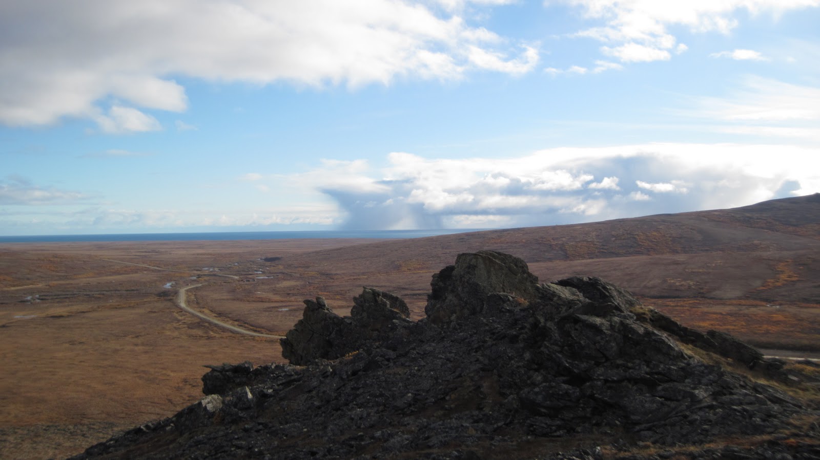
(above)  King Mt. rocks, Sunday after Thanksgiving. The shellac was back!  Holds frontpoints surprisingly well.  Man, this is some tasty climbing, what better way to spend a Sunday than to cling to odd facets and angles of these metamorphics, basted with translucent climbing sauce and topped with snow whipped into a crusty froth.  Little cracks and pockets stuffed with an extra centimeter or two of ice are especially crunchy.  Now it's time to hang all your weight from one arm!

(right)  Weak November light on King Mt.  For every route I have topped, I have chickened out on four others.  Frontpoints routinely explode from the verglas with great scrapings of metal.  Four millimeters of the icy film bonded to the rock seems to be enough to support a front point or hooked tool, but the charm of climbing this film, stretched as it is beautifully over a bare face, quickly runs out when you are any distance above the landing, with tib/fib snapping devices strapped to your legs.  As usual, the only tool placement you can really trust is a good solid thwack into a turf patch.

Hook picks or prosthetics.  Torque the crack or broken back.  Concentrate or frontpoint skate.  Climb ice or Spot Device.  
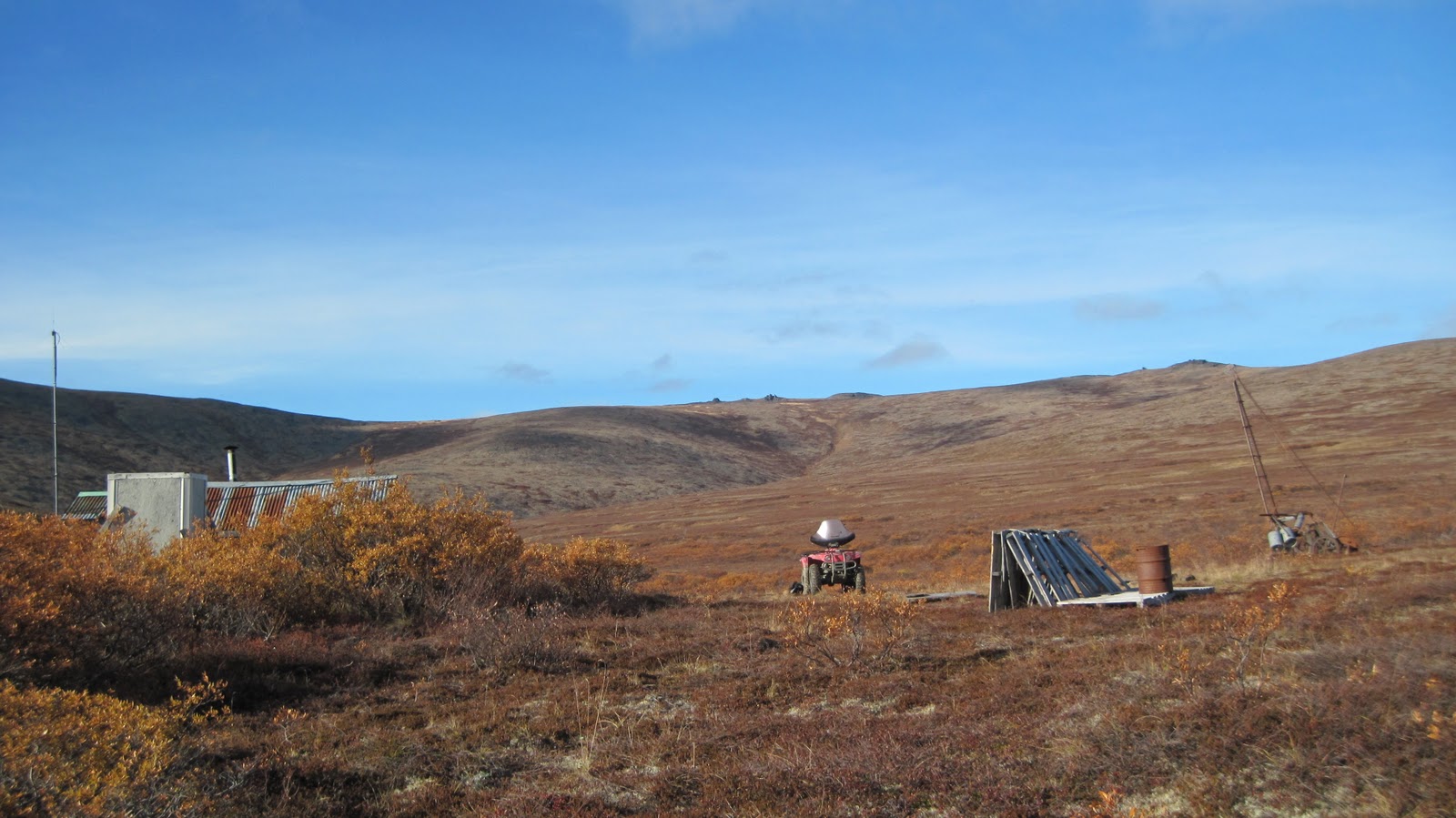
(above)  Mud mounding action from early Spring 2010.     The "mud mounds" are tailings piles left over from gold mining, dirt piles that freeze at certain humidities into the consistency of ice.  They are worked over by gold miners with heavy machinery in the summertime, (all the more in 2010 due to the rising price of gold) become saturated by Fall rains, and freeze into icy dunes suitable for a blunt, barbaric form of ice climbing... and probably a toxic one as well.   
(above) Tailings. Once again, this image is from a previous season, Spring of '09, and it is relevant to note that the dirt in this picture has been worked and reworked since then, so that the mounds in the picture are somewhat different than this year's mounds (of which I have no picture;  the camera has been phasing out lately.) 

(below)  Chipped tooth in the Mounds.  

    It is perfectly possible to get one's "climbing ya-ya's" on tailings in winter.  Out back of where I used to live in the legendary encampments on Happy Road in Fairbanks, an old mining pit was carved into the hillside of Ester Dome, and many a hippy friend was lured from the party up to the forested hillside to try mud climbing in a moonlit amphitheatre.  When I got to Nome, it was like one vast mining pit, and I remembered the fun we had had on the tailings at Happy Road.  Mud mounding is seldom without highballing: one never knows whether the impending fall will bring a harmless roll down steep mud, or a bone-splintering snaggy snapfest.  The fine tailings are better;  sparks fly from your tools when the tailings are coarse.  
     The mud mound's beauty lies in their transience.  Like ice, the climbs are temporary, soon to be demolished by machines and resurrected in the form of new moufile:///Users/imcrae/Desktop/IMG_0668.JPGnds.  I've been motoring out to the mounds frequently this month, in the thin crack of daylight between the end of work and sunset.  Glazed and gleaming ever so faintly with the Thanksgiving shellac, the mounds lead inward to darkness like a corner of the desert. More on Mud Mounds   
(above)  The ice climbs at Ayasayuk in the early 2000s.  Climbed with various partners over the years, and probably been climbed by others (Paul LaBolle among them)...   These climbs have been blown to bits and are gone now...  the pillar in the middle was a steep III or IV.  Link to previous post on Ayasayuk

AYASAYUK is a secret spot out on the Norton Sound coast where great forces of nature clash together to shape the environment.  There were giants in those days.  A high running bluff with bedrock at its base terminates by the oceanside at Cape Nome, where the bluff has been blasted away in increments, leaving an impressive granitic face that grows higher every year.  I never dare touch the poised tripwire-laden rubble pile until it is frozen up.  Those guys that chew it out during the summer are bad-ass.

(Below) Ayasayuk, Saturday after Thanksgiving, 2010.  
This year I kept getting shunted over to the left onto easier mud slopes.  Often felt a vague sense of unease, probably due to looseness.  Had a couple good direct pitches between several of the many roads, and several smatterings of wet water ice here and there. This is my Fifth Iteration of the cliff in my eleven years in Nome.  Here are some pictures of earlier iterations.

(below) Last winter, December 2008.  

(below)  Somewhere around 2003.
Those were the days of fat ice.  Before the giant came with his ANAUTAQ and chopped it all away.  The Earth here has been battered;  I'll bet the Earth was happy to find its new home in Shishamareff and Teller.  All the preceding pictures were taken from the same spot on the Council Road;  you can see the cliff growing bigger.
(above)  Cliff detail, Ayasayuk, 2010.  If you look very closely you can discern a few blobs of ice.  It felt good to sink a pick in real, blue ice.  Man, the lengths you gotta go just to get a little.
(above)  Teller Road, Snake River bridge, December 2010.  Christo also wrapped the roads for Thanksgiving.  Even men with serious trucks expressed their trepidation.  There was surely good ice in the Kigluaiks, but I just kept wussing out on the drive.  One Sunday afternoon I went to the Sunset Rocks but walked the Teller Road from the Snake River to get to the rocks.  The TINGMIURAQ on top of the sign had warned me not to drive any further.

       People sometimes think that climbing ends with summer, or that climbing is only possible through organized efforts involving gear and ropes.  But any thing, big or small, has routes on it.  The chair where you are sitting has some good climbs on it, probably.  Hence, climbing is always happening, at any time, at least to those of a bouldering mentality.
        When everything is wrapped in cellophane, then everything becomes cellophane climbing.  My tally for the Thanksgiving ice:  5 quick trips to the Mud Mounds, 3 trips up Anvil Mt. a trip to the Windmill boulders, a trip to Cape Nome, a trip to King Mt., a trip to the Sunset Rocks, and lots of trips without quite falling down.  Climbing up and down obscure little circuits on moss and verglas, a little bit up here, a little bit down there, monkey hang off some turf, stretch the sacrum, go for it, hook the top, feeling fine....  
        Routes were done.  I am reporting them.  Let them now be worked by backhoe and explosive, front loader and sluicebox, until they are blasted away completely.  It is Solstice now and a fine blizzard has buried the shellac under sastrugi curdles and whipped dollops.  It is not comforting to know that the shellac will be down there all winter, under the snowpack, at the base of all things, waiting.... 

Sunday, November 21, 2010

Slump & Consolation: Fall of 2010


Cirro stratus over the Kigs on a Friday night in September from my doorstep in Icy View (left), right on time to create the illusion of Job one more time to cap off the school week, a week of fine Fall weather held  prisoner prowling the playgrounds smelling out trouble before it happens, all the meanwhile huge arrangements being made for the forthcoming weekend expedition and asses being made of oneself in one's family, all for the sake of climbing in the Kigs,  followed by Expedition Friday and  the sudden inexplicable rising of huge barometric pressure changes at the 3,000 ft. level, wind rising, the Nomens hunkering down to only party, the agony of defeat.  Is this what life is like in El Chalten?


       This pattern has been manifesting for a year and a half:  a precise and maddening enhosement, the weather bad when time is available, weather good when harnessed to responsibilities and the GLUE of town.  I have been through slumps before in 32 year career, but this one has really settled in.  What is implied by SLUMP is a failure to goal-achieve the BIG things.  There is always bouldering in this Arctic bouldering paradise, there is perpetually climbing, almost every day come moves with a move of the pure isolation over a particular section of stone, almost every weekend comes with a GRATEFUL TO THE WIFE mountaineering adventure of a surprisingly high cast—  but the thing that one lives for is the LARGE, the EXTENDED, the CAN'T FIND MY WAY BACK HOME of total commitment and wisdom-enhancing NO FEAR.  And a summit.  In this range, the tippy-top counts, it's part of the mathematical fun.

 Nothing coming in a year and a half.  Enhosement.
 (above) Penny Boulders, crazy meta-sedimentary a mile or two north of Penny Bridge, looking south in this photo, Teller Road in background:  homo traverse boulder and top of the orange lichen alpha clump of this group, the raptor tor, a fine klettergarten.

    Searching for causes of mountaineering slump, I consider this blog, this VERY BLOG.  There exists an exact correlation between start up of blog and beginning of slump.  COULD THIS BLOGGING B.S. YOUR ARE READING NOW BE AFFECTING CLIMBING OUTCOMES?  It's a proven fact (i jokes) that the nonentropy of minds participating in a mass consciousness structure (such as an internet site) can affect the probabilities of a climb.  More concretely, maybe keeping a blog is messing up my climbing brain.  The reintroduction of Ego after all that work to annihalate it! 
     Or, blame it on the GLUE of TOWN.  Muir had Martinez; I have Nome.  But this seems grossly unfair.  For the time has come to reveal a truth.  The slump is the result of an awakening.  The slump is transcendence, a stage of enlightenment.  The slump is the product of a slow awakening to the BEAUTY of the precious gifts of the GLUE?  It is time to look through the skin of this conceit and view the heart of the concept, the truth behind this term, "GLUE" OF TOWN, and see what really lies therein...  
so many blessings i cannot speak of them without the fragile flame of what they are blowing out like a candle:  love, family, friends— don't speak of them for they are the truly sacred— spray of climbing, but spray not of the sacred, love, family and friends... 

now the truth comes out:  the GLUE of town is composed of these wonderful things,

 these blessings...  this quagmire, this nemesis, this THING I had reified into a Chimera, is in reality the very fabric of which life is made, everything that is good, respectable, likable, warm, and human, everything that I cannot describe because my subcription is to the gloom and doom...   climbing is not important— it is the GLUE that truly feeds the spirit...

no wonder it takes such STEELY FOCUS to turn away from town


    (above) Consolation:  Penny Crags, from Penny Boulders, September 25, 2010.  Denied the copious Chi-intakes of the high Kigs, a great bouldering day between storms can forestall the onset of the climbing demons...

into white, the sudden giving way
one foot is gonna be on ice today
and one foot on rock, and rock was my bottle,
look at that white creeping in.
well, let it cover over,
let the whole thing go down,
i'm tired of the spray, 
let the machines resound,
once more into the iPodstream,
the roaring and the Kougarak,
heading into the Kigs today
with four bottles in eight socks.
the blog goes from tundra
into a blanket of snow,
now you've become an icecap
with your secrets below,
let go of summer,
it was overrated anyway,
the Cobras are out, and
now it's time to play
you crunchety-crunched,
you were stemming on rime,
don't push too hard,
ooh, that delicate spine!
the clouds were shrieking,
faith is absolute
live to see another day,
it's all turning to white.
(above) Rocky Mountain on the left, Pk. 2374, 100 ft. Bluff on the right, October 17, 2010.  Consolation in the form of a slog up the main mountain, my third time up this hill.  Too warm temps that day for the choss bluff.

 (left) Earp starting up the Bluff in a previous, more frozen-up year than this one is shaping up to be.


(above) Tom's Cabin:  rocks are visible as smudges up on the ridge.  Upon closer inspection, they open up to reveal,surprising depths of bouldering.  Not the Kigs, but a sweet Fall consolation.


(right)  October 10, 2010 (10-10-'10!  No wonder that day was such fine consolation), late afternoon, up at Tom's Cabin Rocks.  Pictured are a pair of aretes I slimed up.  Anything under 5.6,  I probably slimed up that day, including top-outs on each of the surprisingly exposed pinnacles.  However, the slime parameters were high that day, post extended Autumn rainfall, the lichen saturated to the point of mush. I know Graham and Jeff had slimed up a lot of these problems in previous years during their summer residence at the haunted cabin, and, for all I know, so did Tom, before them.  Increased ectoplasmic readings in this gulch...
(above)  The Discovery Goldfields, my ice hunting grounds on Sunday, November 7.  No ice to be found, but the snow was the finest consolation imaginable, silky sibilant grain snow parting with a sigh over steel edge of touring ski, perfectly weight-supporting.
   TINMIURAQ (above)   What privilege to be an integrated part of a hillside for a day.

     And indeed, these are times of wretched SLUMP.  The Kigs are but a distant memory, the Alaska Range so far away now I can no longer imagine facing those looming seracs.  No throne have we sat upon for many a month.  Only the gnarled clumps that cling to the ground, closer to home.
    Yet, zoom in, zoom in.  These clumps contain fractal depths and thrones in their own right...  flex and strain down in your tundra pit, hidden away from sight wrestling with rock puzzles...  what difference be a move whether it is one foot up, or thousands of feet off the deck?

Friday, November 5, 2010

Bringing Out the Bucket


     This "Prindle Bucket" (above) stashed in the moraines at Crater Creek is an indication I am still in the game.  I am a climber who has gear stashed in the mountains.  My next attempt is imminent.  I'm a player.  To the question, "Been doin' any climbing lately?" I am able to answer in the strong affirmative, yes, how are you, as a matter of fact I AM climbing at this moment, simply by virtue of having a bunch of hardware and ropes in a 5-gallon bucket cached deep in the mountains (because my back is trashed and I have to double-carry everything these days.)
       But now, September had come.  The bucket was coming out.  Summer rock climbing in the Kigs was coming to an end.  The beginning of Loserdom once more....      
        
       Saturday, September 17...  Town had ravaged me...  Too many proboscises had been reamed into my chakras...I had completely lost the plot... a chance opening of circumstances allowed escape from the glue, the terrible GLUE of TOWN, the glue that requires such shameful and embarrassing self-absorption to overcome, to simply get out and do some climbing.  
      Yukon Jack acted counterintuitively as a stimulant, and got me out of Nome on Friday night.  But then, hours later, mounted on a four-wheeler with no high beam in pitch darkness out by Salmon Lake, one mile from my destination after a long ride on a long Friday evening, I drove straight into a large herd of Muskox on the road. 
        OOMINGMAK!!   Drat!    I had only been wanting to get to the cabin and collapse in my bag.  Now I would have to bull my way through this crowd of head-butters like a Polaris Centaur.  Again I would wear the hat of wildlife harasser. 
        One calf did not grasp the concept of get outta the road.  His mom, like Jim Otto, squarely in my headlights.  I rode in tight, quick circles, advancing forwards in incremental loops, my little bobble head swivelling, waiting for the awful contact with the great skull-plate coming out of the darkness.  It took 25 minutes to sweep the herd slowly off, and certainly constituted the most perilous moment of the whole trip.  I was grateful to finally fall asleep in the utter serenity and peace of the most grateful cabin at Salmon Lake... (below)
    Ostensibly, this bucket trip would also be a rematch with the lumpen heap of Pk. 3535, scene of my fog and ennui the week before.  And indeed, the day dawned beautiful, one of those not-quite-freezing Autumn days suspended in time,  but the familiar Kigsborne ennui of hiking up a hill and calling it a climb persisted, like vestigial fog on a sunny day. 
        I followed my trail along the bluffs on the south side of Crater Creek.  AKLAQ was all around, including the polite brown one that Janet, Carl and I had met a week earlier.  But the Aklaitch were fat with fish and berries;  situation non-stressful.  I dozed and power-lounged on tussoks, captivated by the thrumming humming marvel of the Kigs...  That weird thing happened, where the mountains cease to be inert stone, and reveal themselves to be sentient presences, ever communicating....  no way to translate it. 
     
      The climbing day slipped away.  I had been defeated (for the umpteenth time) by the debilitating power drains of town, coupled with my own foolish inability to patch them. 
          As consolation, I went for a hike (above) up the upper east fork of Crater Creek, a valley I'd never seen before.  Up some high moraines until I could see around the corner, lusting for a view of the hidden north face of Pk. 3325—  it proved to be another of those brown facades on the clash zone between the schist and pluton, reminiscent of False Tigaraha:  not worth climbing, unless some ice drip were to drip it on down, which looked entirely possible, north-facing cauldron like it is... A stupendous view down the length of the entire upper Crater Creek canyon—  but I had forgotten the camera down at the bucket.  You'll just have to slog up there yourself.

Saturday, October 9, 2010

Pk. 3535, Crater Creek


Pk. 3535 at the head of Crater Creek.  I walked up most of the South ridge which slants upwards to the right in the picture.

        Some lameness has crept in here.  It brings to mind the unresolved question of:  what is the lower limit of blogworthiness?   The latest is now I have failed to climb a Class 2 hill.  I have launched two Alaskan expeditions intending to achieve success on this walk-up, and been denied.  Shall I then take up valuable room in cyberspace to report this embarassment?  These are questions for the new age;  there is not yet an accumulated body of wisdom to help me decide.  
      But why not blog?  Let me detail every firing of a neuron, I shall recreate my brain on a worldwide web in conjunction with all of yours'.  The fog which follows is only an indication of my interior mental environment.
Pk. 3535 as it appeared the day I went up it, September 5, 2010.  

Fog over mountain
Fog over mind
Soon we will be mantling
Up into the sunshine

The top of the fog is an ocean
And the sky will be blue
We'll climb to the top of this island
If we can only make it through... 
  
(left) View, or lack thereof, western slopes of Pk. 3535 from halfway up South Ridge.
(right)  Claustrogo...                                      A form of madness begins to set in after a day mountain climbing in the fog.   The dissonance created when Equilibrioception is robbed of its visual component creates a mild anxiety, a hybrid of claustrophobia and vertigo:  I call it Claustrogo!  Something to dwell on as one stumbles upward through fog...  (More on Claustrogo)          At a shoulder, the ridge changed direction; I could sense it in the organelles of my vestibular system. The wind intensified.  The fog was really howling now!   The promised sunshine might still lie above, but this mountain was having trouble getting it up.  Come to think of it, the clouds had gone gray;   the September sun was getting low.  A vision of Peronto's weather map from Friday flashed into my head, all green zones and whorling Ls, along with the thought that here was come the next storm.
      Another section of weary plodding up ahead vanished into the mist.  I knew it wasn't far to the top now...  But a type of boredom had hold of me.  My mind had sprung power leaks. CHI hissed out of me and vaporized in the air like breath.  What worth this boring lump of a mountain? my mind reasoned, perhaps justifiably.  I was happy to turn around and head down.  There were interesting granite cliffs on the way.  I could huddle close to the rock in the fog and pretend to be in Tuolumne.  Pk. 3535 differs on Amato's geology map from the other peaks in the Crater Creek cirque (the C-Togs and Kayuktuqs and whatnot) by virtue of being true, unmorphed granite, as opposed to the highly metamorphic gneiss.
(above) DIBELS, Mr. White, Janet.

The miraculous, super-nice thing about the trip was getting to be in the company of friends and loved ones--  I hiked in with Carl, Janet, and DIBLS, we made it all the way to the First C-Tog and had a great night in the wind and rain.  Curious how Carl seems to have his own relationship with Crater Creek, how he repeatedly gets sucked into this vortex.  On the way in, we had Encounter #1 with a big, brown, very polite AKLAQ (Janet's first on the Seward, which seems a miracle, given how often she is found in the brush) who ran up a side hill to let us pass.  We would see more of him later.

(above) Google Earth, Pk. 3535, and hike up Crater Creek
       Here is one of my own personal hidden secret sequestered meaningless little rule for naming peaks:  whichever drainage is primarily responsible for opening up the view so that the peak comes into view, that drainage becomes the eponymous name of the peak.  For instance, "Fox Peak" is highly visible from one certain spot on the Kougarak Road where it crosses Fox Creek (when you are looking straight up Fox Creek), hence, the name Fox, even though the mountain in character seems more a denizen of Crater Creek on its northern side.  According to this rule, Pk. 3535 would become Crater Mountain, because it lies at the exact head of Crater Creek, and is what you see looking up the valley from the road. It's still rather a lump.  And these are just little reductionist fancies I entertain as I slog painfully and interminably over tussocks and through willows.

Monday, September 6, 2010

Return to the Oliver Perry Smith boulders

(above) Nome-Council Road, looking west.  Hike to the marble bands in the picture, walk west along the ridgeline for several miles until you reach a small, fairly paltry set of boulders—  the Oliver Perry Smith boulders.

   Bill the ferry man had gotten drunk and Johnson found himself stranded again, alone, on the far side of the Channel.  There was nothing for it but siwash once again and make the two-day trudge back to Council. He would take the back way, of course.  It wasn't the first time.

 Johnson rather enjoyed these siwashes, truth be told.  His legs covered the miles, his mind was free to roam. Johnson was always known around the diggings as a man who would rather walk miles than ride a mule.  A structural engineer by training, he had come from Europe to build bridges, but had soon run afoul of the Council City and Solomon River Railroad Company, and was reduced to a grunt, mucking his living here and there between the two town sites. 
(above)  The marble band About 55 ft... extremely can't-dependable MEGA-CHOSS.   Some fun highball boulders if you've got the stomach for rock that may crumble and clash into chalk dust any moment.

     Johnson came muck-a-lucking along the wagon way in gumboots.  He had almost got up to Big Hoorah, was just pulling into view of the encampment, when he saw old Lehnhart ahead on the hill, mucking away at something.  Suddenly, Johnson remembered:  'Lehnart— the money I owe 'im!' 
     Johnson veered off to the west immediately, intending to circumvent his creditor in the willows, but soon found himself ascending a steep draw even further to the west, and topping out on the crest of a high ridge, which he began following, somewhat mindlessly, I might add, further and further west.  Johnson ambled along, happy as can be, rifle in his hand.
(above) Looking east along the ridge.  What fine FELL WALKING there is on the Seward Peninsula!  World class....  It out-Scotlands Scotland.

   It was a detour that Johnson sometimes liked to make, especially on trips where he was alone.  It took him well out of his way for getting back to Council, but Johnson nursed a secret... a hidden passion that none of his pards would understand:  he liked the rocks.  Climbing them, that is.
      It was like ballet.  Old Perry Smith had showed him back in the Dresden days, back in their days at the Technische Hochschule, down by the river on the Elbsandstein.  The ways of crimping and torquing the body into the rock, the silent challenge of a rock tower, the strange sort of focus that fell over a man... 'or woman, for that matter,' thought Johnson, remembering Rand's girl that day long ago when they went the wrong way on the Grosser Wehlturm, missing out on placing the schwarze kamin. Oliver flunked out of school because they went climbing that day.  But Ollie never stayed flunked for long.'  
   (above) Oliver.  Rather an interesting piece of metamorphic something-or-other.  Crazy little mini-dikes that look friable but don't quite break when you finger-crank down on them.  Oliver is one of the only worthwhile boulders in the whole obscure clump of boulders.

        Old Perry Smith...  he would never have done something like mucking for gold, thought Johnson.  He would have scoffed at the gold.  He would have said something absurd like, "Sport is Panacea!" just to show how damned clever he was, and then...
raced ahead to launch up the rocks, the rocks that were at last hoving into Johnson's view.
 (above) OPS boulders looking west.  Insignificant little scuds of metamorphic:  NOT a destination bouldering area, but a favorite of the miner Johnson's.

      But when he got to the boulders, Johnson was momentarily too fatigued to climb.  His body sagged down against the big overhanging boulder he fondly called "Oliver," and a deep sigh wheezed out of him as he slumped into the soft cushion of the blueberry tundra.  He got out his biscuits, tipped out a hit of the aquavit, measured out his tobacco.  He noticed all of a sudden a little bird's nest perched on a foothold at eye level.  He tried to remember if it had been there last time he was sitting here.  The clouds looked like they had been painted against the blue.  Johnson sighed the contented sigh of a man without a care in the world.
(above) Oliver.  A fine picnic spot, with shelter from the rain.  Note gun for size.     

        The miner daydreamed.  Johnson got to thinking about Germany again.  Every Saturday they went to the rocks.   They had  not questioned the why?  They climbed, as Oliver often reminded them, for the ding an sich...
    On impulse, with spastic grace, Johnson heaved himself to his feet. The crusty miner faced the rock, and his body seemed to loosen.  Delicately, he attached each one of his four limbs to the overhanging rock.  His fingers latched on tiny sills.   Both his rubber boots cut loose from their footholds, causing his body to swing into space.  His blackened fingers darted out and caught a lichen-covered hold to the side.  .
(above)  Oliver east face.  This shot is SO posed.  This was the first time I ever remembered to bring my glasses so I could play around with the 10-second self-timer on the camera.  I'm pretty sure I sent this problem years ago when I was there with Nils Hahn, but I chickened out of doing it last Sunday.

       Johnson flailed.  No way he was getting over this overhang.  So instead he inched around the boulder, playing the quergang game Ferhmann used to play where you don't let your feet touch the ground or it's like a death fall, and see if you can make it all the way around the boulder without resting.     
    'Oliver would have sent,' thought Johnson.  It was always like that in the Tech tagen, Oliver going up over the beetling hangs, while the rest of them played the traversing game lower down, close to the ground.
(above) Uluraq.  Another experiment with the self-timer.  There is something inherently narcissistic about a self timer;  such a thing seems unsavory.  The small piece of stone in this picture is perhaps the least flaky slice in the Oliver Perry Smiths, a fractured sliver fallen off the mother rock, and shaped like an ulu.  Note the new toy helmet, the Petzl Elios III.

      Johnson played on the rocks until he noticed the sun going down over the Sawtooths and a chill drawing down on the air like a curtain, at which he forgot all about his musings and hastened back in the direction of the Roadhouse, where his friends would be waiting, Lehnart be damned... and he just might get a few ptarmigan on the way back...
(above) High ridge paralleling Nome-Council Road on the west where the road begins to climb over Skookum Pass in the Mile fifties, Fall of 2009.  Those are the forgettable Oliver Perry Smith boulders in profile on the top-  at least that is my own private little fanciful name I carry around for them in the quick of my own little mind.

         Johnson is the person who has climbed this boulder problem before you.  Maybe he is a hunter in the Neolithic, but in that case, how do you define a mountain over time?          
        When you are tempted to post on the internet and claim the FA of a climb on the Seward Peninsula, consider Johnson (who might have lived to go with Allen Carpe on Logan had he not succumbed to the flu in '18), who surely climbed it before you, though his exploits be forgotten.

Tuesday, August 10, 2010

Third C-Tog North Buttress attempt

(left) The objective: North Buttress of the "Third C-Tog," the righthand skyline, last week on the July/August cusp.  I went in to Crater Creek thinking the route was 5 pitches;  I came out realizing it was probably twice that.  Base to summit we're looking at about 2,000 ft. in the picture;  the route itself might be 1,600 ft.  I got one pitch up and BAILED.  I could justifiably blame my retreat on the rainy weather, but deep inside, I know the bail was due to my chronic, deep-rooted failure of will.  (I count COMMON SENSE as a factor in this chronic failing!)  In fact, the weather was so-so during the six days of my trip, constantly threatening, but never precipitating all that much, fine, of course, for the approach days, deteriorating markedly on potential launch days.  In 2009 I bouldered my way to the summit via intermittent cliffs and 4th Class turf on the northwest side of the mountain, but the mountain still needs a truly technical ascent.  From the back (south) side, the  third Tog is a Class 2 walk-up.


                      The critters:  First, the 'Skox (OOMINGMAK) on the hike in, imperiously dominating the right of way (left), then the AKLAQ hanging around our camp the first night (above). He was a young male, and appeared to be nothing more than intensely curious about humans, as if he hadn't quite been paying attention to his mother's lessons and now needed to make up for his inattention in school by studying us closely in real life. He just couldn't get enough of us;  he showed off for a while with prodigious swimming feats in a nearby lake, then climbed up class 3 slopes and scree just so he kick back on a high ledge and study us for an hour or two, all the while giving off an air of youthful carefree abandon.  I had persuaded Rick Anderson to hike in with me for the first night.  After years hiking alone in the Kigs, both Rick and I are a bit jaded on being prey animals all the time.  I was so deeply grateful to Rick for being there as we stood by our tents with guns drawn, rendering the whole thing a lighthearted situation.  
      It was awful lonely bidding goodbye to Rick the next morning.  I moved my basecamp up, and was destined to spend the next few days in hyper-aware solitude twitching with constant Bearanoia, both in sleep and wakefulness. Never did see another AKLAQ, but they saw me.  They dominated my thoughts completely;  but this is the last I shall mention of them for now....

(above)  The route:  A very pathetic act, here...  I went for the Photoshop and drew the little red line EVEN THOUGH I have not yet completed the route.  Has the Internet freed us from the penalties for such a transgression?   This is the age of transparency.  I spent days scoping the route through my shiny new binoculars, and it was SO MUCH FUN drawing the little red line.  The crooked arrow points up the anus to a tremendous, sinuous, CHASM that penetrates the heart of the mountain like an intestine.    
(above)  The foot:  these are the initial cliffs of the north buttress.  The green parts are generally pretty easy climbing, but in a good drizzle, the green can be utterly treacherous, promising good footholds, but with suddenly variable coefficients of friction.  I'm still learning the art of Kigluaik route finding;  it's difficult not to let a route default into a GREEN LINE of least resistance.  The actual route here needs to go over the overhangs visible on the left.
(above)  Proof of climbing.  My new Beal rope hanging down 4th and 5th class slopes.  This is kind of embarrassing.  It might look like one could just SOLO ropeless, and one certainly could, and yet, when one is there, it all feels vaguely treacherous, especially with a scottish mist in the air.  In fact, there was a little 5.5 on this pitch; it provided a fine shakedown, no Gri-Gri, just using knots for rope-solo technique.   Kigluaik GNEISS is so preposterously fractured that climbing is like that old Mousetrap game:  one false move, one twitch, one spasm, and one risks unleashing catastrophic rockfall.  Rope soloing makes for such ridiculously slow climbing on this kind of ground that one longs for winter, when it is all frozen in place.
(above) KAYUQTUQ (Fox), Pk. 3950(?), on the divide between Crater Creek and Fox Creek, in essence, the Sixth Tog, and possibly the second highest summit in the Kigs besides the mighty Osborne, which stands nearby to the southwest...  I personally don't have access to a map which gives me a reliable altitude for this hill.  It pops into view from the Kougarak Road around Fox Creek at Salmon Lake.  KAYUQTUQ is only a little sobriquet I have applied in order to track the thing in my cluttered head.  If it has a name, could somebody please emerge forth with it?
         Kayuqtuq is included in this post by way of a RETRACTION.   For, I have already sprayblogged about this mountain in other posts, including the following post last April...     Fox and Foxy     ...which came after the second of two fun attempts on the mountain's north face the previous winter.  In the April post, I revealed myself to be completely befuddled as to which was the true summit. The photograph above, taken from Tog 3, shows which is the true summit, and myself to have been an idiot last April.  I shall not feel embarrassed, these types of befuddlements are de rigueur in the convoluted Kigs.  I still have not actually summited this mountain.  Somebody must have... yes? 

(above)  The Breach:  the preCambrian Thompson Creek OrthoGneiss has these features I call

    CHASMS...
.... one might simply refer to them as "gullies," but this term lacks the onomatopoeic grandeur of the former word to adequately describe these grand hidden canyons, formed along fault lines within the pluton that act as enormous debris chutes that shed the run-off as the mountain thrusts higher through the lithosphere over time.
        The best climbing of this trip occured after I coiled the ropes for the day, and peeked my head around the corner into this mother of all chasms, the very Breach itself.  Chasms often have very good rock, because they contain actual granite that was on the inside of the pluton and didn't get cooked into gneiss.  The Breach was no exception.  I bouldered upwards on the sidewalls of the chasm for hundreds of feet, losing myself in the continuous movement of granite climbing, sometimes looking down to find myself over that palpable limit where you suddenly say, who are you kidding, this isn't bouldering, it's free soloing...  A chasm is, however, a very very very terrible place to be for long, a hanging house of giant beartraps, an enormous playground slide littered with multi-ton boulders, NOT a place you take the boy scouts on the geology tour, a place where the foulest words you could utter are "SEISMIC ACTIVITY..."
(above)  The bouldering spot:  disgorged from the very maw of the Breach above, it's the Breach Boulders.  Some SWEET lines!  Friction, layback, offwidth, highballs...  Very nice stone...  the creek babbles among cobblestones...  can't say much for the landings.  Worth carrying the shoes for if you venture up Crater Creek....  


(above)  The Corner:  Togs 1, 2, and 3, looking west.  The C-togs are not seen from the Kougarak Road, they are AROUND THE CORNER of this T-shaped, obviously glaciated canyon.  The first miles of the hike are rather botanical, until you get up on the old moraines in the corner area.  I have not yet located any nub of a still-living glacier in Crater Creek, but one may be hiding at the top of the valley. 
(above)  Togs 1 and 2: looking northeast.  Fourth-classed a fun route on Tog 2 in '08 up the right hand side of the main buttress in this picture.  


(above) Togs 1 and 2 again, this time looking south.  After due consideration, I decided these were two independent structures.  Geologically, the C-Togs seem to be the very striking edge of the pluton where it is poking up through the mantle of schist, like a Humpback whale snout breaking up through sea ice.  You can pretty much see where the tattered edge of the schist (the sea ice) is riding up on the summit of the granite mountain (the whale's snout).
     Why "C-Tog"?  What the hell is a C-Tog?  Please remember that for all matters geological pertaining to the Kigluait, I regard my ultimate authority to be Amato & Miller's "Bedrock Geologic Map of the Kigluaik Mountains, Seward Peninsula, Alaska, 2004."  It's rather like my bible.  On the map, the C-Togs appear as little fingernails of pink pressed up against a big zone of brownish-green schist, with a little code that says the pink is pCtog.  The map key tells us this is "preCambrian Thompson Creek Orthogneiss."  That's the shit!  In the absence of any other names, that's what I call the peaks of Crater Creek South Fork...

(above) C-Tog 3 and 4, looking southeast.  The little red line shows a very silly but very fun bouldering/scramble excursion I soloed in 2009.  (link to silly related post:  Crater Creek Scrambles, featuring Carl White )  The yellow line is the north buttress that was the main topic of this post.  The outcome of this climb is still very much pending, though it looks like the rains of August may be dampening further prospects for now.

      If Norman Clyde had had Photoshop, would he have been able to resist drawing in the little red and yellow lines?

    Crater Creek is a fantastic place once you get up there.  It's as good as any National Park.  It's the epicenter of Nome climbing, which ain't saying much, brother, let me tell you, but it's a better hike any day than Grand Central Valley to the south, where the masses go...

      HIKING ADVICE:  I would recommend the south side of Crater Creek Valley (left as you're looking up Crater Creek from the Kougarak Road.)  There's a bluff paralleling and slightly elevated above the river to the south;  if you keep strictly to that bluff, that should keep you out of bushwhacking trouble.  When you reach the beginnings of the moraines (a deep unnamed drainage joins in from the left, or south) it is time to cross Crater Creek and swing wide to the right (north) as you travel left around the Corner.  Don't be too tempted to cut the corner on the inside (southwest), it gorges out into some less pleasant, rocky hiking.  
      As for the parking on the road...  man, I just don't know, lots of camps and private property, good luck, don't piss anyone off, camp on the shoulder of the road, get permission from someone, figure out something unobtrusive...  I like to park a quarter mile or so south of Crater Creek bridge, and then angle northeast towards the hiking bluff