Tuesday, August 23, 2011

Distin Bluff Summer Rockclimbing


and so castles made of sand fall in the sea, eventually...

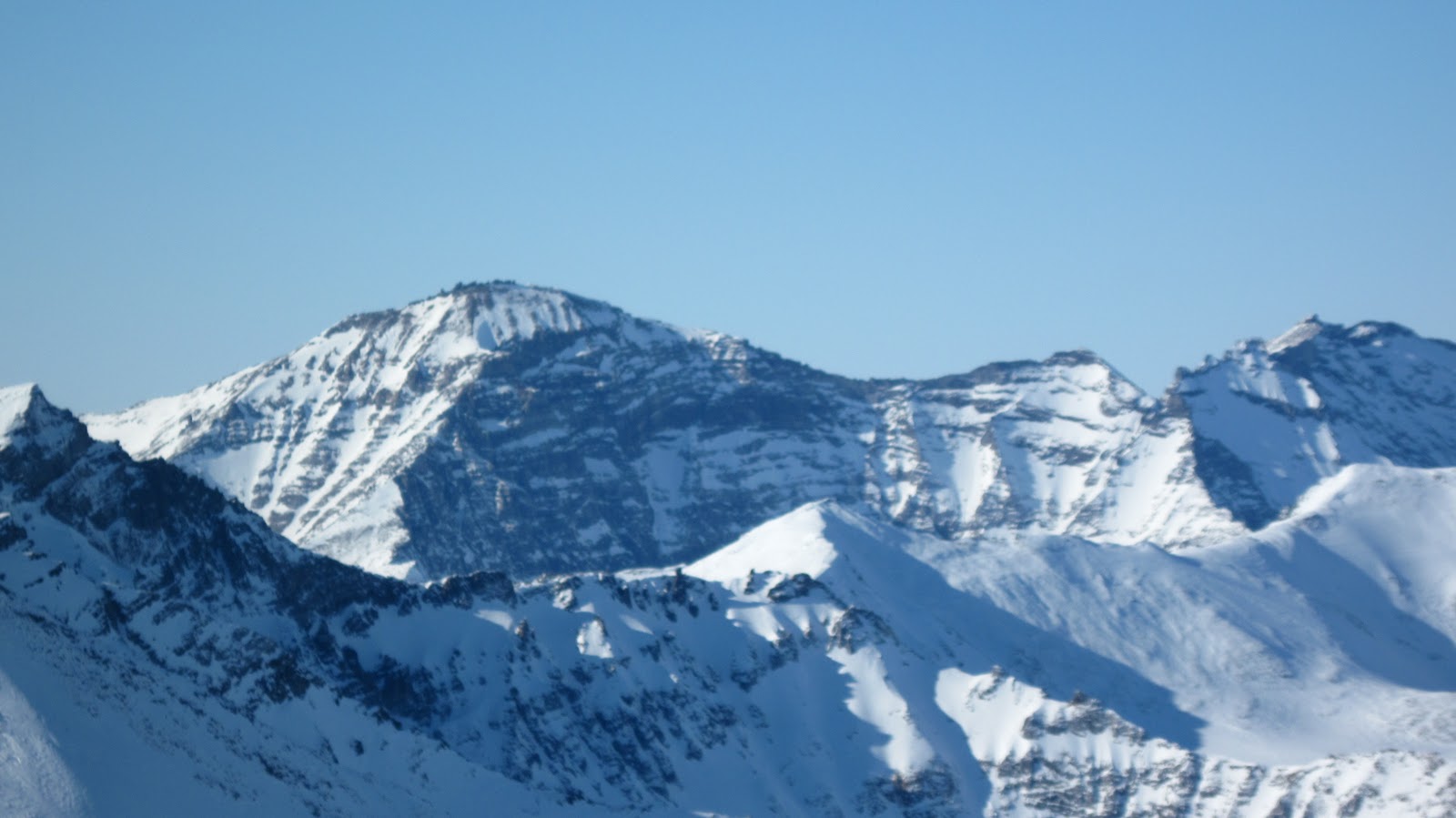
(above) "Distin Bluff" (Pt. 1125), August 2011.  80 ft. at its highest places.  Our first route went up the lefthand edge.  More on Distin Bluff here.  Anybody know the true name of this thing?


town was borg, we were assimilated, instantly the tentacles of digital technology began to snake into the cortical machinery behind our fragile auras;  soon we had forgotten the awareness we had achieved in the mountains...

Andy kept a spark alive;  his plane ticket for home wasn't for a day;  obsessed he was;  in the morning, lying among cables and wires, he had the will to rise and brew coffee;  we were away before noon, mounted double bareback once again on the back of the Yamaha, Prolly, off to the "Distin Bluff" for chossaneering on abhorrent marble.

(above) "Pixuusiqiri" (sinner, wrong doer), (5.7).

never before had i visited this face with a friend during the time when the songbirds were singing, at least not with all the toys, though the place had known the whack of my Cobras well in the winter;  Andy and I felt like tigers from our recent epic in the Kigs and wasted no time hopping onto a likely looking line-


oh lord, that Qaweraq marble, not so bad when frozen, but it can be FOUL when the tundra is green, oh hear me lord-  a crack jam, some well-placed cam, a little duo-doit, i was starting to dance when someone shoved a half ton detached block of marble in my face--  its gang members surrounded me quickly-- next thing I knew they were all around, over me, to the side of me, as a last resort I had to start stepping on their heads just to get out of there.  
(above) Andy Sterns on"Sivuubaruq" (fears the consequence), (5.10c), top-rope

     yes! climbing at last, stuffing in pro, moving the rope out, finally, the real deal, and then somehow, I was standing on solid ground in the middle of the climb;  i thought we had been safely on a cliff of rock, but somehow SOLID GROUND had snaked around and up from the spot where we had started and intruded into the middle of the first pitch;  so i belayed in the middle of the cliff standing at the bottom-  above us, the true line presented itself, out on a patch of Grapefruit limestone, but catastrophic bone-pulverizing collapse presented itself as well-  so we finished on another diminutive patch of Grapefruit limestone;   it was a pitch, cobbled together out of chiton dust and imagination.
(above) "Sivuubaruq"

 for a second course, we set up a top-rope on the nicest looking bit of the cliff, anticipating hours of harmless fun, we settled in at the base;  i was done after one turn-  to have gone again would be like repeating North Twin once you had already climbed it;  the very pores of the marble seemed to ooze menace, the shadow of the death attractor was never far, it was like trying to play Ringo with chalk marbles.

(above) Distin Bluff ledge

no marble tomb for Andy or me that day;  purged, reamed-out, empty again, we returned via Glacier Creek Road to our electronic enclosures in the blinking port, and let the urgencies and exigencies of the things we had known for a moment to be really very small cover us over again.
(above) Distin Bluff in winter

to summarize:  better in winter, stuck together one and all, when the whole creaking freaking tweaking edifice is not threatening to come down on top of you--  the place is really OK with a couple of good axes in your hands-

Saturday, August 20, 2011

Third Tog, North Ridge, Slimedog Millionaire

I'm fixing a hole where the rain gets in...

(above)  "Third Tog" (Pk. 3150+), Crater Creek valley.  North Ridge is the righthand skyline.

     1SA (1 Sunday ago)
     Andy Sterns and I slogged to Crater Creek for another attempt on the North Ridge of the "Third Tog".   Boy, did we get Murphied:  the days we were in the mountains, it rained, and the days we were out of the mountains, the sun shone, and shines still, as the GLUE OF TOWN holds me fast like a clam-digger with one boot stuck in the mud of Turnagain with the tide coming in.  M.L.D.'s-- Murphy's Law derivatives--  always difficult pills to swallow. One endures the irony-burn of all the oh what a nice day!s with as much good cheer as one can muster.  
      Though no SEND was obtained, we did some great pitches of sliming, despite the climb.  Andy was a driving force in comparison with my natural laziness and exuded immense climbing drive every morning.   Where my other Fairbanks friends poke fun at the choss topples in the Kigluaiks, Andy hallucinates routes are there.  We pretended to establish a partial route on the biggest of the Togs, "Slimedog Millionaire," two pitches of ICKY super-slime over fairly nice rock at S-8 ("slime-eight") with a few "Scottish-free" moves.   

(above)  North side of Tog 3, Crater Creek.  To see the approximate climbing line, you could click here. For an account of my rained-out solo attempt on the Tog last year (which I have foolishly reiterated this year), plus a discussion of Crater Creek hiking, you could click here.  The rock is granitic gneiss.

       On last week's attempt, Andy and I got about a third of the way up the ridge before severe SLIME necessitated a quick rappel back to the safety of the green slabs at the base, where Lucy the mountain dog was waiting for us, scampering on fourth class terrain.  
       The whole route, we learned, is probably only four pitches.  On many earlier trips to the mountain, my brain had perceived the Third Tog as a soaring Temple Crag fluted with multiple Moon Goddess Aretes, and had thusly persuaded Andy to "drain his tank" of mileage and come climbing in the Kigs. What we found there was more like a highly-degraded Aeolian Butte-- but what a gorgeous middle-of-nowhere in which to be climbing! 


(above)  The "human mules":  Rick, Daniel, and Andy, with Lucy, pausing at glacial erratic, Crater Creek.  Did I mention we were cold?  Yes, assuredly so, everyone is soaking wet.  A breeze is blowing.  Alaaparut.

       For the first time ever, we experimented with usage of human mules.  The idea was to exploit unwitting locals by offering them a few pittances in exchange for carrying our prodigious kit to the base of the moraines.   Rick and Daniel Anderson were easily gulled into leaving for Crater Creek immediately with 50 lb. packs on their backs, despite the rain;  both father and son, I assured Andy beforehand, were "monster hikers," and they certainly proved true my claim.  The idea was that mules would be cheaper than a helicopter with Bering Air, though the final result was mixed;  we grew emotionally attached to our mules, and felt horrible to see them suffer in the wet brush on the way in, and strange about trying to make it a hired gig... yet, did the mules seem to enjoy their burdensome task?  Next year, we'll all ride the helicopter, mule-brothers, how about it?  Yee-Haw!

(above)  Pitch 1, "Slimedog Millionaire."

      The first night was icky and cold;  we awoke soggy-clothed in the morning with the tent in full-puddle.  My ancient, utterly BEAT BIBLER was giving up the ghost, silly plastic pole-guide rings popping right and left, laminations delaminating, pinholes emerging like dripping stars, a ripping noise with every zip.  After so many years of proud service-- stove fires in the Todd-Tex, the massively-rumbling horrors outside the yellow wall, boredom on the inside, novels, pee bottles, drifting snow, pressing my face into the wall all night, spiders, the porcupine I slept with one night--  the tent finally earned its true name on this last trip:  ICKY WOODS.  
       The next day we retrieved the gear that Rick and Daniel had helped us to cache, under pulses of rain-shower and a sky that shifted directions like a candle at a birthday party where all the kids are blowing at once from different directions.  The following day we arose from our icky beds of gelatinous slime and ascended into mist, "just to have a look at the route."  Many crack systems presented themselves;  we chose an attractive one and started up.  Good jams, plugging cams, slimy hands, what does it matter if you got good jams?  But after a few fun moves, a squeeze chimney lubricated with Preparation-H raised a chafing conundrum: "Uh, Andy, I could aid this, but it would be so much more fun if only it were dry.  I just know I would enjoy shoving my body through this painful, corrugated, cheese-shredder, if only it were dry."  Rain was falling.  The black squeeze glistened with Preparation-H.
       So we switched off our northwall brows, and whipped up a top rope, and had an absolute ball climbing in the 100% precipitation for the rest of the day.  We left our gear and returned to Icky Woods.  A patch of sun came out and set us to steaming.  We dried our bags in the sun. Andy proclaimed our fortune had turned, the weather was now good.
(above)  Andy descending Class 4 slabs.  The buttress directly over his head is the proper route;  we chose greener, path-of-least-resistance lines a little further to the right.

       The next day, we went back up into chance of showers, "just to assess the slime-factor," but both of us knew it would probably be our one, big attempt--  we were sodden, and our calories were running out.  Lucy, the Border Collie, on her first technical climbing expedition, proved perfectly cognizant of a dogs role in wall climbing;  at the exact point where the 5th class commenced, she was happy to renounce her until-then constant obssession with following our every body movement, and retreat to the base like a good dog, with no blatant whimperings, nor attempts at mental manipulation at which this one-year old herding-dog excels.   
(above and below)  Pitch 1, "Slimedog Millionaire."

       We decided to damn the aesthetics and just clutch up whatever route would get us through the slime-fields the easiest.  A Class 4 approach pitch on wet grass led to some rock.  I placed an El Cap's worth of gear in about 40 ft., then did a cool little move across a dihedral and belayed.  The pictures show Andy following the cool little move across the dihedral. 
      The dark clouds were engorging, the rain ceiling was coming down fast.  Something happened to me for a moment;  the old tiger came out.  An arrogant Benowitzian impatience took hold;  I sunk all ten fingernails into vertical dirt and spider-clawed up the next 5.7 hanging tundra pitch, without putting in ten-thousand pieces or wailing like an expectant father.  Just as quickly, the tiger subsided back into loserdom and I felt fearful again.  Why the almost angry burst?  It was obvious to me that we would never complete this climb that day, we were soaked, we had no puffy coats, the wind was conjuring hypothermia, and the climbing was slime, only slime.  I felt like returning to Icky Woods immediately and reading about hypothermic Bolsheviks in my book, "The People's Act of Love," by James Meeks.  YET, I knew that Andy, bless his heart, was down there at the belay, perfectly excited to forge upwards into the increasing rain of our decreasing interval, to do one more pitch, just for the "fun" of it. 
          
(above)  The upper pitches of Third Tog, North Ridge.

      I came to a large, ledgy area with a slime-fall coming down from above.  The rain was like a foam, everywhere, over everything.  The upper part of the route looked very doable.  Murphy!  It actually looked like fun, exposed climbing.  This was the point where my woeful misjudgment of the climb became apparent. Hitherto I had held this climb of the Tog as a Jorasses-like north wall where hapless alpinists could potentially end up as frozen barnacles plastered to the headwall by cake-frosting, grimly visible from the green floor of the valley, forever out of reach.  Now I view it is a fun climb on decent choss that one could do in a few hours.  Must get back in there to solo it;  or you!
(above)  Rappelling off Slimedog Millionaire in the rain.  Pitch 1 went where the rope is.

(below)  Andy Sterns in the wet.  Slime factor 7.  Retreat.  As always, Andy is radiating positive vibrations, even though he appears in this shot to be glowering.


        Down at Icky Woods, Andy tuned a weather report on KNOM.  "There is a 100% chance of rain today, 100% tonight, 100% tomorrow."  Powerbar wrappers mucilaginously clung to the tent walls, which shook and spattered with wind and rain.  Lucy curled stoically outside in a nest of mud, too young to ever have known the precedent of coming inside Icky Woods. We discussed our options.  We had brought our gear down from the wall.  The GLUE OF TOWN was oozing in through the cracks in our steely focus.  We discussed relationships and what assholes we were. 
       In the end, it was decided that a full return to town was way too hideous a prospect:  responsibilities and commitments would be waiting there to spring like hidden predators.  We settled on the idea of hiking out to Earp's cabin the following morning with half the gear;  we would hike a "Togathon" the following day, in and out of Crater Creek, sixteen miles, to retrieve the rest of the gear.

(above)  Andy wading Crater Creek on our exodus, Thursday, August 11, 2011.  Still a casual crossing, but I had never seen the water that high.

       Here is what my friend Diana Haecker wrote in the Nome Nugget, week of August 18, about the day that Andy and I chose to flee Icky Woods and the mountains:

                         The unusually heavy downpour of rain last week made Thursday, August 11,
                         the wettest day in almost seven years with a precipitation of 1.21 inches, reports
                         the National Weather Service.  This is in line with the trend of this wet summer
                         of 2011, which already saw July being the seventh all-time wettest month in
                         Nome's 105 years of weather data record keeping.

It sucked.

       Crater Creek had physically increased in length.  We suffered.  Allapa.  We reached the 4-wheeler.  The plan was for Lucy to run alongside the 4-wheeler for several miles;  "I'll just perch up there on top of those bags," her eyes seemed to say, so we let her on.   The Clampetts motored down the Kougarak Road towards the dry cabin. 


(above)  Salmon Lake

             Earp's cabin had never felt so good.  I'll never forget the smile of the dog, who had been sleeping out in the drink for days.  But like an invisible gas, the GLUE OF TOWN seeped into the room.  A phenomenon known as "Relationship Force" was exerting a strong current on Andy, as he had not seen his partner all summer.  That meant we were hosed;  I myself am tragically predisposed to succumb to the GLUE.  It became a foregone conclusion:  the next day, our party of three piled onto Prolly, the 4-wheeler, and motored back to the fleshpots of Nome.

(above)  Tog 3 in Winter.

        The "Togs" is my pet name for the metamorphic-granite structures that one encounters in the south fork of Crater Creek.  These cliffs are not visible from the Kougarak Road, but unfold spectacularly when one turns the corner on the obviously-glaciated valley about six miles up.  The name derives from a color-coded designation in the explanation of my geological map of the Kigs, "Bedrock Geologic Map of the Kigluaik Mountains...," by Amato and Miller.  The good climbing rock in the Kigs shows up as pink on this map, and the explanation reads:  "pre-Cambrian Thompson Creek OrthGneiss," from which "C-TOG" was derived, which Andy and shortened this trip to simply TOG.
         I identify 7 separate Togs in the valley.  This is a cusp area where the pluton is in contact with the schist;  Crater Glacier must have come through during the last glaciation and sliced off the very edge of this plutonic uplift, leaving little fingernail clippings of granitic gneiss lying upright on the southeast wall of the valley.  There's plenty of rock up there.  The 7th Tog (Pk. 3950+?) is one of the highest peaks in the region;  got to get out of this naming business, really, the true EarthSea names of things are locked inside the land.    The Third is the largest of the Togs;  the summit is pleasantly attainable on the Class 2 south side;  try bouldering your way to the top on the northwest side via discontinuous I-can-imagine-it's-granite slabs interspersed with great fat-pad balconies made of hanging tundra.


(below)  Crater Creek area.  This is an old, rather sloppy map.  Regarding the approach to the Togs, the verdict is in:  it's easier to hike on the riverbed on the way in (but more bearonoid).

Tuesday, May 31, 2011

Pk. 3595, Oro Grande peaks


    ... and a desperate DEATH MARCH of SCHOOL ensued during the month of May... blogganeering was OBLITERATED.  I became a full-time editor of edgy 6th Grade Literature.  KIGSBLOG lay dormant.  (The weekends, however, held ACTION, fueled by Tyler's rage for the fine Spring skiing.)
     While the blog slept, Spring emerged.  But here, now, from this memory station at the beginning of big blue summertime, KIGSBLOG must fly back to where we left off:  the unfinished post from April, concerning Ryan and Ian's errant voyage into the mystery lands of the Oro Grande by snowmachine, and the near-death experiences along the way...
 (above)  Basecamp in the Oro Grande, April 2011, looking north.  Pk. 3595 at left edge of photo. 


      The GLUE OF TOWN was fierce.  Like a cartoon character who has stepped in glue, Ryan labored against long sticky tendrils of causation that stretched, but never quite let him go.  Great matters of life and death portended in all the signs, but neither he nor Ian recognized their significance in the present, blinded as they were by the sunny weather, firm snow, and desire to get into the remote and mysterious Canyon Creek.  ...how was i to know that Ryan himself was in violation of the NO SKETCH PARTNER rule?  
         Pulling out of Crowley's gas, the first 30 seconds of the journey, Ian escaped the wheelchair only by the grace of God when the skid on his machine augured into a meter-deep furrow in the snow— a furrow dug by the very Snow Cat vehicle on board which that very morning he had ungraciously turned down an opportunity to ride.   ...knowing NOW what i did not know THEN, this horrible flip from the machine appears to have been a nodal confluence point for several threads of causation forming a synchronicity attractor of significant magnitude:  emotions, fractured friendships, reproduction, self-confrontation, all were to follow in the intervening weeks, with the nasty, near-miss accident, as so often happens, lurking in the matrix, exerting its own gravity... how do i get so lucky time and again?  Thank you to Arctic Cat for designing the cockpit of the BEARCAT so the rider does a perfect 360° flip over the handlebars...
 Admitting possible internal injuries, they continued;  their collective will to get into the backcountry and go camping on the most beautiful snow-machine mountaineering weekend of the year became the MACHETE which sliced through every problem, every obstacle the GLUE could throw in their path, and soon they were roaring down the Teller Road like Wyatt and Billy in Easy Rider.
(above)  Pk. 3595 viewed from adjacent peaklet to the west, looking northeast.  A way led through slough-avalanche slopes to the main summit, but the NO SKETCH PARTNER rule forced a retreat. The NO SKETCH PARTNER rule states: always prioritize the needs of your partner ahead of your own ambitions. The terrain in the picture would probably have taken me three hours round-trip, but I had told Ryan I'd be back in one, as the GLUE OF TOWN seemed to be pulling at his ankles like a strong rip-tide.  I pretended to be Rudi Matt in Banner in the Sky, forsaking the summit in consideration of others, but the truth was, I was nauseous from all the pain killers I had ingested the night before to treat my snow-machining injuries.  in other words, hungover.  How many John Barleycorn bails have my afternoons seen? 
         I would have done better to ascend from the Oro Grande directly to the notch just in front the summit in the photo, but the snowpack had been sort of crackling with chain-reaction, avalanchey noises that morning, so it didn't seem wise at the time to venture onto plus forty-degree slopes.  By the end of the day, however, I had gained a bit of confidence in the snow, however, and was able to ignore the disconcerting crackle-echo noises.   
 

(right)  Bouldering on crumbly paragneiss halfway up Pk. 3595.  
   Ryan came halfway up the route in his shoe pacs.  We stopped at a nice ledge, and he took this picture.  The Oro Grande tors on the crest of the ridge are composed of the good old "pre-Cambrian Thompson Creek Orthogneiss," but the rock on the way up seems to be more in the manner of "highly resistant, coarse-grained pelitic paragneiss and schist" (according to the Amato map). 
     The snow slope in this area was criss-crossed with tracks from an AKLAQ freshly sprung from winter sleep.  As evidenced by the tracks we saw, the bear had, at one point, had been getting rad just for fun, jumping and sliding repeatedly off a dangerous cornice.
     The tracks also told a story that explains why Seward Peninsula AKLAT are so wary of humans.  No sooner had this poor AKLAQ emerged from its den, blinking in the morning sunlight, then it was beset upon by human predators.  Ramon's party (see below) had seen the bear and high-marked up to the den. Then Ryan and I camped a half mile away. As we were setting up the tent, a Super Cub on skis swooped in and landed up by the den.  The next morning, a young hunter from Nome came motoring breathlessly up to our camp inquiring about the very same bear.  Man!  The people are after you right from the get-go!  No wonder the mothers teach their cubs to run at the very sight of us. Up among the very highest tors, I saw how the AKLAQ had outfoxed everybody by climbing a circuitous route into an obscure valley to the northwest.    
(above)  Isabel Pass, chance meeting with other snow-machiners between Glacial Lake drainage and the Oro Grande.  Other people?!  In the Kigs?  Shows you how nice an April weekend it was.  Here we see the redoubtable Ramon and his posse of snow-machining fiends telling us that we are lost.  An astute reader will remember that Ryan and my destination was Canyon Creek.  Ramon is explaining that the pass to Canyon Creek is not the one we are in;  we needed to hang a left ten bumpy miles earlier. (see map, below)  It was at this point that Ryan and I decided the Canyon Creek camping trip had turned into an Oro Grande camping trip. 


(right) Region north of Glacial Lake  
1.  Glacial Lake  
2.  Isabel Pass. Dennis H. told me that was the name of this pass.  Is that right?  
3.  Pk. 3595.  I call it 'Oro Grande Peak' but that is my own appellation.  This is merely the high point of a long, prominent ridge, but Pk. 3595 as a distinct entity seems to be quite prominent from all over the range. 
 4.  Unnamed Pass.  This, I am told, is the snow-machine shortcut to Canyon Creek
(above)  Suluun, the Dorsal Fin, viewed from Oro Grande, looking southeast.  One of the biggest chunks of granite (gneiss) in the Kigs. Andy and I climbed several routes there, including the left skyline:  trip details here and here.
(above) Tor detail, Oro Grande peaks.  Amato, my patron geologist for the Kigs, told me he climbed "all" of these peaks in the nineties, but was vague on details-- at least, those details not relating to the geologic. 
(Above) Pk. 3595 (the one on the left) is merely the high point on a prominent, tor-studded ridge that forms the north side of the Oro Grande drainage, visible from village of Teller as a classic row of Sawtooths, hence, Kigluaik.  Is this the namesake ridge of the entire range?  This ridge, which I personally refer to as "the Oro Grande peaks," proved an exception to the rule that the north side of a ridge in the Kigluaiks will always be the precipitous side--  these tors poke out of the top of the ridge like true tors should, but there's not the usual fearsome drop-off on the north side. 


(Above) View to the south from peaklet to the west of Pk. 3595.  The little conceit of Kiganeering is to get to the top of something, so I put on crampons and labored, sweating Yukon Jack, to the ridgecrest. There might have been some Class 4.  This picture was taken from the same spot as the one earlier showing the main peak.  

Views from the DRIVE OUT of the mountains from Oro Grande via Mosquito Pass. (Above) we see the long wall of the West Face of Mt. Osborn (Pk. 4714), the mini-Emperor Face of the Kigluaik. I'm sure people have snow-machined up into the cirque, but what are the odds someone has climbed Osborn from this side? Not high.... 

(Below and bottom) Two views from the drive out of a hill I call "Turncorner Mountain" (Pk. 3250) because it is where you finally turn the corner to get to Mosquito Pass when slogging from the Kougarak Road.  My sweetie Kristine and I climbed the lefthand ridge in a 13 hour epic (Class 4/5), years ago in the pre-Raina days.  
somewhere we are still there

Tuesday, April 5, 2011

Distin Bluff Chicken Out

(left) Distin Bluff (Pt. 1129), Saturday, April 2.  The pixelization is due to  blowing spindrift.  I spent last Saturday huddled in relative warmth and sunlight against this hundred-foot cliff underneath great umbrellas of snow-streamers that blew out horizontally off its top.

       The object of any April weekend is penetration into the "real mountains."   Stopping partway in the foothills to play is a failure, a "chicken out," a mental turpitude stemming from an unwillingness to motor out into the deep water completely alone.  It is the nature of the Kigluaiks that a 20-mile slog from the foothills from a busted machine is a doable thing without frostbite;  on the other hand, a 35-mile slog from the inner mountains from a busted machine would be a HELL OF A SLOG, and the rescue party would probably intercept you before you ever reached Nome the next day.  Then the locals would  excoriate you mightily.  Hitting your rescue beacon is practically unthinkable;  one would most likely never be able to visit the mountains again, your machine would be stripped from your good name, and the headline would make page 1.
         So, wherever I use the term "chicken out," substitute the words GOOD JUDGMENT.  Last Saturday I saddled up for a solo penetration into Glacial Lake, my ego puffed with dreams of the blogganeering accomplishments I could engender there:  a mixed route up the south face of the picturesque peak that rises from the northeast side of the lake.  Years before I had tried this route and been defeated by post-education weariness halfway up when a violent nap overtook me in the warm winter sun.  On a second attempt  with Marshall Earp, we rang the CHICKEN OUT bell instantly upon arriving at Glacial Lake to find there a wind of such ungodly ALLAPA proportions that there was no question of shutting off our warm little machines.  Without a word we had turned around and went back to Distin for fun and dry-tooling in the regular old SUB-Arctic at the end of the sixteen-mile Glacier Creek Road.


(below) Reruns of Joni bouldering on Distin Bluff last year.


            And now for the CHICKEN OUT!   I got to the pass at the end of Glacier Creek Road that leads to the Stewart River and on to the heart of the Kigs.  How deep the snow was!  Although  Crusteo, my battle-scarred Polaris 340, was going good, he was pretty much submerged and streaming snow into my face, plus he was eating a lot of gas.  Two deserted valleys separated me from Glacial Lake, and the mountains were all FUZZED OUT with that tell-tale WIND GAUZE.  A Russian hard man would have continued on towards the goal.  Too long in the flesh pots, I repeated the pattern from last year, and formed the bight-of-shame leading back towards Distin.

       The game of 4-season bouldering seems to involve the capacity to hang out in little micro-climates out of the wind, behaving for all the world like tattooed, fat-pad Californians hanging out at the V11 all day, except without the chicks, plus you're alone and freezing to death.  The least windy place is always at the top of the mountain, in a little nook pressed right up against the cliff.  There you can hang out next to the radiant stone and listen to the mountains rage all around you.  I was sad because I could see the whole sad sweep of time and I never let you know I cared about you.  Then you climb up and down the cliff, sinking good sticks into turf, torquing and hooking the marble, stemming and mantling and swinging and daggering, occasionally finding yourself way off the deck in situations that pass instantly from the hedonism of bouldering into the cold, psychopathic indifference of alpinism.  It's all in the kinaesthetic movement.  You're looking for the Csikszentmihalyi moment, which you will never remember anyway, lost as it is in the eternal sunshine of the bouldering mind, but you will feel better for it all at work on Monday.

      The coolest part of the day was stopping in the evening for a telly ski in Hatcher Pass quality powder in some nameless bowl among the wastes of the Snake River Valley (below).  Life can be sweet, enjoy for all it's worth.

Monday, April 4, 2011

Nugget Pass Powder

(left)  Allapa at Nugget Pass area, Grand Central in background, Sunday, March 27.  As I came even with Tyler, his celebrated time machine already drawn and aimed, I unconsciously broke out of parallel and into telly snob.


March Powder Storm

The FLUFF is on
There'll be no climbing today.


No perching, pasting and grunting,
Your hooks will stay in the pack,
No stemming and slamming your wallet 
Into slabs that gain no purchase.
They'll be over there sucking down the lines
And I'll be there with them;
the FLUFF is on, and
There'll be no climbing today.


The silken sound of graupels
Swishing aside by the millions
Has got them in a kind of trance;
if my skin stays on
I'll be able to pet the monkey on my back,
He pops on at the bottom of the run,
Gets off at the top and hucks another one,
But they'll be no climbing today
For the FLUFF is on,
It's like skiing on a cloud.


The monkey came back at the bottom of the run, so
We climbed the mountain again;
Crazed with the powder,
The silk and sinuous sliding,
We never crossed each other's tracks,
The waves were all synchronized;
And none of us we
Battled the gravity,
No one offered fealty
For the FLUFF was on,
It was all just winging.


Someday we'll return to struggle,
Offer ourselves to the jaws of the mountain,
Instead of smooth over the sinuous curves;
We'll be clinching and closing with constrictions and praying
For the Lord to spare us one time;
But for now the FLUFF is on,
The stairs are all coated with vapor
Get boards for your feet and take to the machines,
Leave your Cobras for shovel and beacon,
There will be no climbing today.


(right) Skinning up.  Erica and me, our trusty little machines looking like turds left behind in the snow.  These are the hills east of the Kougarak Road.  Tyler was instrumental in helping us achieve TOWN ESCAPE VELOCITY on a hungover morning that broke windy and gray in Nome, on a day when many a local outdoorsman failed to break through the low psyche, but a day that proved to be calm and transcendently beautiful in the mountains, the light unreal bright, with downy feathers all over everything.

Wednesday, March 23, 2011

Ascent of "Kayuqtuq" (Pk. 4000+?)

   Recent post attested to thwarted attempts on Peak 4000+ located on the divide between Crater Creek / Fox Creek here .  Vowed to return to this insignificant hillock that my Christopher Robin imagination had transformed into a Chimborazo, a Cotopaxi, it had stolen my heart away, the Sentinel of the East End of the Kigs, a bookend paired with the Singtuq (Pk. 3870) way over on the West End, a bump become my albatross.  Three attempts I had made on Kayuqtuq, defeated each time by my servitude and laziness.  It was time to resort to the path of least resistance, which in the Kigs, is almost always the south side of the mountain.  
    Here is a pixellated figment of the mountain from the North, viewed from South Fork Crater Creek, March 2009. (below):
    The moment Earp touched ground after ascent Osborn Sunday (see here for account), the GLUE OF TOWN began to exert a strong undertow on her machine.  Perhaps "GLUE" is a misnomer;  what I saw tearing away at Joni was a FORCE, manifesting from thirty-five miles away, a concatenation of cares and responsibilities exerting attraction from a distance.  Soon, she was gone...  
     The GLUE was pulling at my machine in the direction of TOWN as well, but there was also a repulsive force emanating from town that caused me to turn, cold and soaked from the arduous climb, in the direction of wilderness.  Soon, thanks once again to Earp, I was ensconced in the cabin at Salmon Lake with gear drying, like Clyde huddling alone at Glacier House, but with MAD Magazine instead of the Iliad for company.
     The weather was banging fine, the conditions nearly perfect in the Kigluaik for mixed climbing.  My thoughts turned to Kayuqtuq;  not to be a crass peak-bagger or anything, but the peak had to be bagged.  The next morning, basking on porch with Jack Aubrey coffee in hand, I was visited by an honest-to-God KAYUQTUQ:
(above)  KAYUQTUQ (Vulpes v. alascensis)  I named him Ray Guy.  A good omen.  The peak was in the bag.

      However, before the old man could bag the peak, the old man needed a rest day from the GREAT THRASHING PUNISHMENT of bagging Osborn the day before. Rest day was used to reconnoiter a snow-machining route up Fox Creek.  It took quite a bit of searching about on foot with the Iron Dog parked to find a way past a cornice at Fox Creek's bottleneck, about three miles in from road.  
        Once this bottleneck was negotiated, however, the overwhelming OBSCENITY OF THE SNOW-MACHINE became glaringly apparent.  I was able to motor easily to the very base of Kayuqtuq's south slope.  If I had crampons with me, I would have just climbed it on my rest day.  I had snow-machined nearly to the top of my Chimborazo, my Cotopaxi.

(below)  Summit pyramid KAYUQTUQ (Pk. 4000+) from north shoulder of mountain.  My second attempt, solo, was thwarted when I chickened out of soloing this rather appealing-looking mixed ground. The drop-off to the right (northwest)  is really quite fearsome.


(above) Summit, Kayuqtuq (Pk. 4000+)  I have no reason to be sure of that elevation.  I like to fancy it is one of two "four thousanders" in the Kigs, along with Osborn.  I'll hazard a guess it has been climbed before, but I'll hazard a second that it was never climbed in a winter month either.  The wind came in huge spurts that day, like waves of customers at a market;  at the summit, it was perfectly calm.

 (above)  View towards southwest from summit of Kayuqtuq (Pk. 4000+)  1.  "Turncorner Mountain" (Pk. 3200+) between Northstar Ck. and Windy Ck.  Kristine and I climbed that big old righthand skyline one summer.  2.  Tigaraha, with its three granitic summits.  3.  Pk. 3213.  4. "Pen Tri Cwm" (Pk. 3650+), so called by Anchorage party. 5.  Mosquito Pass area-  routes to be had.
       This type of panorama fondling and pee marking is shameless, utterly embarrassing, really quite fun, never gets old.
 (above) Looking down East Ridge.  Attempt number 1 with Earp last February ended up with us retreating from somewhere in this photo.  We decided this peak wasn't anywhere near worth frostbite.  Did I mention it was cold?  Yes, very, ALLAPA!!, it was cold that day.  Lots of nice mixed climbing on gneiss around here.  If it were Scotland, there would be routes!

Monday, March 21, 2011

Mt. Osborn FWA

(above)  Osborn from the northeast.  Traversing icy slopes to the right underneath the row of summit tors to get to Osborn's high point, you are traversing over the great sinister wall holler of the Northeast Face.   The moves are not difficult, but you would not want to snag your bell-bottoms with your crampon points.  The regular route on Osborn comes up from the left (southeast) and traverses the summit ridge;  a rope can be of comfort on this summit ridge in alpine conditions.

 
(above) Northeast wall Osborn, March 2011. Earp demonstrated the climber inside her is still very much alive by gunning the throttle through a series of spiritual and situational green lights for all-out attempt on the Sluicebox Couloir.  We roared into that dreadful cul de sac on March 13, Joni's birthday, with guns loaded, ready for fearsome struggle.


(above) Earp on 4th pitch of Sluicebox  Couloir.  Both of us had felt the sting of Osborn's northeast wall before.  On another of Joni's birthdays in 2006, we had gotten halfway up the Sluicebox before a breeze sprang up on top, nearly drowning us down in the cleft with waves of spindrift.  Joni had been nauseous the entire climb and able to speak only in low groans.


(above) Upper half of Sluicebox, March 13, 2011.  But when we got to the wall last Sunday (supported on snow machine by Quinn, fresh from the ritual of pure madness known as the Nome-Golovin snow machine race) we instantly perceived that our route was anemic.  Where there should have been an ice hose dribbling down the upper wall, there was only cold marble.  Some elementary force of nature, probably the great South Wind event of February, had denuded the wall of its promised ice.  Gone are the freezing-rain layers of Thanksgiving and New Year's, if they ever existed at all at this altitude, in this frozen cauldron.  Compare this picture from a week ago with pictures of this wall from years earlier (below):


(above) Osborn from Grand Central.  The Northeast Face, and the Grand Central Glacier at its foot, is around the corner to the right.

       Upon finding the Sluicebox NOT WORTH CLIMBING IN THESE CONDITIONS, the effect was like waking out of a deep trance.  "What are we doing here, Earp?  How did we get here?"  We stood blinking in the bright sunlight.  So focused had we been on the NORDWAND, now that we were released from years of servitude in the gulag, we didn't know what to do with ourselves.
       If the gold medal for valor was not to be our reward this time.  I peeked in to my little black book for other nearby opportunities to conflate my sore and collapsed ego.  How could I contrive some new frontier out of the mountain wilderness at my disposal?
       "I know, Earp-  let's make the FWA (first winter ascent) of Mt. Osborn by the regular route."  As far as I knew, the mountain had not had a proper ascent to the true summit during the calendar winter.  Nor has it yet, by my reckoning, as you shall see, unless you count the leveling of an ice ax to the proper altitude an ascent.  Joni was plenty psyched to climb Osborn, having never ascended the crown jewel of the Kigs in any season.  Such contrivances as FWAs are generally poo-pooed as proper motivation to climb by the spiritual masters of true alpine wisdom, but a confused old dad like me finds they provide a structure of sorts upon which to pin decision-making, and energy resource allocation in a fatigued market.  So we motored around the corner of Osborn, parked our iron dogs in the sun, and commenced slogging up the southeast rib.   Earp, breaking training from WEIO,   was soon far ahead out of sight up the mountain.

    
(left)  "Snakey  Mt."(Pk. 2950+) and "Pen Tri Cwm" (Pk. 3600+) from the south fork Grand Central area.  These are peaks in the very cool South Fork of Grand Central, you see them to the south as you're hiking up Oz.  The pass to the right just out of the picture leads to the Windy drainage and is easy, though I've always been too chicken to MACHINE IT.  The saddle to the left of Snakey leads to the Sinuk, but is probably Class 3 or 4, so it is best for those seeking passage to choose the Windy/Sinuk side of Snakey Mountain.
      Years ago, Mikey and I slogged up the very ski-able backwards-S couloir on the lefthand mountain in the photo, which she later labelled as "Snakey" on a photo, which is how I have referred to it ever since.  Tyler calls it the "Z-couloir.  We are both in agreement that it represents the next great problem in Kigs descents— perhaps it's been hucked already.  The two pitches on the summit arete were steep and icy and made me glad that Mikey and I had brought a cord.  "Pen Tri Cwm" was a name bestowed upon the righthand peak by Todd et al in a Scree article, if I read it correctly, the name referring to its position at the head of three different valleys, Sinuk, Windy, and Grand Central.  A cool name for this mountain, which maintains a rather managerial prominence over the entire corridor of the Sinuk when viewed from the mouth of the Sinuk river--  I wonder if there's an older name from the early fish camp days? 
(above)  Looking south from the summit of Osborn.  Background peaks:  Snakey, Tre Pene Cwm Idi, Tigaraha, Turncorner Mt., Mosquito Pass Mt. and a chunk of Osborn's seldom-visited West Wall in the foreground.  The Hands-Full Factor was a bit high this time on Osborn's summit ridge--  the peak seems always to be embedded in a cold, upper stream, hands seem to stay inside gloves, cameras seem too imminently droppable to risk extracting from the pocket.
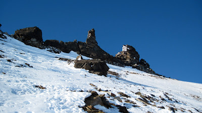
(above)  Summit tors on Osborn (not the actual summit) taken on descent.  These tors run like a fence along the top of Oz;  you HAVE TO traverse all the way to the north to reach the highest one, which is only higher than the penultimate one by probably ten or fifteen feet.  The Penultimate Tor, located at the southern end of the fence is the more spectacular formation;  on one of my earlier attempts I mistook it for the high point and rope-soloed it, finding moves at about 5.6, but then had no more time to traverse for 25 minutes to the north to get to the one that looked highest.  Roman may have soloed the Penultimate in the nineties while he was scientificaneering in Nome, but all is fog and uncertainty, it's hard to say.  The North Tor is easier, Class 4, or maybe Class 5;  I would say DON'T bring the rope in summer, but the thing can be useful snagging two people tied together by one when they are whizzing down the icy face in winter. 
       Earp had no love for the summit slopes and their bottomless chutes into wall holler;  she suffered my intimacy with the summit tors, my fabricated little rules for proper conduct when claiming ascents of Osborn, the merciless icy wind, and the way I foodled around in the scree and bullet-hard ice, picking my way ever so slowly across easy ground.  Many say they have climbed the Oz, some will tell of driving snow machines to the top--   but most, upon interrogation, reveal they merely reached the summit ridge, and do not deem the tors poking out the top of the mountain worthy of including in their definition of ascent.  
     The theme is contrivance as a motivator.  Without the conventions of traditional ascent, one would be content to stop short of the summit and there would be no game to play, no reason to escape the GLUE OF TOWN in the first place, no harmony of line or palette, no winner of the Iditarod.  And the rules need to be tailored to the particularities of a particular range.  I therefore propose that an ascent in the Kigs only be counted if the very topmost tiny rock has been attained.  
       I stopped short literally one meter shy of the top of the tor.  I raised my axe in the air, and it attained an altitude above sea level commensurate with the top of Osborn, 4714 feet.  It was not difficulty that stopped me from the last move, though, God!, you hadda be careful there, a thing just skids right on down and doesn't stop from there.  No, it was....  complexity, human complexity, I was paralyzed, transfixed, we had to get back home.  
             Therefore and hencefoth, Osborn awaits its FWA..