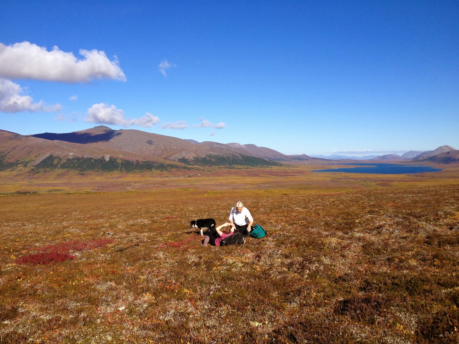
Tuesday, May 27, 2014

White Alice Rocks

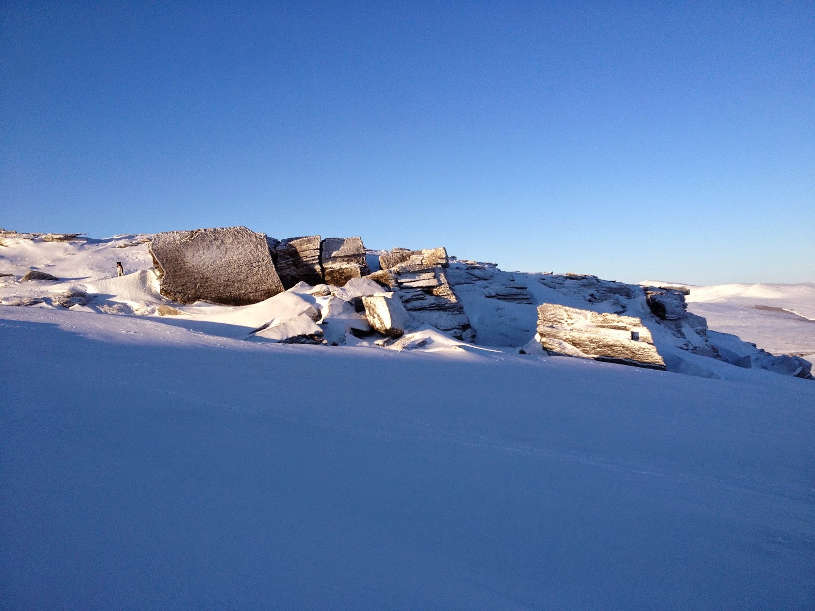
I would like to write about a scrap of metamorphic rock. A low-lying table of schist placed a few hundred yards northeast of the White Alice towers (of Cold War DEW line fame), it barely suggests a bouldering area. A mere nook, a slight shelter out of the wind is all most climbers would give it. Placed alongside, say, the Sherwin Grade on the Sierra's east side, this rock would attract zero notice; it probably wouldn't even rate as a picnic rock. It might be something you might randomly sit on, but that would be it.
But starkly placed on the east shoulder of Anvil Mountain within easy reach of Nome, the rock transforms into a destination bouldering Zen-garden, an ever-shifting funhouse of iced-up planes of textured rock. In previous winters, the White Alice Rocks were sealed over under the snow-- in other words, nonexistent. In summer, these rocks offer little more than worthless crumbles. But last winter, the shockingly low-snow year of 2014, the seal of snow pulled back like a bubble bursting revealing a tiny ingrown wonderland of climbing joy, a sweet little mixed-bouldering area, freshly decanted and never-before dry-tooled, only a 5-minute drive from town, a short hike up Bear Creek on a northwest tack from the little skier parking lot at Newton Peak, the end of the road spot in wintertime on the Dexter Bypass Road.
(above) Lucy in wind with White Alice towers in background, on one of our many visits to the White Alice Rocks this previous winter. The towers were tropospheric scatter antennae for microwave radio waves. Many a thrill-seeking Nomen made the hideous, toxic, carcinogenic climb up the sixty foot towers via a curved internal scaffolding made of I-beam girders. A 

Ground cornices of drifted snow form troughs at the very base of the rocks, wavy, perfect luge runs on which Lucy banks her turns at full speed for the sheer joy of it, while I boulder just above on overhanging rock, laying back on the tools which are hooked on schist, with the curve of the snow in the trough matching the curve of my back, the snow bank making a natural, ergonomic spotting device.
Between pump-outs in the blowing spindrift, huddle between the rocks, lost and forgotten above the town. Stare at the surface of the rock. Graupels of snow collect on the catchment systems of lichen clinging to the wall. Rime crystals of ice stand up on the rock like columns. High-frequency whistling noises issue from a hole in the rock eight feet to your left. Bored and getting cold now, simply reach up above your head, hook a tool, and resume the workout again with a one-arm pull-up. Off you go.
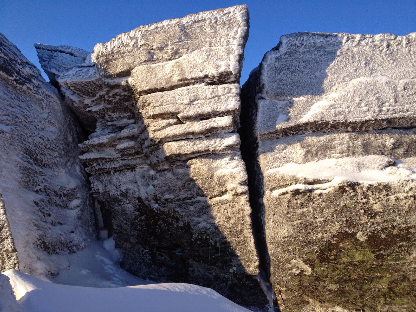
  Who could not say this is real climbing? For God's sake, you're fifteen feet off the deck chicken-winging with tool and arm between dirt and flake, while the other arm is sparking away with the chisel of the pick against featureless stone, your shortened front-points feel like they might all of a sudden explosively scrape off the holds, with each second you are trying to stand on the points with heels lowered and vector of gravity unchanging, they get closer to their blowing-out point. Though the rock be but a smudge upon the hillside and you have greatly used your imagination to contrive the climb, it must surely be real climbing. 
Information conveyed in the skeins of snow filagreed across the hardpack like a neural network. The tiny bump on the shoulder of Anvil Mt. welcomes you back, glad to see you again, politely asks you how your time was in town, and what brings you back, a little bouldering perhaps?  You have completely enlivened the winter for this slight conclivity of rocks and tundra. What otherwise would have been highly inanimate has been rendered more animate by your bouldering visitations.
(above) A decent dry-tool circuit may be successfully devised at White Alice.  

Let this be the official Pee Mark:  MARK!  I hereby lift my leg upon the White Alice Rocks by categorically stating that if it's an obvious problem of M6 difficulty or less at this area, I probably climbed it during the Winter of 2014.  I climbed 56 boulder problems in 14 trips to the rocks, and named each one with a super-groovy title translated into Inupiaq, and attached specific ratings in a variety of global rating systems to each problem, and indexed all the problems in a color-coded grid system which I have submitted to Kigsblog for publication. And here we see the true, hidden intent of the blog: to relieve the swollen bladder of Ego by spraying on the Internet.
Three or four "high-ballsey" problems surface from the flotsam of Winter memory:  a verglassed slab ending in a wide mitten jam, an iced-up offwidth with a pick-to-adze Gaston at the crux, an exposed arete with a slammer moss-cloud jug at the top. These are problems that leave you feeling clean and giddy. You feel  like an astronaut using tiny holds and bodily movements to manipulate the movement of the weightless Earth through space. Earth is the motorcycle and the climber the rider. Hammer and swing.  And all so close to town. 
And which is the LEE POINT on the dial this time at White Alice today? You will always find a calm spot out of the wind, some specific radian in the lee, but you might have to walk the circumference of the rock cluster to find it. If the wind is out of the southwest, your spot will be to the northeast, and so on. Sit with your back pressed tightly to the rock, the wind whistling past the overhang above your head. The calm spot will not be at the base of the boulders, but up high near the top on some grassy ledge just under the crest. Here only will your lighter light and your fingers thaw.  Take some time and jettison these silly concerns of town you have carried all the way up here.
With the simple thwack! of a moss cloud, Head clears. The pick of your Terror snaps down, the vector of force translates through elbow to wrist to shaft to pick, the final vector precisely aligned on the exact angle of a crimping forefinger that impales the pick deep into the frozen rhizoids of the sod clump. You are saved! This glorious life-giving moss stick has delivered you in an instant from splintered bones. A second ago you were highly stressed, hanging off loose holds way far off the deck. Your mind was vaulting into that rarified calm space which dwells beyond the boundary layer of panic. Now, you are fine, your future assured, your children will be orphans no longer.  Just the sound of your axe thunking into the turf and the feel of the pick piercing the dirt has caused your hips to imperceptibly lower, your shoulders to relax, your anxiety to clear, as if chrome molly and carbon fiber contained neurons.   
The stone thinks, it must be aware, I know it. Not the degree of thought humans enjoy, of course, not nearly so far on the spectrum of mental process, but if the potentiality for Mind manifests at the boundary layer of the leptons and quarks, then the potentiality for mind is present in the atoms of the White Alice rocks. Climbing, being an ancient shamanic practice which harmonizes the nonentropic electromagnetic patterns of the climber with the non-entropic electromagnetic patterns of the rocks, (both rocks and neural networks falling under the category of nonentropy) elevates the rocks to an even higher level on the spectrum of mental process. Climber and White Alice Rocks form a system that is mental, in which it is discovered that the stone, also, possesses rudimentary awareness.
(above) North from Anvil Mountain, January 2014


Frog cavorting on eye of piton,
Vulture glowering far from the village,
Looking out over the valley
Never stops making me happy.
Twilight has stopped the world.
Rock world, Rock man.
For every action there is an equal and opposite reaction.
The light has gone out.
We now must feel feel our way down...
(above) Town, looking south from Anvil Mountain, January 2014.

White Alice Rock was for me the hotspot of the (not so) long winter season. I was drawn there again and again, in all moods and weather. A place of meditation, rest, varied  climbing, and wind. Chimneys, hooking, torques, shafts, glove hands, and at least two versions of verglas that came and went in January and February, not the 3-centimeter shellac of seasons past, but enough ice for a little more spice in a life otherwise filled with repetitive motions in the rumor-mongering universities far below. But what might not be understood is how such a low-lying turd of a rock could produce such variegated climbing? But anything is possible in a world of imagination.  

Thursday, May 8, 2014

Iditarod 2014


(above) Drew assessing slope at Sampson Creek, looking northwest, through tilted iPhone.

        Like children at the beach running to the wave, Drew, Chelsea and I rode snow-machines tipsily towards the historic finish of Iditarod XLII at three in the morning. Drew wore Adidas with gym socks on his feet, and his colleague Chelsea rode two-up (whatever that means) on the back of a rather dimunitive Yamaha Bravo, through the same arctic -blizzard that had, a few hours earlier, taken four-time champion Jeff King out of the race. For all we knew, Aliy Zirkle and Dallas Seavey were around the next corner battling for first place, and we were the three slushes about to get tangled up in the historic finish.
      "This is blowing it! Let's turn around now before it's too late!"
       Surreal wind, pixellating long-term memory, the trip back wreathed in the fuzzy gauze of ground blizzard, the children running back from the wave without wetting their feet. Back at the Bering Sea Bar & Grill, we were amazed at how soon musher Dallas Seavey appeared behind us.  We must have narrowly avoided a faux pas.  Everyone was zonked out at 5 in the morning, Dallas Seavey most of all. Aliy Zirkle, with her beautiful second-place finish, wins the KigsMusher of the Year Award..


(left) My shadow is pointing east toward Sampson Creek.

        Drew, flown in for Iditarod from nearby waterlocked summits of Beringia and already fully embedded in the GLUE OF NOME, was hot to ski something. The bowls out back of Engstrom's Mountain seemed within range of a stretching GLUE-TENDRIL of town, and seemed also as if they might contain the UNPACKED we so desperately craved, so we calculated an escape vector from the Iditarod and roared off on our dreadful Hogs over bare, icy trails to a Monday appointment at Sampson Creek, near Mile 18 of the Kougarak Road, just past the most death-trappy spot on the whole 65-mile long road, an elevated gravel ramp way off the deck, guarded by an inquisitive troll that lives on a knoll in a mansion above the Nome River, and comes out to greet you should you slow your vehicle down.
       No Jackson Hole to be found at Sampson Creek. We did hydro-frack a few turns between ice patches in the upper bowls, and had entirely too much fun in the half-pipe of the creek, but the run wasn't even as good as the runs at Drew's home area on Sivuqaq. I had let Drew down, as well as under-represented Nome's skiing potential to a visiting dignitary. So, right then and there, an Iditarod ski-salvage trip was planned to Tom's Cabin, an idyllic bowl in the next valley to the west.  But first, it was back into the GLUE-STREAM sucking us back toward the fleshpots of town, and the flagrant Iditarod shenanigans awaiting us there.

(left) Drew's tracks at Sampson Creek. Due to low snow deepening the parabolic curve, it's been a fine year for half-pipes.

       Drew and I were to be joined on our skiing expedition to Tom's Cabin by the dog team of Janet Balice, winner of the GETTING OUT THE MOST AWARD for three seasons running now, plus Janet's daughter and new mushing partner, Chisana.  In lead dog position, the redoubtable DIBELS, one of Nome's top ten lead dogs of all time. Riding with me on the Bearcat, Lucy, the Tschingel of the Kigs, shmooshed up between the cowling and my body, learning to throw her weight out on the turns.
(above) Tom's, March 13, 2014. Dibels, Janet, Chisana, Lucy, Drew.

      Surely the enchanted bowl of Tom's would have snow.  Yes it did!  Snow that makes a sifting sound like that of silk, a distinct blanket, Utah powder, Hatcher Pass, sweet cherry pow pow, a foot deep. The souwesters off the Bering Sea slam into Monument Ridge and gently sift the powder grains into the big lee of the bowl, especially down a northeast-facing draw of which Drew and I found ourselves swishing and swashing for great moments of giddiness that didn't last long enough, this isn't the Nevada side of Heavenly here, folks. But redeemed, redeemed we were, and Nome skiing was redeemed as well, and our skis were sated, at least for the nonce, as we swooped down into the maw of Monument Creek, and made the short up to the cabin, to have some tea, and another run.
(above) Dogs at Tom's cabin

       We executed difficult climbing moves inside the cabin to avoid getting burned by the stove as we writhed about in the LED darkness trying to locate items, at least half the party hampered by possible diagnoses of A.D.D., but nevertheless drinking deeply of life and slush beers, and all departing friends.
(above) Kigsblog staff photographer Raina McRae skiing in Dry Creek, Nome, Alaska, Iditarod 2014, staff Mountaineering Dog Lucy in tow. In the background, bare frames from World War II barracks.

     In the midst of the Iditarod fun torrents, these totally cool Olympic dudes from Nananordic showed up like Pied Pipers with a boatload of skis and boots for children, and led the little Nomens out into the lashing wind for some inspired ski lessons. My students got to miss class the week before Iditarod. I joked with them that our visitors would be "Super-Olympians" on account of Lars, the director, actually being in the Olympics twice, but a few days later, I would get to see the moniker was actually true.

     It was the last Sunday of Iditarod-week before the dread return to work. Drew had already returned to the island. I had not yet recovered from the  shock-absorber workout at Tom's Cabin, when I got the call from Tyler:  Bear Mountain was on! The whole gang would be coming, Tyler, Keith, Jeff, but also Lars Flora, afore-mentioned Johnny Appleseed of rural Alaskan skiing. I boasted of Drew's and my powderific runs at Tom's on Friday and Saturday, but by the time we got up the mountain Sunday, Mr. Wind had returned and was moving the snow across the slopes in dunes, big traveling dollops of powder snow that exposed bare patches of ice between them, so that you might have enough snow for  one and a half tele turns before you came clattering out onto bare ice fighting for your edges. March winds made everything frostbitey as we took off skins. Tyler and Lars disappeared into the clouds while the rest of us prepared to thrash our way down the difficult conditions.

    Minutes later, I watched Lars descend out of the clouds:  he was riding telemarks! He would dig in on the snow dollops, and then leap onto the ice patches, and back into the snow dollops, without any interruption of movement, from one island of traction to the next. On Monday, I told my students:  "Yeah, that guy Lars can ski!"  At that moment, he was putting the skis on the plane for Gambell, where he was scheduled to meet up with the students of...  Drew!


(above) Kigsblog Chief Editor Allapa on the lower part of Bear Mountain earlier this Spring.

This post is the putrefactant which has caused such a blockage in the intestines of Kigsblog. Hopefully, now that the infectious mass has been purged through publication, Kigsblog may flow more freely once again in order to report the other momentous adventures of this rather odd Winter season. 

Sunday, February 23, 2014

Ayasayuk '13: Sixth Iteration

At the risk of citation, here is the full disclosure of Ayasayuk 2013, with sincere apologies for the trespass, and this Kigsblogpost.

(above and below) View from the middle of Qubliaq, an unfinished and transitory drool of ice squirting from the middle of a 50° frozen mudwall festooned with gneiss chunks. Due to weak mind, I chickened and downclimbed at the cusp between mere enmanglement and probable fatality.
         Ice climbing is a changing medium, we know this. Unlike rock, the ice you climb today is not the same ice you climb tomorrow. But what if a piece of rock were as ephemeral?
       Every summer, another slice of the Bluff at Ayasayuk is blasted away by dynamite, trucked 15 miles to the Port of Nome, and distributed to village seawalls around the Seward Peninsula. What's left behind each Fall is a fresh, new, and ever-lengthening cliff overlooking the Norton Sound. Some weird aquifer must be zig-zagging around inside the rock, seeping out the face in random places, creating thin ice flows never two years the same.
       This year's Ayasayuk iteration logs as the second most interesting in fourteen years-- no Grade III pillars like in 2004, but the huge 180 ft. Third Tier from last year is still intact, with frozen trickles squirting out in new and varied places. Despite driving the ice road out to the quarry a total of seven times in November and December, the annual game of climbing from the bottom to the top went unfulfilled; I chickened out in the middle of the Third Tier, at the cusp between mere enmanglement and visualized certain death. The ice started growing in late November, peaked around mid-December, and then got destroyed in the rains of January.
(above) Ayayasuk quarry, December 2013. Can you spot the water ice? It's not easy.

       Who works at this place? What are your special names for each feature, terms known only to yourselves? Is it the job of certain individuals to scramble around on the steep stuff? Are you out there?  I can see the exasperated expression on the contractor's face. I am your biggest fan. I salute your work. The quarry hath becometh an ecosystem, a microcosm unto itself, a little kingdom of frozen mud, ice, and stone. What amounts to a scar is beautiful. I would not dare blog of it, and hath not in the past; however, it seemeth unlikely that great hordes of nano-puff recreationalists will soon be flocking to this particular sketchscape. The very mud itself oozes instability, death attractors, enmanglement clouds. Whoever driveth the Excavator on such a precipice must surely be a badass.


(above)  Bouldering around at Winter Solstice

       The measure of a village was, did it have a kasgi? John R. Bockstoce's The Archaeology of Cape Nome, Alaska says that the village of Ayasayuk lay tucked west of the Bluff, and Setuk and Mupterukshuk tucked to the east. Norton Sound can be thought of as a bathtub ringed with six or seven old beach lines. Present-day Nome sits on the third beach. The second beach is about a hundred feet offshore, where every nice day in summer we see a row of floating gold dredges; the beach miners are fifteen feet below on the sea floor hoovering up the gold, just as they did on the famous third beach in the Bonanza of 1899. Villages followed the beachlines as the millenia went by. You build your next village further inland (or out, as the case may be) in the row of driftwood from the beach line that went before, as the water in the bathtub rises and falls.


(above) Found among a pack-rat elementary school teacher's possessions.


 (above) Pirated from the interesting Bockstoce book.

    One gets an image of an entire northern Norton Sound shoreline populated by whole chains of kasgi as of the early 1800's.  So where did these populations go?  Today, the ghost villages are indiscernible from the driftwood, at least to an unobservant, non-archaeologist climber hurrying along to perform narcissistic deeds on the scar where the headland used to be. One need not look further back than 1918 to see where all the people went. Rubbed out. No wonder this shoreline is, at times, haunted with ishigait.  One of these little beings went flying by the cabin at Topkok on a tiny snow-machine, but when I went outside to inspect the tracks, I found no trace in the freshly fallen snow. 

(above) Third Tier from the mezzanine, looking east.


       Kigsblog has descended into gray depths of middle-aged anxiety, inflexibility, and loss of will. Most climbing trips these days end in chicken-out, each post must rationalize a failure. This year's iteration of Ayasayuk  is no different—  the complete bottom-to-top ascent, which is a little game this climber plays and usually quite achievable, got away from me this year, despite six or seven trips down the Zambonied road to the quarry, 15 miles east of Nome.

          I succumbed to Technical Chicken-Out.  On the Third Tier, I was unwilling to commit to soloing the second 45° mud pitch, a section of remaining wall that did go the previous year. The grade had grown subtly steeper following another summer of excavation above, and the saturation / penetrability factor conspired to make the mud-climbing feel more sketchy. I employed whole complexes of further excuses to get out of actually climbing the thing, including the whole notion that climbing such sloping choss was really just a farce, but had entirely too much fun clambering around anyway with my poor beat-up Cobras and dull Charlet-Mosers by the sea, the shining sea.
 (above) Third Tier ice flow at its peak, mid-December, 2014        

      So I hatched a plan for a type of long hanging top-rope wherein I would take the road to the top of the Third Tier and rappel down. Chickened that one, too... the Ayasayuk quarry face is just too damn sketchoid a place. I visualized the rope pulling volkswagons of gneiss and crushing both me and Sim, a mysterious character who began coming along on these December adventures. Winter Solstice was upon us, and none of these trips were an exception to the rule that the ice climber must run out of light when climbing out on the Council Road. Had a lot of fun highballing around on the Third Tier this year, but never did link it up with the Fourth.   
(above) Fourth Tier ice looking west

A MAJOR ICE CLIMBING DISCOVERY came when Sim and I boot-skated our way up the icy access roads to the Fourth Tier on top. What we found there was the Beginner's Ice-climbing wall, which was appropriate for Sim because it was. This was where we spent our cold days through the late Fall, teetering on short points, trying to allow the experience of climbing ice to become relaxing so that we would not tax our poor, feeble arm muscles by holding on much too hard. The nice thing about the Fourth Tier, it was just a darn nice balcony at which to hang, views of Setuk and Mupterukshuk to the east, and the possibility of Pinnipeds and Cetacians in the gathering sea ice below.
(above) Sim at the 30-foot Beginner Wall.

      Hollow sound, familiar sound, booming sound, propagating doppler dominoes remembrance-of-epics-past sound—  THE BEGINNER WALL IS COMING  DOWN!  Oh, and here's the horrible thing:  I, I, I, am belaying, well off to the side, safely sequestered from the multi-ton fall of Pompeii which is about to thunder down— it is not I who will be crushed but Sim, who has been flailing around on top-rope and whose bodyweight is probably causing the collapse, who will be located directly under the impact. Another partner done gone! As if the fate of the escapade were predestined to converge upon my worst fear! At least Andy Sterns had already signed his contract with the devil at the time of our accident;  Sim, he is innocent, a Zen dude from the Rec. Center wall who thought he might try ice climbing.
        It is over. Sim is fine. The small frozen pond at the base of our wall settled as Sim rained down chunks of ice upon it. Sim's name is Simon.   
(above) From Ayasayuk looking east, Lucy, and Sim. Did I mention it was cold? Uh, yes, yes it was cold.

         The spell of the quarry had begun to come over Sim, I could tell. On our January trip, the one where we discovered the ice gone, dessicated by rain, the quarry face in ruins, the walls dripping rocks so badly you couldn't stand anywhere near the base, we encountered a lone, rather diminutive Oomingmak hanging out at the rim of the Fourth Tier. We walked right past the little guy, and he kept popping up at odd angles amongst the Minecraft maze of the quarry. Was he injured, or was he hanging out in shame after some lost butt? Later that day, at the base of the Second Tier, looking in vain for a climbing line through the dripping rocks, Sim suddenly said, "Woah, heads up!" Perceptually speaking, the micro-second with which I accelerated to a run caused the incident to be registered in my memory of it as having begun to run before Sim said anything. The "Polar Vortex" held the midwestern U.S. in its grip in January, 2014, but up in Nome, Alaska, the frozen mud was melting and the quarry was a daft place to be. 
(above) Looking down the Third Tier, December 2012.  A godawful dripping choss ramp of stone and mud, a frightful place to hang, but an interesting world unto itself that grows on you after a while.

       The machines, frozen Excavators and Loaders, lonely sentinels gazing out to sea from their regal platforms on Ayasayuk.   Non-entropic pattern in an exploded waste of choss. Each one with a personality. Each haunted by an operator who is probably in Hawaii, or maybe reading this blogpost. "My name is Caterpillar, King of Kings:  Look on my works, ye mighty, and despair!"

       The lone and level Norton Sound stretches far away...

Saturday, November 9, 2013

Mt. Brynteson Southwest Ridge

     Mt. Brynteson, more hill than mountain, behind the Rock Creek Mine, down the seven-million wilderness-destroying Boondoggle Road, wafting through layers of fog, last Sunday afternoon.  Cool place, maybe, for a hard-up junky searching for an icy crumb.  The real fun not to be had up on the hillside in the couloirs and quartzite ribs, but down below, searching between the mountain and the road, in the mining ruins, for smidges of ice among the folds and tailings that have been worked over for a hundred years of Nome's mining history. 
(above) MineCraft Falls.  A weird scene inside the gold mine, a bubble of reality embedded in deep fog, a pod of hallucination, somewhere east of Glacier Creek Road, west of Nome River.
(above) The mighty Minecraft, perhaps the height of two men.  Nevertheless, in the act of mantling onto ice tool many inches off the deck, that "yur gonna die" feeling, when the whole mass felt as if peeling away from the sheeting right down on top of me, leaving mangled bones sticking out like the kind you see on youtube. DO NOT DAMAGE PROPERTY LAW maintained with no punctures in the rubber, fortunately, thanks to high volume of beautiful ice.

     Southwest aspect of Brynteson steep as a Cairngorm facing into those big sou'westers coming in off the Bering Sea:  plenty good place to hunt for rime or verglas in the late Fall, if one can get up the 7 Million Porkway that late in the season inside one's nice, warm, planet-killing car.  
     Where Lindblom Creek intersects the road, up to the southwest ridge of Brynteson, classic fell walking with hugely-satisfying side-excursions onto crumbling quartzite smegma-piles carpeted with frozen tundra, old rock crampons on and off big clunky expedition boots. Hero poses off old-kind Black Diamond Cobras sunk well and deep in dirt.  Continuous movement in and around gullies, snowfields, and even the occasional actual cliff.

(above) Naively conjecturing quartzite, southwest flanks of Brynteson cliff detail.  Possibly climbable without fear of total squishage, not much more attractive than it appears.

    My first attempt on the hillock of Brynteson with Isis and Jo-Jo, those good dogs, back when they were still alive, with Isis in skijor setup so she wouldn't go chasing the first hoof to come along.  Six miles over crust from the Bypass Road.  Denied the summit by a prodigious herd of Oomingmak (Musk Ox) who would not under any circumstances relinquish the rounded summit so that myself and my dogs might stand upon it for a moment.  Fog and furious wind that day.  Hallucinated voices.
      Several ascents since then, including the one in this post, and this one: Avalanche on Mt. Brynteson.  Fast way to the summit up Lindblom Creek / Southwest Ridge, like last Sunday. Trails everywhere.   
    
(above) Raina, Kristine, and Isis, BITD.  Isis, legendary KigsDog, gone on two separate occasions for four and half days each time in the central Kigluait Mountains during late-summer, necessitating many trips down the Kougarak Road on school nights searching in the willows of the Sinuk until pitch black, Isis skewered on a willow by her dog pack, her intestines slowly eaten out by foxes.  Also, a barfing ride in Paul Mallory's homebuilt Super Cub searching for dog from banked plane.  Dog found both times at the Mile 29 gravel pit, fat and happy, looking quite satisfied with herself.

(above) Trespassing?  Bering Straits Native Corporation?  Don't know...  just oblivious white dude with pocketful of Powerbars not bothering to read regulations, or even history of a place, full of himself and nothing more than movement over tundra, rock, ice and snow.  Also, haunted by memory of a time before the road into the Snake River Valley, no worry of trespassing.  So, now a feeling of privilege rationalized by righteous indignation giving the right to claw and scratch over this piece of land.

   The Brynteson couloirs.  Moments of climbing, the minimum one could ask. Look down beneath triangle of legs, a pair of frontpoints embedded in steep frozen turf, nothing but mist behind.  Whack!  Mantle. Thud!  Scuttle.  In denial of protruding youtube bones suddenly realizing. Effervescence of adrenalin.   Enough to keep the rat alive, barely.  Another crumb of climbing in Beringia.

(above) Lucy in the Fell a Sunday ago.

     Franklin L. Johnson, gold miner, Nome stampeder, native of Vastra Gotaland, late of Wisconsin, hiking out back of Bergstrom's Gulch in the Fall time somewhere in the Nome diggings, 1911.  New creepers on his boots forged in Minnesota.  Forced to sit down to take the creepers on and off, a time-consuming process picking at the leather straps.  
   "Mt. Brynteson, eh?  Well, I knew the man misself, 'n I don' see why they'd name a mountain after 'im."  Old scrap over a boundary, a shot dog, Swede things nobody else understood. "And Lindblom, for all dat!" screamed to the creek below. 
     Idea.  See if the creepers will work on that steep sod there. Whack!  Thud!  "Goldsteigen!"  Just like his one guided climb in the Alps, frozen mud.  Thoughts of the day on the Grossglockner with Fehrmann.  Johnson's oily gloves clapped on knobs of rock, creepers holding well in solid patches of frozen sod.  Patch of sunlight appearing across the watching valley on Twin Mountain.  
     "Damn!"  Busted spike, bent metal.  So much for the new creepers...     
  (above) All the fun hunting for the ice among the folds. View from the pathogenic car, Glacier Creek Road, Sunday, November 3, 2013.

Monday, September 23, 2013

Peak 3650+ and Peak 3320, Eastern Kigluait

          SUMMARY:  a short account, mostly peemark, of two "three-thousanders" in the Eastern Kigs this year:  Peak 3320, a lumpen mass of quartzite located at the easternmost corner of the gigantic frown shaped by the entire Kigluaik Range as a whole—  so call the peak "Iqiq," meaning "Corner of the Mouth"— done earlier this year during Iditarod week 2013.  Then, two weekends ago this Fall, Peak 3650+ in the same general area, the high point of an interesting series of ridges above Big Creek Creek forming the northern rim of Crater Creek—  call it "Aqalgiqpaq Peak" (Big Grouse) as the high point lies between these two drainages (and because I hold to a curious little rule that names should be inupiaq in Qaweraq country)
(because inupiaq is the language the land speaks)
(these are just my own personal little pet names, but I think each one fits the character of the eponymous mountain).
            Mere peak baggery reported here, only a trifle of "fell walking," definitely not the North Face of North Twin .  I am becometh a peak bagger, a hobbyist, a silly birdwatcher.  FYI, both peaks make great day hikes from the Kougarak Road.  There is a niggly little rule of Kig that says you have to keep going until you've reached the very most apical point of a mountain, whether it be a fine tor or a bump on the ridge, so be sure to keep going until you are the highest thing around.
(above) Looking west from summit of Pk. 3650+.  Crater Creek runs southwest toward Mt. Osborn on horizon   The best rock route in the Kigs is visible on the Third Tog  near the cener of the photo.  Kayuqtuq, or Peak 3850+, otherwise known as Tog 7, looms just to the left of Osborn.  I once had a theory that Kayuqtuq was the second highest peak in the Kigs, but this myth was debunked.  In this picture, you can barely make out the tip of Peak 3922, a Grand Central hill, poking out over the top of Kayuqtuq.   Kayuqtuq has been down-sized accordingly, though the contour lines be vague.
(above)  Peemark map of peaks in the Eastern Kigluaiks. All the places I have lightly scented with my spray, in order to make a small statement to gratify my ego.

(above) Peak 3320 ("Iqiq," "Corner of the mouth"), left peaklet in the back, taken from Peak 3650+,  looking east toward the Bendeleebens.  Peak 3320 is the easternmost three-thousander of the range.  During Iditarod, of course, it was swathed in hard-shell marshmallow sauce, but I carried no camera that day, so this Fall picture several months later will have to suffice.  This pictured is showing a big chunk of quartzite, (according to the Amato/Miller Geological Map.)

      PEAK 3320 ("Iqiq"):   The WEIGHT!  Felt it immediately upon arrival at Earp's cabin at Salmon Lake.  The WEIGHT is different than the GLUE.  Whereas the GLUE is a steady pull back towards town, the WEIGHT is a kind of dread bearing down on the shoulders— dread over being alone in the naked north in Winter on a single snow-machine, out where the population is zero for many square miles in all directions.    
      The whooping and barking of the Iditarod over the tiny radio at Earp's cabin only accentuated the WEIGHT.  Deep silence drilled into my sub-awareness.  My "technical chicken out of Iditarod 2013" occurred right then and there in the no-heat cabin.  Disguising cowardice and lack of will as something approaching good, common sense, I decided I'd better not attempt anything too ambitious that trip. 
       After a late start the next morning,  fired up Super Smooth Andy G. and motored north up the road up to where it turns on the corner on the easternmost Kigs.  Scanning the hillside constantly for a way up that wouldn't result in Super Smooth! wrapped to the axles in willows.  Finally breached the horizontal willow band at full throttle up Homestake Creek, and proceeded up the slopes of Peak 3320 as high as the .570 Bearcat dared without tipping. 
       Donned crampons right at the machine, and began slog.  Fine day, not too alaapa.  First the snow was soft, then it was tundra, then it was hard.  As you could see from the picture above, nothing was too very steep.  The Bendeleeben Range hung on the horizon sixty miles to the north, calling to me across the deep waters like a frozen, blue Bali Ha'i.  I was hoping for a jagged summit tor encased in ice;  alas the summit was rounded. However, the ubiquitous north-side drop-off was in evidence.  Almost surely this mountain had been climbed before;  the scent of geologist was all over the rocks.  
       Admired view a long time, flat-footed it down the mountain.  Orange and yellow light played out over the deep blue bowl of the Imruk Basin.  When I reached Andy G., he started and we followed our own tracks back down to the road, back to Earp's cabin at Salmon Lake for another cold and lonely night listening to the Iditarod on the radio, and another day of climbing tomorrow.
(above) Peak 2600+, the sweet little peak visited the second day of my Iditarod. This picture is taken looking south from Grand Central;  I hiked up it from the other side.  The other side abuts Fox Creek and makes a nice shortish hike from Salmon Lake.  No crampons necessary.  This was one of several "climbs" that got me in trouble in KigsCourt:  because I didn't use my Iditarod vacation to climb something more challenging, the Judge says I was establishing a pattern of "Technical Chicken-Outs" and threatened to revoke my climbing license.
     
(above)  Big Creek Bluffs, with the limestone/marble/deathchoss band transversing the hillside.  A decent workout can be had bouldering along the bottom of this band, marveling at the varying metamorphic geology as you traverse along.  A paucity of anchors, a shortage of vertical, and an overabundance of deathchoss make top-roping here a dubious proposition.
(above) Earp top-roping the deathchoss at Big Creek.

      PEAK 3650+ ("Aqalgiqpaq"):  No WEIGHT!  No GLUE!  Arrived at Salmon Lake late Saturday night, with the stars and aurora reflecting on the dark water.  Any high expectations I might have had for myself had already been beaten down by a summer of Lethian forgetfulness and demotivation.  Calm, peace, resignation, the susuration of Cranes.  Got up early Sunday morning and motored down to Grouse Creek, not far north of the Crater Creek bridge.  Lucy bounded out of truck bed, and up we went.      
      Now, Peak 3650+ is a peak I had attempted multiple times before.  There was the ominous incident one late Fall near the "Lactation Boulder" (an awesome erratic of quartzite lying on the tundra folds between Grouse Creek and Crater Creek) when we got separated after having a picnic right next to the front porch of an aklaq lair, probably one in which the aklaq was inside sleeping!  There were several defeats by big powerful NAPS that swept out of nowhere and overtook my mind in the hot Fall sunshine.  More than once, maybe,  got lost in FOG.
       But there were only green lights this time, and crimson hillsides with fruit abounding.  Lucy and I scampered up thousands of feet of Class I and II talus slopes anchored in place by tundra patches, until we leveled out on the mystical and convoluted ridgetops above Big Creek, where we lay in the sun for huge swaths of time scoping through cupped hands out west across the ENTIRE range, from the Singtuq at the western end, to this peak at the eastern end where we perched.
       Prototypical summit of the Kigs, pathetically rounded on its southeast flank, frighteningly vertiginous on its northeast, with the prettiest little rail of rock running along the topmost ridge, about as high as a picket fence, so that the hiker hikes along the ridge neatly and anti-septically separated from the dangers of the abyss, yet dares out of boredom to make little dare-devil climbing moves on top of the rail, thus getting small, occasional whiffs of exposure to stay awake.  This summit, too, must have been visited before, though I wonder if others have been as meticulous in tracking down the true high point of the massif, vis-a-vis the Kigluaik "apical point" law, as I was required to be.  Going by human inner-ear transit, which can be pretty darn accurate, I determined the high point was an unsurveyed mound of quartzite halfway between Point 3325 and Point 3509.  This peak enjoys a certain prominence, which might account for the surplus of triangulation points on the old USGS topos, but a prominence which is only evident as you stand on the mountain itself;  the thing comes off as a heap of ridges when viewed from afar.          
(above)  "Grouse Creek Pass," a low divide between Grouse Creek and Crater Creek, not far from the Kougarak Road.  This may be the best way to access upper Crater Creek.  This picture is looking west from Grouse Creek.  The background peak notched in the pass is  Peak 3300+, a peak I call "Warren Peak," hiked up several springs ago in deep fog via the low-angle left skyline.
          If MENTAL PROCESS pervades matter and energy for all regions of space/time, then mountains also are pervaded by MENTAL PROCESS.  Mountains think.  The reason this seems preposterous, is that mountains, being made of relatively stable abiotic minerals, (at least, you hope they're stable!)  are not particularly entropic.  Mental process only manifests at detectable levels where a certain level of entropy is present, such as a neural network with nerve impulses whizzing down nerve pathways, or a planet with all kinds of things going on inside its atmosphere.  So MENTAL PROCESS is a zero-intensity wave that passes right through the mountain without making much difference.
        What I mean by "mountains think" is that the potential for MENTAL PROCESS exists at any spatial point within the mountain, except that, let's face it, there's not much probability it will manifest anywhere in the dead zone of stone.  But perhaps there is an "as yet unexplained" phenomenon that generates MIND within the stone due to the mountain being a component of a larger entity, the Earth, which can be said to be thinking, especially if it's busy little consumer-resource systems are included.  I know, I just know, these mountains have some type of awareness, it's just different than animal awareness, so we can't access it.  And because it is a weak force as it manifests within the systems, it resists empirical proof and eludes scientific observation. You will think I am out there talking to myself...

(above) Video of Lucy sending Copper Creek Falls, 2 Saturdays ago.  Class 4/5.
(above)  Lucy peacocking on top of the Anvil at Anvil Mountain on a Fall weeknight.  The Anvil is not to be underestimated as a rock climb, though many a kid has soloed it.  A case could be made for the Anvil being fifth class by any route.  So when I climbed to the top and called Lucy,  I figured I was only tormenting her, a primate mocking a quadraped.  I was surprised to find the quadraped soon standing next to me on the summit, but I was dismayed too, for it meant I would have to carry her somehow while I soloed down.  But no, she down-climbed just fine. She found a little dog ramp of her own.

(above) Hold your life out at arm's length, beauty suspended in clear drop of time.  Kristine, Raina, and Lucy, picking September blueberries above Copper Creek.  And there's the peak Lucy and I were blessed to climb the following day, "Aqalgiqpq," hanging on the horizon left of Salmon Lake.