 |
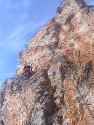
| In December light, James is climbing quarried chunks of granite held together by frozen mud |
 |
| Red arrow points to Ayasayuk, Cape Nome. |
 |
| Third Tier ice, 2015. We climbed a dirt/ice line out of the picture to the left. James was fated to leave town, the Winter Solstice world grew mega-cold, and the GLUE OF TOWN sealed me over. I never made it back out to climb this pitch. |
Cape Nome lies about 20 miles east of Nome. Viewed from Nome on a clear day, the bluff resembles a 5-mile long sausage, with the seaward end of the sausage visibly gnawed-on. Drive out there on the Nome-Council Road and the gnaw-marks prove to be the 450 ft. high Cape Nome Quarry, a long-time source of “industrial grade armor stone and rip-rap commonly used on seawalls, causeways, and breakwaters,” and also, my secret, no-doubt-trespassing, little ice climbing area in the late Fall.
So loose, such a hanging mine field of rock and mud is the Cape Nome Quarry, that one would never set foot on it unless it were well frozen. The Quarry is a little microcosm unto itself, a self-contained space shaped not unlike a Greek theatre. The ice that "cryo-sucks" down the face each year is a study in randomness, for no two years are ever the same. Somehow, a central flow always develops, but the path followed by the water varies according to a complex equation involving temperature, saturation, and dynamite.
We are used to the ephemerality of ice, but this is ephemerality of Earth. Some years the quarry face has been blasted away completely leaving no trace of the climb from the year before. There is something satisfying about doing a climb which has never existed before, and will probably not exist into the next year. This year's iteration of Cape Nome did not offer particularly high-volume ice flows, but it did offer the usual helping of climbing adventure as I managed to once again to ascend the quarry face from bottom to top, up the middle of all four tiers.
 |
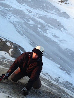
| James hiking the First Tier, Council Road below |
 |
| Ayasayuk, November 2015 |
I drove out there twice in late November to check it out. Some interesting pillars of ice had blossomed, but my first order of business was to complete the yearly game of ascending the quarry face from bottom to top. I started up solo, but in the middle of the third tier, the ice receded into the mud wall, leaving me looking at a hundred feet of exposed, frozen mud soloing. All I could think of was how much better this mud section would be if I could go back into town and talk James into coming back out with me to hold a psychological rope.
So we returned in early December. Technically, it was James' first alpine climb. Too bad his first ice climb had to take such a ghastly form. Stupidly, we double-rode on the snow-machine to get out there, bumping across the tundra, getting lost in the fog, and overheating the machine as people passed us by in their nice comfortable trucks up on the road, which was still open, it turns out.
We accessed the magical quarry kingdom from one of the access roads that transverse the face, and then dropped down to the main Council Road to make the full, bottom-to-top ascent. The first two tiers of the face are a casual mud romp, no rope necessary. Frozen mud seems to behave exactly like ice, and crampons and axes work quite well if the saturation is right. In between the tiers, the access roads provide big, spacious ledges.
The Third Tier is the highest of the four tiers, more than a pitch. The main ice flow could be cascading down on the right in a spot that was different than the year before. A new pillar had formed, and above that, ten-inch thick slab of ice was trying to adhere to an utter hanging shit-pile of creeping granite blocks. I fully intended to return for this ice a later date, with a rack of stubby screws and a James now schooled in the ways of ice climbing, but for now, the line was to take the path of least resistance, up a mud groove to the left with an easy piping of Grade 1 blue ice at the back of it.
At the spring, the high point of my solo a week earlier where the ice recedes into the mud wall, I made a good belay and brought James up. It's not like the next pitch was hard. There's not a hard move on it. There is just something hideous about steep frozen mud climbing. The medium is like real ice, so you whack your tools extra hard, but you feel like some sort of slump or solifluction is going to suddenly pitch you off and down the 45° slope in a great clattering, clawlike mass of spikes and rope. I drove a few Snargs and Spectres straight into the mud. They wouldn't have held a thing. I really don't know what James thought of the whole charade as he is always rather an inscrutable lad, but I do know I was overjoyed to have him there holding the useless belay. Hard to say whether that pitch was a Class 4 scramble up some dirt, or a real pitch deserving of an "M" rating. Probably the former....
The Fourth Tier, only about 60 ft. high, offered more flows and steep ice, but the afternoon light was throbbing with darkness. We did an easy pitch up the middle and reached the top. Waves from the dim sea lapped against the beach hundreds of feet below. An emaciated Red Fox watched us curiously. The December sunset was only a red smudge against the gray pall in the west. The lights of Nome could already be seen, and the GLUE of TOWN began to suck us slowly and inexorably toward it.
 |
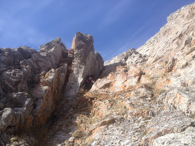
| Third Tier from the Proscenium |
 |
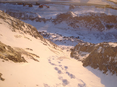
| Looking down Third Tier |
As we zig-zagged down the access roads in the big, deep, Arctic dusk of December, still wearing crampons because the roads were a sheet of ice, I noticed the hydraulics of the ice flow underfoot. In places, birms made by machinery had caused the ice to pool up and grow thicker. Could it be that water flowing down the access roads is the source of the ice flow at Cape Nome Quarry? I had always assumed that some type of aquifer was leaking out the scar of the blown-out bluff, but this makes little sense given the elevation of Cape Nome and the fact that water does not flow uphill.
Geologists do not seem to have come to a consensus regarding the Late Proterozoic meta-granite of Cape Nome. Is Cape Nome related to the meta-igneous gneiss of the Kigluaiks thirty miles to the North? Just what is this anomalous little intrusion of ancient rock doing here?Marine life seems to get bunched up in the waters off the cape. Before the dynamite and the flu epidemic of 1918, plenty of people lived on the bluff. Strange little men called isragak roam the grassy headland. It was named "Ayasayuk" by the natives, "Tolstoi" by Captain Tebenkov, "Sredul" on an 1852 Russian hydrographic chart, and finally, "Nom" by Sir William Kellet, though what the British explorer meant by writing that word on his map is anyone's guess.
 |
| The glory days somewhere around 2003 when that Grade 3 ice on the right used to come in. This is almost an entirely different cliff than the one in 2016 (though odd vestiges remain). Begging forgiveness from BSNC... |


